hudsonvalley21
-
Posts
4,027 -
Joined
-
Last visited
Content Type
Profiles
Blogs
Forums
American Weather
Media Demo
Store
Gallery
Everything posted by hudsonvalley21
-
I think this is the Kuchera, could be wrong tho.
-
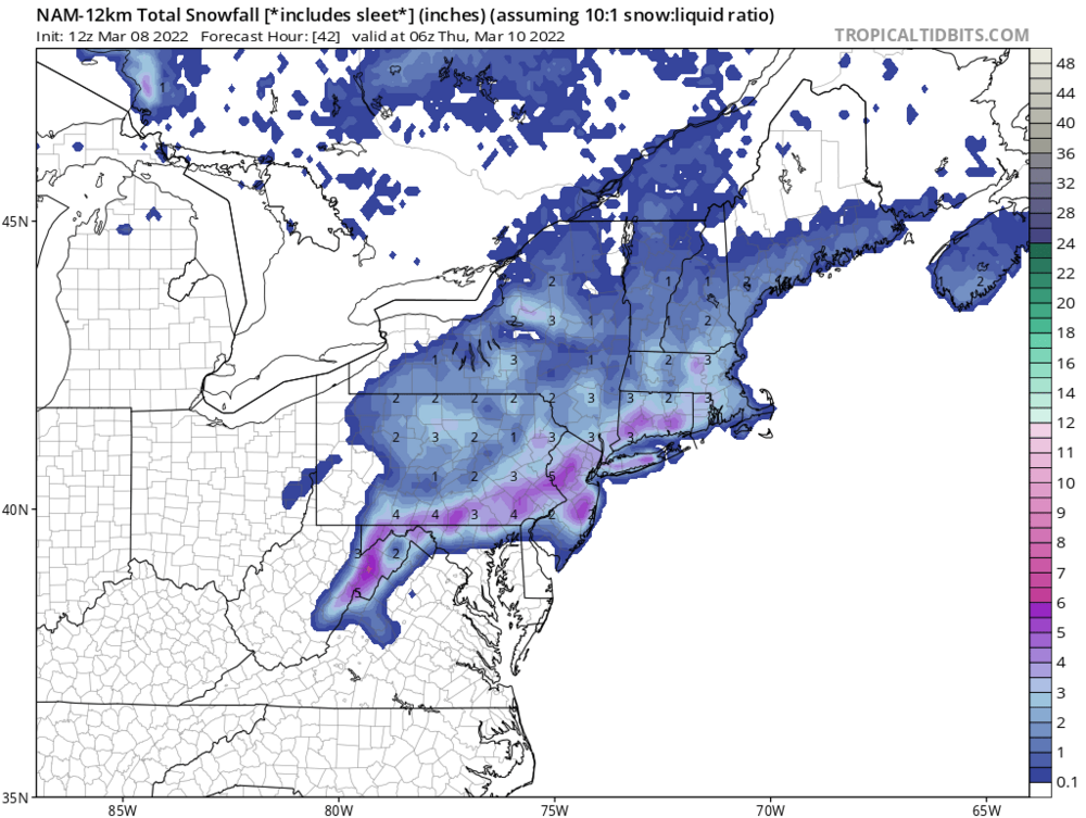
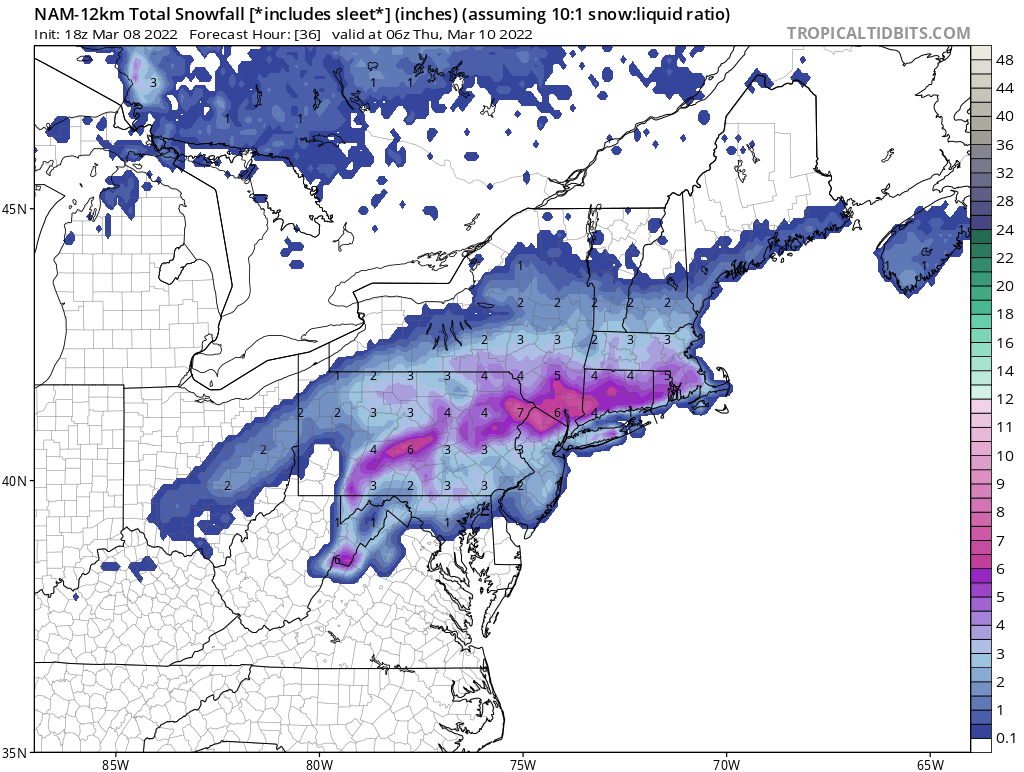
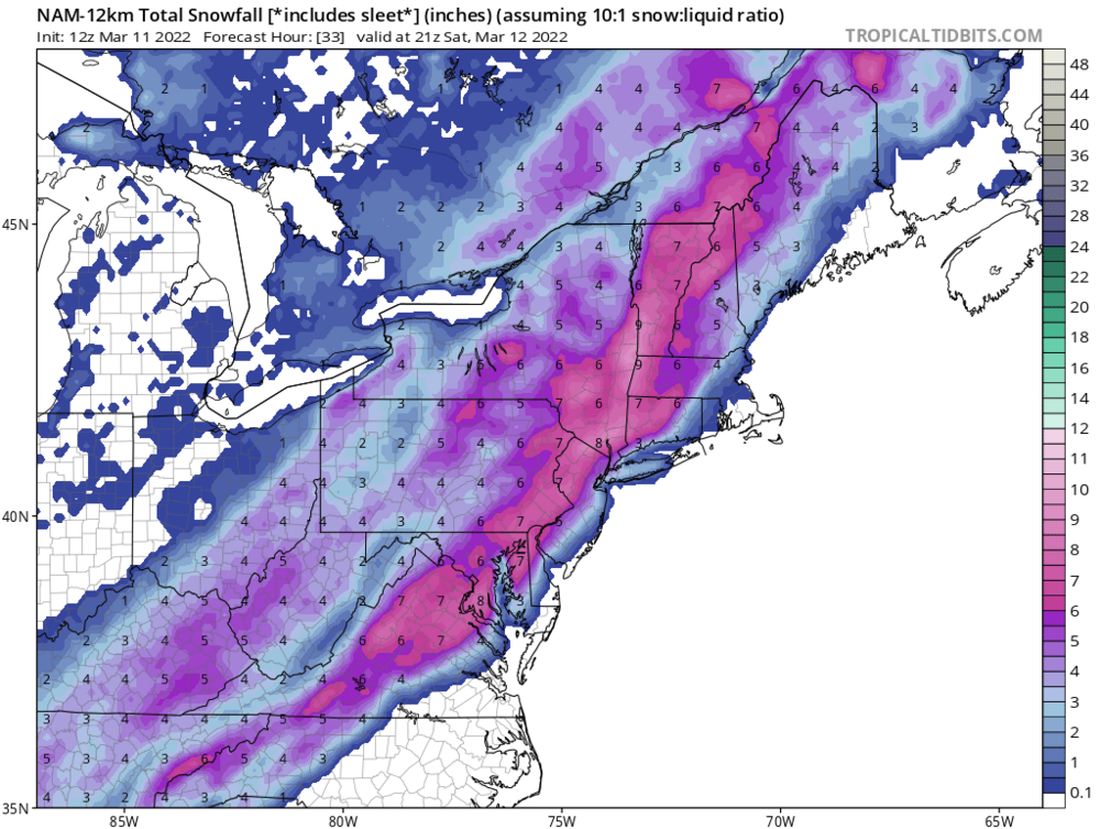
18z NAM up-ticked from the 12z run
-
18z NAM up-ticked the snow amounts from the 12z runs.

-
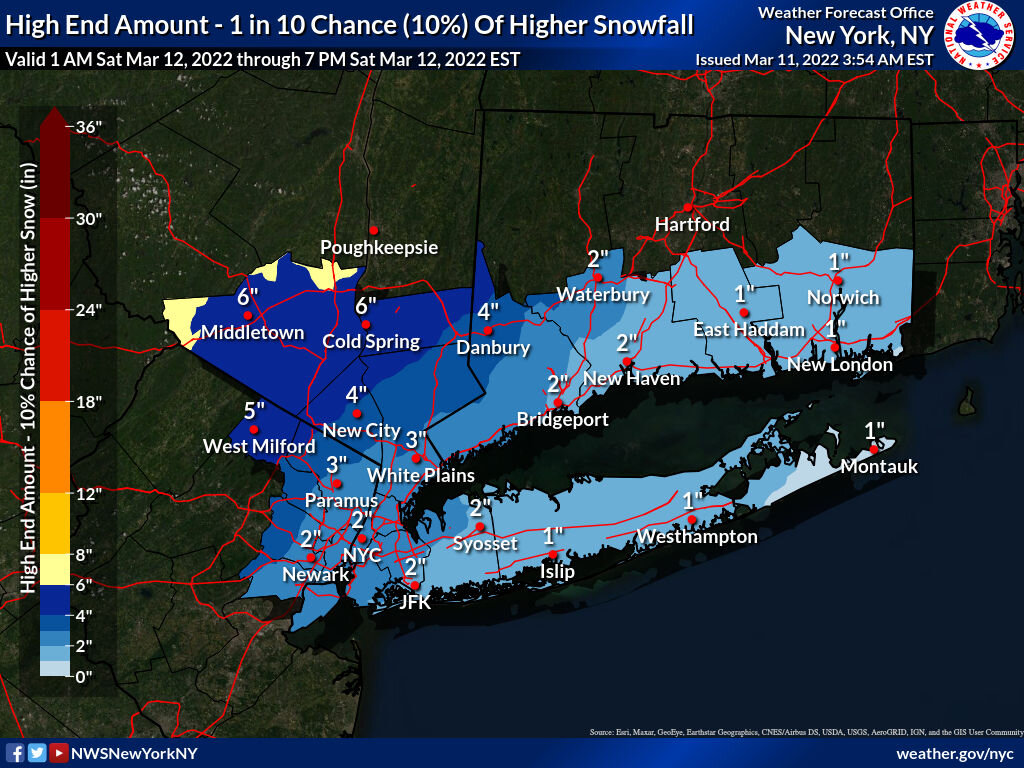
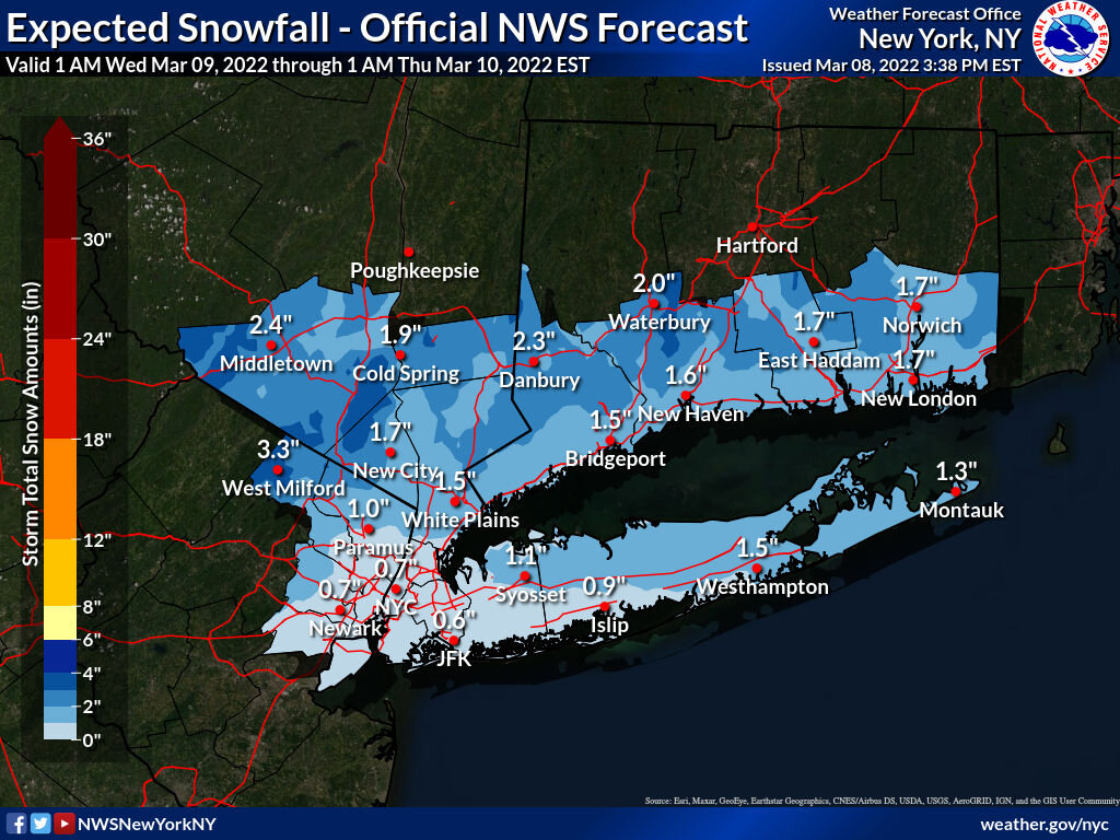
Well they went with the colder 12z runs. Now with wind gusts up to 40 in the point n click forecast. WINTER STORM WARNING IN EFFECT FROM 6 AM TO 7 PM EST SATURDAY... * WHAT...Heavy snow expected. Total snow accumulations of 4 to 7 inches. Winds gusting as high as 45 mph. * WHERE...Orange County. * WHEN...From 6 AM to 7 PM EST Saturday. * IMPACTS...Plan on slippery road conditions.
-
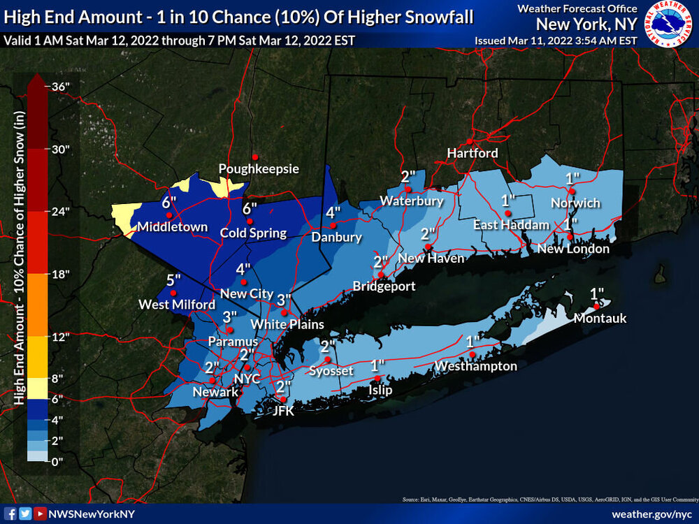
Me neither, and just 1 inch above warning criteria for snowfall. maybe they are going with the high end maps from this morning. They haven’t updated those maps as of yet.
-
They might, my thought is they keep the warning up and tomorrow morning they might scale it back if the short range models back off after looking at the 00z runs.
-
Hopefully there won’t be so much paste with the winds and cold temps. Bad recipe for tree and power issues. Overnight Saturday could be tough for some especially up our way.
-
Hopefully the winds won’t be much of a factor along with the paste. Don’t need the tree and power line issues.
-
Forecast low on Saturday night in the area from the teens inland to the low 20’s along the coast will give some folks some frozen paste
-
This thing will be moving quickly, but as you mentioned, the dynamics will give a few lucky ones a nice event. We’ll see how it pans out.
-
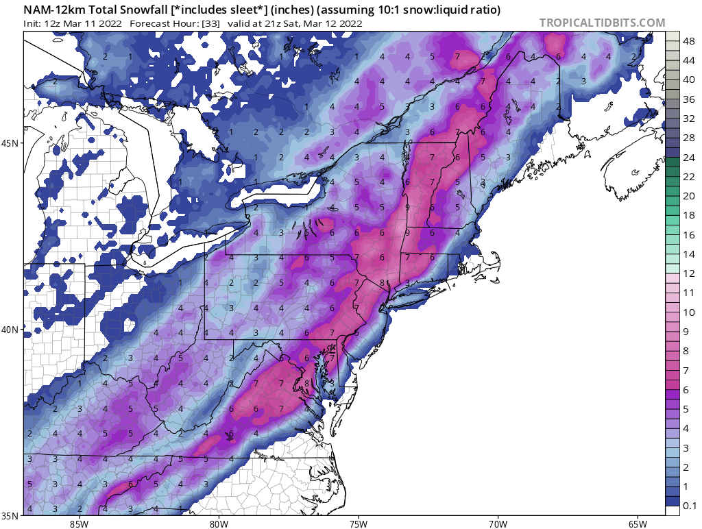
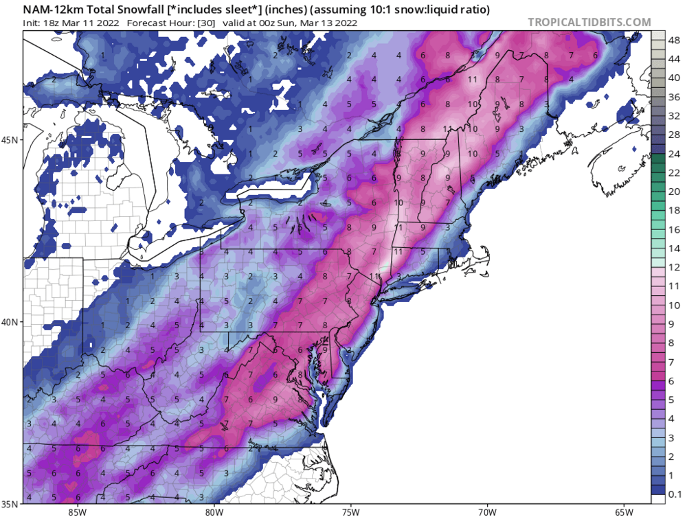
12z NAM also backed off on the QPF along the coast vs. the 06z run. This thing will be moving along quickly.
-
Could be to cover the higher elevations in the area. My thought anyway.
-
They could bump up things in their afternoon package after looking at the 12z runs
-
Agree, and the WWA posted for Orange County is in that advisory criteria. Winter Storm Warning would be for 6”+ up this way. It will be interesting too see what the 12z runs show coming up.
-
3.1” will do it here.
-
Moderate snow here currently and accumulating on all surfaces now. Temp.31
-
Moderate snow here now accumulating on all surfaces. Temp.31
-
Moderate snow in Ramsey, NJ dusting on grassy surfaces. Temp 34
-
In Ramsey NJ. temperature 34 with a mixed bag. No accumulation
-

-
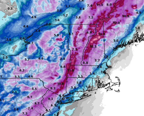
Agree, I doubt that we will see 10:1 ratios. Just showing that it appears that the QPF has bumped north.
-
We’ll said. Maybe one more time over the weekend too.
-
18z NAM is showing a little more for our area vs the 12z run


-
18z NAM coming with more north of the city vs the 12z run.