hudsonvalley21
-
Posts
4,027 -
Joined
-
Last visited
Content Type
Profiles
Blogs
Forums
American Weather
Media Demo
Store
Gallery
Everything posted by hudsonvalley21
-
Not bad, well needed. 0.84 does it for me here.
-
Great rain so far, short events to soften up the surface and absorb some instead of it all running off. Sun currently trying to poke thru. So far 0.55 in the bucket.
-
In some moderate rain now.
-
0.47 in the bucket so far. Looks like another round coming up from NJ in about an hour for us folks in Orange County.
-
Quick heavy downpour here with a rain rate of 2.84. A few rumbles of thunder 73/72.
-
Quick heavy downpour here with a rain rate of 2.84. A few rumbles of thunder 73/72.
-
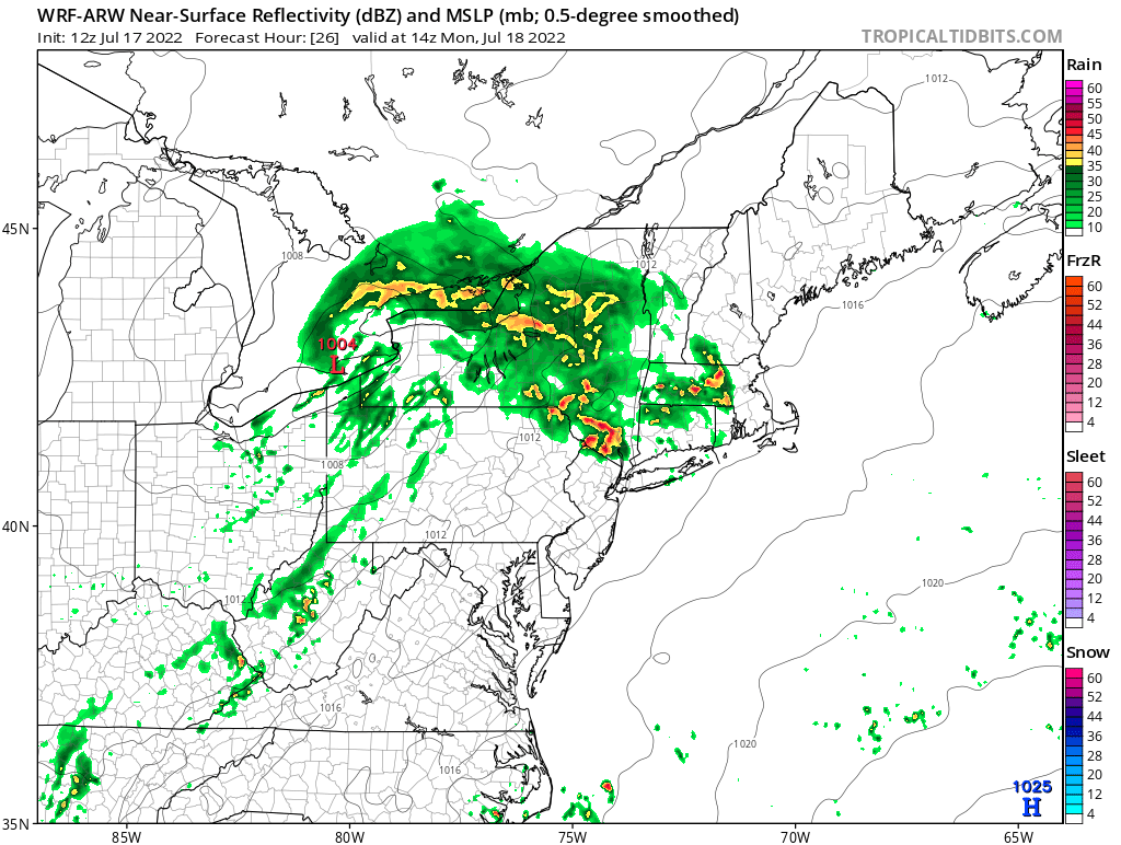
We could really use this QPF map to come to fruition. Maybe a couple of rounds of activity tomorrow. Day 2 Convective Outlook CORR 1 NWS Storm Prediction Center Norman OK 1241 PM CDT Sun Jul 17 2022 Northern Mid Atlantic... Pre-frontal surface troughing, extending from near the migratory low southward through the Mid Atlantic, likely will become the focus for the more prominent boundary-layer destabilization during the day Monday. The boundary-layer probably will become characterized by seasonably high moisture content, but lower/mid tropospheric lapse rates are expected to be generally weak, and most guidance suggests that CAPE may not reach 1000 J/kg. However, a belt of 30-40+ kt southwesterly flow in the 850-500 mb layer will potentially contribute to an environment conducive to organized convection given sufficient destabilization. It is possible that this could include a couple of supercells with a risk for tornadoes, particularly across the Poconos and Catskills into Hudson Valley vicinity by late Monday afternoon.

-
Day 2 Convective Outlook CORR 1 NWS Storm Prediction Center Norman OK 1241 PM CDT Sun Jul 17 2022 Northern Mid Atlantic... Pre-frontal surface troughing, extending from near the migratory low southward through the Mid Atlantic, likely will become the focus for the more prominent boundary-layer destabilization during the day Monday. The boundary-layer probably will become characterized by seasonably high moisture content, but lower/mid tropospheric lapse rates are expected to be generally weak, and most guidance suggests that CAPE may not reach 1000 J/kg. However, a belt of 30-40+ kt southwesterly flow in the 850-500 mb layer will potentially contribute to an environment conducive to organized convection given sufficient destabilization. It is possible that this could include a couple of supercells with a risk for tornadoes, particularly across the Poconos and Catskills into Hudson Valley vicinity by late Monday afternoon.
-
WRF is showing a couple of rounds for some of us tomorrow.


-
Swing and a miss here too. The only moisture I got was from the birds dropping flyover bombs after eating juicy blackberries from my neighbors mulberry tree.
-
84/65 with clear skies here currently. West wind around 10 mph.
-
Can you go on vacation more frequently? We could use the rain.
-
0.04 here.
-
Just picked up a quick 0.14 on the pop up shower that just moved thru.
-
Just had some light rain up this way. Skies are trying to clear. 73/70.
-
Agree, great light show. 0.48 in the bucket. Well needed overnight taste of water for the vegetation.
-
The state has been dodging bullets for a long time. There has been trees falling onto the highway throughout the entire stretch of this system and in any type of weather or no weather event at all. This killer tree made them finally do something. I agree, it’s sad this had to happen to finally address this condition.
-
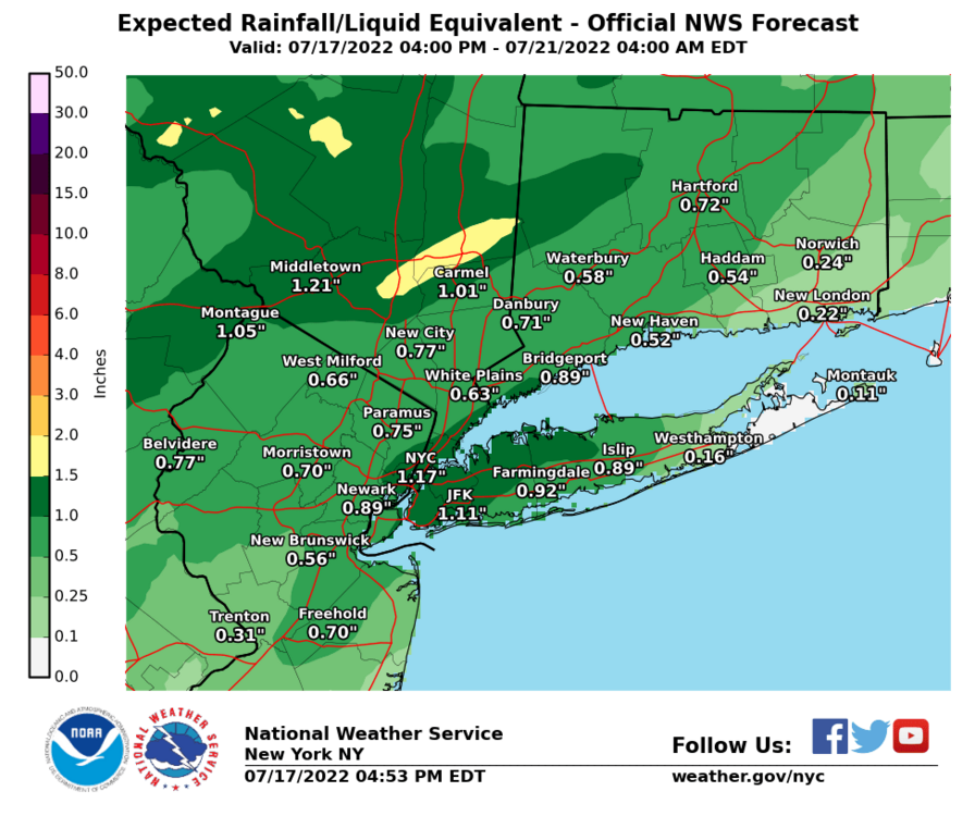
Thanks for the updates, anything on how much QPF? looks like Upton has maybe up to 0.50 and WPC 5-7 day QPF maps have backed off a little.
-
The ground surface up this way is dry and rock hard. Any heavy rain will just runoff. People camping this holiday weekend should keep an eye out for possible flash flooding conditions especially the camping areas along the Delaware River.
-
Grass is going dormant here and the ground surface is rock hard. Hopefully we get a slow soaking Saturday night into Sunday. Anything heavy will just runoff. Also agree with the fireworks thrown in the mix.
-
Beat me fair and square, .01 here.
-
DCA _ NYC _ BOS __ ORD _ ATL _ IAH ___ DEN _ PHX _ SEA 1.1 1.3 0.9 0.4 1.5 0.8 1.3 0.7 -0.2
-
Happy Father’s Day to all. Wonderful weather to enjoy it in.
-
HRRR is showing some activity around 11pm tonight. total from this morning was 0.27”

-
Same here with the rattlers. 0.26 for the bucket. Agree with the radar presentation, seemed overdone.