Wxoutlooksblog
Meteorologist-
Posts
1,032 -
Joined
-
Last visited
Content Type
Profiles
Blogs
Forums
American Weather
Media Demo
Store
Gallery
Everything posted by Wxoutlooksblog
-
I would think we could have an isolated warm day or two during the first half of April but a "warm pattern" probably not. I think that in the cool or possibly even cold pattern we could see a warm day if a warm front lifts just north of us briefly. There's still leftover confluence over northern New England and the Canadian Maritime provinces and the duration of any warmth should be very brief. Later in April possibly as early as sometime during the second or third week of the month may be a different story where we could have an isolated cool/cold day in a much warmer pattern (70s/low 80s). WX/PT
-
To some extent at least for the first week or ten days of April I tend to agree with Accuweather if that's what they're going for. I think that towards the end of the second week of April or the beginning or middle of the third week of April the pattern will somewhat dramatically flip/flop bringing warmth to most of the East Coast from D.C. to NYC. When I speak of warmth in this case I am speaking of 70s and lower 80s, not 90. WX/PT
-
For the potentially warm or snowy period 3/28-4/3 depending on what you look at, I'm looking for the warmth to get stuck just south of NYC with fog/drizzle then showers/storms temperatures in the 60s mostly. 73 up to Newark maybe. But I could see rapid warming during the second or third week of April perhaps up to mid 80s region wide for a time, and 90 first or second week of May. I think we'll see a strong Bermuda HP set up early and often this season. WX/PT
-
It looks as though we might transition back to a colder wetter pattern for a while beginning next weekend. WX/PT
-
I think the coldest we are going to see from this point is highs in the lower 40s and lows in the upper 20s to lower 30s but I think over most of the next 2 weeks except for just a couple of days 50s+ we'll see highs upper 40s and lows lower 30s. I do not think the NYC Metro Region will see any more accumulating snows. Maybe a flurry. I think there is a 50% chance we hit 70 degrees briefly on one of the warmer days in the next 2 weeks. WX/PT
-
My gut feeling right now is that it probably won't come back but I cannot draw that conclusion absolutely for a few more run cycles, probably 12Z tomorrow and 00Z Tuesday. At the moment all we have for hope is the NAM (which is not much) and a few outlier ensemble members. Everything else is a "not happening" and in the last 8 hours has been getting worse, not better. But in the passed we have sometimes seen an unexpected reversal in trends within the last 72 hours. So I wait until tomorrow night or Tuesday 12Z to sound the "all clear". WX/PT
-
If you get a trend back from Icon it will probably be 6-12 hours prior to the onset of snow (if there is any). Icon is not one of the top tier models. ECMWF is still the best, GGEM very good, UKMET good. I'd look for changes in one of those three models to signal a reverse in trends if it is to be. Icon and GFS would not be first to the punch bowl. WX/PT
-
Totally agree. I think we are still seeing the normal model fluctuations that we see before most of them narrow down to more of a consensus. Once we get to President's Day we should begin to see a more clear cut trend. They will probably continue to go back and forth debating the track and position of the upper low, the kicker, and the surface track for the next 24-36 hours. Right now, I think this can end up going either way. But it certainly looks better than earlier and than on the other models. WX/PT
-
GFS doesn't make much sense. We have a closed upper low west of us. It pulls the low pressure system right up the coast offshore as shown by virtually every other model except the ICON. Even the ensembles support the track up the coast. Right now IMO the odds heavily favor it not that it couldn't change. It could. But we will watch the trends. This could possibly be a KU storm with potential for a foot or more of snow. WX/PT
-
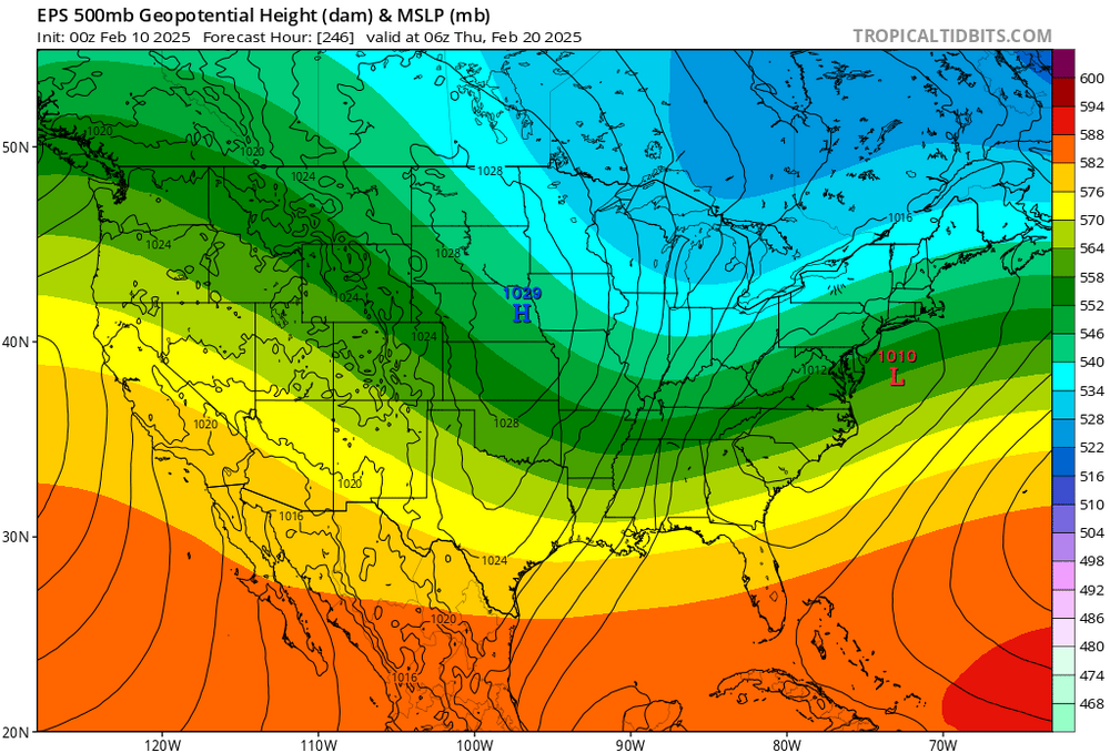
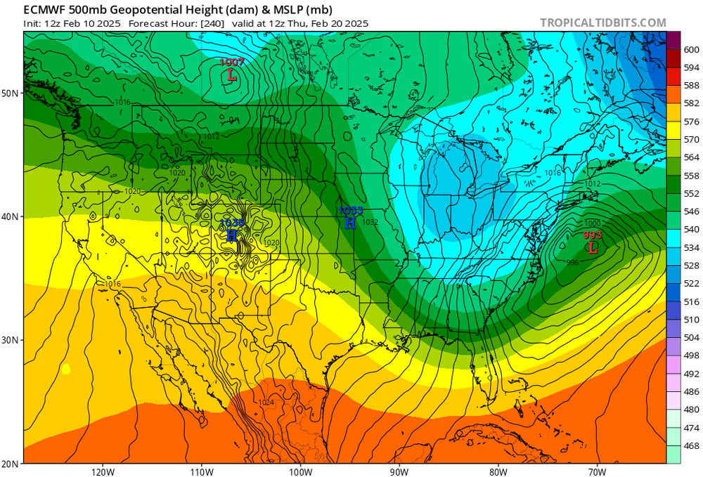
The Euro operational has a storm which if these maps verified (which they almost certainly won't) would suggest a major snowstorm possibly KU the 19th-20th. WX/PT
-
On most of the operational models at 12Z and 00Z now we are starting to lose the great pattern they had up until today. The only model holding onto it is the GGEM from which the storm right after Presidents Day might be suppressed way to our south if it even has a chance to develop. WX/PT https://www.tropicaltidbits.com/analysis/models/gem/2025021000/gem_mslp_pcpn_frzn_us_38.png


