DTWXRISK
-
Posts
3,412 -
Joined
-
Last visited
Content Type
Profiles
Blogs
Forums
American Weather
Media Demo
Store
Gallery
Everything posted by DTWXRISK
-
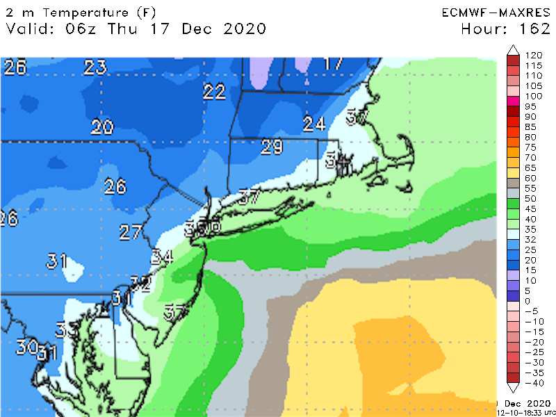
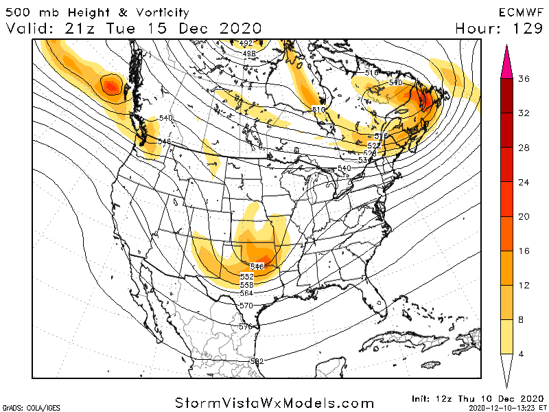
MON DEC 14 looks like a cold rain to me... the 850 mb is cold enough but 925 and surface temps are way too warm even in the mountains
-
18z GEFS is still looking very good and MUCH different from the op GFS AT 18Z this tells me... and this is just NY view ...fell free to dispute it... but this tells me that the op GFS runs are having its usual issues with PTJ/ STJ interactions
-
90% of the time there is NO nw trend .. this MYTH comes from the older versions of the shitty op GFS always starting every low off the coast of GA at 168 hrs as a weak ass flat LOW
-
UM what storm for xmas?
-
AT THIS RANGE THE ONLY THING THAT MATTERS ARE ensembles and does the op run MATCH the ensemble mean ( or close to it )
-
you are over reacting to the 18z GFS
-
i told yall my return would bring it back.....

-
much better WOOF
-
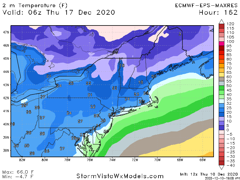
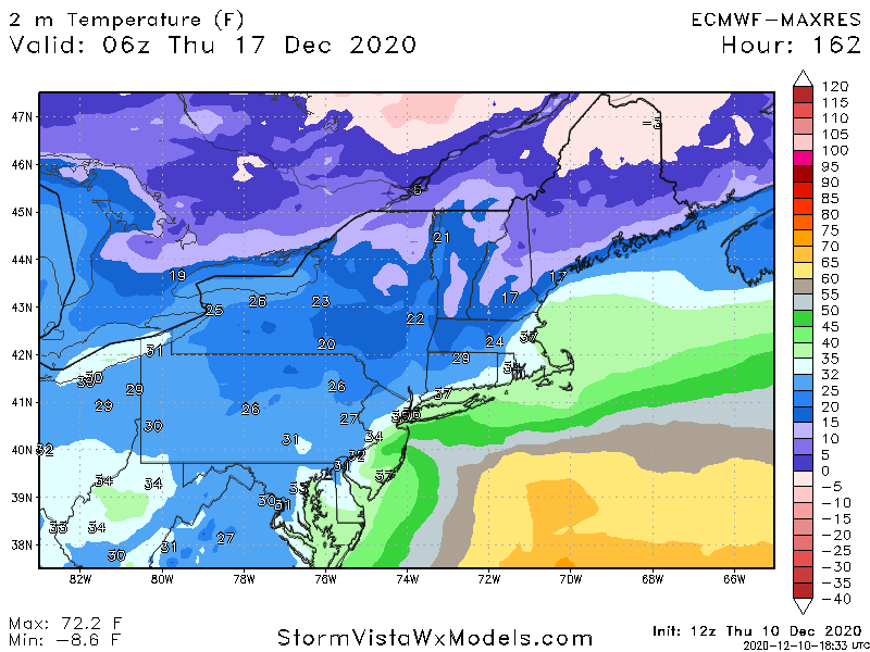
As much as I Want those snow maps to be right for NYC ne NJ coastal CT .. the surface temps are NOT great
-
taken verbatim the surface and BL temps on the 12z Thursday Euro for eastern NJ NYC coastal CT are marginal... like I hinted at before... the ecmwf of course could be too warm
-
+2
-
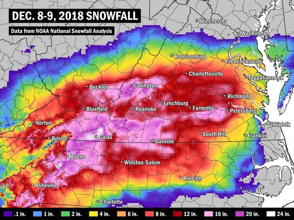
In fact 2 years TODAY in RIC had 12-16" of snow NWS went 1-3 " what is worse is that ALL of the model data with 72 hrs EXCEPT for the GFS has HUGE snow amount there so its the mentality that thinks well that never happens there which is the problem hence the reason why NWS and all 3 TV stations spent the next 4 days issuing apologizes
-
I see you are still lying about your snow totals
-
( yes I want everyone to have snow... I dont get joy from my region and or other regions missing out on it . Sorry )
-
WOOF for New England
-
dude... that is not even close to what I was saying merry xmas
-
yes in the AM but by 18Z readings in Mid 30s... Td 30-32.... could be heavy wet snow
-
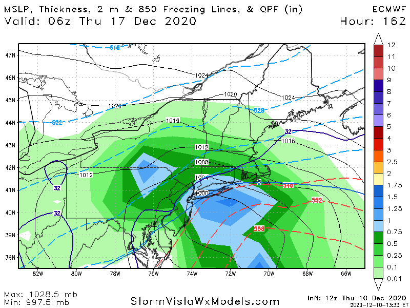
the LOW that develops on the front DEC 14 ... temps TOO warm low levels for VA MD DEL NC WVA
-
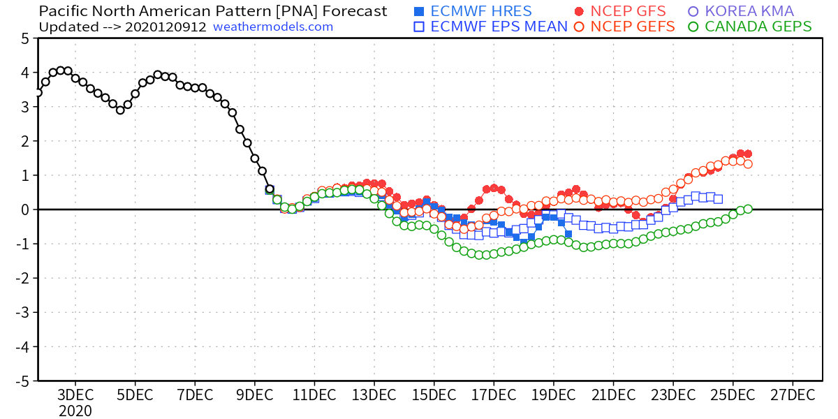
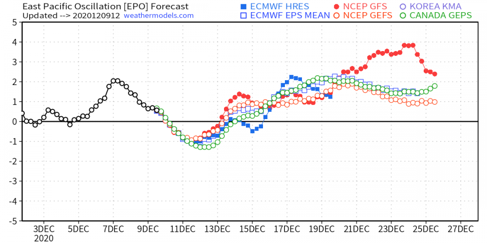
PACIFIC NOT SO MUCH

-
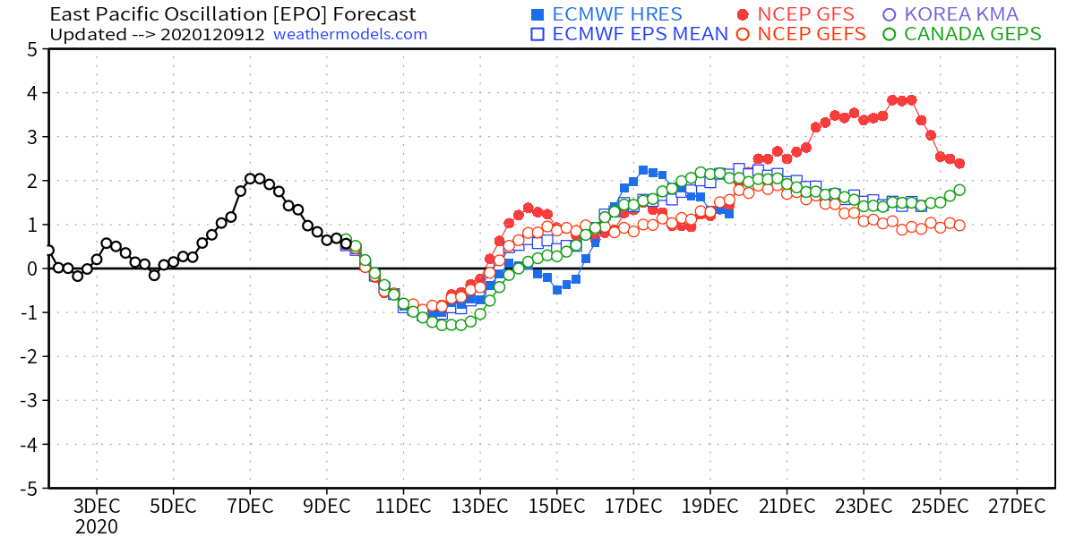
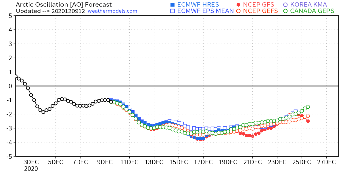
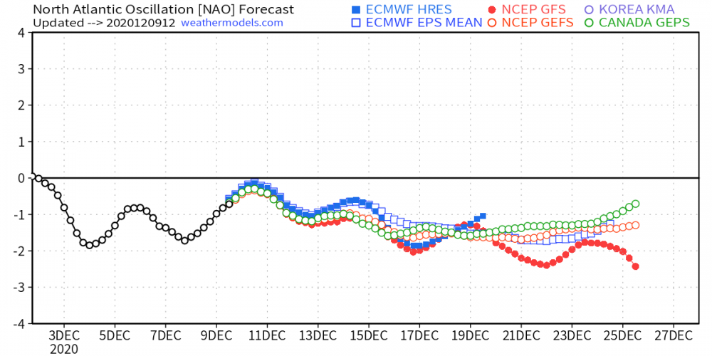
ATLANTIC TELECONNECTIONS LOOK GREAT

-
Shen valley could SEE i 81 snnowstorm with this event as cold sw va western MD eastern WVA
-
I am as BULLlSH about Mid DEC for the NE US-- say from PA turnpike north as any one . in fact I made a post last week about DEC 2 abut Mid December potential in the general thread ( which no one looked at ) . I ddnt know which short wave was gong to be the one.. DEC 14 or DEC 16 ...until yesterday. I am bullish about MILLER B DEC 16 event... I think to see something like this in Mid DEC in a moderate La Nina should be a red flag to all the oh woe to me this is a shitty winter crowd I am NOT against posting snow map BUT I loathe the wxbell and weathermodels snow maps ... Give me pivotal weather and euro wx snowmaps. Hell even tropical tidbits snow maps when used correctly are better but yeah yeah for NE USA for 12/16 i am NOT woofing yet .. Growling yes..
-
https://lab.weathermodels.com/