FallsLake
-
Posts
6,317 -
Joined
-
Last visited
Content Type
Profiles
Blogs
Forums
American Weather
Media Demo
Store
Gallery
Everything posted by FallsLake
-
Not giving up yet, but the writing is on the wall (or has been since January). Really amazing how many days I didn't have to run the heat. Usually in January and February it constantly stays on; this year half the days it was off. Maybe we can pull a cool spring and not turn on AC until late May.
-
I also feel lucky getting what I got. Areas just miles to my south got very little. I have a feeling this spring may end up colder than normal. Seems in years past, after a warm winter spring tends to balance it back.
-
Yep that would be the safe bet. (so)Bring on a 1996 repeat!
-
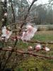
By the way, if it's going to sleet I say let it stay sleet. If we can get some higher QPF totals that could equate to a decent event. One of my favorite storms was the 1996 sleet fest and that dropped 6" of sleet in Wake forest.
-
I know I shouldn't complain, but I'm on pins and needles for MBY. The short range models have me right on the boarder of the transition. 5 to 10 mile shifts mean very different totals. But if this ends up a sleet fest I'll still enjoy it.
-
RDU folks, till a good place to be for this storm. We very well could get mixing but I think that would not last long. Still looks to be a nice daytime snow on Saturday.
-
So there are some on this board that are now pulling for the euro and not the GFS. A few others like both. Still funny how things can switch.
-
We have a lot things and folks against us right now: Euro, mets, MA forum, climo, range (still far out), and luck.
-
A good Miller B with good CAD that transfers to the coast at a lower latitude? Or a bad one with weaker CAD and gets north or our latitude?
-
But we can enjoy it while it last. I said this before, for the amount of snow we actually get each year it's amazing how many times we're at least in the game to get a significant storm. So basically you're right, we get sucked in a lot and have a lot of heartbreak.
-
The DGEX would be historic as it's depicted. As stated in the other thread even at hour 192 it looks to still be at it's height (at least over central/eastern NC). Now back to reality, we could still have some enhancement to whatever storm we get. Water temps off the coast are still above normal and could add to a storms development; in which the models may not calculate correctly. So the 6z GFS could still be a good setup.
-
My 4000th post. Bummer of a day. Things not looking good for the SE in the short term and long term. La nina looks to be in control and providing the typical pattern that keeps the cold to the west. Of course I have hope for the rest of winter, fab February has saved us the last few years, but right now there's no excitement.
-
It would be wonderful to have every model run show a great winter storm. As other have said, at this time range all you want is a storm signal. Even if this storm does (or doesn't) occur, can you imagine how many more model solutions will present themselves in the coming days.
-
But it gets blocked (...get it?):
-
We need the PNA to go positive. Whatever cold air we (NA) have will continue to just dump to our west. I know the EPO can do wonders but its seems a positive PNA is a primary indice for the SE.
-
Yep, that GL low seems to be the killer. Maybe that can turn in our favor in future runs. (also) The thing that can be upsetting is the day 16 of these run now takes us into mid January. We in the SE are now starting to lose prime winter storm time.
-
This thread should be hot today after the latest run of the GFS. Everything stays to the west. I guess you could say both the 0z para and 6z GFS look a little interesting at day 16; but hasn't day 16 always looked interesting.
-
I'll have to say it's hard to get excited about future prospects with the current warm temps we're getting. Should be close to 70 at RDU tomorrow. I guess the only thing to do is enjoy it.
-
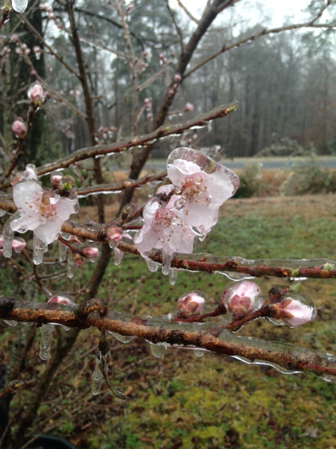
I liked the ice we received last March. But not that horrible storm we received in 2002: http://www4.ncsu.edu/~nwsfo/storage/cases/20021204/