MikeGold
-
Posts
710 -
Joined
-
Last visited
Content Type
Profiles
Blogs
Forums
American Weather
Media Demo
Store
Gallery
Everything posted by MikeGold
-
7" as of 1030. Thinking an inch or so more at best so totals will be a little lower than expected especially since it was all snow locally which accumulated immediately.
-
Ann Arbor just activated emergency broadcast system that pings cell phones telling everyone to get off the roads.
-
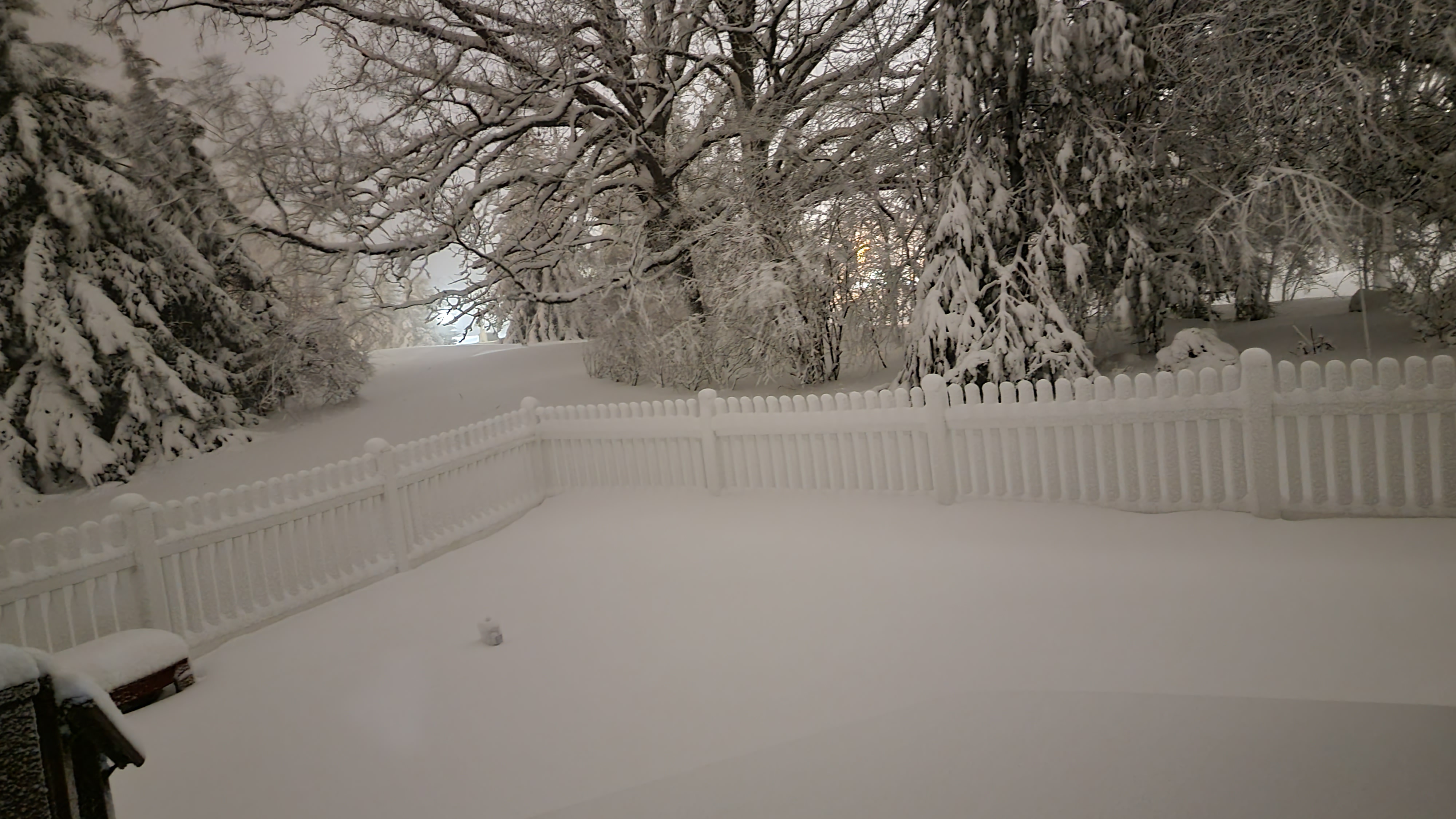
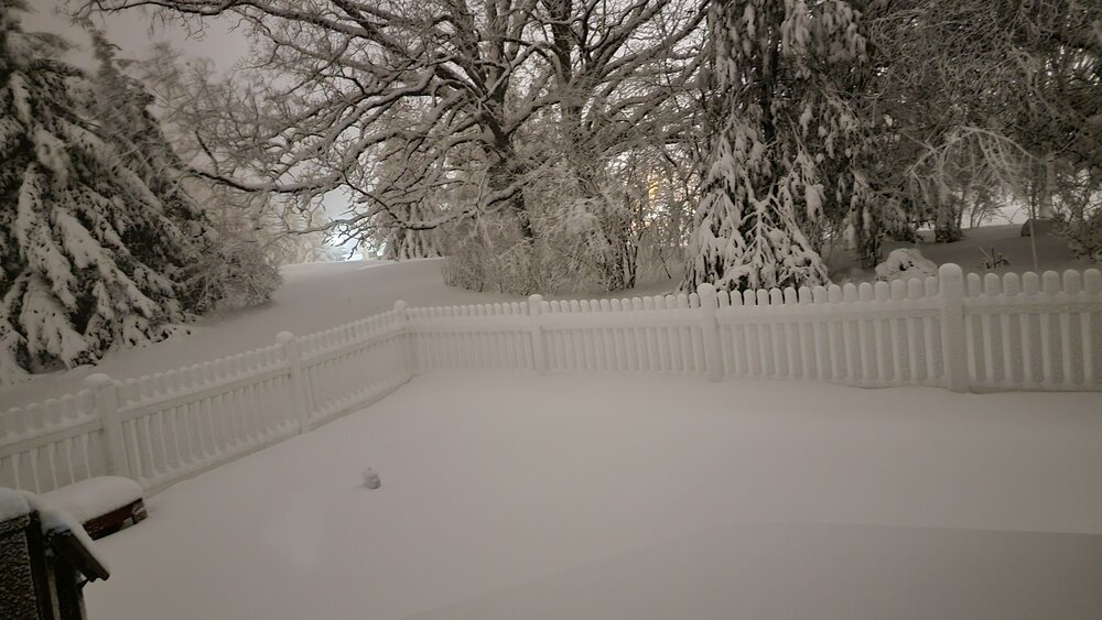
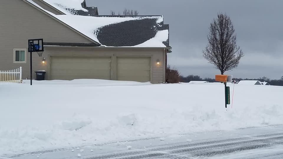
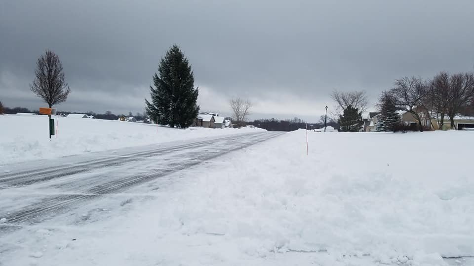
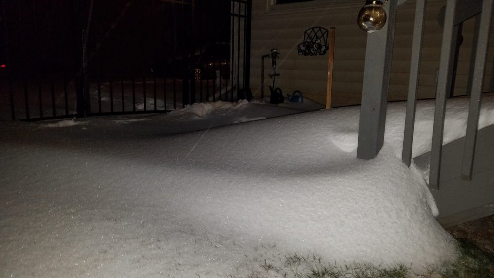
Current backyard view.
-
Epic thundersnow around 7 pm. 3 or 4 strokes extremely bright/loud; best thundersnow I've seen in many years. Hard to more pleased with how this storm turned out locally. Power is blinking right now....so maybe too much of a good thing?
-
Large flakes, and 35 just NW of Ann Arbor. No mix at all so far.
-
Specifically just East of where Wagner road crosses 94. I was first made aware of that area by a snowplow driver who told me it is where he consistently runs into the most snow in previous winters. Dexter should also do great in this setup with its cooler temperatures although precip totals are normally a little less than Ann Arbor.
-
Looks like ground zero will be the Ann Arbor area especially in the higher elevations on the west side. That is where it will be a couple degrees cooler and where the hills should be able to squeeze out some extra moisture with orographics in play due strong easterly winds.
-
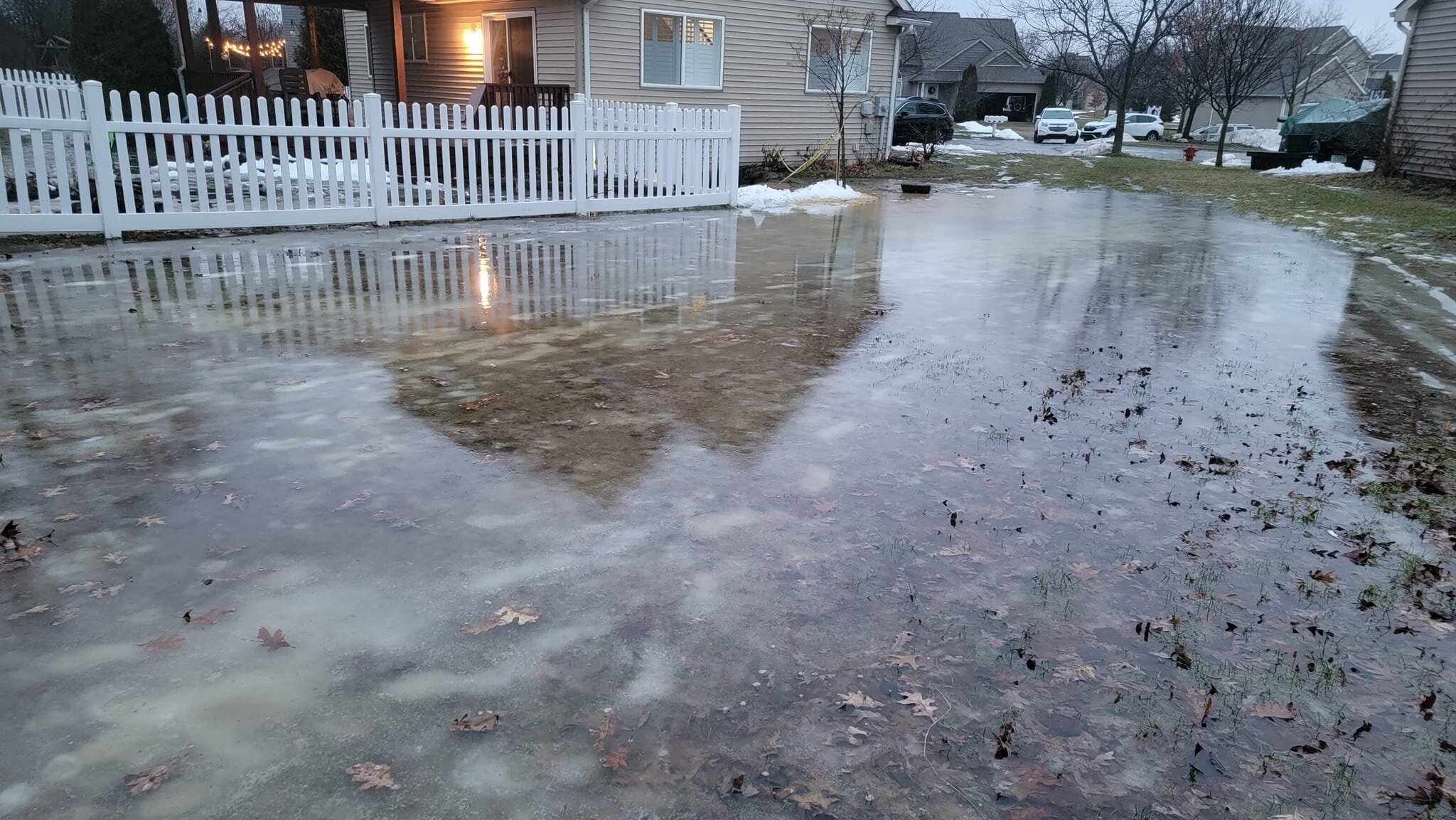
Bit of a disaster here in Dexter. The combination of frozen ground, snowmelt and overnight rain has caused it to flood into my basement. I had to create a dam out of snow to block the flow into a window well. This house just doesn't get a break. It was hit by the big Dexter tornado in 2012 and suffered EF2 damage.

-
I'm only 50 miles west of Detroit with moderate snow and a coating on the ground already so got to think the change over in Detroit will be much sooner than noon.
-
Rain/snow mix started at 5:30 just NW of Ann Arbor but still 36. Later than expected change over and lesser snows expected tomorrow have dropped expectations down to the 10 to 12 range.
-
Easy way to visualize this is to look at the DTX seasonal snowfall maps. Generally big jump in snowfall totals just East of Howell. Any easterly component to the wind will put Howell in a bit of snow shadow. https://www.weather.gov/dtx/seasonal_snow
-
Howell is definitely not a good spot for snow probably because it is too far east for lake effect and too far west of the glacial ridge where enhancement often occurs. Eastern Livingston/Washtenaw counties seem to always do better and not just with snow either. FYI...think 12 to 16" is still doable in the Dexter/Ann Arbor area if storm #2 ends up still clipping us.
-
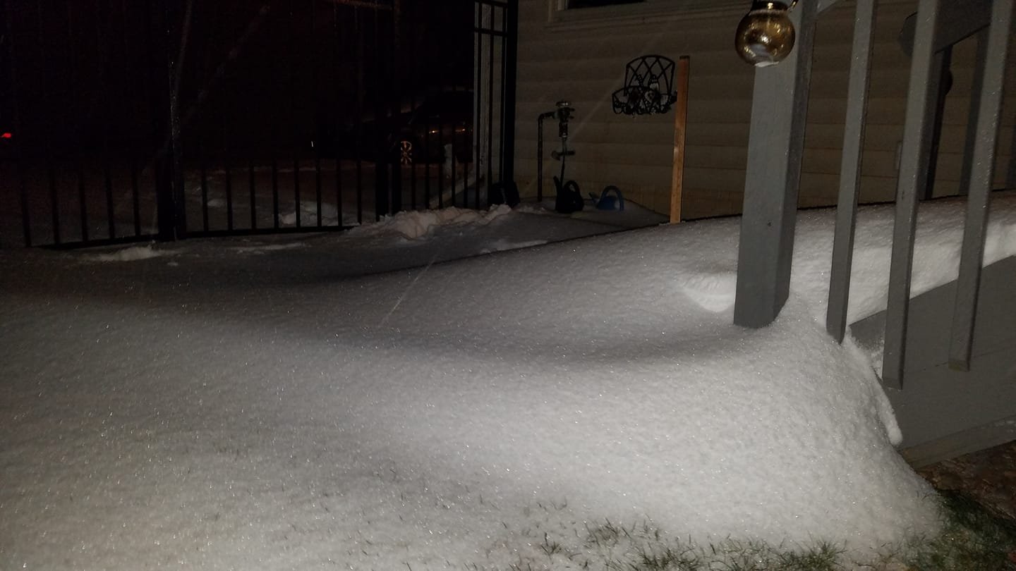
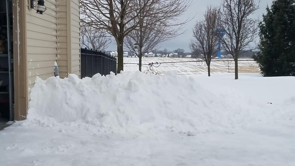
The aftermath. Shoveling this snow is no joke; especially the snowdrifts. Must be at last 1" of liquid in it.
-
Oddly, just changed back to snow/sleet mix here at 8 am. Little surprising. Thermal profiles must be riding the 0 c isotherm. EDIT: Just big flakes coming down at 8:30. It appears the warm nose of air already has shifted to the East.
-
Located near Grass Lake close to the Jackson/Washtenaw county line. Still sleeting fairly nicely at 7:30 am but mostly freezing rain during lighter intervals. Temp going up fairly quickly..now to 29.5 F.
-
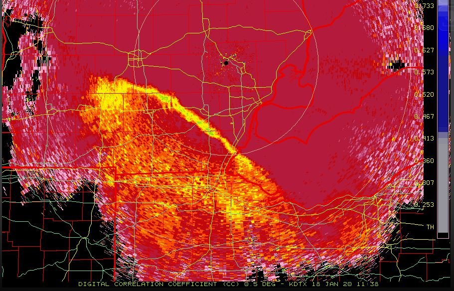
The changed over from to snow to mixed precip encouraging on SE Michigan is pretty obvious on radar this morning.
-
Changed over to heavy sleet/freezing rain earlier than expected(models portrayed the ice staying about one county to the south during the main event); around 5:30 EST. Picked up 4 to 5"(very difficult to estimate) with drifts to 1 1/2 feet or more near the house. 28 F, winds gusting to 25 mph. Yuck!
-
Not the mention that the ground will be frozen with much of the snow falling at night or early morning hours as well. The forecaster did at least mention that areas of strong vertical motion will have better ratio's of course plus some minor terrain effects along the glacial ridge. 10 to 1 is probably the way to go with this one. Thinking 5 to 8 inches locally followed by a few hours of drizzle followed by up to 1" of lake effect as the strong winds should have no problem blowing streamers a long way along I-94 with decent moisture also in place to boot.
-

January 10th-12th Winter Storm Potential
MikeGold replied to Thundersnow12's topic in Lakes/Ohio Valley
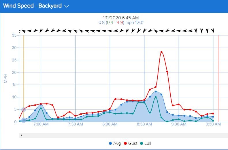
See attached wind and temperature profiles this morning for my location. Couple of things of note. The actual wind change generally to the NE occurred at a wind lull. The wind change well proceeded the actual temperature drop although a sharp gust occurred at the exact moment of the sudden temperature drop.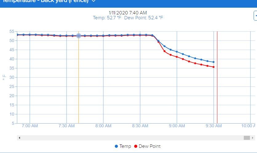
-
January 10th-12th Winter Storm Potential
MikeGold replied to Thundersnow12's topic in Lakes/Ohio Valley
Very balmy January morning at 53 at my location in E-Central Jackson county. The wind just switched to the NE in the last few minutes and the temperature is dropping after 1.37" of rain overnight. The overnight rainfall slightly over performed guidance which is a little ominous as a record crest is currently forecast for the Grand River in the city of Jackson. https://water.weather.gov/ahps2/hydrograph.php?wfo=grr&gage=jacm4 Flooding there is extremely unusual. Lots of heavy rain on the radar remains upstream. Guidance differs on how much precipitation remains to fall and exactly when the freezing rain will reach this fall South. Winds gusting to 30 mph out of Northern Michigan just to the North of my location certainly suggests temps will have no problem falling the rest of the day. Guessing about 1/2" of ice followed by 2" of snow which will make for some good photo opportunities tomorrow morning for sure. -
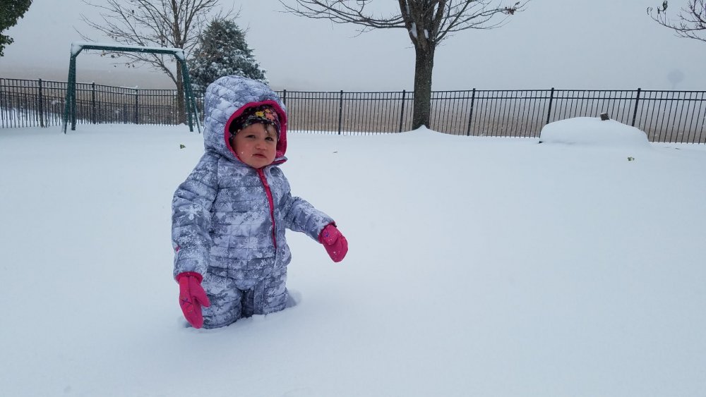
Toddler snow stick. Almost 10". Snow band is still hanging on but waning now.
- 341 replies
-
- 14
-

-

-

-
Under an intense snowband for the last several hours. Now 9" near Grass Lake, MI. I-94 West bound between Grass Lake and Jackson closed.