DDweatherman
-
Posts
5,230 -
Joined
-
Last visited
Content Type
Profiles
Blogs
Forums
American Weather
Media Demo
Store
Gallery
Everything posted by DDweatherman
-
I always used to love those days being the only one there and having peace and quiet to work. However, the drive back in traffic and poor drivers makes it less worth loving.
-
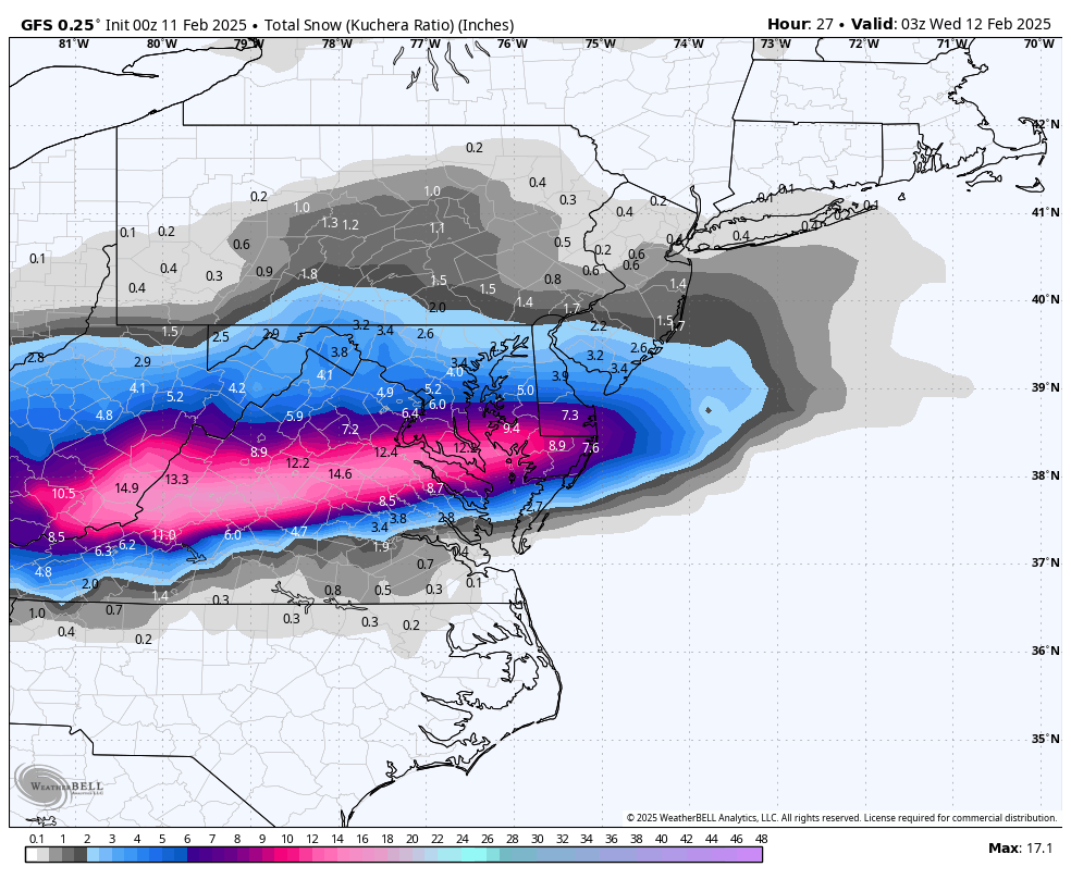
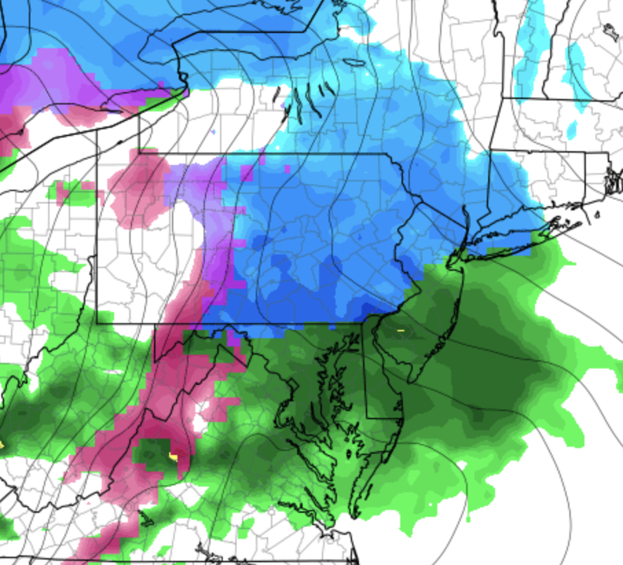
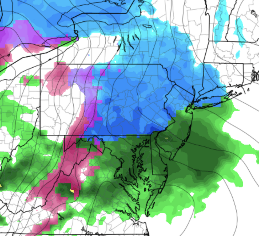
Those frames don't look bad, but 14z HRRR was sadly drier for DCA and NW.
-
Good stuff, I'm thinking 6-9" for CHO on this one!
-
You’re gonna get rocked down there, enjoy it! Make sure to go on a few Jebs
-
I have to sadly predict 2.2” for MBY, might be overdone but maybe there’s a NW death band that’ll show up. I won’t be there for it, so I’m sure there will be a surprise.
-
Such a classic one in the last sentence. Too many things to get blamed for! I too would be quite bullish going strictly off satellite images and WV, as the connection on this one is a long fetch of moisture with the gulf open for business. It wouldn’t appear to be moisture starved. Here’s to hoping the HRRR catches on at 13z, even though this is a 1-3” event for MBY. had to change my flight out of DCA to 1230 today when I was looking at radar and obs before bed. 4pm would likely have been no go even down in UHI hell.
-
Eh, hr 27 looks worser like Narl said. Maybe I'm high?
-
Pretty wet in spots from what I can tell.
-
There have been so many days this year with snow whether it be snow showers, actual snow, etc.
-
He's compiling his analysis as we speak. Also pulling up the RAP.
-
Not really, still mainly mixed bag or rain
-
I was more so talking about the southern edge. Big time differences in NoVA down to RIC.
-
A very big difference between the GFS and Euro just about a day out from this one... also note the ICON looks more Euroish and the RGEM looks more GFS-ish. NAM is in between.
-
Damn right, now it has to be real.
-
Clearly wave 2 weds night is essential for the N MD/S PA gang.
-
Aldie, though rural, has kinda become the high rent district out in London hasn’t it? @aldie 22 they’ve built a lot of big time homes there and in Purcellville I believe.
-
Thank you! I'm enjoying this from the NAM h57
-
Can h57 of the 18z NAM deliver? Probably the best chance at making up for lost snow tomorrow/weds AM. Also, @stormtracker or anyone else, should my file max size be 261kb? Recently, I haven't been able to attach anything...
-
I have actually been rooting for a cutter, looking at the evolution, that definitely helps with a 50/50 for a blocked miller A or hybrid system coming up from the south.
-
Consider me really interested in what happens Weds night when I'm trying to fly back into DCA. Maybe not so much for the flight in, but the drive up to my house from there.
-
or maybe just in ground truth at gametime. These systems are uber sensitive to the smallest changes.
-
It's like the NOGAPS/navgem reverse bias. If you see it amped, that's good because its usually progressive. If the HRRR is progressive and de-amped, shit because it's usually amped. Na mean?
-
I’d take 3-4 to get us over 20” on the year. Then hope for a thump weds night
-
I wish it was someone we all liked less that did the pbp’s lol.