SouthCoastMA
-
Posts
8,568 -
Joined
-
Last visited
Content Type
Profiles
Blogs
Forums
American Weather
Media Demo
Store
Gallery
Everything posted by SouthCoastMA
-
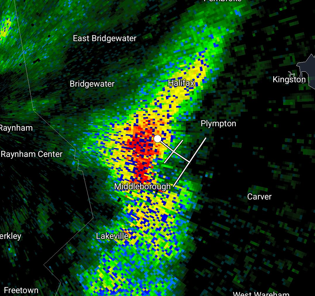
bet there is some snow in this cell
-
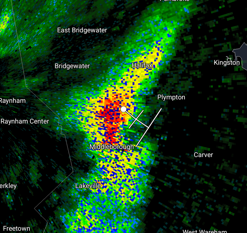
pea sized hail/ice falling..39°. seems more like sleet now
-
Mother's Day at this point? looks like a stubborn cool/cold pattern..brutal
-
46° and drizzle clouds pushing westward
-
End of April and early May looks like ass
-
DT and TT getting some 40's/50's for several days in a row will be a good character building exercise.
-
It's actually better here than yesterday.. 58° 61° and mostly sunny. The life of being within 2 miles of the water. But yes, this week was overrated along the coast aside from Tuesday..and part of Wednesday.
-
Late april into the first week of May looks like the Final Boss of spring misery in new england. See 6z euro AIFS Hosting a party on May 3rd, so we hope that doesn't pan out.
-
6pm high so far of 66..better late than never
-
Meanwhile, 74° in Bourne..5 miles to my SW.
-
Full sun and 53.1°. Likely still better than next weeks vomit
-
64.2°..went from about 76 to 60 in early afternoon before we rebounded a few degrees, while falmouth was still 77°
-
Just like that soil temp is close to 50°. Ill throw down some stuff tomorrow or Friday
-
news to me
-
Do you own a hose or sprinkler?
-
74.1° today - amazing turnaround compared to yesterday
-
Last part of April looks like ass..had a feeling
-
that actually makes the 95/75 crowd seem less nutty by comparison. 40s and rain in April blows.
-
A windy, cloudy dud today. now at 50°
-
48/26, chilly today Last year I made it to June 1st before installing
-
soil temp still in low 40s? ill need to wait another week for the pre emergent
-
57.6° - Not bad if we can approach 60 That extra 5-7 degrees in this sun makes a difference
-
SST's in Cape Cod bay are still in the low 40's. Going to be a while before anyone is safe along the coast.
-
Might be overdue for a week long wheel o'reah at some point this spring
-
53.6° Will be difficult getting past the mid 50s here until Tuesday