

olafminesaw
-
Posts
3,160 -
Joined
-
Last visited
Content Type
Profiles
Blogs
Forums
American Weather
Media Demo
Store
Gallery
Posts posted by olafminesaw
-
-
2 minutes ago, Queencitywx said:
FWIW 12z GEFS has a mean snowfall at Chapel Hill of 4". For those of us in the western areas of the triangle, I still like this event.
A big improvement from 6z for most everyone.
-
Just now, WidreMann said:
The pattern isn't that hostile. We get a transient +PNA, neutralish NAO and negative AO, with a decent cold shot coming down, with reinforcements. It's not the absolute ideal pattern, but I've seen worse patterns produce wintry weather here.
When you get a deep moisture feed, with a high pressing down it's a phenomenal pattern, regardless of what the indices are.
-
 3
3
-
-
The crazy thing, is how cold the FV3 GFS is already at the surface. It won't take a perfect track. A less than ideal track would make for a lot more sleet than modeled I imagine, because there are so often sneaky warm layers with transfers. Even if things trend pretty far north, we should get something on the front end, which is a big bonus. You know you're in a good spot when you're equally worried about suppression as you are it coming to far north.
-
-
Much more reasonable FV3 map, to balance out the general clownishness around here. I would take this to the bank. Of course, we still have an eternity for things to go wrong, never forget that.

-
2
-
-
1 minute ago, WidreMann said:
The high doesn't have as much support and is tilted back towards the west rather than being a proper banana high. The downstream trough is also a little weather, so confluence will be as well.
Still, seems like an improvement, with the possibility of a transfer, much like the FV3
-
Much faster, which should be better, with the positioning of the High
-
19 minutes ago, griteater said:
^ He also has an advanced algorithm for snowfall...but having said that, his clown map for the FV3 is inflated like TTidbits where there is mixed precip, so something is off there.
https://www.weathernerds.org/models/field_definitions/Snowfall.pdf
There's also a lot of borderline soundings, where his algorithm is counting as snow, but there's no point splitting hairs at this point. When it comes down to forecasting closer to the event, it's probably better not to rely on snow maps, but do qpf frame by frame with precip type based on soundings.

-
Substantially stronger High at 138, bodes well.
-
So many days to go...

-
1
-
-
A nasty ice storm on the back end. 8 hours or so of fairly heavy freezing rain, with temps in the upper 20s for the triad.

-
Wunderground is calling for 1-3" of snow on Wednesday. I guess a dusting to an inch or so is probably the ceiling, with good rates needing to overcome temps in the mid thirties. The timing is perfect on the GFS, so that would help. Any snow is a win in December. I just moved here, so I'm not sure about local climo, but it would seem, the mountains often would steal snow with this kind of little clipperish thing.
Edit: Although Now I see it has more to do with the Coastal low, which seems like reasonably optimistic set up.

-
1 hour ago, PrinceFrederickWx said:
About five days left to enter- we have 48 contestants so far.
Notable absences include @Bob Chill , super weenie @attml and previous champions @Stormpc and @olafminesaw
Also some of you (like @George BM ) need to post an actual forecast. I'm actually not sure if @WxWatcher007 forecast is a troll or serious at this point though.

Sure, why not
DCA: 17.3"
BWI: 19.4"
IAD: 23.5"
RIC: 9.8"
SBY: 8.7"
-
-
If the eye were less ragged we'd be talking about yutu returning to its former glory. There's pretty good model agreement now on a track similar to Mangkhut. I feel for the small communities trying to rebuild there, if it does indeed make landfall (hopefully with some substantial weakening beforehand).
-
-
This gas station awning is blue shed 2.0:
-
3" per hour rain rates

-
1 minute ago, fountainguy97 said:
For what it’s worth the 12, 18, and 00z hrrr run have all had this type of gusts (70-80 and even 90mph on 00z) 00z being the most agrressive. You can probably shave those gusts down to 60-70 mph. As a general rule I usually reduce those gust maps a little.
Now the normal 18hr runs are getting into range.
Yeah, it's a little out of it's range though. If it sticks to it's guns through 6z, then I'm all in for 60-70 ( east of the triad anyway).
-
1
-
-
3 minutes ago, fountainguy97 said:
Yeah very hard to say. But I’d say there is a shot at some big time gusts tmrw. This storm is on another level than normal as far as intensity. It’s very possible for some residual 80-90knt 850mb winds to filter down almost 100% when the dry air filters in.
Setup is there. But stars would have to align.
The HRRR has enhancement started 14z tmrw so 10am? That’s the time to watch for verification. That and of course current run to run trends.
And when you get run to run consistency from the HRRR, 9 times out of ten, it is going to be approximately correct. That probably means "only" gusts in the 40-60 mph range, but it's something which we wouldn't even be considering if it weren't for hires models.
-
I don't think I've seen a troll have this much success since way back around the time the internet troll was invented.
-
2
-
-
2 minutes ago, Dunkman said:
I don't know, I'd certainly think about including the Charlotte metro up through the Triad. People here have done absolutely nothing to prepare in any way. Should be interesting tomorrow.
It's funny to me how much hype there was surrounding Florence, even after we knew for sure it wasn't going to be a big deal apart from some flooding. This should be equivalent or worse, and I've hardly heard a thing about it. Blame the media I guess.
-
Quiet around here, but perhaps what will in many ways be the worst part of the storm, still to come.
-
Just now, pugsgirl13 said:
I'm in Greensboro N.C. Its really windy here. How bad do you think it will be? Should I worry?
Winds should remain more or less where they are right now for a long while. Flooding rains may be a concern, but totals over 6" should stay to our south and the higher terrain.
-
1
-
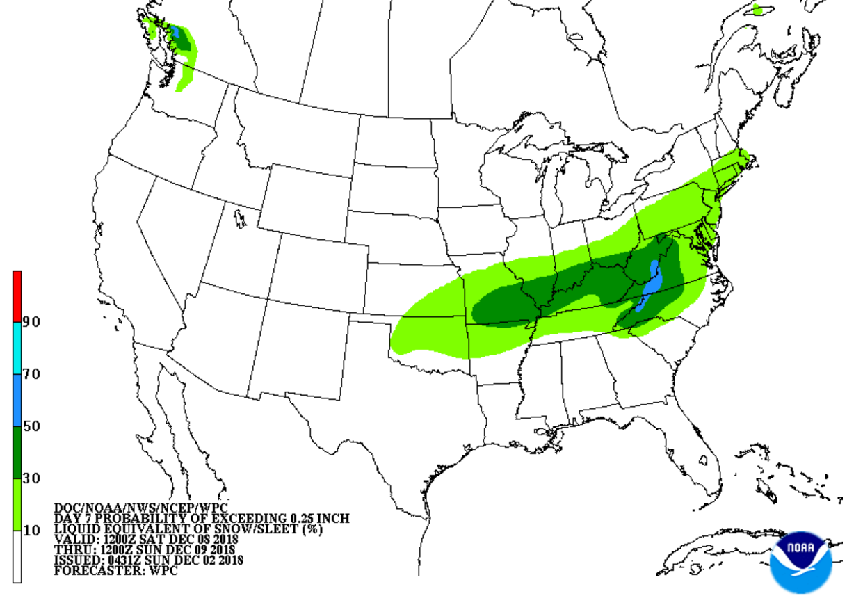


December 8-10, 2018 Winter Storm
in Southeastern States
Posted
The positioning of the High suggests it will be further south