olafminesaw
-
Posts
4,602 -
Joined
-
Last visited
Content Type
Profiles
Blogs
Forums
American Weather
Media Demo
Store
Gallery
Everything posted by olafminesaw
-
Nothing like a good cold front to knock the temps down
-
It seems RAH has had a handful of 1pm 100 degree obs but none at 12pm. Impressive stuff!
-
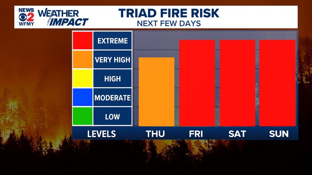
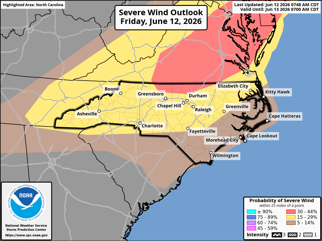
The 30% wind risk area has been extended south all the way to the northern part of the nc piedmont

-

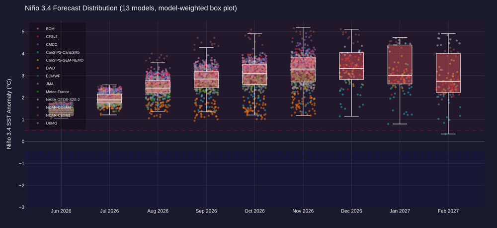
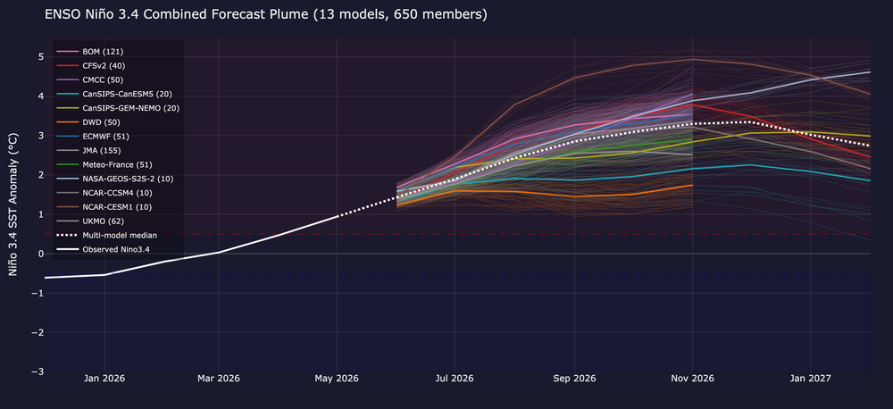
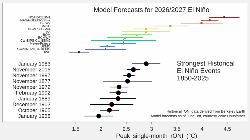
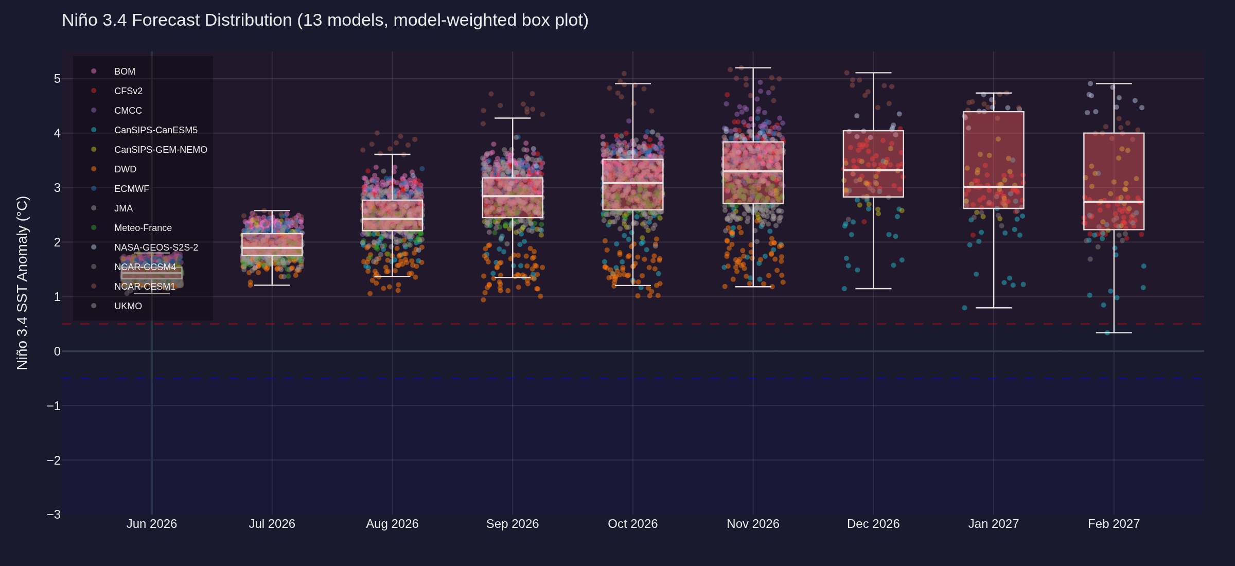
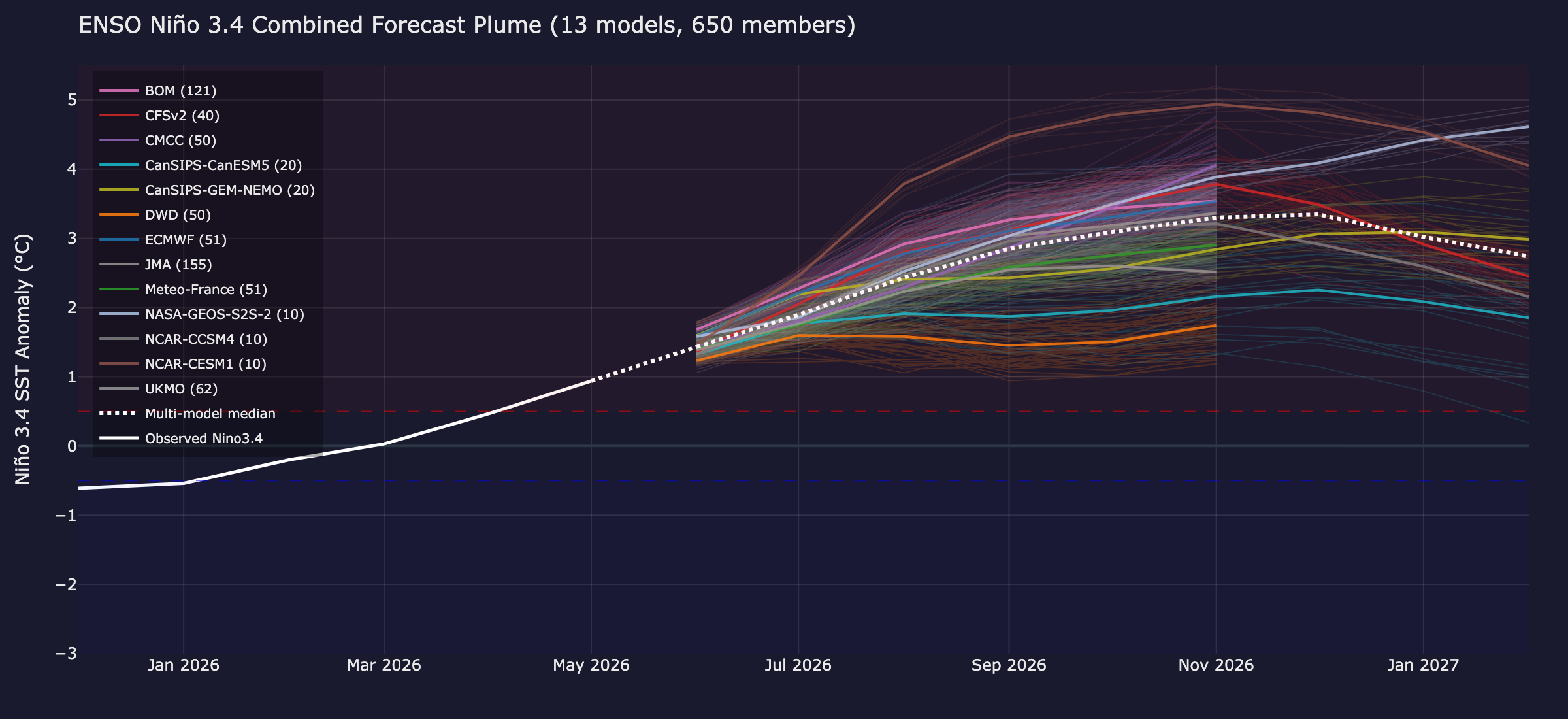
2026-2027 Super El Nino
olafminesaw replied to Stormchaserchuck1's topic in Weather Forecasting and Discussion
-
-

-
Also we are getting Dewpoints in the mid 60s instead of low 70s, so it's kinda a wash from a heat index standpoint
-
Let's start a GoFundMe to tear down the Appalachians
-
https://mesonet.agron.iastate.edu/plotting/auto/?q=97
-
-
2026-2027 Super El Nino
olafminesaw replied to Stormchaserchuck1's topic in Weather Forecasting and Discussion
-
Some signs of life in the long range as tropical moisturizer potentially heads our way
.thumb.png.1b28b07ee543b1ace44b1befc75931fd.png)
.thumb.png.7985eb053e07c6b5298e94496803fcfb.png)
-
-
Official low 48. Also the coldest June temperature since June 2 2003 (47)
-
A truly fascinating article on the development of a new AI model using data assimilation from this startups own balloon data network. https://techcrunch.com/2026/06/01/this-ai-weather-startup-is-out-forecasting-government-agencies/
-
I had raindrops on my windshield this morning. This guy is full of it.
-

-
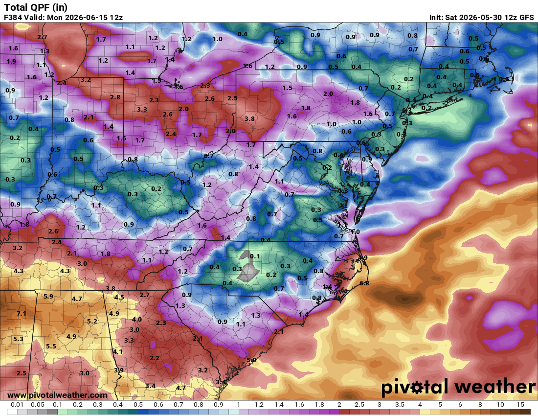
Models have had to correct way south on every system the past few months
-
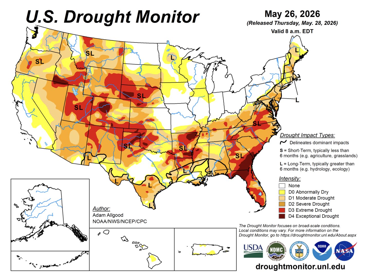
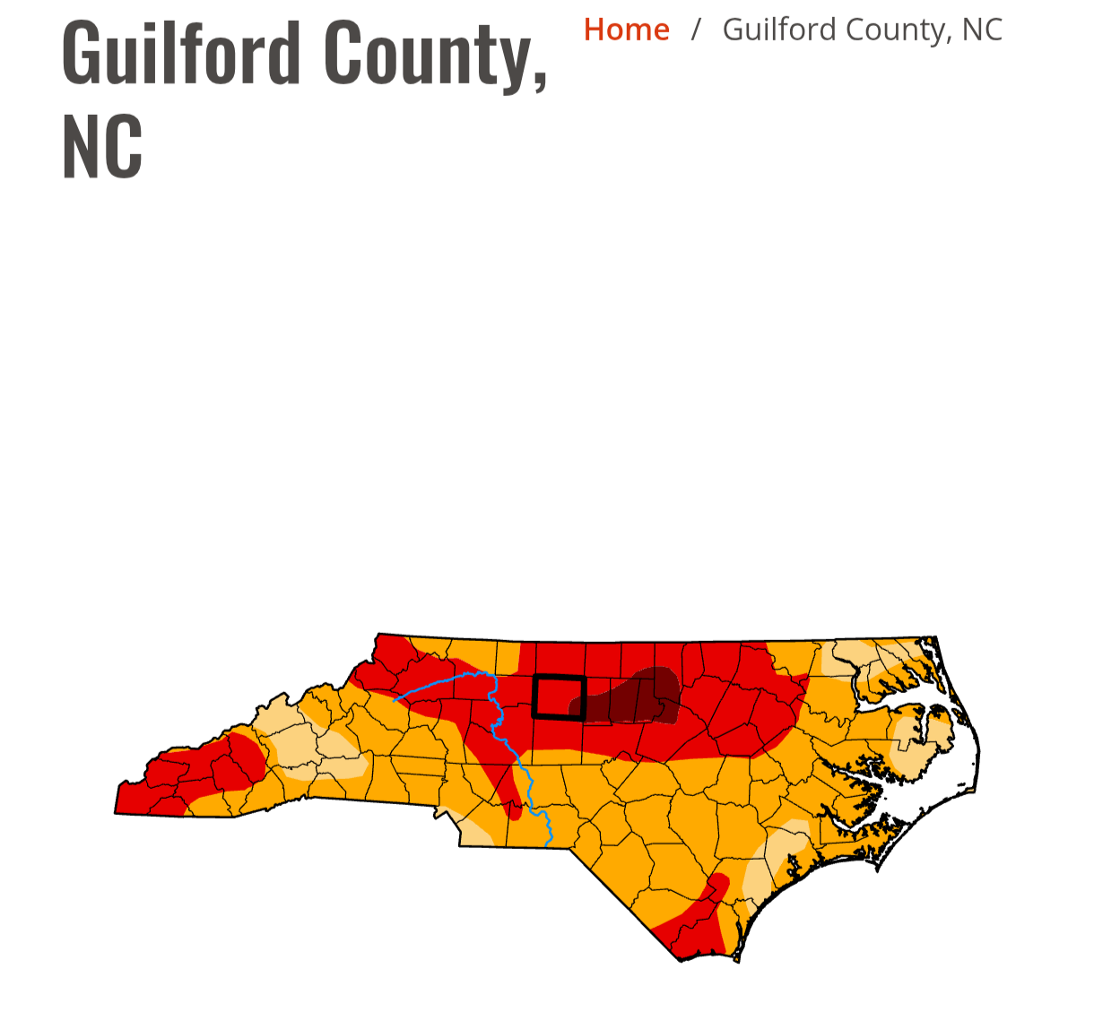
At least they should have dropped the short term drought designation in those areas. I understand that lakes and resovouirs may not have recovered, but soil moisture is likely pretty much back to normal
-
They tend to be note overly reactionary. Updated outlook:

-
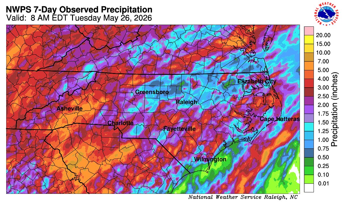
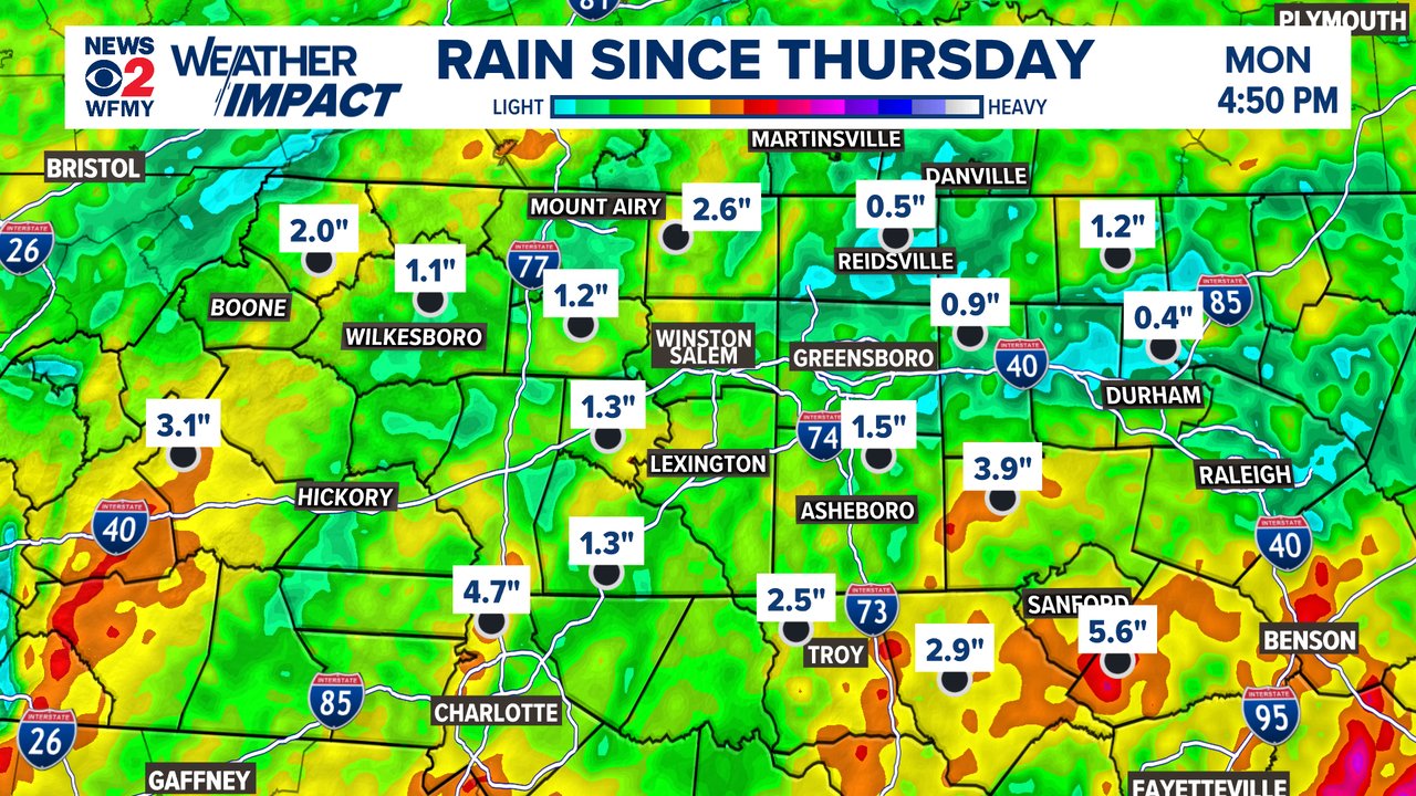
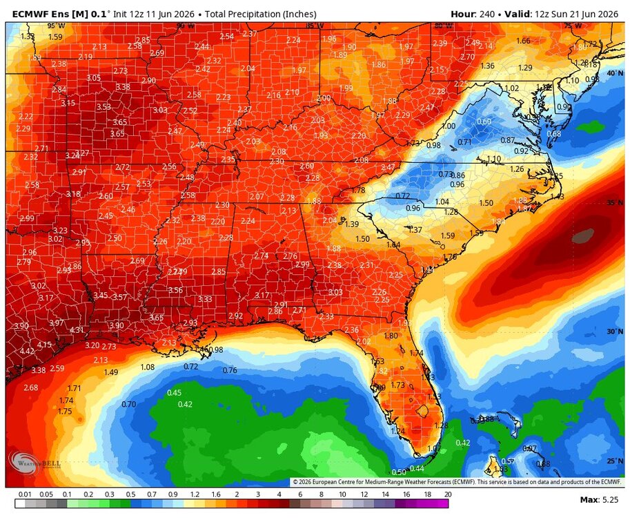
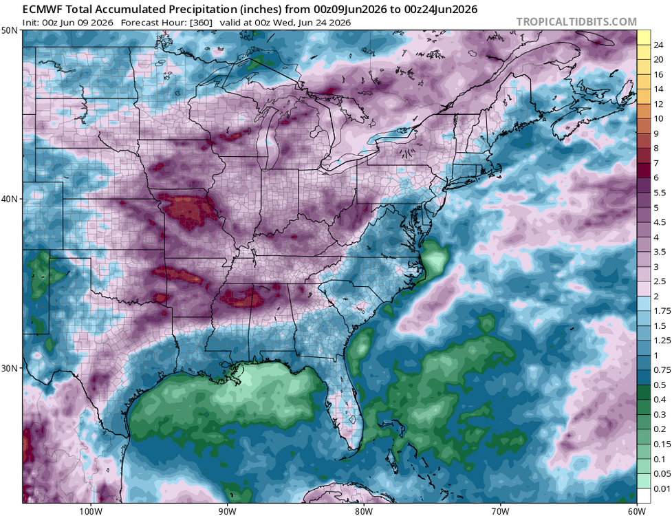
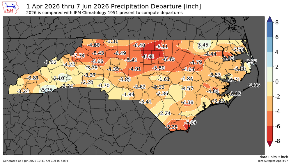
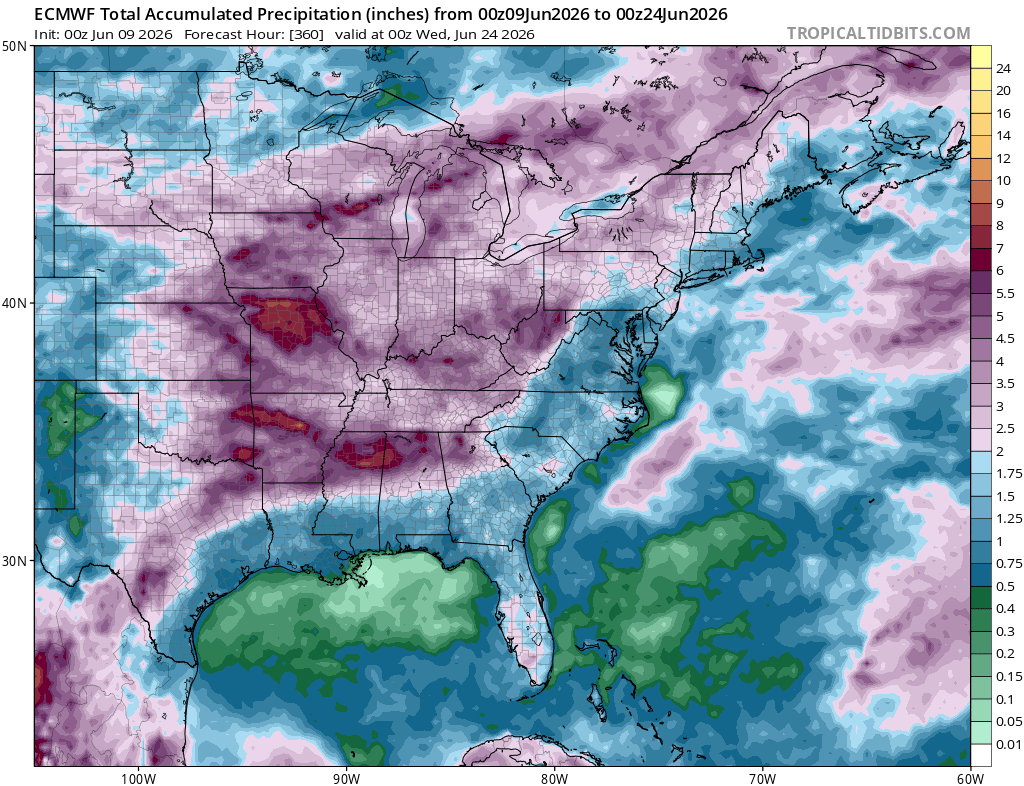
GSO picked up 1.45" in 25 minutes in that last cell, more than we picked up in the 5 day stretch when we were supposed to get 2-4"
-
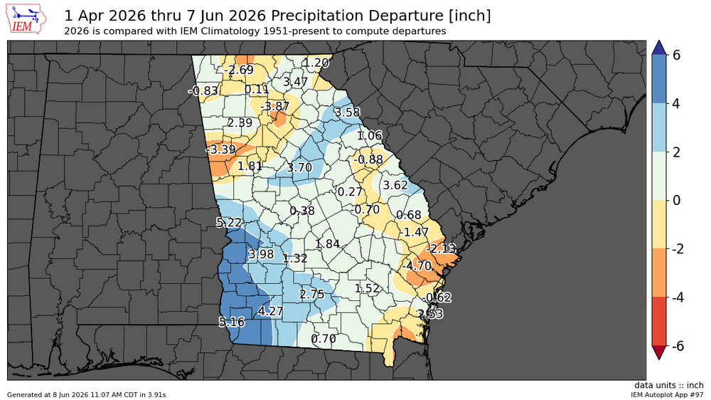
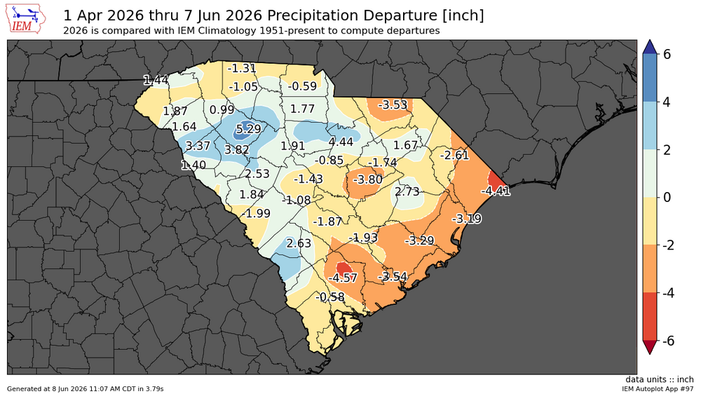
5 day totals GSO .96" RAH 1.00" Charlotte 2.53 Greenville SC 2.21" Columbia SC 2.1" Atlanta 2.39"
-

-


.png.94a2930536ec80e92518f9046258a101.png)
.png.5ceb354da7a55677d27bb582d326dc7c.png)