olafminesaw
-
Posts
4,601 -
Joined
-
Last visited
Content Type
Profiles
Blogs
Forums
American Weather
Media Demo
Store
Gallery
Everything posted by olafminesaw
-
Yeah it seemed to be working somewhat better before mid-morning but now it's as bad as ever
-
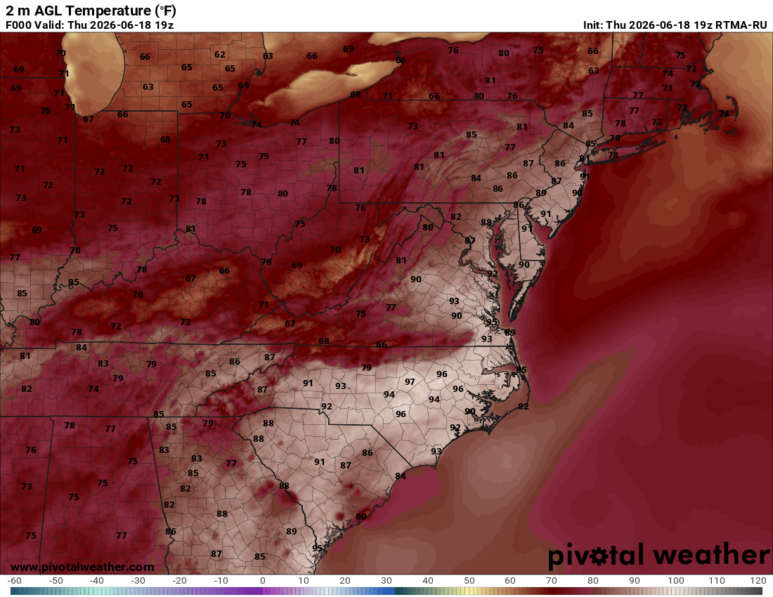
Temps busting big time for those near/under the slow moving showers
.thumb.png.265748db7ba99c5c87e3f4e045427cf1.png)
-
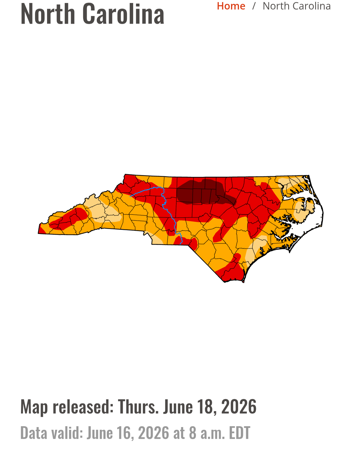
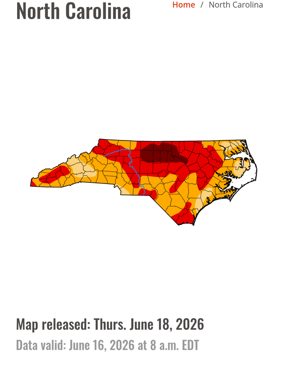
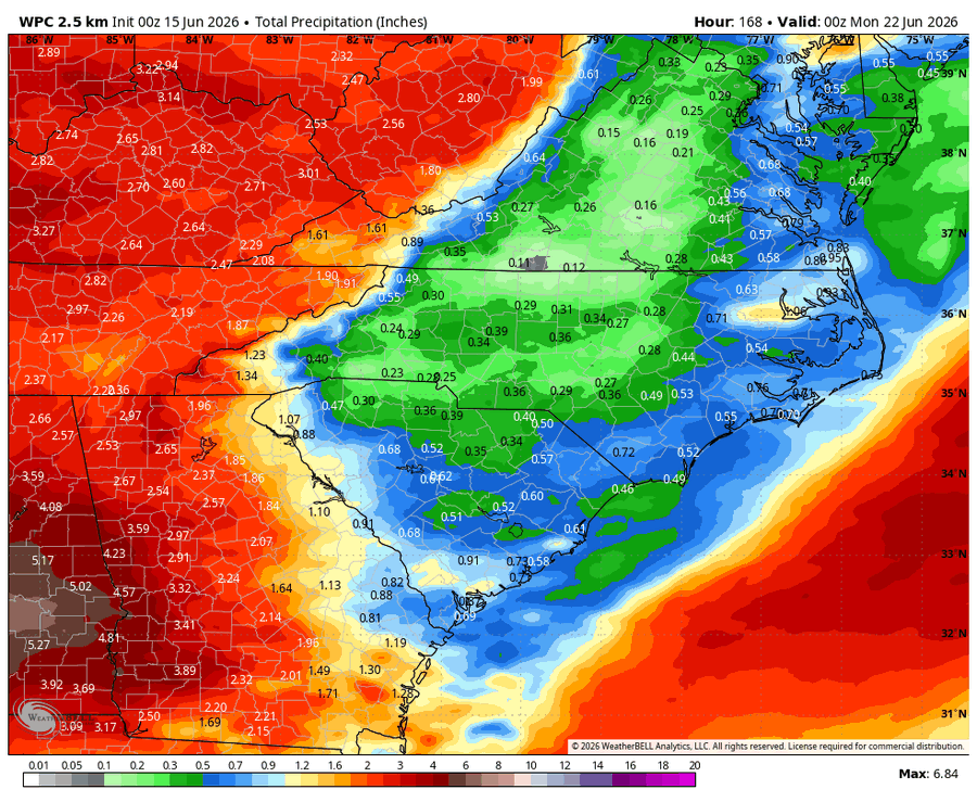
This is why the drought monitor did not show improvement. There were some improvement to short term drought (shallow soil moisture, levels of small creeks etc.), but long term drought has no meaningful dent made and the heat/moderate humidity will only worsen water levels over at least the next couple weeks
-
More of a (relatively) dry heat/strong cap to prevent convective complexes.
-
Not cool. Not cool at all.
-
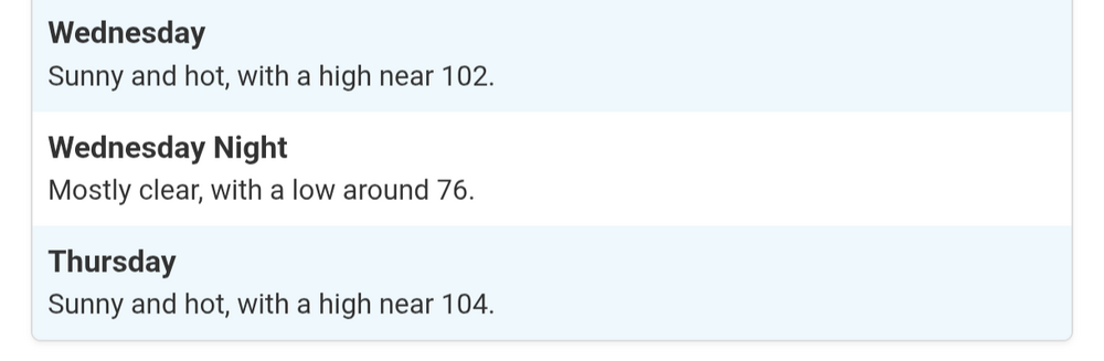
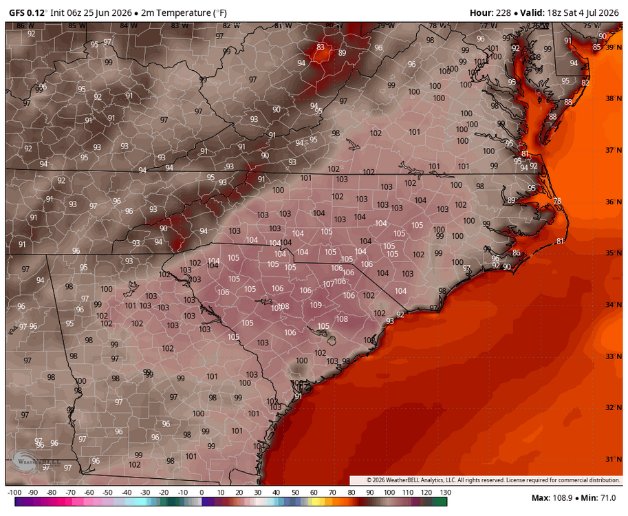
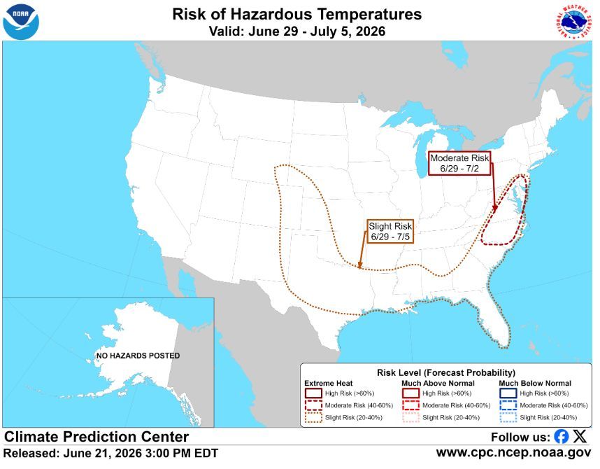
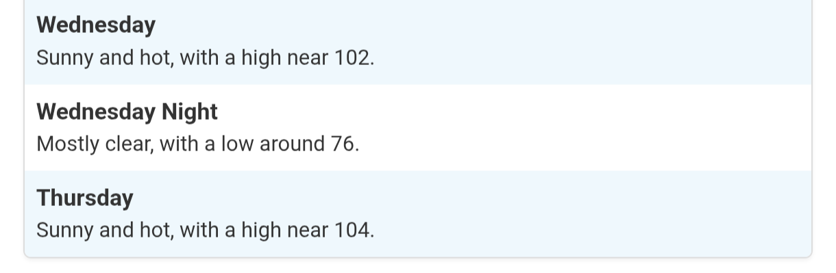
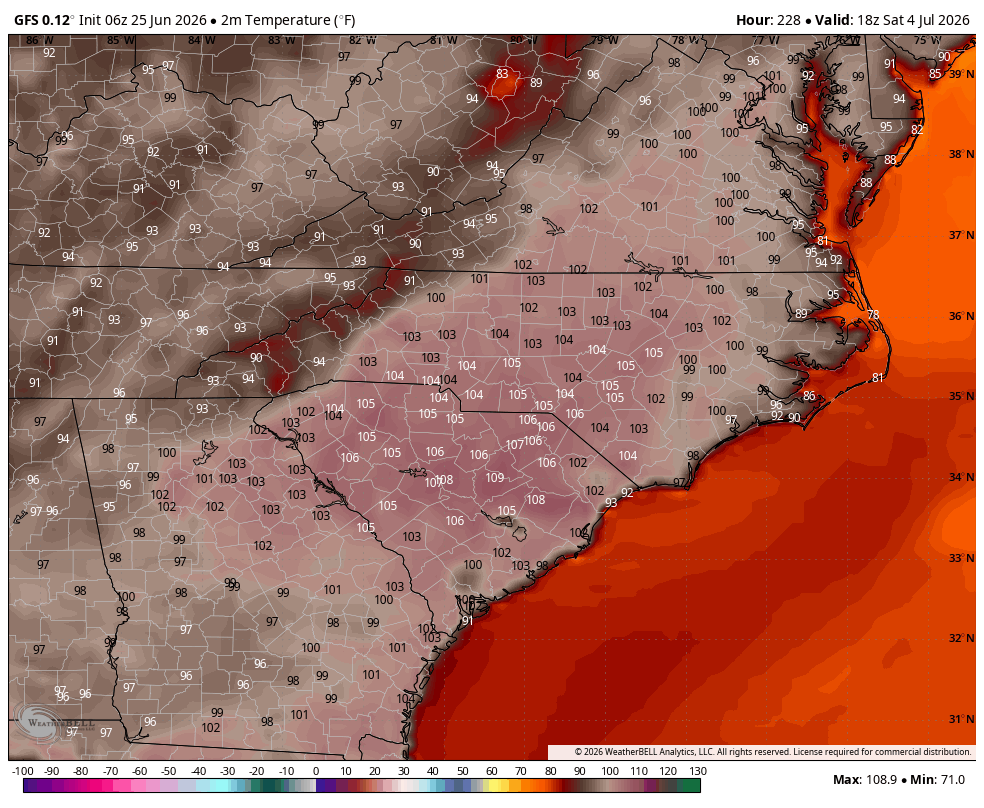
July fourth temps are scorching. An appropriate portend these days
-

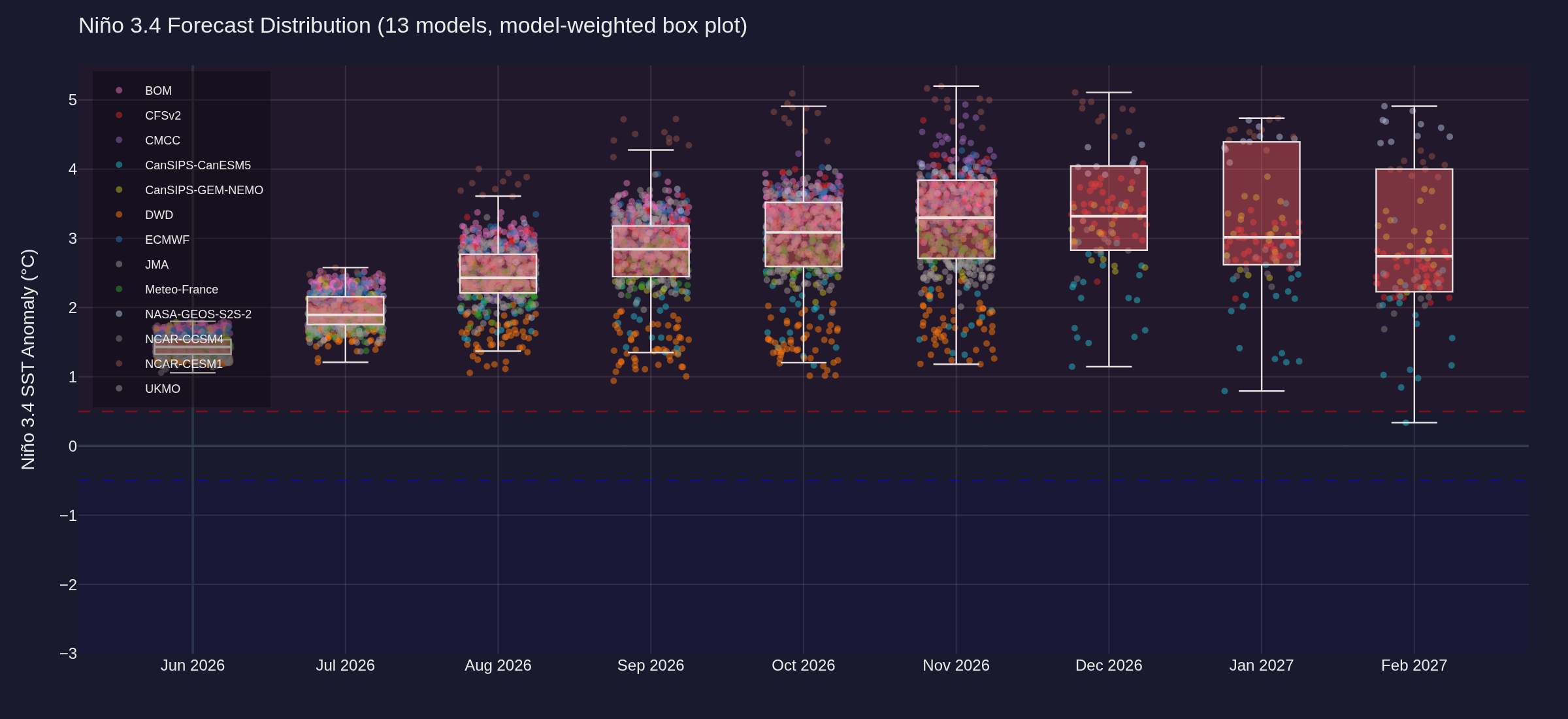
2026-2027 Super El Nino
olafminesaw replied to Stormchaserchuck1's topic in Weather Forecasting and Discussion
Forecasts have leveled out and holding steady now at +3-+3.5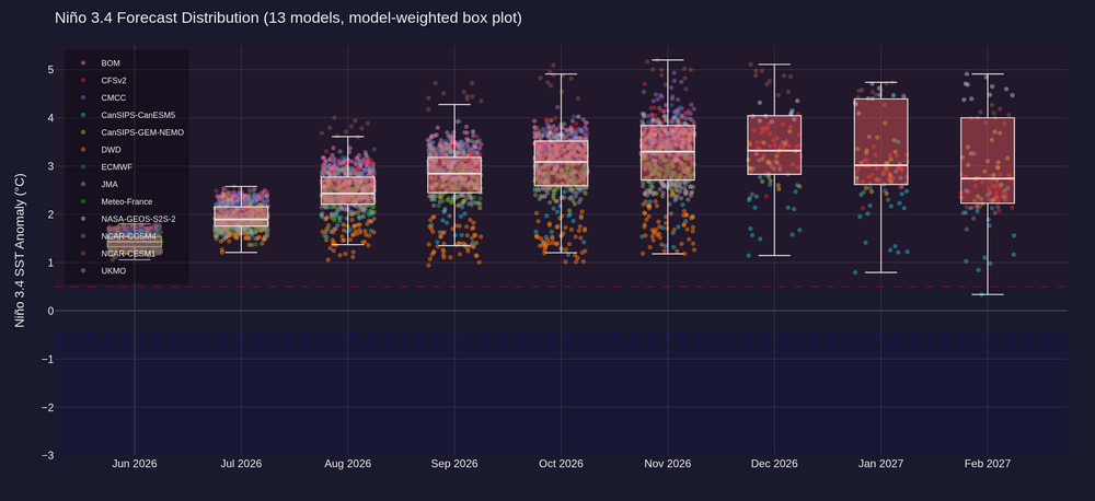
.thumb.png.7cf307fcec61f804a38a245d3d8ff8c3.png)
-
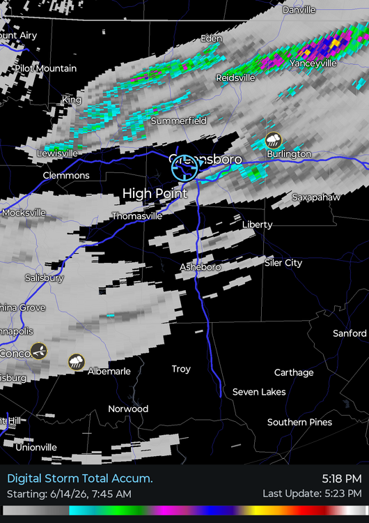
The wind with that line of storms was white impressive last night even though here in south Greensboro it wasn't nearly as bad as north Greensboro. What was really usual was how long the wind was sustained, 10-15 minutes of winds gusting to 40-50 mph
-
This gif came to mind

-
-
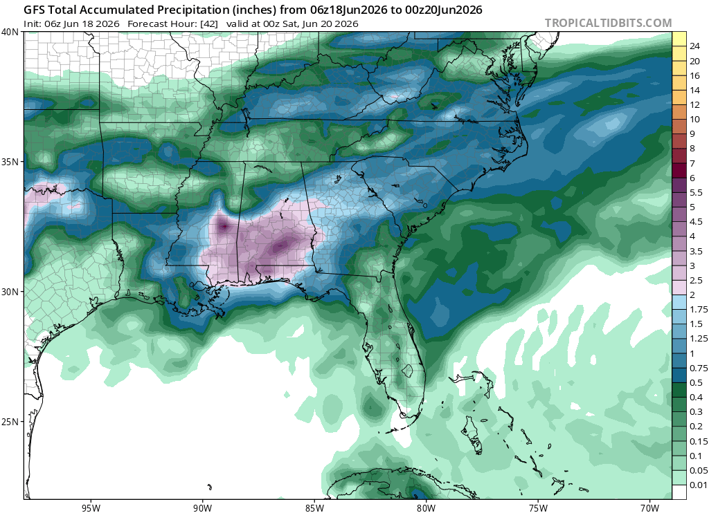
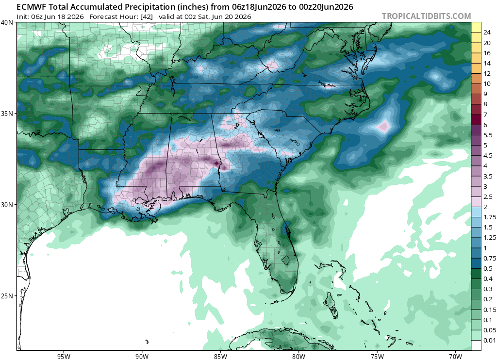
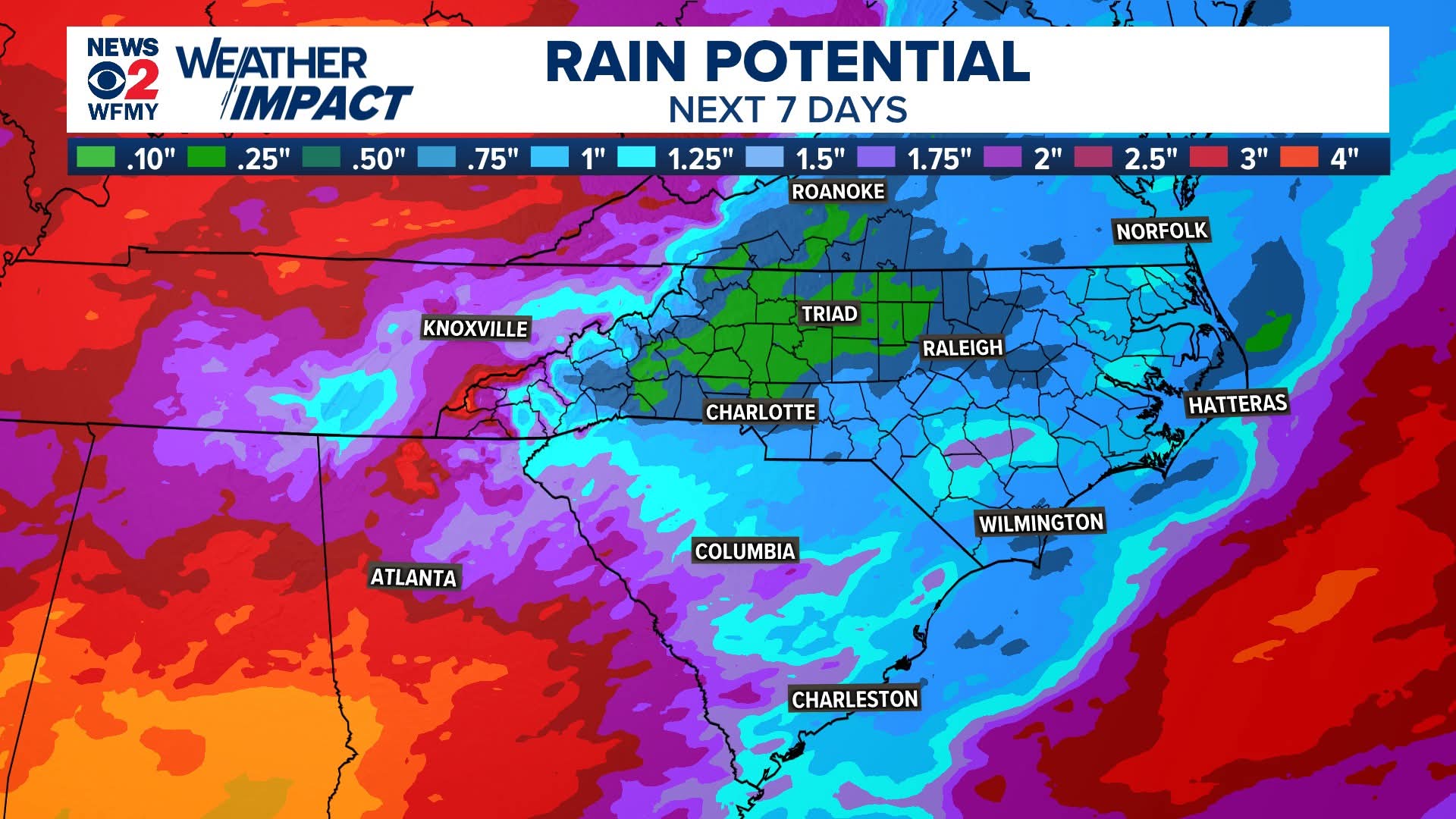
Thankfully although there have been some winners and losers relatively speaking it was a .5"+ rainfall across the Piedmont. Pretty rare to get widespread rain like that in June
-
Quite the temperature gradient across the are with storms bleeding south

-
Updated drought monitor expands extreme drought to cover Guilford county.
-
For sure. Weird seeing positive trends for once
-
Pain

-
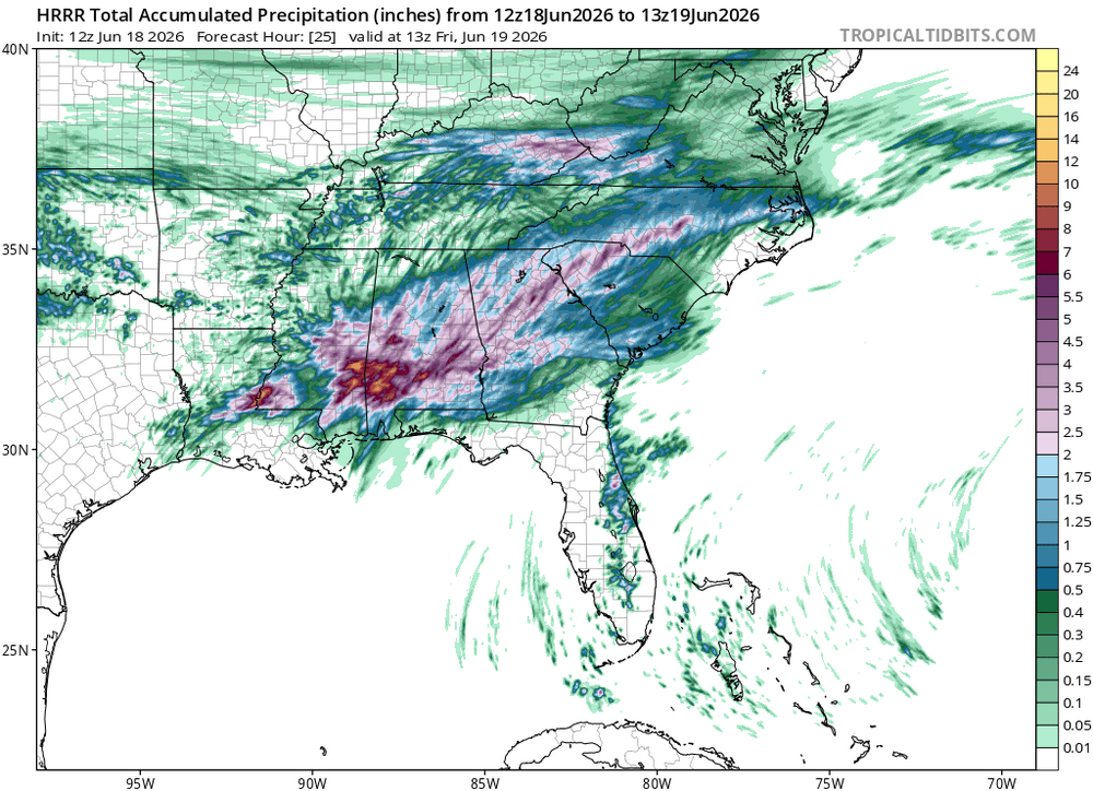
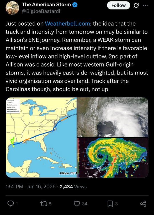
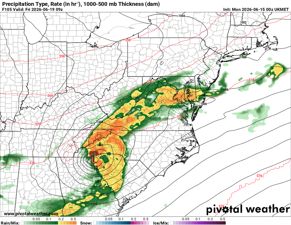
I suspect this will end up designated as a subtropical storm.
-
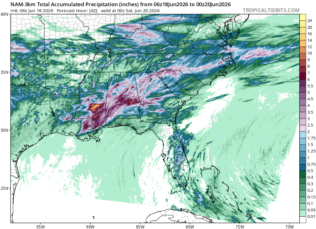
SPC knows the NC wall of dry air

-
-
Yep. The Euro AI has been on it for the past couple days with the southern cutoff as per usual
-
Agreed, interesting days ahead perhaps
-
Let's hope that tropical thing does something. Otherwise prospects are paltry over the next week
-
It was nice to get some outflow, but this sucks...
-
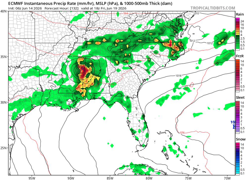
Yep. Tropical storm at landfall before regaining TS strength over OK. Hard to imagine a not even TD organizing and strengthening over land except perhaps crossing over swampland
-
This has the one of the most bizarre Euro runs I've ever seen. Develops a tropical storm inland? There's not even a closed low prior to the energy coming ashore. Must be some kind of hybrid thing, but seems mostly warm core. Not even way out in fantasy land!
-
Nothing like a good cold front to knock the temps down
.png.b1b3f604df0fc9f676793872cb8fae11.png)

.png.a448e40cc09f92c0ff34f09adccc35e5.png)