olafminesaw
-
Posts
3,739 -
Joined
-
Last visited
Content Type
Profiles
Blogs
Forums
American Weather
Media Demo
Store
Gallery
Everything posted by olafminesaw
-
If we don't manage to reach freezing this spring it would tie the earliest lasts freeze on record. Dropping to freezing in this next cold snap would be right around average, so I would say it shouldn't take "Barney" cold to get there. Models sometimes under do cold from radiative cooling, especially for the Sandhills, which typically would come the morning after the coldest day on models.
-
It really busted bad in NC. Just seems like we have less active posters in GA & SC
-
Wow! We have certainly entered the time of year when precip distribution tends to vary considerably across the region. .11 for GSO
-
Precip drying up east of the Apps? Who'd have thunk
-
Do the local stations actually determine that,or do they rely on whatever service they get all their products from? I just noticed a lot of channels across the SE use this designation along with the same graphics, so wasn't sure what all that entails
-
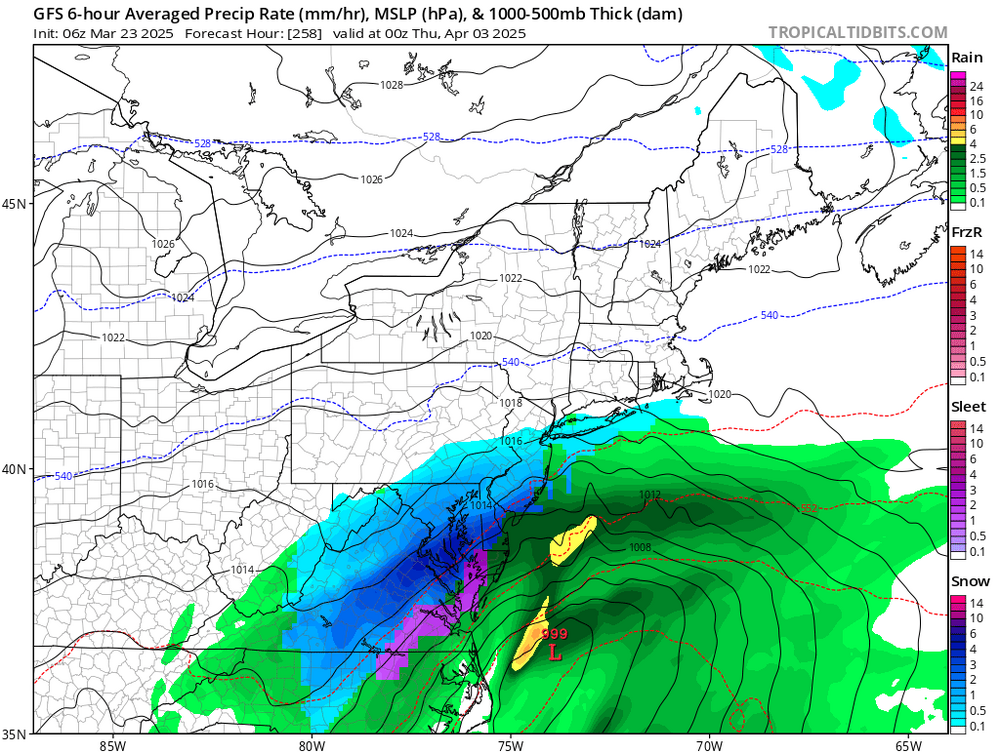
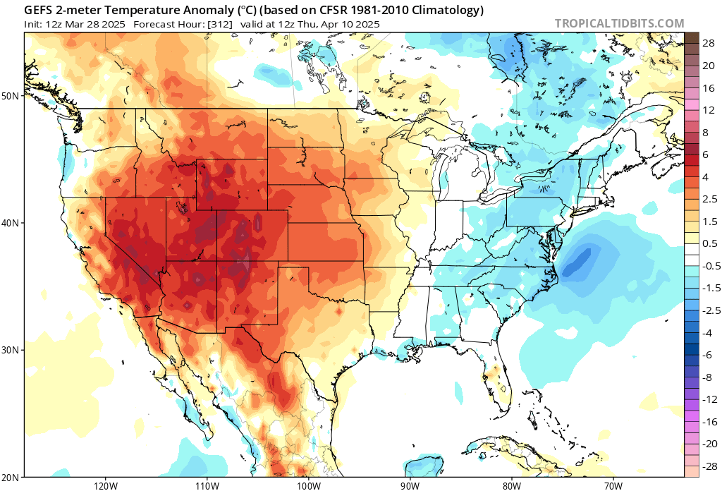
The GEFS is hinting at a cool stretch around that time.

-
I agree! Perfect temps for not having to run the HVAC at all, while also getting to enjoy a nice warm afternoon
-
-
Pretty good verification on this one. Didn't quite reach the magnitude people feared (far from a generational outbreak), but that's a good thing
.thumb.jpeg.572194a3f62a47be6d9a3b7681d0b787.jpeg)
-
I don't think it dropped, thank goodness
-
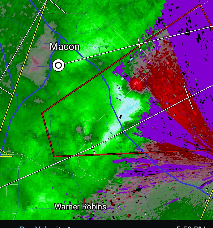
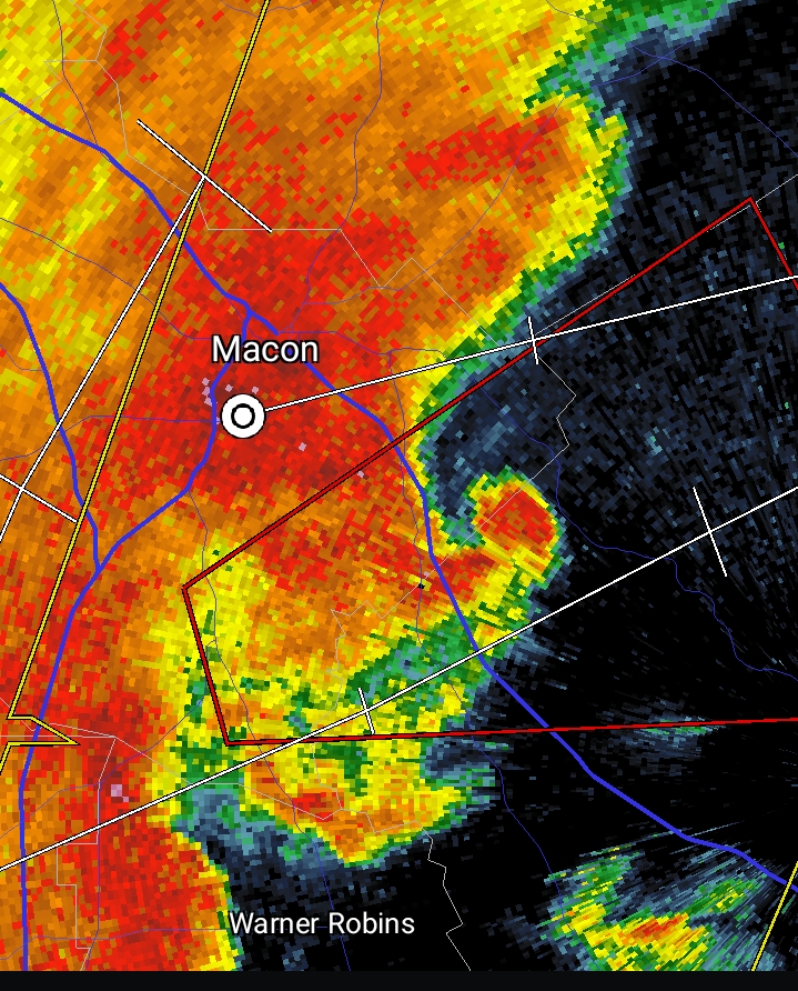
Big debris ball heading into the west side of Collins. Hoping it can miss just to the West
-
Will head through a relatively populated part of the state
-
-
While things are relatively quiet, any thoughts about tommorow in the Carolina's? Seems like the SPC outlook is pretty tame while local mets are hyping it up a bit.
-
My bad, I misremembered. I do feel though they are a world a way climate-wise. Would be nice to have more posters from those states
-
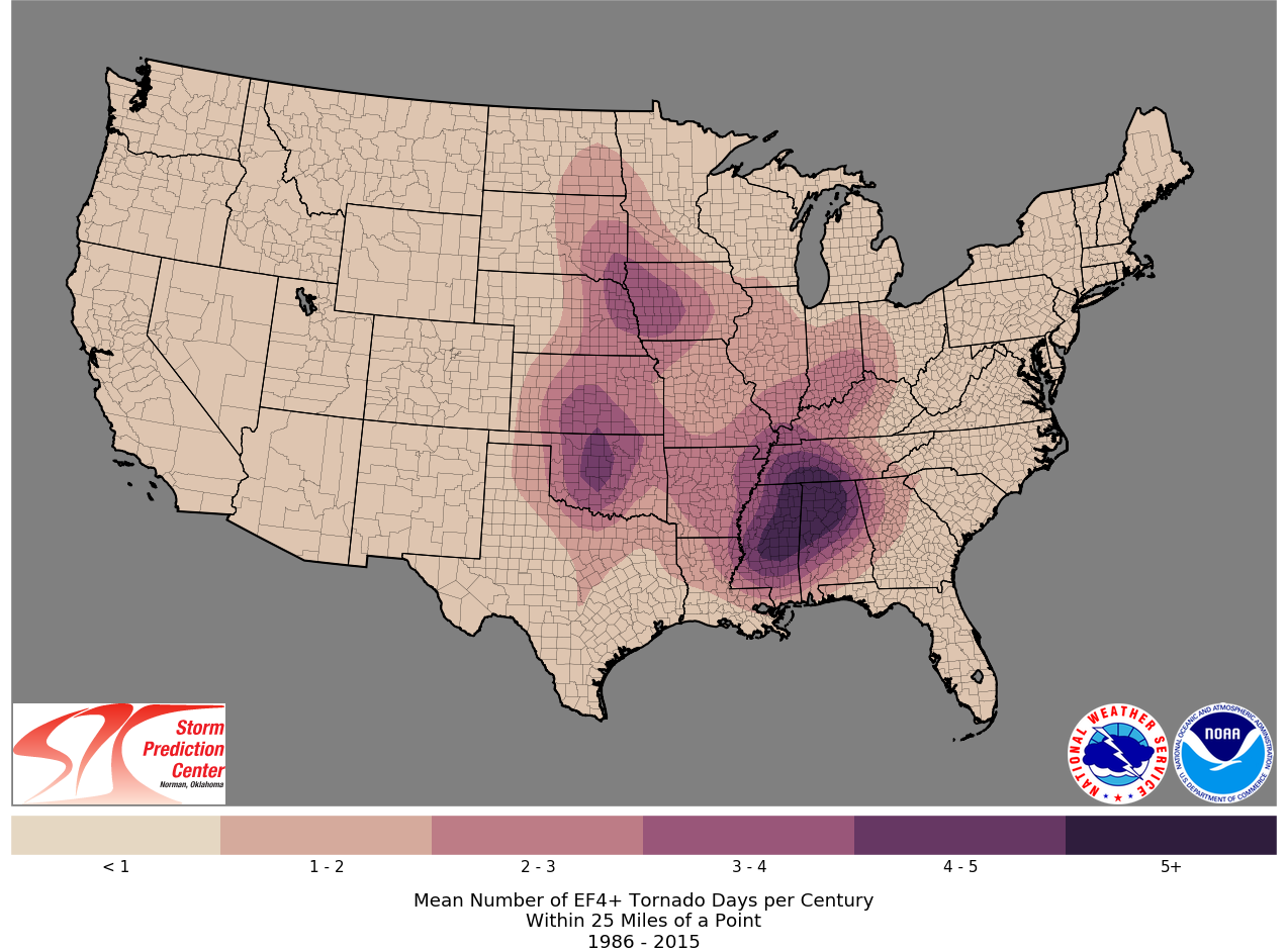
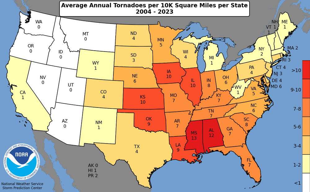
I agree, but it does suck that AL & MS don't really have a subforum that's truly theirs. Technically they fall on the western states sub, but nobody posts there from the deep south
-

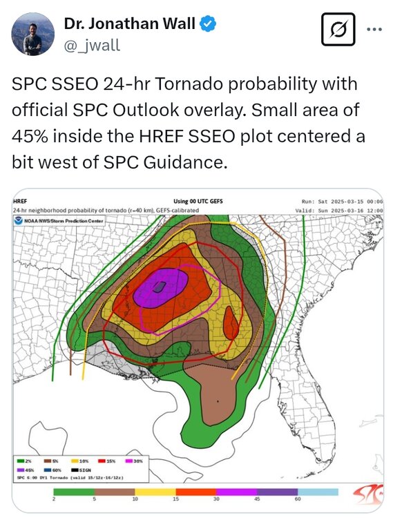
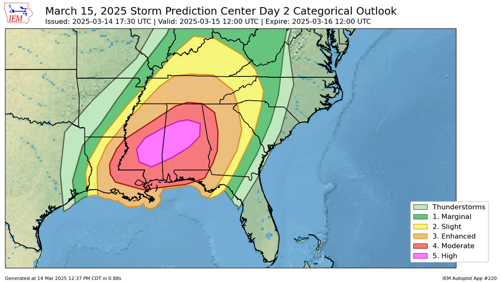
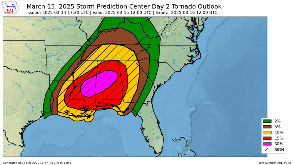
March 14-15 Severe Weather Outbreak
olafminesaw replied to HillsdaleMIWeather's topic in Lakes/Ohio Valley
Parts of Alabama are in the moderate day 1 and high day two -
Pretty darn close
-
They actually reduced the wind threat, removing the 45% area entirely. I guess that may be due to increased confidence in super cell storm mode, which don't tend to produce a wide swath of high straight line winds
-
-
Day 1 for the Midwest in the discussion. Probably better question for the Lakes/Ohio valley subforum, kinda forgot this was the SE thread!
-
Today's SPC discussion mentions gusts of 60-100mph. Can anyone think of a time when the SPC mentioned wind gusts that high, excluding Derecho setups?
-

-
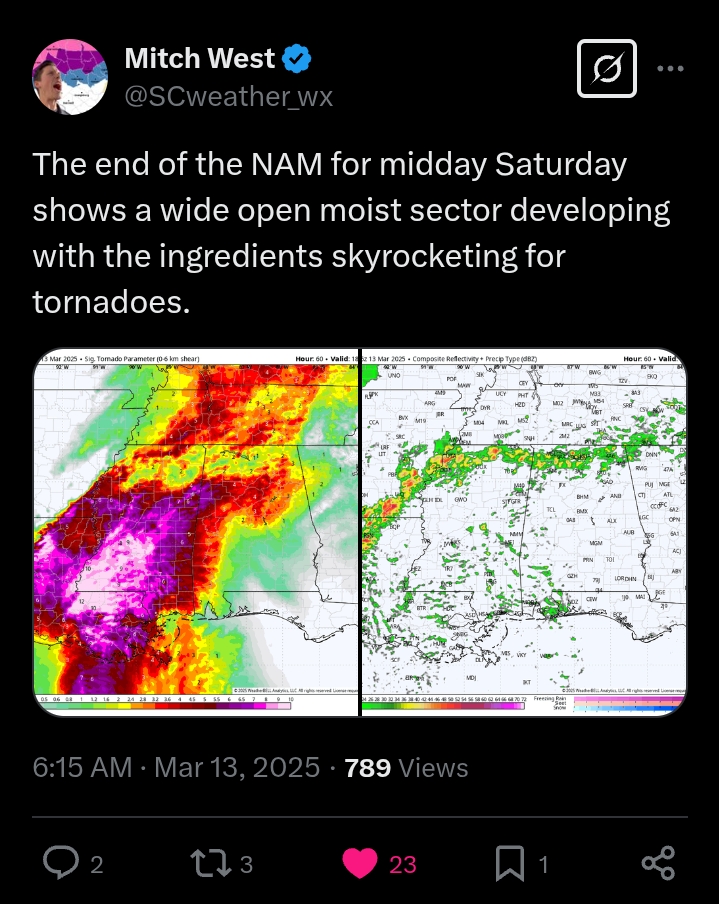
This AI model is a bit more aggressive for the Carolinas. I love a good strong storm, but hoping that we can keep the high end stuff from materializing.


.jpeg.7ca4f43377100c63bb90e2f3d307b5ee.jpeg)