olafminesaw
-
Posts
4,593 -
Joined
-
Last visited
1 Follower

About olafminesaw

- Birthday 08/05/1995
-
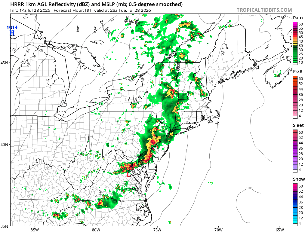
Latest HRRR is much more promising FWIW probably more run of the mill borderline severe but something

-
The HRRR/hires NAM have basically no convection after the MCS rolls through outside of far Eastern NC. It's not looking good TBH
-
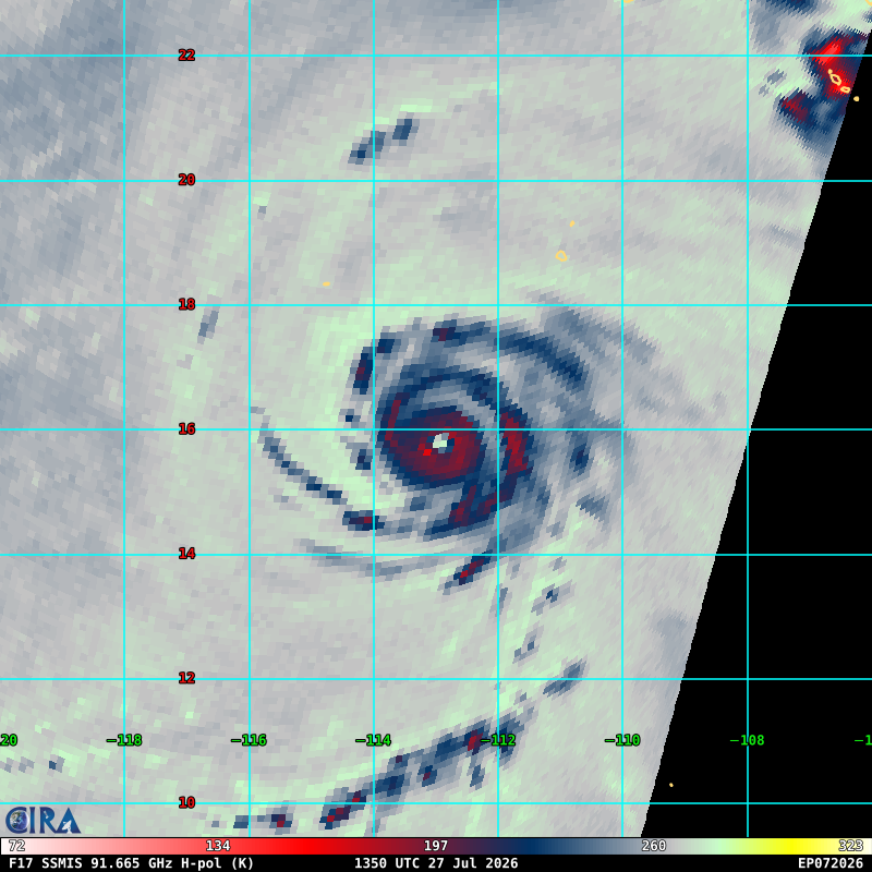
Structure of the year award goes to Genevieve
-
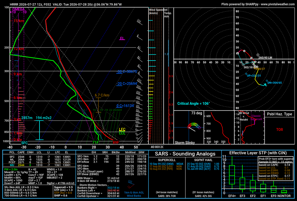
HRRR sounding in the triad Tuesday evening. I do kinda wonder if upper level wildfire smoke will tamp down the potential somewhat
-
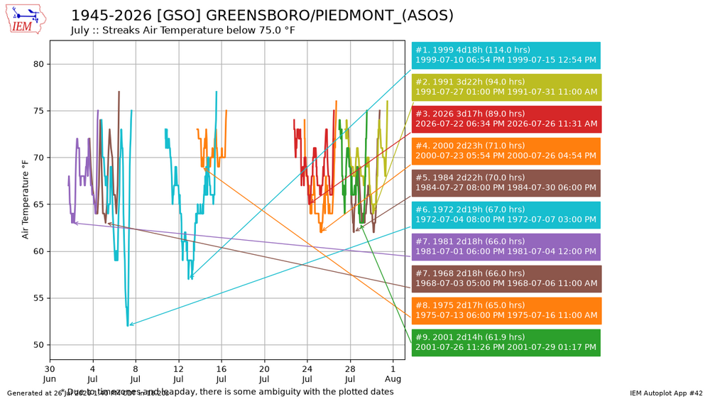
Third longest streak in July of below 75 temp
-
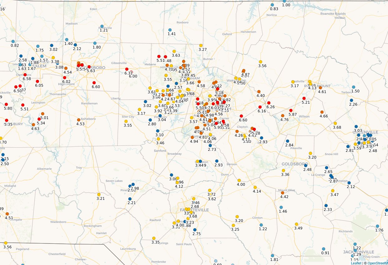
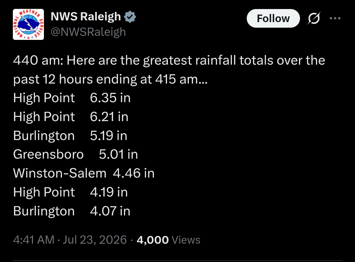
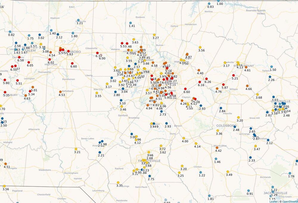
Wow! With the rain this morning, just surpassed the July average at GSO, total MTD 4.93"
-
A little easier to read
-
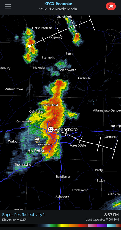
Over an inch of rain and counting!
-
Don't you worry, the snow line will stay firmly north of the mason Nixon line all winter long
-
For all but Guilford county perhaps
-
-
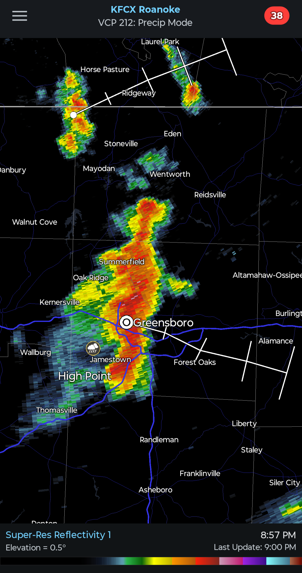
It's a Christmas miracle! Dropping .5"+ across most of Guilford county with frequent lightning. The .53" total at GSO is the most we've had in a day since June 22nd!
-
It's true and also Raleigh's drought was probably the most anomalous in the state before recent rains. 1986 was the lowest rainfall year through this date for both GSO and RAH. But for RAH that total was 14.13, while GSO managed only 8.6" YTD in 1986. So while GSO is running ~3" behind RAH YTD this year, we are actually running ahead of the 1986 record by a wider margin (wetter than), when compared with RAH which would catch 1986 with one good dry spell
-
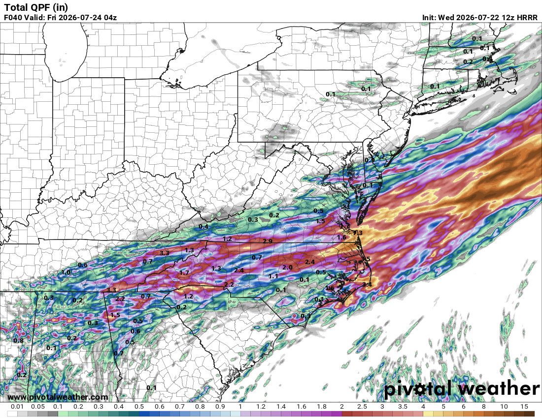
July totals for RAH, feast or famine. Hoping for an area-wide soaking from Bertha's left behind moisture GSO .83 Raleigh 5.25 Chapel hill 3.15 Fayetteville 1.05 Asheboro .64 Rocky mount 1.4 Goldsboro .83 Wilson 3.63