

mimillman
-
Posts
3,615 -
Joined
-
Last visited
Content Type
Profiles
Blogs
Forums
American Weather
Media Demo
Store
Gallery
Everything posted by mimillman
-
1/24-1/25 Major Winter Storm - S. IL, IN, and OH
mimillman replied to A-L-E-K's topic in Lakes/Ohio Valley
About 7” down and temp is noticeably dropping -
1/24-1/25 Major Winter Storm - S. IL, IN, and OH
mimillman replied to A-L-E-K's topic in Lakes/Ohio Valley
1/2-3 2014 was awesome. Still coming down nicely here -
1/24-1/25 Major Winter Storm - S. IL, IN, and OH
mimillman replied to A-L-E-K's topic in Lakes/Ohio Valley
Huge flakes under these LE bands -
1/24-1/25 Major Winter Storm - S. IL, IN, and OH
mimillman replied to A-L-E-K's topic in Lakes/Ohio Valley
Daysha is loving it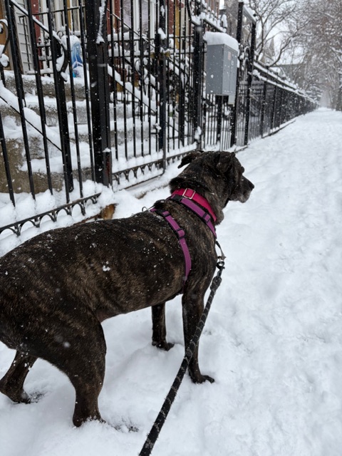
-
1/24-1/25 Major Winter Storm - S. IL, IN, and OH
mimillman replied to A-L-E-K's topic in Lakes/Ohio Valley
Fluffiest snow I’ve shoveled in years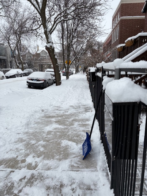
-
1/24-1/25 Major Winter Storm - S. IL, IN, and OH
mimillman replied to A-L-E-K's topic in Lakes/Ohio Valley
SN+ -
1/24-1/25 Major Winter Storm - S. IL, IN, and OH
mimillman replied to A-L-E-K's topic in Lakes/Ohio Valley
Cook county getting the LE goods for once -
1/24-1/25 Major Winter Storm - S. IL, IN, and OH
mimillman replied to A-L-E-K's topic in Lakes/Ohio Valley
Snowglobe. Probably close to 5” down -
1/24-1/25 Major Winter Storm - S. IL, IN, and OH
mimillman replied to A-L-E-K's topic in Lakes/Ohio Valley
About 1” down here -
1/24-1/25 Major Winter Storm - S. IL, IN, and OH
mimillman replied to A-L-E-K's topic in Lakes/Ohio Valley
Evanston - Lakeview gonna get it -
1/24-1/25 Major Winter Storm - S. IL, IN, and OH
mimillman replied to A-L-E-K's topic in Lakes/Ohio Valley
Sounds like you busted then -
1/24-1/25 Major Winter Storm - S. IL, IN, and OH
mimillman replied to A-L-E-K's topic in Lakes/Ohio Valley
Steady SN- roads covered -
1/24-1/25 Major Winter Storm - S. IL, IN, and OH
mimillman replied to A-L-E-K's topic in Lakes/Ohio Valley
All surfaces coated here in a razor thin dusting -
1/24-1/25 Major Winter Storm - S. IL, IN, and OH
mimillman replied to A-L-E-K's topic in Lakes/Ohio Valley
Epic season for you guys. Last season like that for Chicago was 2020-2021 and still lots more to go. You’ll end up probably with a something more similar to what 2014 was to us -
1/24-1/25 Major Winter Storm - S. IL, IN, and OH
mimillman replied to A-L-E-K's topic in Lakes/Ohio Valley
What is your total so far this season -
1/24-1/25 Major Winter Storm - S. IL, IN, and OH
mimillman replied to A-L-E-K's topic in Lakes/Ohio Valley
Tiny flakes in Logan square -
1/24-1/25 Major Winter Storm - S. IL, IN, and OH
mimillman replied to A-L-E-K's topic in Lakes/Ohio Valley
Looks like 9” -
1/24-1/25 Major Winter Storm - S. IL, IN, and OH
mimillman replied to A-L-E-K's topic in Lakes/Ohio Valley
This is the biggest storm for Indianapolis since Jan 2014 I presume? -
1/24-1/25 Major Winter Storm - S. IL, IN, and OH
mimillman replied to A-L-E-K's topic in Lakes/Ohio Valley
Call looking good -
1/24-1/25 Major Winter Storm - S. IL, IN, and OH
mimillman replied to A-L-E-K's topic in Lakes/Ohio Valley
-
1/24-1/25 Major Winter Storm - S. IL, IN, and OH
mimillman replied to A-L-E-K's topic in Lakes/Ohio Valley
This was very well put -
Winter 2025-26 Short Range Discussion
mimillman replied to SchaumburgStormer's topic in Lakes/Ohio Valley
Call looking good -
Winter 2025-26 Medium/Long Range Discussion
mimillman replied to michsnowfreak's topic in Lakes/Ohio Valley
Just need the Feb torch to hold out until the 2H of the month after my UP trip -
1/24-1/25 Major Winter Storm - S. IL, IN, and OH
mimillman replied to A-L-E-K's topic in Lakes/Ohio Valley
Torch -
Winter 2025-26 Medium/Long Range Discussion
mimillman replied to michsnowfreak's topic in Lakes/Ohio Valley
B2b NOLA 8” storms. Chicago kinda sucks


