michaelmantis
-
Posts
269 -
Joined
-
Last visited
Content Type
Profiles
Blogs
Forums
American Weather
Media Demo
Store
Gallery
Everything posted by michaelmantis
-
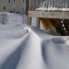
Anything more then 4 inches here would be largest storm of the season for me. Looking decent for I-88 and north in N IL.
-
Since we're all a bit jaded with the models...
-
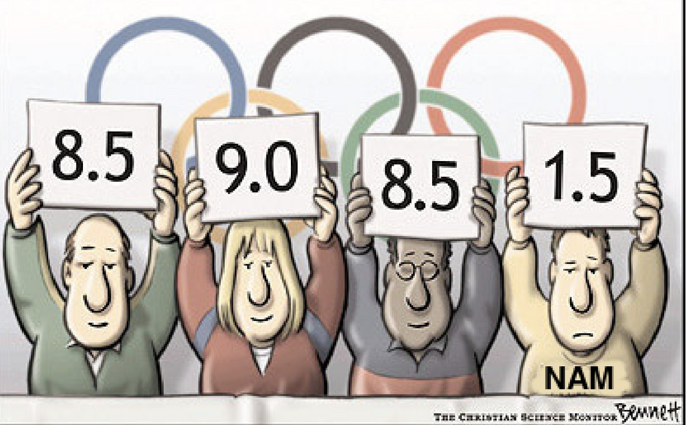
I keep coming back to a line from the TV show "The West Wing" where the President says "'You don't live longer, it just seems longer" and I wonder if these model quirks are really the result of having more data (even if it is bad data) available or if it just *seems like* we have more data and thus give the models more credit than they deserve. A broken clock is right twice a day and the NAM is going to be spot on occasionally. The extended forecast period (as I believe) used to by 5 days, then 7, now 10 days. Technology got better and our ability to see things earlier helped forecasting. But these 24-36 hour model swings are really where it baffles me. Yes I get that 100 miles of a storm track forecasted a week in advance is damn good, but that same shift in 24 hours causes a lot of disruption, extra costs of time/money/people, etc. Someone posted last night the NWS putting out a forecast with "snow ranging from 2 to 10 inches" (and I loved @RCNYILWX reply) and right now this winter has proven to me that the models even are struggling with a 24 hour Nowcast of some of these events and I just wait until the day-of to adjust activities due to potential weather. If I was the NWS I am not sure what I'd do. They *have* data, they *have* models, they are not just making up or wishcasting. But how does the 3 PM shift write the AFD (and send the public messaging) when I'm sure many times they know/feel the 3 AM update is going to flip flop potentially with a huge model change?
-
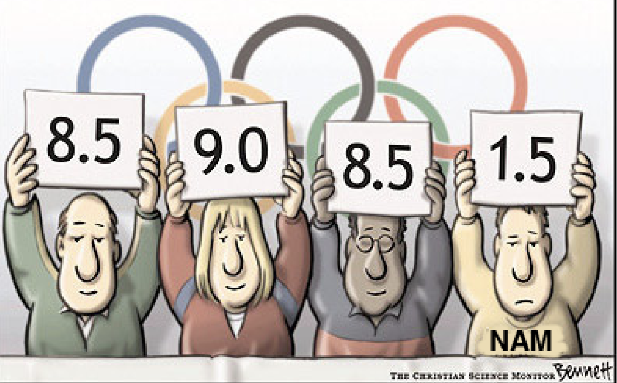
I am the "weather guy" for my family and the one who gets all the texts about "what is the real forecast". I saw a local Chicago met toss up a bar chart of 4 models ranging from 1.2 inches to 10 inches. I can't see how that is helpful for the general public. I told my family to be aware Friday morning there may be some significant snow during the day or there could be a cold messy mix. It almost seems like a "impact scale" should be the way this is publicly communicated. 1 inch of snow during rush hour is more impactful than 3 inches of snow overnight on a weekend. Regardless, the NWS will never win. They are in the bad position of being seen as too conservative, too agressive, late to the game, etc all at the same time!
-
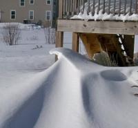
Nice hit for our area if it verifies. I'll take 1/2 of this and then hopefully put away the snowblower for the year.
-
Also the fun of the storm goes away when it melts practically the next day or two. Bring on Spring!
-
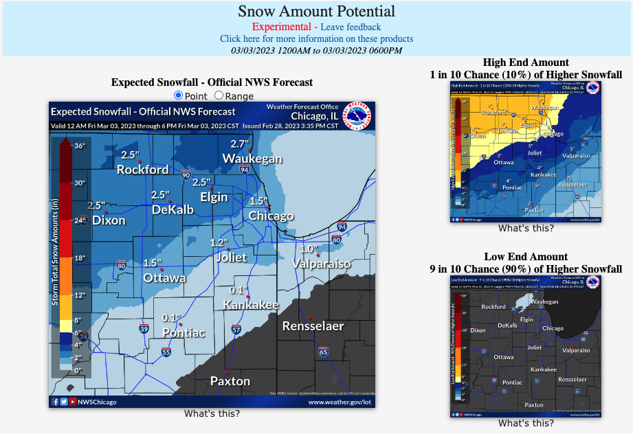
First pass from the NWS Probabilistic Snowfall website from LOT... Quite a spread! https://www.weather.gov/lot/winter
-
School district closed for a second day due to power outages still. Damn.
-
I could not believe the impacts this thing had out my way. I was about 15 miles farther west than ChicagoStorm and it was *bad* out here. School canceled (power fluctuations at local high school caused a small fire) and lots of limbs down. Rural roads were icy and the buses just could not get out this morning. My birch tree survived but man it was leaning a good 30 degrees. People a few blocks down have been without power for 15ish hours. Part of old Elgin (where there are above ground lines) got it bad. All melted within a 90 minute period before the wind started. So that was a saving grace.
-
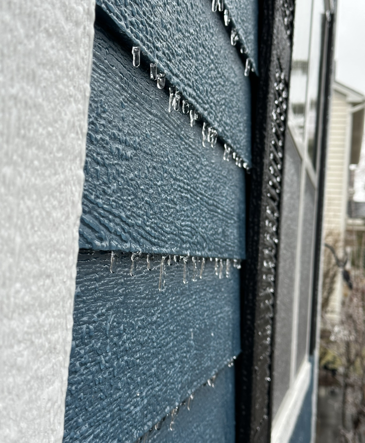
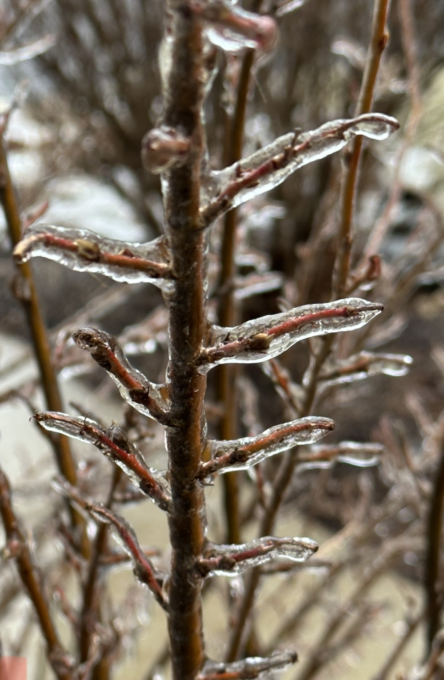
I've never seen as much ice in 15 years where I live. Birch tree still standing but that thing is creeking and bent over and when the wind starts up it is a scary sound. Roads seem perfectly fine (was out a bit) but *everything* above ground is covered with a decent glaze. The wind forecast tomorrow scares me, only saving grace is my forecast says temps should rise to the upper 30's before much of the wind starts. Sustained winds with the ice on trees now would be a huge problem.
-
Noticing the wind picking up for the first time. No pingers, just rain on the windows/house. Drive safe everyone if you have to go out.
-
I have a Birch tree covered with ice that if we get a few gusts or sustained winds I'm afraid it may fall. Leaning a good deal. About to head out and the roads themselves look ok. River of water through the backyard from the run off.
-
31.6 for me for last 3 hours. Rain coming down pretty nicely now.
-
The temp where I'm at in N IL is overing between 31/32. It's rain now, icing up on some areas. One of those situations where a degree down would make a huge (bad) difference. We look to be at the low for the day (31/32) and fingers crossed it doesn't drop a degree or two. It would get bad very fast. Edited 2:55 - Power flickering; I can count on two hands the times in 15 years I've lost power here.
-

-
Seems like more rain now but definitely a good deal of ice.

-
Just was out for a quick drive and roads are fine but grass and trees have a coating of ice that quickly started within the last hour. Temp 31 degrees (dropped a few the last hour).
-
Normally I'm all for the thread-the-needle being on the edge of precip, but I'm not liking being uncomfortably close to all the ice that is being predicted. Ricky made me feel better a few days ago with the oversampling of snow/cold in N IL but this is just a little too close.
-
Anticipating a nice cold rain, but what's the source of that purple blob in far NE IL?
-
Thoughts on that band over the river making it our way?
-
Roads are a sloppy mess and looks like a thump of snow is crossing the Mississippi River that should be in the Chicago area in a few hours. Throw a few inches of quick snow on top of this and freezing temps and it's not going to be fun. But then again it will be all melted this weekend anyway! Bring on summer!
-
Heavy pingers and sounds like someone throwing sand at the window. I'm 5ish miles from the snow line. My bet is there's a good hour or two of SN+ at the end of this right during the afternoon rush! ;-)
-
Huge cotton balls fell for around 30 minutes and now just a nice decent snowfall but smaller flakes. I'm right on the edge of the WSW that was just issued and this one is looking like a 4 incher for me. Someone may get lucky if a band sets up over an area and I'm sure there will be a few circles of 8ish somewhere that gets lucky.
-
You never hear about I-90 being the focus area of a storm it seems like. Always I-80/88 ;-) Very much liking my spot 5 miles south of I-90. I posted a few weeks back, all I want is some good sledding snow.
-