
Hoth
-
Posts
9,962 -
Joined
-
Last visited
Content Type
Profiles
Blogs
Forums
American Weather
Media Demo
Store
Gallery
Everything posted by Hoth
-
 Northern stream appears to be dropping in more quickly so far.
 -
Wouldn't it be great to celebrate the 25th anniversary of one of the greatest winter storms in history with a crushing encore performance?
-
I won't fight ya.
-
3k would be epic.
-
Thank goodness SWC closed for the season.
-
If you get a clean phase, absolutely possible. the +PNA and block would certainly argue for it in that event.
-
If you look at the GOES16 northern hemisphere water vapor, our northern stream looks like it's about to nosedive off a cliff. You can really see the squeeze of the rising PNA and the block taking shape. http://weather.cod.edu/satrad/exper/?parms=global-northernhemi-08-48-0-100-1&checked=map
-
Somewhere up in Litchfield or the Berks might still be in the game.
-
Yeah, no bueno with the ongoing power issues. The tree damage is pretty remarkable. I have a few neighbors that had trees come through the roof like you did. Arbor vitae, cedars, white pines and old maples for the loss.
-
Yeah, I'm confident we get it. The Euro has been too far southeast in the midrange with almost all our storms this winter. I could see one more big move northwest with a better phase and then it'll lock in.
-
Man, there are a lot of EPS members that would be SNE slaughtering.
-
The cure for that is almost worse than the disease.
-
If EPS continue to be well west, we can get cautiously excited. Also, Euro has been southeast with almost all nor'easters this season and has trended NW with time.
-
Lol keep safe search on!
-
GEFS is cause for priapism among NE weenies. Geez.
-
I like the idea of a last minute correction like that one. That was a classic "not happening, James" system where spacing and other subtle problems looked to skunk a great opportunity, but then it came roaring back in one modeling cycle and ushered in three weeks of epicosity. I agree with you that the n/s vort could well be underdone given its source region. We've seen these things trend stronger on a few occasions this year.
-
"It's the new future." Said during every bubble ever. Remember when they were euphorically calling for Dow 100,000 in 1999?
-
Just wow.
-
How are you arriving at your projected price? What do you use as a valuation method? Blockchain as a technology is interesting, but Bitcoin as a currency or reliable store of value seems flawed. This screams bubble to me.
-
We spoiled.
-
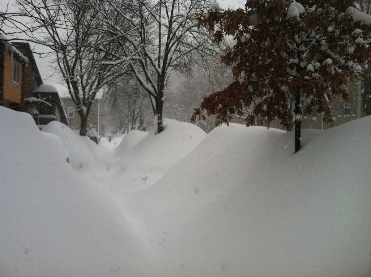
Actually just found this old series of stills from after the storm a mile or so from my hood. Winter wonderland.
-
Great post. Thanks for the rehash.
-
New Haven area. Picked up a quick 15 or 16 on top of the already robust pack, but had blinding thundersnow for a few hours overnight. Probably more memorable because the models failed so badly and were projecting 4-8 sloppy inches.
-
This was a fun one. Big positive bust and some of the heaviest snow I've ever seen. Jan '11 was great. Never thought I'd see it exceeded, especially not just four years later.
-
Great storm, but most incredible and horrifying subsidence near PVD I've ever seen. Toaster bath stuff.
