

DeltaT13
-
Posts
3,006 -
Joined
-
Last visited
Content Type
Profiles
Blogs
Forums
American Weather
Media Demo
Store
Gallery
Posts posted by DeltaT13
-
-
26 minutes ago, vortmax said:
Yeah, I thought it looked fishy to have a WSW stop right before Monroe Cty. with no advisory.
There is a significant elevation drop from Genessee county into Monroe. That little downslope just annihilates the Erie band right as it enter Monroe. I've watched it happen 20 times over the past 15 years. We've been known to scrape out a couple inches which would be more than enough to keep me happy... Even snow in the air would be better than the nothing we've gotten the last week or so.
-
30 minutes ago, tim123 said:
In extreme cases I have seen roc under warnings from lake Erie and Wayne county under advisory.
Yeah, and it has never once verified. This is something I stand very firmly on, especially being a west side of the county observer. I'd take an inch though, we are desperate in this shit pattern. haha
-
 1
1
-
-
4 minutes ago, TugHillMatt said:
Wow...major warmth and rain waaay up into Canada for the beginning of next week on the Gfs models. Major thaw #3423543 for the winter?
Better enjoy whatever snow we get.
Yup rain up to the damn hudson bay. Next week is a complete trainwreck. Numerous rain chances, not just one. You can't make this stuff up
-
 1
1
-
-
There are a ton of knobs to turn on this page that you can use to assess the Erie ice cover. Just an awesome site! Enjoy
https://weather.cod.edu/satrad/exper/?parms=local-LakeErie-natcolor-48-0-100-1&checked=map&colorbar=undefined-
 1
1
-
-
What a beautiful radar. This is the type of band and setup that spurred my interest in weather at an early age; when I lived in North Tonawanda. . Makes me nostalgic to be honest.
-
3
-
-
"Lol. It amazes me someone can look at the pattern being progged and assume rainstorm after rainstorm for two weeks.
Enjoy being emotional. Didnt you give up on the last storm a day or two beforehand? The one that gave you almost 18 inches?"
This is a new and interesting side of you.....way to be a dick. I certainly did not give up on the last system but when half the models were caving towards a southern solution for a couple days I certainly was disheartened just like the rest of us. To be honest, I called for 12 inches in Rochester MANY days in advance and guess how many inches Rochester got, 12 inches on the ****ing money! (Don't believe the airports notoriously bogus ASOS, it always comes in high) My Buffalo, Rochester, Syracuse numbers were damn near spot on. I never once bought into the hype of the Kuchera clown maps. I expected it to be a decent storm and maintained course for the most part. And aside from some isolated locations on the South shore, the lake response was anemic at best. I got a whopping 3 inches of Lake effect in 36 hours which was more or less exactly what I foresaw.
All I can do is look at model outputs and I don't see a great pattern ahead, I see 4 rain chances in the next 384 hours. Wouldn't it be nice and more normal to see zero rain chances during what should be the coldest stretch of the season? Getting rain two days after being subzero is not a good pattern to be in.I hope I'm wrong and look like a fool, that would be the best possible outcome.
-
Just now, OSUmetstud said:
Yeah. Youre wrong.
I'll say two things. One I will be uncharacteristically emotional about the next two weeks because I have a very long and very expensive snowboarding trip booked from February 2nd through February 10th in the 'dacks and vermont; and right now the long range is simply not looking good. You can't dispute that there are rainstorms on the long range and to be honest the long range forecasts have been very consistent and solid so far this year. Most storms that appear at day 10 more or less pan out.
Two, why exactly am I wrong? Give me some hope because all I see is a progressive pattern that fails to lock in any cold for the Northeast.-
1
-
-
Next two weeks look absolutely abysmal from a synoptic standpoint. Rainstorm after rainstorm.
-
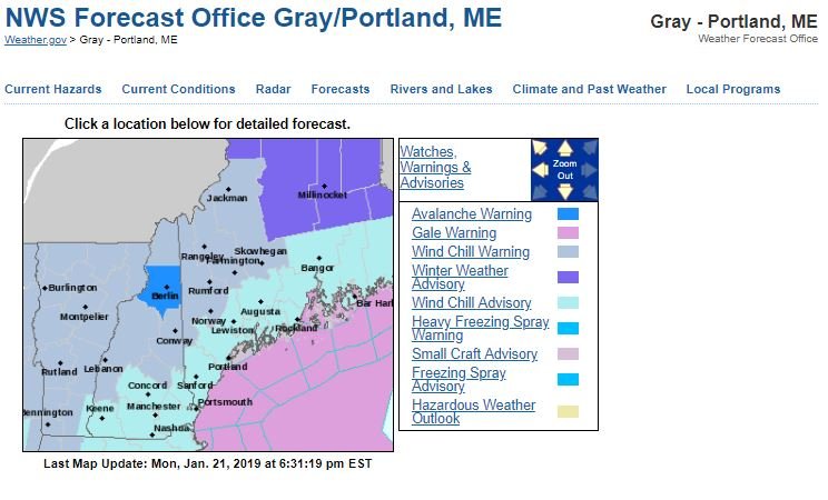
This is a first for me at least. I've never seen an Avalanche Warning anywhere on the East Coast. Pretty cool.
-
2
-
 1
1
-
-
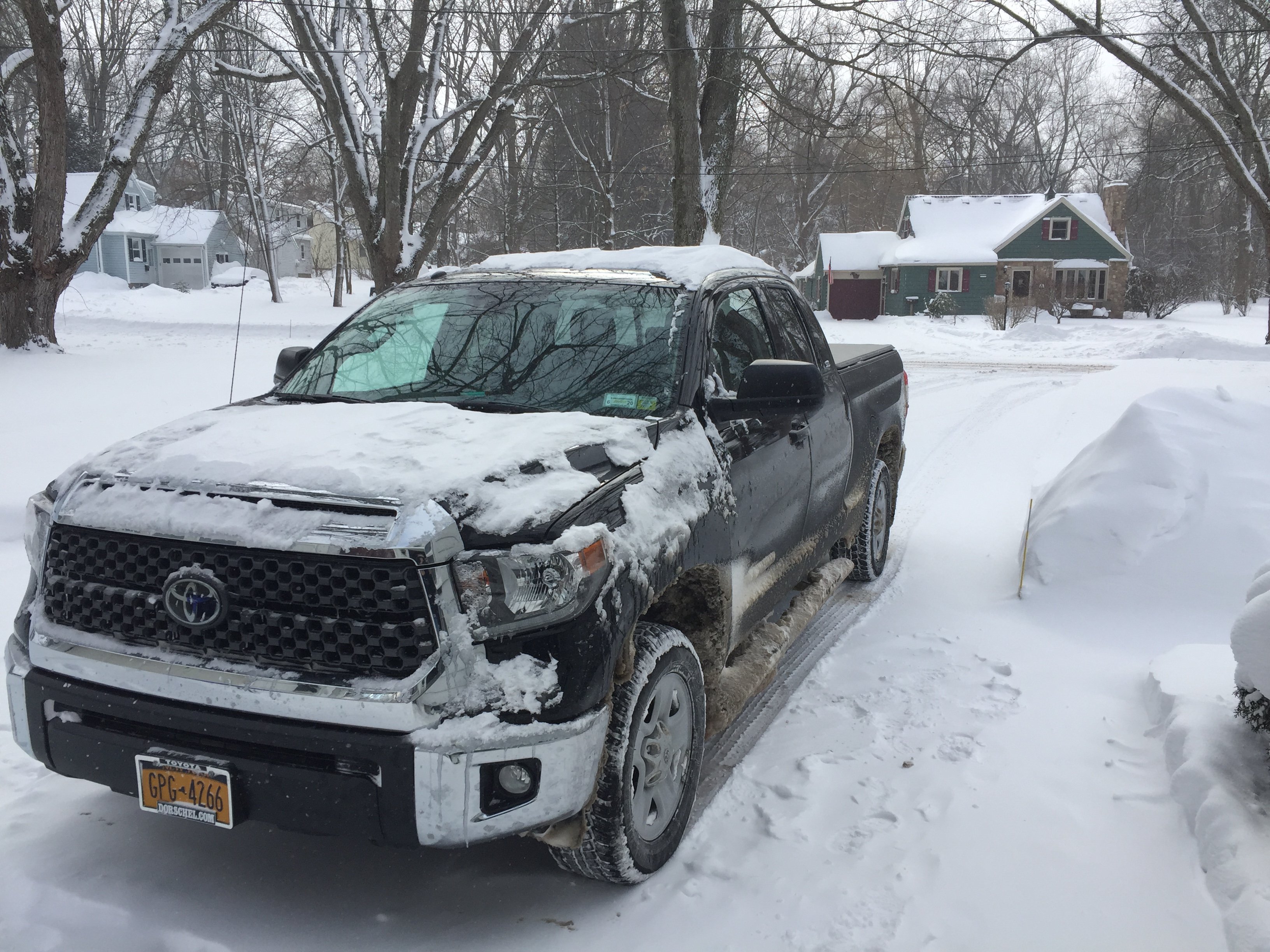
Well, that was a fun and fairly long lasting event (at least for the South shore counties). I put 225 miles on the Tundra from about 9am Saturday until noon today, and nearly every single one of those was in 4 Wheel Drive! I got up around 730am today and drove from Gates to Long Pond, then over to Ontario in Wayne County (along the lake the entire way). I then doubled back and drove down through the carnage on the side streets in downtown Rochester and in the park ave area (Cars completely buried). I will concede that the lake response was better than I expected, yet still not quite to Tim's hype level. So maybe we compromise? It was localized though so I'm sure some place from here to Oswego did well last night.
Some observations. Directly along the lake conditions were intense with frequent ground based whiteouts, fog, and continually changing intensity of snow as I drove along and through the roll convection. It was pretty awesome and a very fun drive, I highly recommend it. Snow depths peaked about 2 miles in land then dropped again around 5-7 miles inland. Temps along the shore were 8f while just inland quickly dropped to about 3f or colder. Somewhere in Webster seemed to get the most lake effect (for the route I chose) and I would eyeball about 6 inches on top of the main storm amount so they were probably pushing 16-20 on the ground which was impressive. Unfortunately, the lake effect was barely able to make it to my backyard, however I'm happy with just snow in the air and snow covered roads.My storm totals:
- Saturday Start of event - 5pm - 3 inches
- Saturday 5pm -12am - 4 inches
- Sunday 12am - 6am - 5 inches
- Sunday 6am - 4pm - 1 inch
- Sunday int Monday 4pm to 12pm - 2 inches ( I was too tired to clear it last night)
15 inches total with 12 on the ground as compaction continues, but a very dense snowpack none the less. And I got 3 inches of lake effect which is 1 more than I expected.

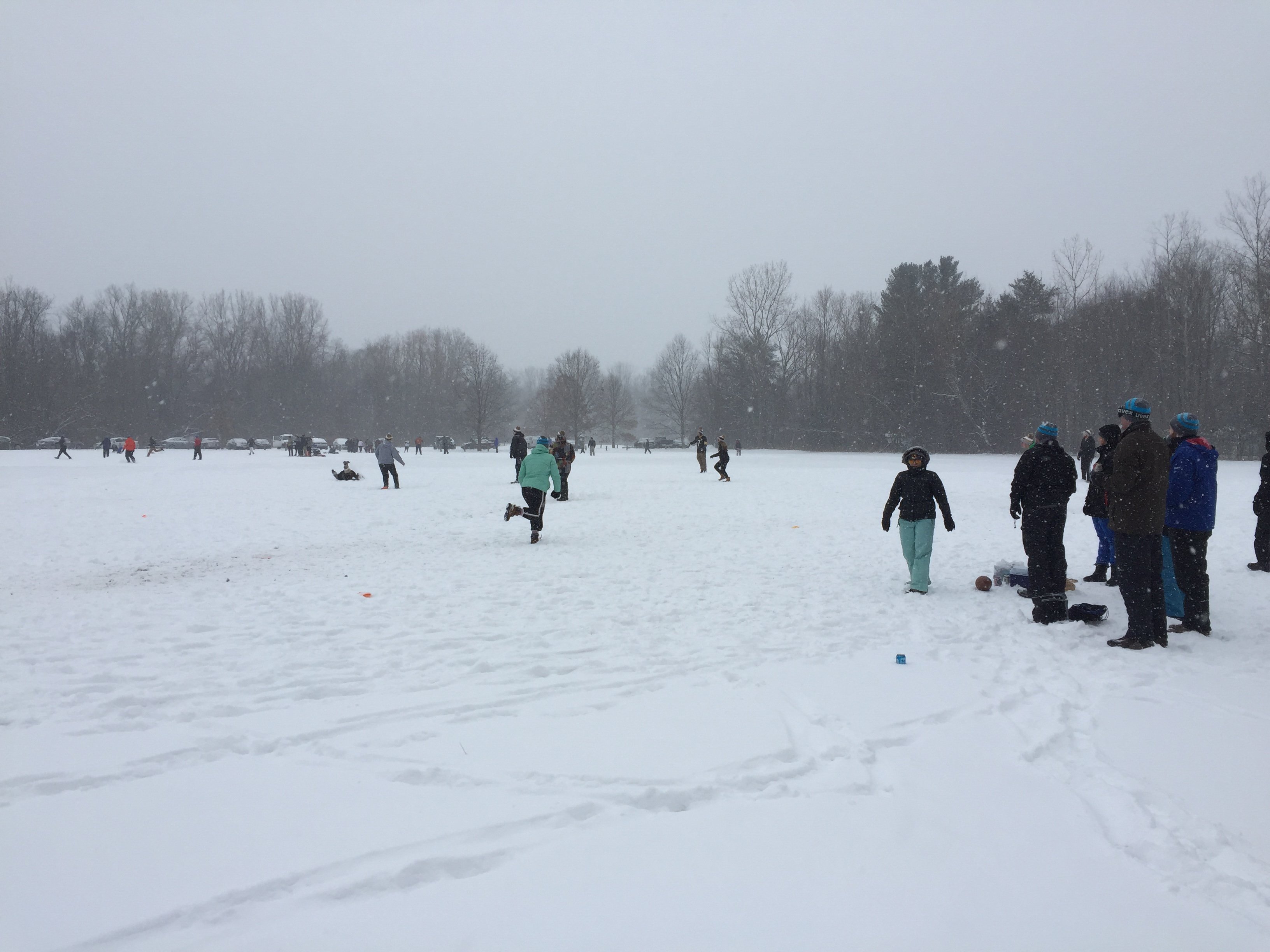
Some Snowy Kickball to start off the storm

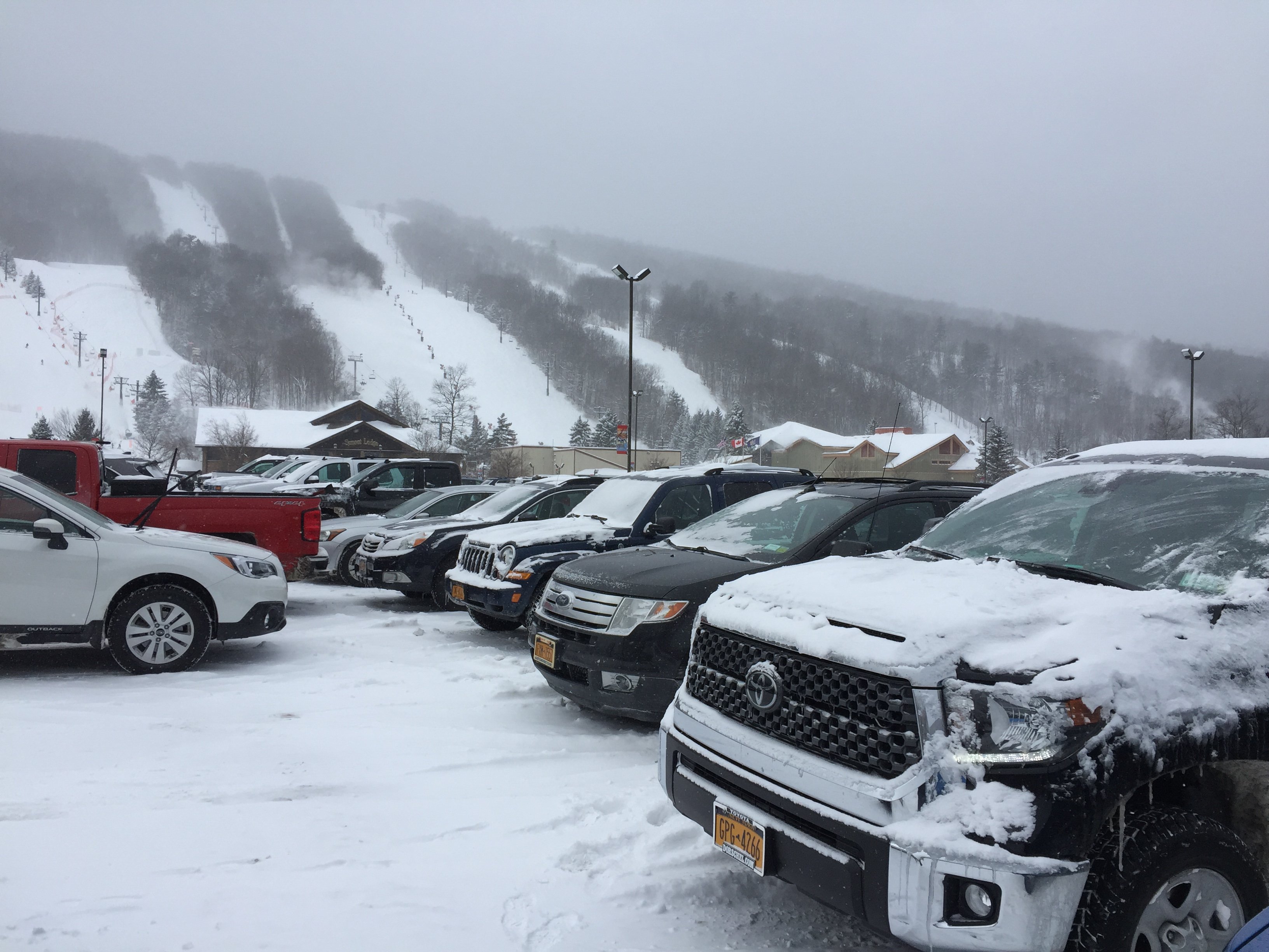
A frigid trip to Bristol in search of POW. It was good but hard work and bone chilling cold
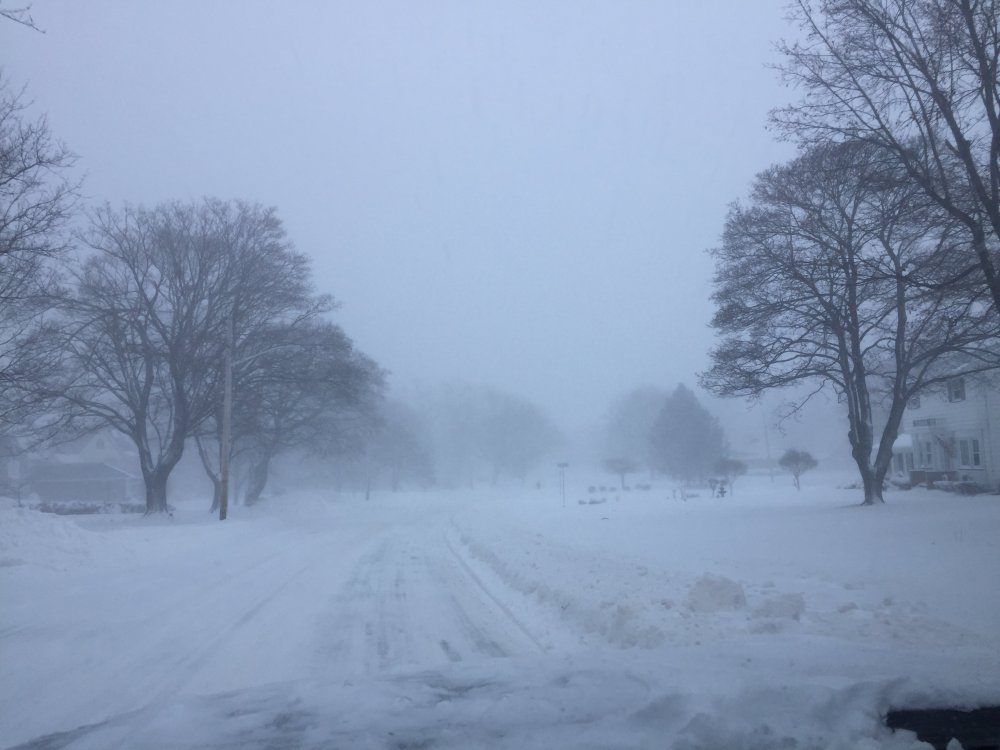
Trip along Lake Ontario, visibility was worse than the camera shows
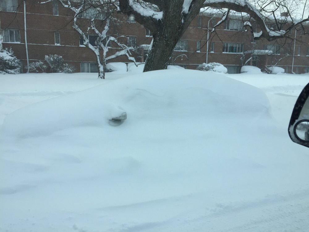
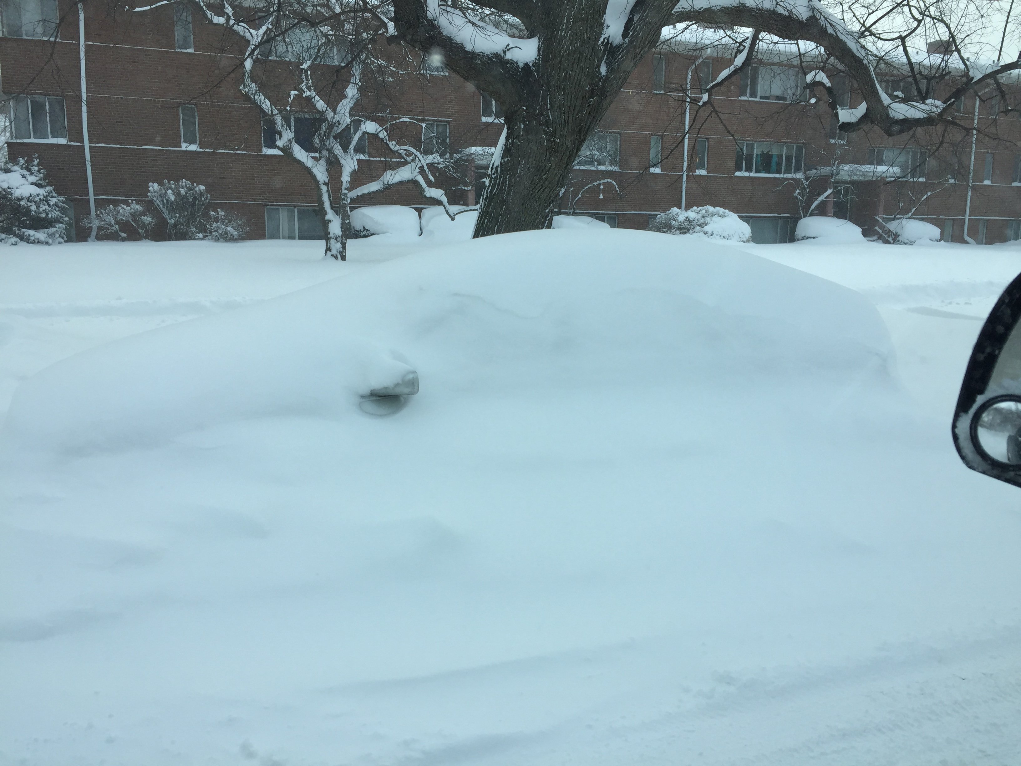
Buried cars on the side streets of Rochester
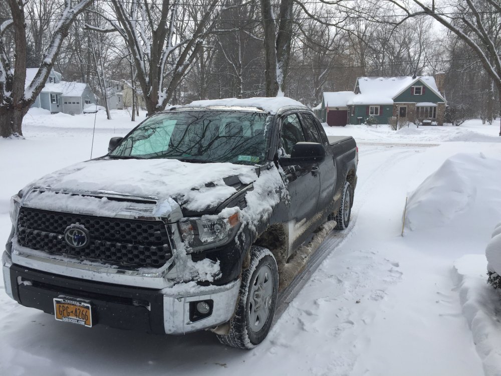
The way a Tundra should look!
-
4
-
1 hour ago, tim123 said:
2 inches since noon delta t
I have 1 inch since 6am and nothing going on now. You do have a better location though. We’ll see where we end up but I wouldn’t get your hopes up.
-
Just and I expected. We’ll be lucky to get an inch of lake effect. It’s just not a good setup. That said, it was a very decent event overall. Anytime it snows for 24 hours straight you can’t be mad.
-
I am Bristol but will post more later. I measured a storm total of 12 inches in my backyard. Very dense dry snow so apparent amounts seem low but it’s a lot of snow.
-
It might not be stacking up high but it’s very dense stuff that will make a fantastic base snowpack.
-
1
-
-
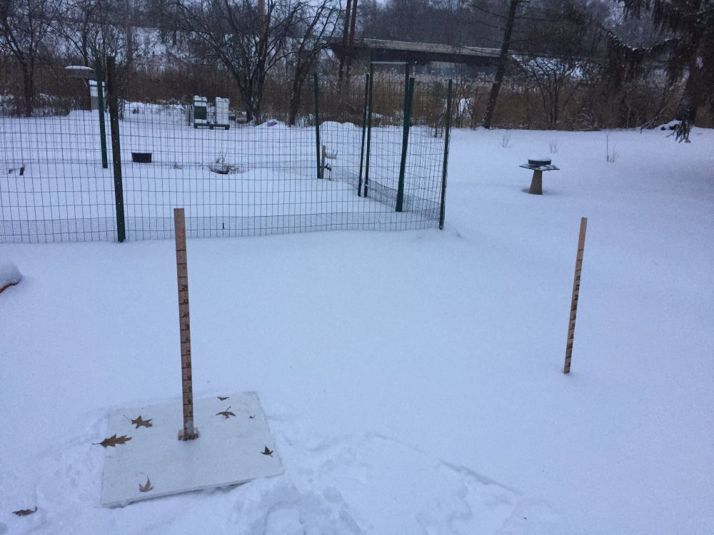
Snow board was cleared at 5pm. I’ll clear again around midnight then again at 6am. About 4-5 inches on the ground right now.
-
2 minutes ago, WesterlyWx said:
4.3 inches as of 3:40. More than I expected by this time for sure however I too am worried as rates have actually lightened in the last half hour and Radar returns are wreaking somewhat too. What’s going on?
This is all virtually just bonus waves of overrunning snow. We haven’t even gotten into the good stuff. It will ebb and flow. Be patient as it can turn up quickly.
-
1
-
-
Well I'm off to play in my winter kickball league. Conditions don't get much better than this!!
-
2
-
-
Sounds blizzardy to me. System now gets into the upper 980s.
-
Just took the dog to the vet up in Greece. Almost two new inches on the ground and snowing heavily. The roads are atrocious already because temps in the mid teens are negating any effect from salt while allowing for efficient accumulation. It’s fantastic!
-
1
-
-
Moderate Snow in the ROC already.. Maybe a half inch of fluff down. Can't beat some bonus frontogenic snow!
-
1
-
-
1 minute ago, rochesterdave said:
It’s my next purchase. I’m not 25 anymore.
To be honest, they are super useful beyond safety. They are Incredibly warm, they hold your headphones in, they keep you dry, they secure your goggle and give you a place to put them....and they protect your brain! Not too shabby
-
2 minutes ago, rochesterdave said:
I hit my head while skiing this evening. One more excuse for moronic behavior.
Oh no! I rocked my head one time pretty bad at Bristol in 2006. I have never been on a mountain since without a helmet on.
-
Just now, tim123 said:
Say we get 20 from storm. At 1 inch precip. Then lake affect gives say half inch. If it's small flakes say 10 to 1. That's still more inches. I could totally see that in a 24 hour period from 12 sun to noon monday
Well you are in a prime spot to get the best of this setup. Get your snowboard ready and clear it at noon Sunday and every 6-8 hours thereafter. Let's put a data point on this event.
-
Just now, tim123 said:
Usually when we get a airmass like this the lake is much cooler. Say 34 35. The lake is in upper 30 to low 40s.
If we had a long fetch things would be different. Our northerly fetch always needs assistance from synoptic moisture to do anything more than spit out flurries. But flurries are better than sun, so I wouldnt complain. I just think snow totals will be more or less wrapping up by noon Sunday.


Upstate/Eastern New York
in Upstate New York/Pennsylvania
Posted
Brockport can do ok. Most of what you are talking about is more of a hybrid setup with an arctic front dropping through and intensifying the Erie band. Straight lake effect does not directly impact Rochester with warning criteria, it just doesnt. , I don't know how else to convince you. I mean you live in Wayne County, I live in the West Side of Monroe county...and have for the last 17 years. Which person might have a better handle on how much snow Lake Erie drops here?