-
Posts
3,006 -
Joined
-
Last visited
Content Type
Profiles
Blogs
Forums
American Weather
Media Demo
Store
Gallery
Everything posted by DeltaT13
-
Upstate/Eastern New York
DeltaT13 replied to BuffaloWeather's topic in Upstate New York/Pennsylvania
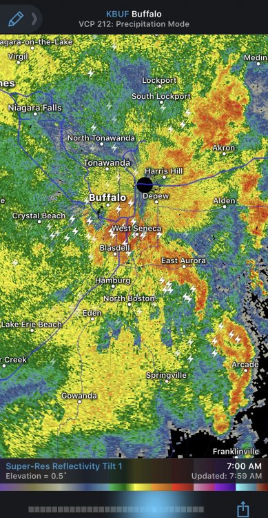
Equilibrium levels up around 20k! There will be a brief break in the rain following the cold front. Later Wednesday afternoon and Wednesday night deeper wrap around moisture will arrive as the strong mid level closed low crosses the eastern Great Lakes and heads into New England. The wrap around moisture and forcing from the mid level trough will produce a few scattered showers Wednesday night. More importantly, deepening cold air will support growing lake induced instability. Flow may be sheared initially, but should align better from the WNW later Wednesday night as lake induced equilibrium levels rise to 15-20K feet. This will support a robust lake response east and southeast of the lakes, with rain showers becoming widespread. Deep moisture and lift extending up through the graupel growth zone may support some thunder as well. -

Upstate/Eastern New York
DeltaT13 replied to BuffaloWeather's topic in Upstate New York/Pennsylvania
Anyone keeping an eye on this potent Miller B Nor'Easter this week? Latest runs have the secondary low bombing to 971 just off the coast of Maine. Looks like a couple of very raw, rainy, and windy days on tap for us. Before it transitions we get a hefty thump of rain too. i think the highest peaks of New Hampshire and Vermont might get some significant snows. It's fun to have some active weather to track. We are officially into "interesting weather mode" for the next 7 months. -

Upstate/Eastern New York
DeltaT13 replied to BuffaloWeather's topic in Upstate New York/Pennsylvania
Looked back at my weather journal and just last year Rochester had a coating of snow on the 18th of October with several other days around that time having flakes in the air. -

Upstate/Eastern New York
DeltaT13 replied to BuffaloWeather's topic in Upstate New York/Pennsylvania
Denver was 82 degrees at 3pm yesterday and was 21 degrees by 6am this morning. A 61 degree drop in 15 hours. Thats intense! -

Upstate/Eastern New York
DeltaT13 replied to BuffaloWeather's topic in Upstate New York/Pennsylvania
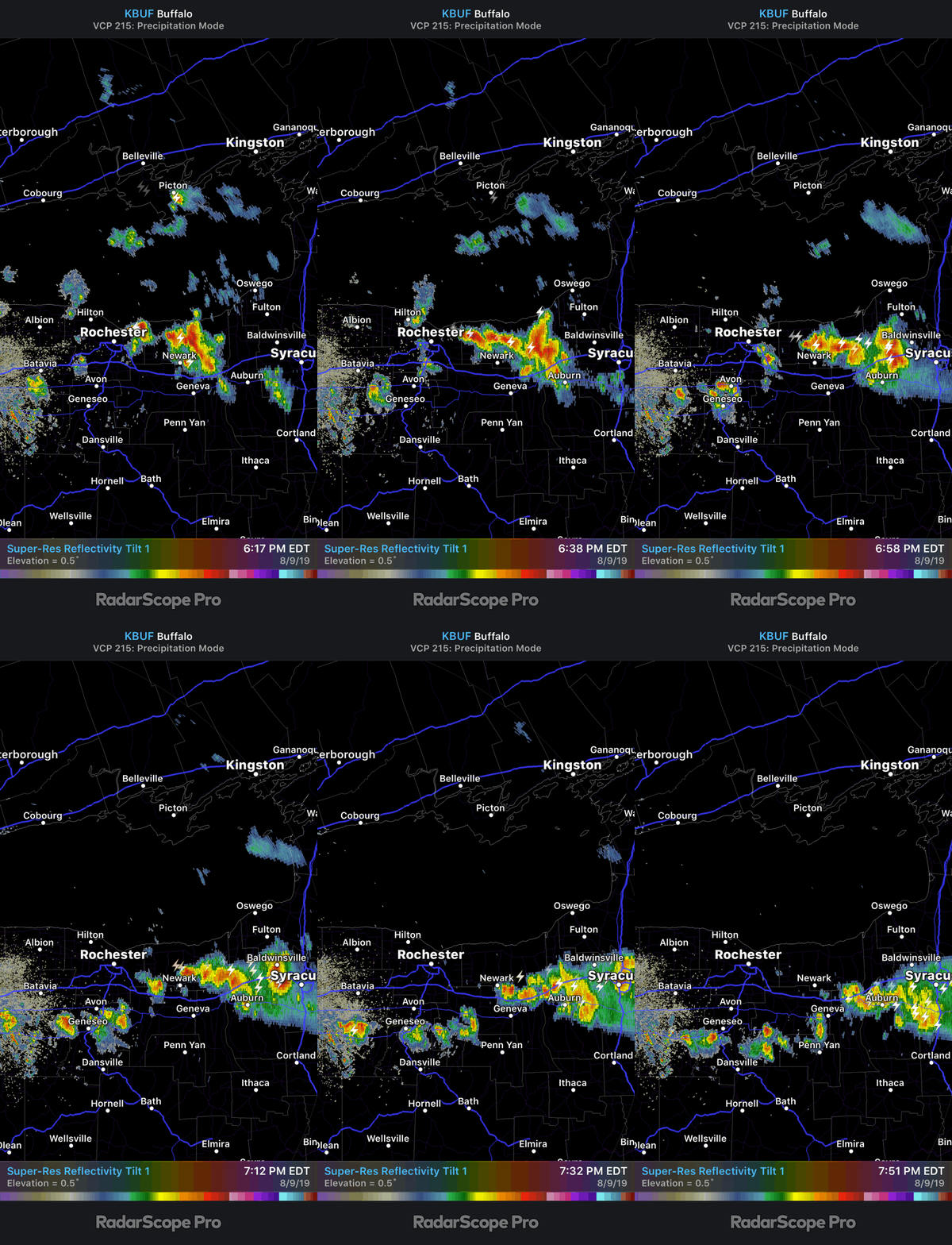
It appears to be morphing into an MCS so it may organize and strengthen with nocturnal stability. If so I’m guessing it will start to turn right (south) as the night progresses. -

Upstate/Eastern New York
DeltaT13 replied to BuffaloWeather's topic in Upstate New York/Pennsylvania
The fantasy runs keep coming. Check out this amazing hit from a still category 1 hurricane right in our kitchen! I've dreamt of this scenario for decades......if only it wasn't 372 hours out, lolz -

Upstate/Eastern New York
DeltaT13 replied to BuffaloWeather's topic in Upstate New York/Pennsylvania
The week of September 22nd has had some interesting outputs the last few days. Every few runs it tries to phase a powerful tropical system with a very strong mid latitude storm which brings down ridiculously cold air (528dm heights!) It never lasts more than a run but its exciting to see things like this popping up even if its straight fantasy at this point -

Upstate/Eastern New York
DeltaT13 replied to BuffaloWeather's topic in Upstate New York/Pennsylvania
Let me confirm this with my magic 8 ball later tonight. lolz -

Upstate/Eastern New York
DeltaT13 replied to BuffaloWeather's topic in Upstate New York/Pennsylvania
What a stormy pattern for the lower lakes. If I hadn’t got shafted so much these last few days this might one of the stormiest periods that I’ve personally experienced in many years. Places down near Geneseo and into the fingerlakes have seen round after round of storms for days. We usually just get a line or day of storms followed by an air mass change. It’s very cool to be locked into this persistent pattern of convection where the atmosphere reloads and destabilizes on a very fast return cycle. -

Upstate/Eastern New York
DeltaT13 replied to BuffaloWeather's topic in Upstate New York/Pennsylvania
It looks like it really hit its peak and elongated right over you. Nice! It’s just getting here now as a nice rain. I miss thunder though -

Upstate/Eastern New York
DeltaT13 replied to BuffaloWeather's topic in Upstate New York/Pennsylvania
Nice to see a low end severe threat today. You don't see an area wide Special Weather Statement all that often from the NWS. It's hard to tell if this will pan out as we have this remnant MCS type complex still moving through with the "Front" now right on its heels and almost merging with it. I was really hoping we could get several hours of heating and sun this morning to prime the pump, oh well. Will be interested to see how this plays out but I'm thinking the Fingerlakes and Southern Tier take the brunt. -

Upstate/Eastern New York
DeltaT13 replied to BuffaloWeather's topic in Upstate New York/Pennsylvania
I didn’t think there was any way this storm could miss me. Unreal. It’s like the parting of the Red Sea. West side of roc is in a moderate drought now. ☹️ -

Upstate/Eastern New York
DeltaT13 replied to BuffaloWeather's topic in Upstate New York/Pennsylvania
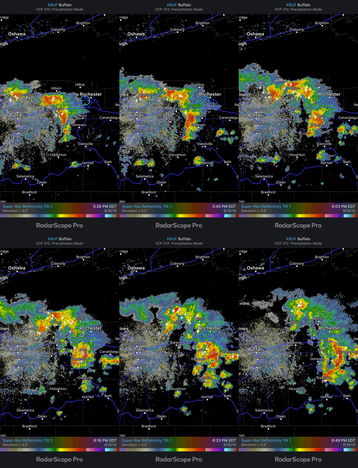
Wayne county really got blasted by some potent storms late this afternoon. I definitely did not expect that but I guess it makes sense with such an anomalous cold pool during mid August. It certainly appears like Lake Ontario aided in the storms in someway (frictional convergence, higher dew point air, etc). They were hit by several stronger cells before this loop started too! Im mad I didn’t capture it sooner. Anyone out there to verify rainfall amounts or hail? -

Upstate/Eastern New York
DeltaT13 replied to BuffaloWeather's topic in Upstate New York/Pennsylvania
High Res meso models show some lake effect bands firing up overnight off Huron and Georgian Bay. Tis the season. Just about 2 months of summery weather left and then its game on. I'm already getting excited thinking about fall and the first flakes. -

Upstate/Eastern New York
DeltaT13 replied to BuffaloWeather's topic in Upstate New York/Pennsylvania
Only picked up .20" yesterday. Looks like a much better chance today. The Atmosphere is conditionally unstable with some tall skinny CAPE, not much shear but pretty juicy. -

Upstate/Eastern New York
DeltaT13 replied to BuffaloWeather's topic in Upstate New York/Pennsylvania
Yeah, finally got some light rain this morning. I'll see what the rain gauge has in it when I get home. Still looked like dry under some of the bigger trees though so it certainly wasnt much. -

Upstate/Eastern New York
DeltaT13 replied to BuffaloWeather's topic in Upstate New York/Pennsylvania
We havent had a drop yet here at the University of Rochester. Absolutely surrounded by towering cumulus all morning and afternoon. You can't make this up. haha. -

Upstate/Eastern New York
DeltaT13 replied to BuffaloWeather's topic in Upstate New York/Pennsylvania
It's starting to feel like it will never rain again in KROC. The last truly good soaker we got was on July 5th and 6th, Since then we have had less than an inch of rain total, so basically an entire month without a soaking rainfall. It's like the god damn Sahara out there! The Lake Erie pacman looks to devour everything again today. -

Upstate/Eastern New York
DeltaT13 replied to BuffaloWeather's topic in Upstate New York/Pennsylvania
Could really use some rain here in the ROC. Looks like we have some hit or miss chances tomorrow and early Wednesday then dry for another 5-7 days. Great for outdoor activities, not so great for the gardens. Just need a quick inch tomorrow...... Not really complaining though as Park Ave fest is this weekend! -

Upstate/Eastern New York
DeltaT13 replied to BuffaloWeather's topic in Upstate New York/Pennsylvania
Did a little digging on the Holiday Valley Snow. Seems like it was tarped off since April to save it for their mud run they held a few weeks back. I knew it was impossible for it to last on its own. -

Upstate/Eastern New York
DeltaT13 replied to BuffaloWeather's topic in Upstate New York/Pennsylvania
I agree this spring felt crappy but June was only .6 degrees below normal. Warm nights really brought up our average even though daytime highs were a bit cooler. -

Upstate/Eastern New York
DeltaT13 replied to BuffaloWeather's topic in Upstate New York/Pennsylvania
40 days is huge difference in time. I wouldnt be shocked at all to see snow in May and Early June. But July, I just don't buy it. -

Upstate/Eastern New York
DeltaT13 replied to BuffaloWeather's topic in Upstate New York/Pennsylvania
I'm quite suspicious there is more going on with that post than they lead on. There is no way snow lasted that long without some sort of assistance (piling or shading it purposely, perhaps even using a solar blanket to reflect back the sun). If the snow had a very thick covering of debris I could see it being insulated and possibly lasting this long, but that is raw pure white snow, something smells awfully fishy to me. -

Upstate/Eastern New York
DeltaT13 replied to BuffaloWeather's topic in Upstate New York/Pennsylvania
A lot of hype about the rain tomorrow. This just further shows how overly dramatic the media and NWS is getting. Since when is an inch of rain big news? We could actually use some rain as the gardens and lawns were feeling downright hard yesterday. It's been a perfect week so far, one day of rain, then three more gorgeous days. Looks great to me! -

Upstate/Eastern New York
DeltaT13 replied to BuffaloWeather's topic in Upstate New York/Pennsylvania
It was snowing at the summit of Whiteface Mountain this morning. First time I've ever seen that (Adirondack snow in June) although I'm sure its happened before.


