-
Posts
3,006 -
Joined
-
Last visited
Content Type
Profiles
Blogs
Forums
American Weather
Media Demo
Store
Gallery
Everything posted by DeltaT13
-
Upstate/Eastern New York
DeltaT13 replied to BuffaloWeather's topic in Upstate New York/Pennsylvania
What an exciting time to be a WNY'er! This storm has a lot of tricks up its sleeve. I'm definitely not sold on the GFS as it seems amped to moon like it has been all year ( I seriously wonder if there is a bug in the code somewhere). That said, almost all models have continually trended in a favorable direction for us for many days. I've put in for a day off on Friday to hit up Holiday Valley, hoping that pays dividends! -

Upstate/Eastern New York
DeltaT13 replied to BuffaloWeather's topic in Upstate New York/Pennsylvania
Exactly, when I think of all the big cities around all the great lakes you can almost always find a way that they can get some sort of lake effect band to hit them at least once a generation to give them a substantial snowfall (18 inches plus). But poor Toronto is just in a horrible location. Even when that rare East West Band forms every few years it clobbers Hamilton to St Catharines and almost never clips Toronto. In most peoples eyes, these stats actually make Toronto a very attractive Northern City. It's just us weirdos that see it as a detriment. haha -

Upstate/Eastern New York
DeltaT13 replied to BuffaloWeather's topic in Upstate New York/Pennsylvania
Agree, but even dividing those numbers by 5 (which is similar to what you're eluding to) still yields a statistically significant "snowstorm" for Toronto. I'm happy to see them at least have a shot. Toronto is an unbelievably snowless location for its latitude and proximity to the great lakes (which obviously don't help them). Look at these pitiful numbers... If they even got 7 inches it would be their largest single day snowfall in over a decade, AMAZING Most snow to fall in one day during recent years in Toronto Inches Date 3.5 November 15, 2018 6.1 February 12, 2017 5.4 December 11, 2016 4.1 February 21, 2015 6.9 December 11, 2014 4.1 December 14, 2013 5.0 February 02, 2012 2.5 February 26, 2011 5.3 January 28, 2010 -

Upstate/Eastern New York
DeltaT13 replied to BuffaloWeather's topic in Upstate New York/Pennsylvania
When was the last time you saw Toronto near the sweet spot of a storm. Granted this is a clown map but they are close to getting a very legit amount of snow. As a side, note, why on earth does tropical tidbits not show accumulated snow over the great lakes (or any major body of water)? I understand that the snow won't actually accumulate there but its not as if the snow won't fall there. It's downright idiotic and makes it harder to read these maps correctly especially for those of us that are close to the lake shores. They really should fix that. -

Upstate/Eastern New York
DeltaT13 replied to BuffaloWeather's topic in Upstate New York/Pennsylvania
-

Upstate/Eastern New York
DeltaT13 replied to BuffaloWeather's topic in Upstate New York/Pennsylvania
I think you got a really nice weekend all things considered. High Peaks snowpack is currently at a seasonal high. Weather this weekend looks simply perfect for hiking. Sunny skies, light winds, moderate temps. As long as the snow isnt too exhausting you should be able to really cover some ground. Get some good pics! -

Upstate/Eastern New York
DeltaT13 replied to BuffaloWeather's topic in Upstate New York/Pennsylvania
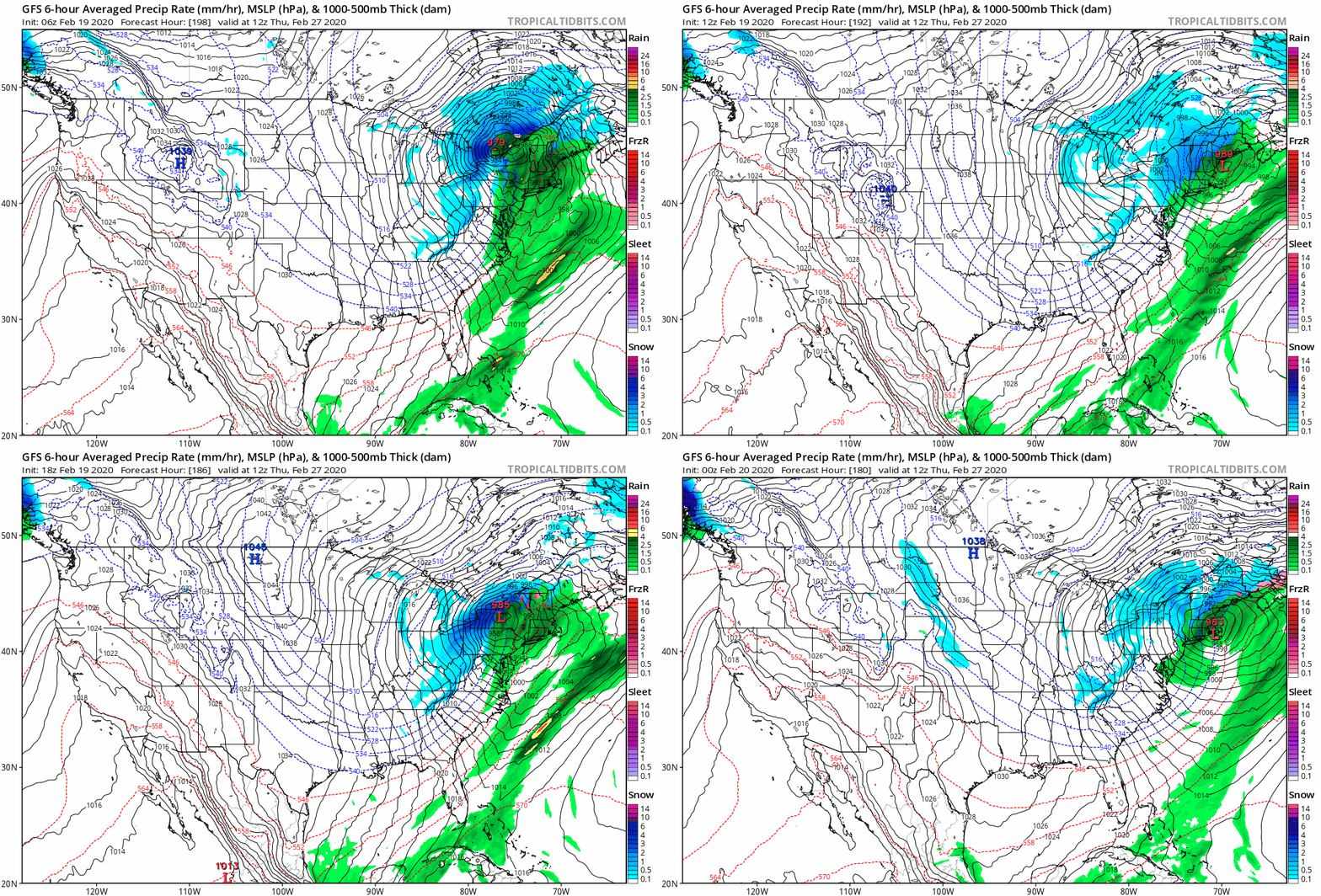
You're not kidding either. The GFS really has a knack for deepening storms to virtually impossible levels this winter. The 12z run had it dropping 19mb in 12 hours. -

Upstate/Eastern New York
DeltaT13 replied to BuffaloWeather's topic in Upstate New York/Pennsylvania
Alright, the GFS is starting to hone in on something with the last 4 runs. 7 days though, why do we even do this...... -

Upstate/Eastern New York
DeltaT13 replied to BuffaloWeather's topic in Upstate New York/Pennsylvania
12z GFS was really ugly. About 4 chances for rain with one strange shot at some snow with a hybrid Miller B system. Getting ready to toss in the towel on this Winter. Somehow I actually salvaged some decent days on the slopes. -

Upstate/Eastern New York
DeltaT13 replied to BuffaloWeather's topic in Upstate New York/Pennsylvania
Yeah, 2 inches would be the top end of what I received in my backyard. Saw some 12"+ totals coming in from Central Wayne county overnight. -

Upstate/Eastern New York
DeltaT13 replied to BuffaloWeather's topic in Upstate New York/Pennsylvania
This is a strong contender for bust of the year so far. Amazing -

Upstate/Eastern New York
DeltaT13 replied to BuffaloWeather's topic in Upstate New York/Pennsylvania
Well they are still really only forecasting 3-6 of synoptic so I’m not sure what part you are interpreting as exciting. They are just doing a thorough job explaining the dynamics of the system. I hadn’t noticed until they mentioned it but that is an incredibly large and powerful upper level jet. -

Upstate/Eastern New York
DeltaT13 replied to BuffaloWeather's topic in Upstate New York/Pennsylvania
I guess I take those accumulated snowfall maps with a grain of salt. It just seems like a good storm track with a reasonable amount of moisture to work with and a better than normal wind trajectory for the subsequent lake effect Ive really only ever expected 3-6 and I think that’s completely within the realm. The point and click from Syracuse is a little depressing though. -

Upstate/Eastern New York
DeltaT13 replied to BuffaloWeather's topic in Upstate New York/Pennsylvania
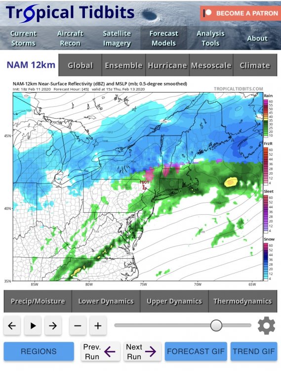
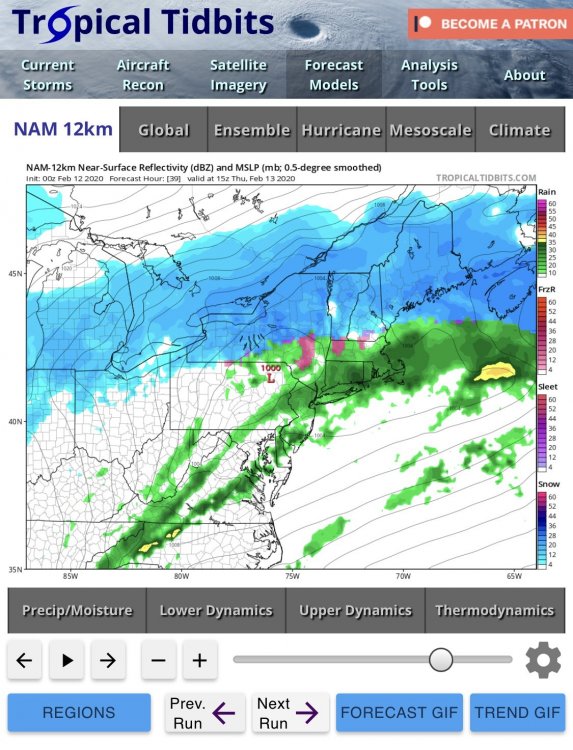
I feel like I’m in the twilight zone. The NAM looks north with as much or more precip than previous runs. The hrrr really didn’t look bad or that different. I’m confused. Nothing looks that bad. -

Upstate/Eastern New York
DeltaT13 replied to BuffaloWeather's topic in Upstate New York/Pennsylvania
Well then a shift south doesn’t seem so bad. Right? -

Upstate/Eastern New York
DeltaT13 replied to BuffaloWeather's topic in Upstate New York/Pennsylvania
Looked just far enough south to remove that dirty taint from corrupting your precip with sleet and a glaze. -

Upstate/Eastern New York
DeltaT13 replied to BuffaloWeather's topic in Upstate New York/Pennsylvania
Well it’s not too weird. The storm was certainly biased East west with the highest amounts east of us. From the primary synoptic side of the storm I measured 4 inches of low ratio snow. Then overnight into Saturday we picked up 3 inches of absolute fake 30:1 snow. Then another inch on sat night. So total from Friday to Sunday was 8 inches. But only 4 of those inches had any real substance too them. For once the airport measurement was spot on compared to my backyard. -

Upstate/Eastern New York
DeltaT13 replied to BuffaloWeather's topic in Upstate New York/Pennsylvania
18z see is the best run yet in regards to next weeks rain storm. I think we have had almost 10 runs now that have trended at least in the right direction. As for the Thursday storm, I'm not sure where the doom and gloom is coming from. This storm has been 3-6" for days and still looks easily locked in as such. In fact the latest run looks about as good as any. We only got 4 inches with the storm last Friday and it was a great day of chasing and snowboarding. We just have to adjust our standards a little this winter. -

Upstate/Eastern New York
DeltaT13 replied to BuffaloWeather's topic in Upstate New York/Pennsylvania
Aren't WSW's and advisories and all that jazz only important for the clueless general population? I couldn't care less how they qualify a storm in regards to verbiage as long as it snows and snows a lot, lol. The nomenclature doesn't change the tangible weather that occurs. For super weather nerds like us we shouldn't care at all what silly level of advisory the NWS gives out, we know whats going to happen in far more detail than some dumbed down product. -

Upstate/Eastern New York
DeltaT13 replied to BuffaloWeather's topic in Upstate New York/Pennsylvania
I was there for several days before the Friday storm and conditions were pretty awesome even then (Whiteface). Now is the time to get up there before we get washed out again. -

Upstate/Eastern New York
DeltaT13 replied to BuffaloWeather's topic in Upstate New York/Pennsylvania
https://www.matthewparrilla.com/mansfield-stake/ -

Major Winter Storm 2/6-2/7 OBS
DeltaT13 replied to PaulyFromPlattsburgh's topic in Upstate New York/Pennsylvania
I wouldn’t worry unless you were going really back country. Resorts will be fine. -

Major Winter Storm 2/6-2/7 OBS
DeltaT13 replied to PaulyFromPlattsburgh's topic in Upstate New York/Pennsylvania
You don’t see this often. Good news for you Buffaloweather. Avalanche risk in the adirondacks https://www.news10.com/news/nys-dec-warns-of-avalanche-risk-in-high-peaks-region-of-the-adirondacks/?utm_medium=social&utm_source=facebook_WTEN -

Major Winter Storm 2/6-2/7 OBS
DeltaT13 replied to PaulyFromPlattsburgh's topic in Upstate New York/Pennsylvania
Just measured 3.5-4” on the west side of Monroe county. Hoping we can get another inch or two from lake effect but that might be a stretch. Feeling a bit underwhelmed but I knew Roc was riding the edge. Still feels good to see the whole forum in on some kind of action with a few people catching a monster event! -

Major Winter Storm 2/6-2/7 OBS
DeltaT13 replied to PaulyFromPlattsburgh's topic in Upstate New York/Pennsylvania
I’ve been out driving around roc. Snow is moderate to heavy at times. Flake size is a little small. Roads are atrocious so it’s a great day to really test these new blizzaks. They are eating it up. Looks like Ontario is really kicking in. Should keep us in the game through at least mid to late afternoon.


