-
Posts
3,006 -
Joined
-
Last visited
Content Type
Profiles
Blogs
Forums
American Weather
Media Demo
Store
Gallery
Everything posted by DeltaT13
-
Upstate/Eastern New York
DeltaT13 replied to BuffaloWeather's topic in Upstate New York/Pennsylvania
Probably one of the worst (if not the worst) in modern history anywhere in the world. -

Upstate/Eastern New York
DeltaT13 replied to BuffaloWeather's topic in Upstate New York/Pennsylvania
Ice storms have the potential to the be some of the most devastating weather on the planet in the perfect catastrophic scenario. -

Upstate/Eastern New York
DeltaT13 replied to BuffaloWeather's topic in Upstate New York/Pennsylvania
Yes please! -

Upstate/Eastern New York
DeltaT13 replied to BuffaloWeather's topic in Upstate New York/Pennsylvania
-

Upstate/Eastern New York
DeltaT13 replied to BuffaloWeather's topic in Upstate New York/Pennsylvania
What’s the issue, those are almost perfect summer temps...Cool nights. Warm days. Absolutely gorgeous. -

Upstate/Eastern New York
DeltaT13 replied to BuffaloWeather's topic in Upstate New York/Pennsylvania
Damn dude. I get it. I do quite a bit of investing. It’s also nice to knock a few years off a mortgage and pay the same amount monthly while saving 75k in interest. I dunno. I think you can have it both ways with rates this low. -

Upstate/Eastern New York
DeltaT13 replied to BuffaloWeather's topic in Upstate New York/Pennsylvania
Dang man you should be trying to shorten that term not lower the payment. I’m trying to see if I can get a 10 year right now. That is a killer rate though. -

Upstate/Eastern New York
DeltaT13 replied to BuffaloWeather's topic in Upstate New York/Pennsylvania
The average high for Rochester is 81 degrees this time of year and is already declining. Therefore anything above that is above normal, I know math is hard for dimwit trolls like yourself, but you can do better. After almost a decade on here, I finally have to block a user. I advise the rest of you to do the same. And when the loser makes a new handle, we can ignore that one too. Let's keep this place relatively clean. -

Upstate/Eastern New York
DeltaT13 replied to BuffaloWeather's topic in Upstate New York/Pennsylvania
I agree completely. I’m sitting here completely baffled as to what the hell is going on. There wasnt a single model that showed any of these prefrontal storms or rain until 8pm or later tonight yet. Very bizarre. And does that mean we still get the MCS squall line later too? -

Upstate/Eastern New York
DeltaT13 replied to BuffaloWeather's topic in Upstate New York/Pennsylvania
Dew point up to 71 in kROC. It’s juicy out there. -

Upstate/Eastern New York
DeltaT13 replied to BuffaloWeather's topic in Upstate New York/Pennsylvania
While I think this is probably true, as the actual shortwave moves through this evening it brings impressive lift and dynamics. The low levels will still be somewhat ripe. Could be some surprises. Don’t lose faith yet! -

Upstate/Eastern New York
DeltaT13 replied to BuffaloWeather's topic in Upstate New York/Pennsylvania
If the first batch can soak the ground a bit and then we break into a few hours of sun that would be the ideal setup. Would love to see the DP's jump into the upper 60's to 70 with a little extra low level juice. It's a risky scenario though, the first round of showers will definitely steal some CAPE and leave the lower levels slightly more stable. -

Upstate/Eastern New York
DeltaT13 replied to BuffaloWeather's topic in Upstate New York/Pennsylvania
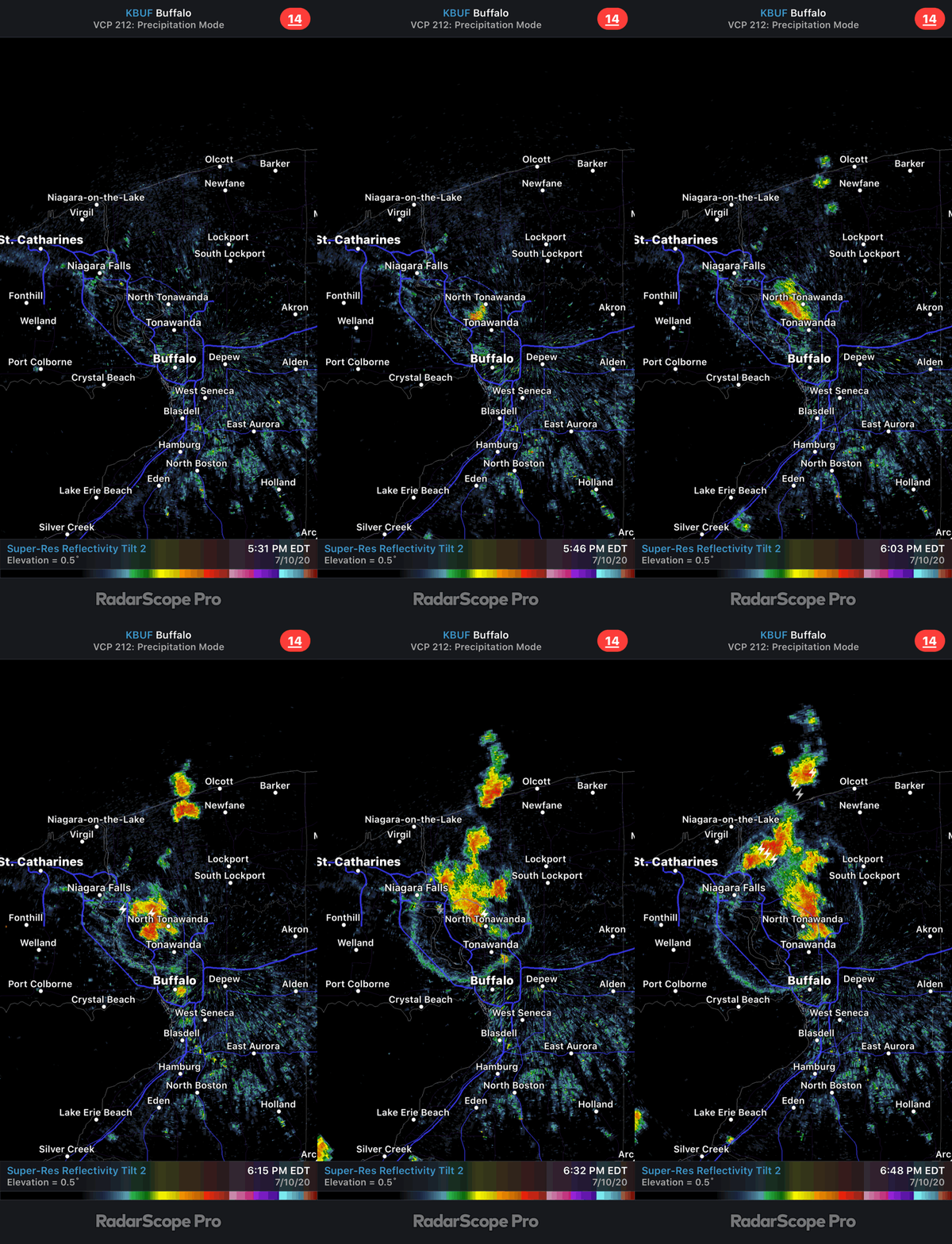
18z High Res NAM really increased coverage and intensity of tomorrows convective event. I like the way its trending! -

Upstate/Eastern New York
DeltaT13 replied to BuffaloWeather's topic in Upstate New York/Pennsylvania
I fully agree that the average person still completely blows it when attempting to interpret a forecast. I saw some similar posts where people just assume that a tornado will be coming through at some set time tomorrow. These are the reasons I never became a pro forecaster, you work so hard only to be have idiots misunderstand your forecast and then ridicule like you were wrong and they were right. It must be so frustrating. -

Upstate/Eastern New York
DeltaT13 replied to BuffaloWeather's topic in Upstate New York/Pennsylvania
Ummm a 2% chance of tornados in WNY is orders of magnitude higher than on an average day. Don’t be deceived by percentages. This is the same mindset that a 1% death rate from covid is nothing to worry about (that equates to 3.3million dead Americans) -

Upstate/Eastern New York
DeltaT13 replied to BuffaloWeather's topic in Upstate New York/Pennsylvania
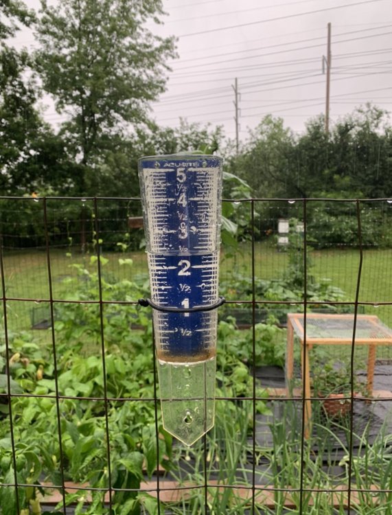
Thats crazy, you guys got 2-3 inches of rain. Are you on a hill where it really runs off? I have standing water in portions of my yard still today. I thankfully won't need to water anything for a good 5-7 days. -

Upstate/Eastern New York
DeltaT13 replied to BuffaloWeather's topic in Upstate New York/Pennsylvania
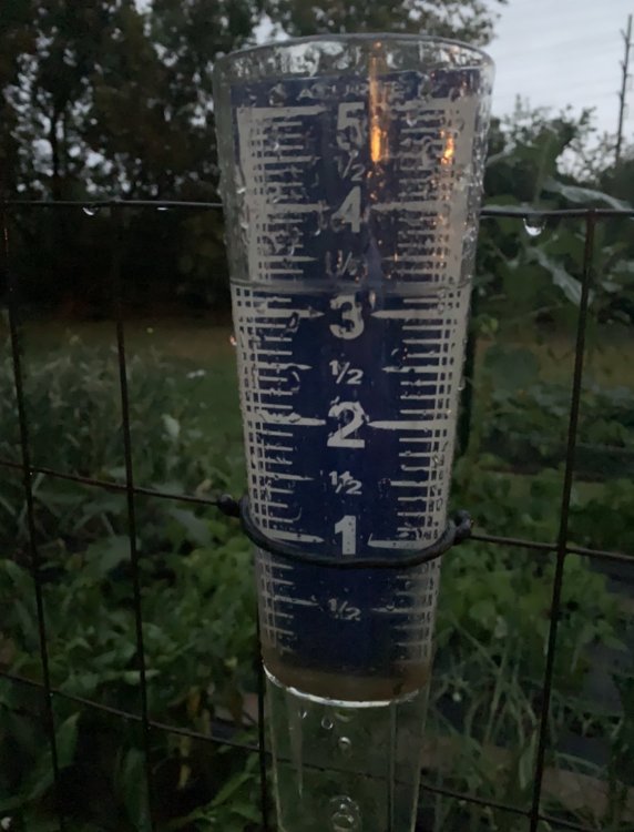
I’ve been in my house for 13 years and that’s a top 5 heavy rain event. 3.30” in 6 hours. Enjoyed watching it all day and evening. Even got a little nap in the three seasons room. Best background sleeping noise ever. -

Upstate/Eastern New York
DeltaT13 replied to BuffaloWeather's topic in Upstate New York/Pennsylvania
-

Upstate/Eastern New York
DeltaT13 replied to BuffaloWeather's topic in Upstate New York/Pennsylvania
The dynamics just north of the center of that low are strong. Hopefully as it approaches things fill in for you. -

Upstate/Eastern New York
DeltaT13 replied to BuffaloWeather's topic in Upstate New York/Pennsylvania
Getting crushed here. Getting close to 1.75 in about 30 minutes and still coming. Heaviest rain I’ve seen in years for my backyard. Hallelujah! -

Upstate/Eastern New York
DeltaT13 replied to BuffaloWeather's topic in Upstate New York/Pennsylvania
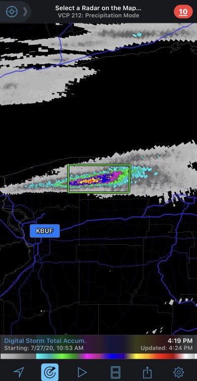
The Monroe/Wayne county line just got 3 inches of rain in an hour if the digital estimate is right. Major back building in some of these storms. -

Upstate/Eastern New York
DeltaT13 replied to BuffaloWeather's topic in Upstate New York/Pennsylvania
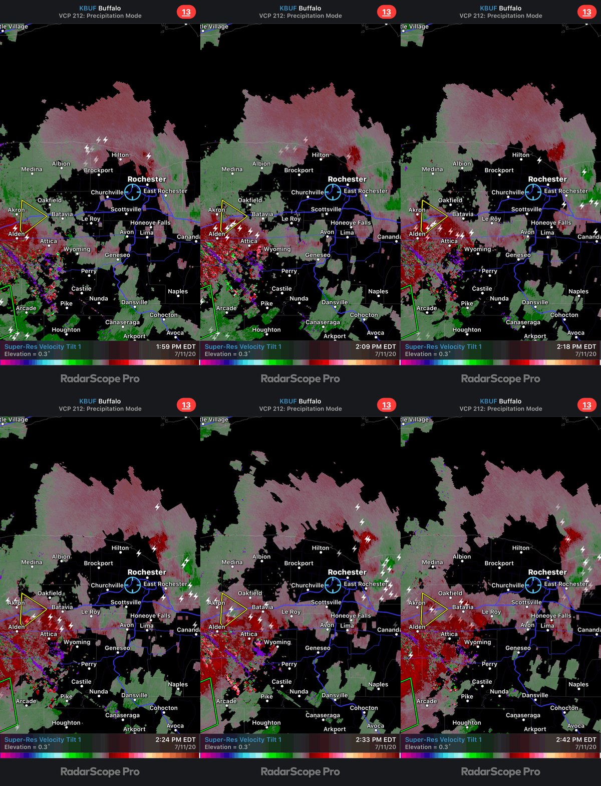
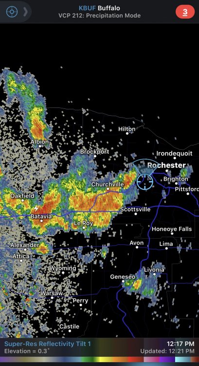
The new arm of storms looks like it has some rotation. Probably doesn’t have the updraft strength though but interesting. Just to the right of Leroy at the end of the loop. -

Upstate/Eastern New York
DeltaT13 replied to BuffaloWeather's topic in Upstate New York/Pennsylvania
Some places are going to get inches of rain today. Other places might end up with less than a .10. Tricky setup with this tightly wound “tropical-ish” low and ribbons of instability. Swing and a miss on round 1 -

Upstate/Eastern New York
DeltaT13 replied to BuffaloWeather's topic in Upstate New York/Pennsylvania
-
Suspicious was a bad choice of words. Perplexing is better. It’s just unusual that dansville and other normally really hot spots came up short while Buffalo roasted. Weird wild stuff... I saw 98 on the truck thermometer numerous times driving on 104 in Wayne county. Also saw it hit 98 in downtown Rochester on 490 so there is no doubt that it was extremely hot. Once I got out to my house it dropped to 94 which seemed reasonable and agreed with the kROC NWS numbers at the time. A great heat wave with very manageable humidity.


