David-LI
-
Posts
1,273 -
Joined
-
Last visited
Content Type
Profiles
Blogs
Forums
American Weather
Media Demo
Store
Gallery
Everything posted by David-LI
-
Looks like the center explodes in the last hour https://weather.cod.edu/satrad/?parms=meso-meso2-02-96-1-100-1&checked=map&colorbar=undefined
-
It is blowing up in the last few frames
-
Way more west than forecasted by models
-
Mind sharing website you're using to track?
-
 I know it's the NAM and probably overdone but Pivotal weather and Tropicaltidbits show a difference of about 20mb on the NAM3k at the same time Sunday. Different calculations?
 -
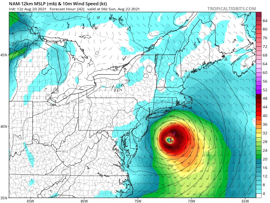
NAM 12k going for a Long Island landfall. Hope watches go out today so people that watch the news this afternoon and evening can be alert.
- 1,603 replies
-
- 1
-

-
- hurricane gusts
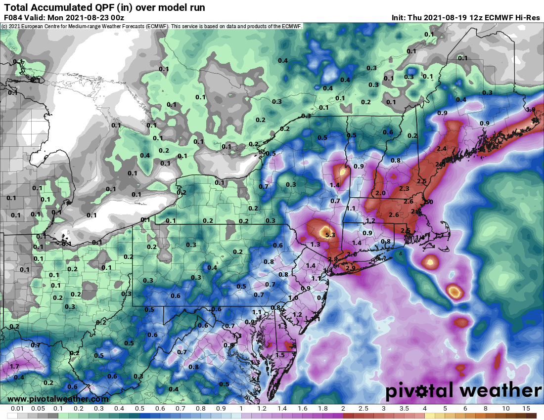
- flooding rains
- (and 2 more)
-
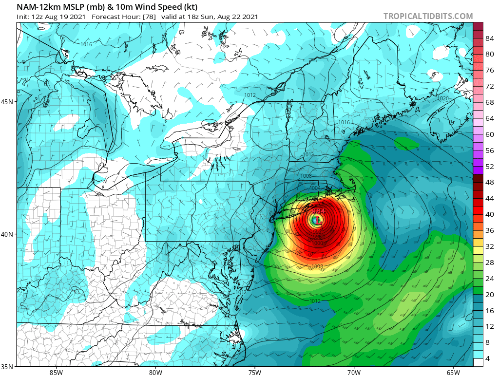
What do you guys think of the rapid intensification seen on the NAM 3k? I'd like to see if tomorrow that will verify and we have Henri at 975mb.
- 1,603 replies
-
- 1
-
-
- hurricane gusts
- flooding rains
- (and 2 more)
-
Not happening. Recon flight a few moments ago observed pressure of 1000mb and winds at around 55-60 kts. Ukie started at 985mb.
-
Euro at hr 60 very weak and disorganized, hardly resembling a tropical storm.
-
Euro at hr 54 is a disorganized mess hardly resembling a hurricane.
-
When are they sending recon aircraft?
-
FWIW, GFS did well with Elsa last month.
-
Can you post when that's available? Thank you
-
Wind is always a concern for Long Island and coast.
-
fwiw, 12z NAM with landfall in the Twin Forks

-
What's the best website to track live hurricane data, winds etc, if such site exists?
-
Not a meteorologist, only a pro weenie so take with a grain of salt. It seems that the Euro started Henri weaker than what it is currently, and GFS started stronger. Henry is currently at 70mph sustained winds, close to Hurricane status. Safe to assume a stronger intensification will lead to a more northwest track compared to a more eastern track if Henri remains weak as shown by the euro?
-
Chances that we get some nice thunderstorms tomorrow with the low passing by? 3k NAM looks active.
-
Smoke from West Coast wildfires, probably from the one in Bootleg, Oregon.
-
I’m surprised no one has mentioned yet how the moon looks pretty in red.
-
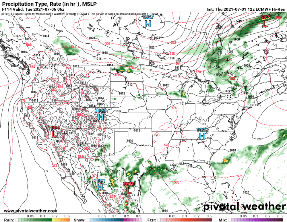
Euro with no sign of storm. High pressure and clear skies.
-
Euro showed nothing last run. I trust the king.