David-LI
-
Posts
1,439 -
Joined
-
Last visited
Content Type
Profiles
Blogs
Forums
American Weather
Media Demo
Store
Gallery
Everything posted by David-LI
-
 Hoping for a bigger lightning show
 -
This looks interesting
-
I wonder if schools are open in Long Island due to state of emergency? how are things in Long Island? I haven’t been outside actually working indoors
-
Make a deal with citi bike and rental scooter companies for people to get around for free or at discount
-
What do you mean by lighting up?
-
Seeing patches of blue sky opening up in north Nassau county
-
Must be tough being a TV met and looking back at your wind graphics of 30/60 mph
- 1,603 replies
-
- 2
-

-
- hurricane gusts
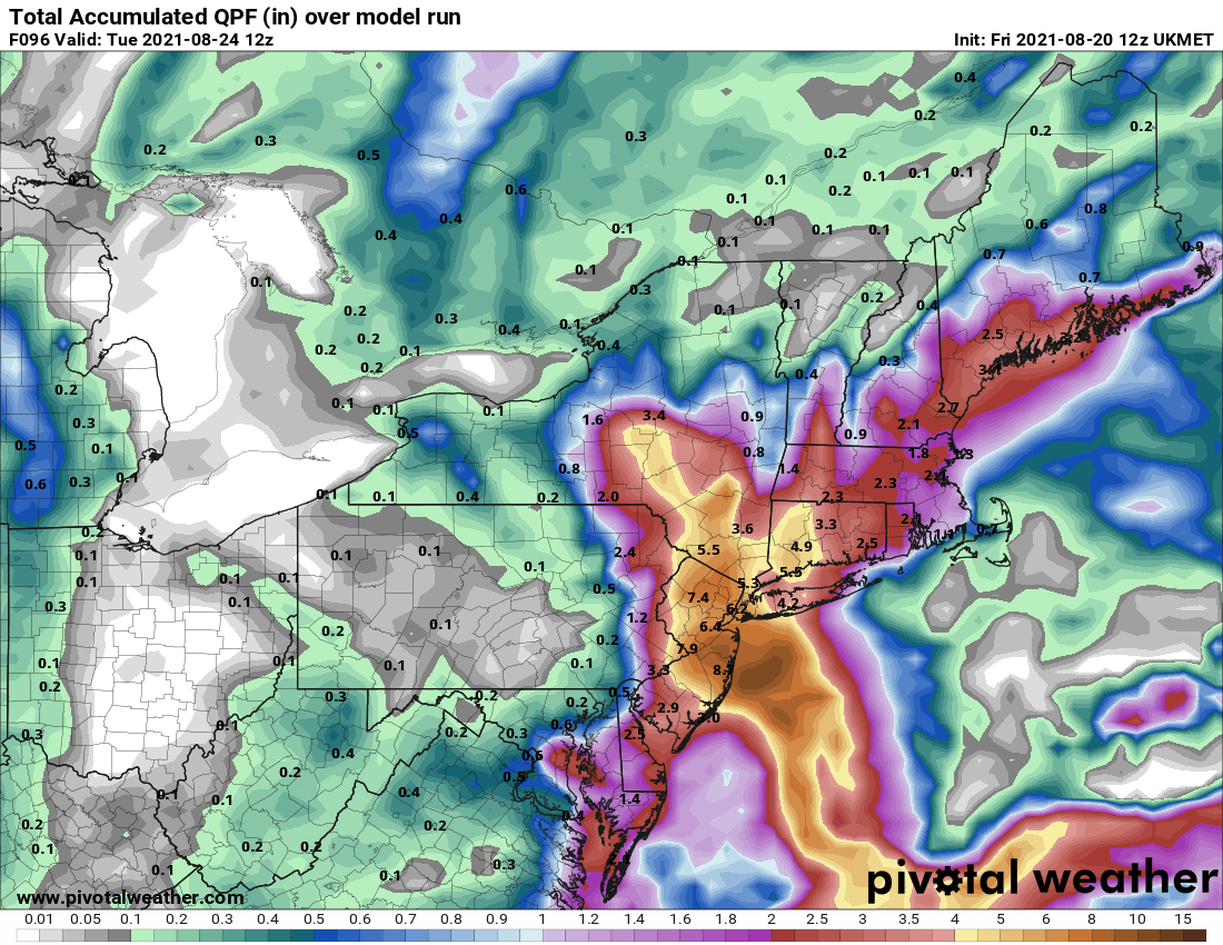
- flooding rains
- (and 2 more)
-
Hm could be catching up to something
-
Great not only losing power, but we are also getting Cum Wind
- 1,603 replies
-
- 6
-
-
- hurricane gusts
- flooding rains
- (and 2 more)
-
"We should shoot Henri. The best thing when you see a hurricane is you shoot it. Believe me."
- 1,603 replies
-
- 1
-
-
- hurricane gusts
- flooding rains
- (and 2 more)
-
My guess is that some websites use their own calculations with data provided by the model to produce a map. Hence the discrepancy in pressure on different websites. That's just a guess I have no idea how it works.
-
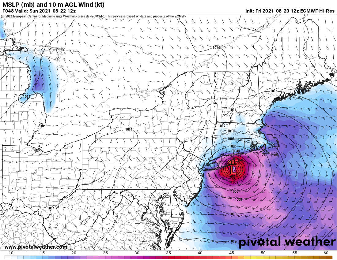
If it makes landfall in Nassau County as Ukie shows I guess I'll have some gusts followed by calm winds while the center of storm passes over us.
- 1,603 replies
-
- 1
-

-
- hurricane gusts
- flooding rains
- (and 2 more)
-
Canadian with a landfall in Central Long Island. Noting that it started fairly weak.
-
Nothing on Pivotal Weather yet.
-
I wonder if it can make a double landfall as Cat 1, First Montauk then CT
-
New London airport in CT
-
It appears the GFS at hr 48 is a few miles west and a few mb stronger compared to 06z. Looks like a Twin Forks landfall.
- 1,603 replies
-
- 1
-
-
- hurricane gusts
- flooding rains
- (and 2 more)
-
I just know that only a few hours of decent sustained winds and chances are high that power goes out in my area. It always does with windy storms let alone a Cat 1 or TS.
-
God pushed the ignite button
-
Definitely a surge. Not similar track to Sandy. Sandy made a NJ landfall.
-
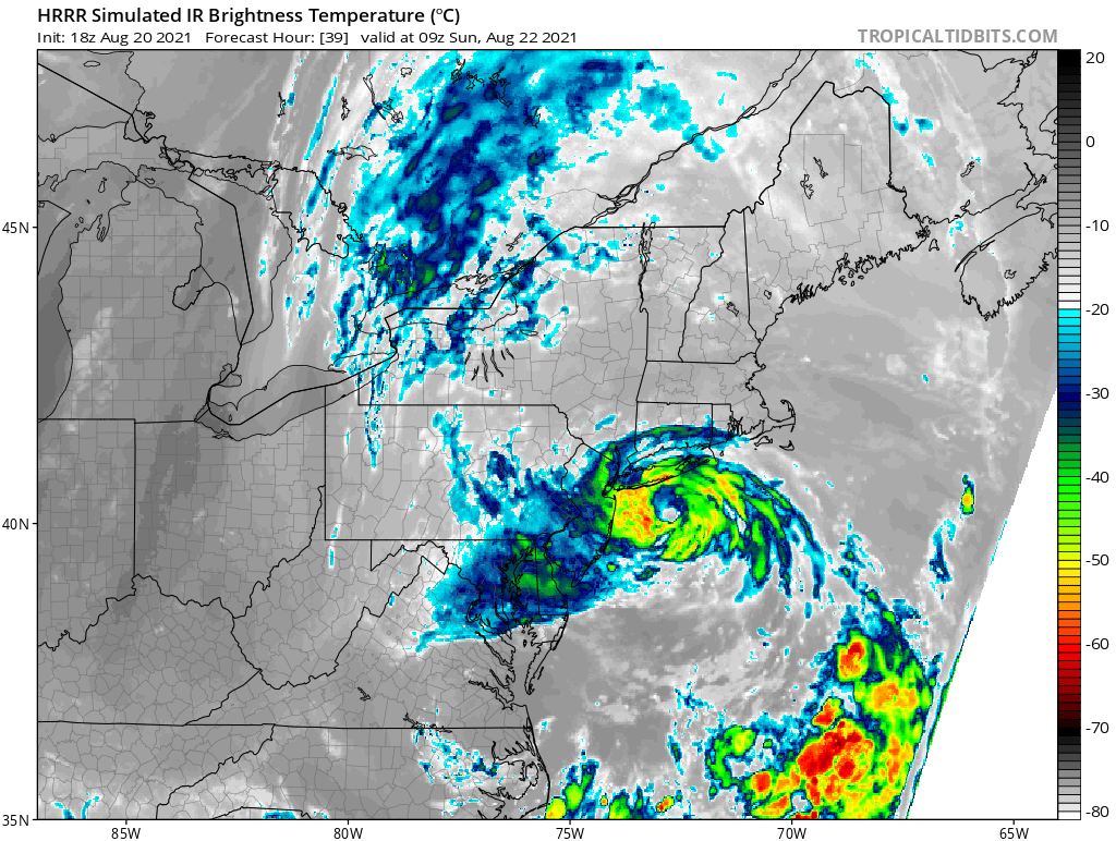
Looks like the center explodes in the last hour https://weather.cod.edu/satrad/?parms=meso-meso2-02-96-1-100-1&checked=map&colorbar=undefined