Typhoon Tip
Meteorologist-
Posts
43,906 -
Joined
-
Last visited
Content Type
Profiles
Blogs
Forums
American Weather
Media Demo
Store
Gallery
Everything posted by Typhoon Tip
-
Thursday's a lost cause... Not surprising. It's April. Not sure what part of a April 15 anyone's expectation would be any different - to the straw man... When I saw the model sale over the weekend for 6 or 7 days of unabridged 20+ dailies while maintaining a polar boundary as stationary from S ON to a Bar Harbor Maine, I pretty much was going bah ha ha ha. No purchase here. I'm sure it could happen... but just circumstantially with both numerical climate, the recent many weeks of trend, and my own hatred from god, that too much weighted dice.
-
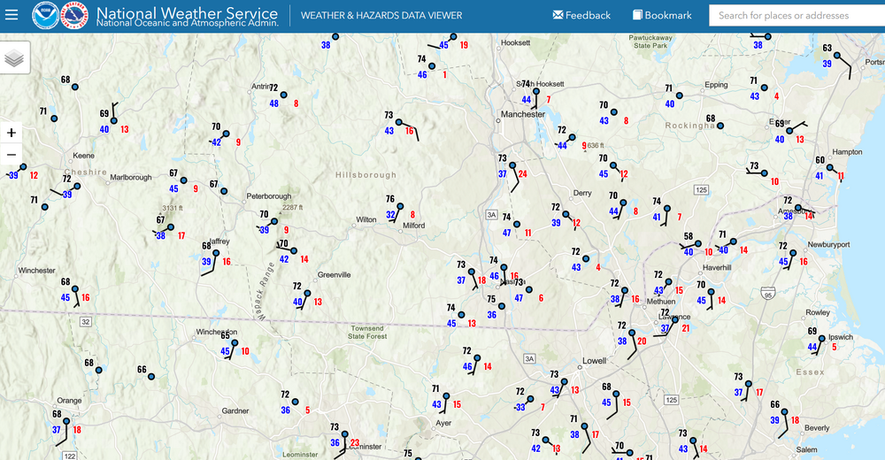
12 NAM is about 39.8 F Mass coast Wednesday between 21 and 24Z while it is 84 in ALB and about 90 at LGA. Welcome to Labrador's rectum
-
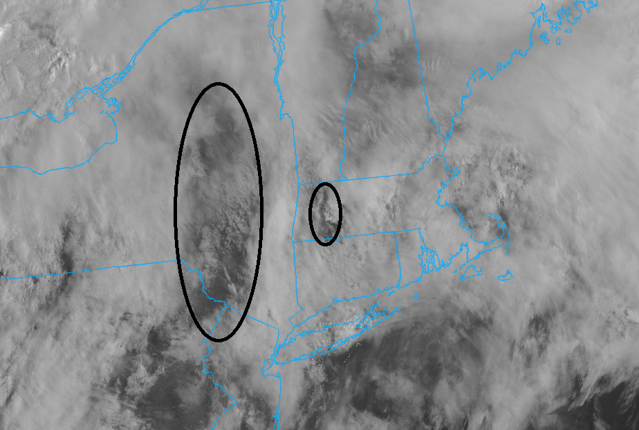
Progress ... some sky lights unzipping. I just hate it when these cloud packed mornings do this and waste days. It's a spring thing...
-
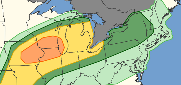
...Northeast... Rounds of thunderstorms are expected during the afternoon and evening within a warm advection regime. MLCAPE should increase to around 1000 J/kg within a moistening low-level airmass. Strong deep-layer westerly flow and steepening low-level lapse rates will support isolated strong wind gusts across the region. I wouldn't be shocked if the Marginal gets extended E and a smaller Slight region gets embedded..
-
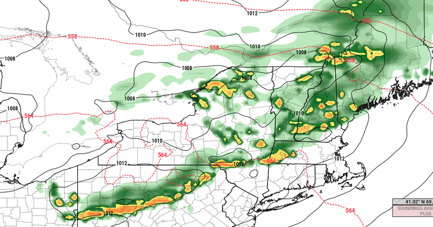
Too bad we don't have better lapse rates Tuesday afternoon because that looks modestly interesting given the other synoptic parameters. W to WNW at 700 mb, SW below 850mb is a directional +helicity. About 20 to 25 kts +d(v) between 925 and 500 so not great speed shear. But I said "modestly" heh But a front is approaching into a DP anomaly that pushed its way up to S VT/NH latitudes in most guidance. > 60 F, with ongoing temperatures 80+. This is a June CAPEd air mass smeared up under an impulse cutting through N VT/NH late in the afternoon and evening, arriving after the morning and early afternoon were baked under more sun than clouds. As an aside, tomorrow is going to seem out of place. Anachronistic because the landscape is still lagged lagged so far behind what people typically associate with air of summer aroma. Anyway, the Euro still sniffing out enough instability and a mechanics to ignite broken lines of coherent convective QPF structures in these charts.
-
Need the sun... WPC's analyzing a warm boundary danging NW/SE over mid PA/W NY. That's 600 mi away. It may mix out and reposition NE. Sometimes that happens where you get warm front jump. Could... It's one of those situations where there's a WSW flow at all levels so limited mechanical resistance. If not and it moves the distance tho, we have a ways to go before we get into any kind of air mass latency assist. That means we're wholly dependent on the sun to recover from this 47 to 50 F blegh. Also, folks should count on Thursday being an eastern region wide bust because Mets try to fight (unsuccessfully) the inevitability of 150 mb deep shallow slab of BD incontinence. Heh. The upshot is that there are some models not as cold porn as the GFS' lvl details and if one of those worked out, you get pleasantly surprised.
-
If we don't start seeing some sky-lights opening in this pan - dimensional shit show on morning satellite I may be inclined to take the under on machine guidance. MET/MAV are still 68-73, and it is early ... so we'll see. Incidentally ... both are 78 to 84 tomorrow and Wed along the BDL-FIT-ASH-MHT axis. actually, MET's 73 in NH on Wed.
-
It's really super shallow, too. The 850 mb temp and wind layout really doesn't even speed up over that. It's all from 925 and lower
-
Sides, that doesn't look "ruined" to me "as is". It's probably a waste of time to discuss the snap shot, particularly at this range, but for shits and giggles.. we are still 558+ hydrostats when that front episodically slips S. It's not like that's we 540- bisecting Maine.
-
not to be a douche but I warned ya. It said this couple whatever days ago that it's very precarious given both our climatology, but the season's persistence/behavior, to sustain a stationary boundary with +PP running E of Ontario without it collapsing S. It may even go back N... ? sure. I just would be duly impressed if we actually got 5 or 6 days in a row of 70+ weather. Not given our climatology of mid April alone, but then including the way persistence has also been over the last 7 month, heh. That'd be pretty fantastic
-
That was an incredible heat wave... It was also in the 90F range in Eastern 2010 (2012) weekend. Heat in April has a bit of an advantage - which is quite counter intuitive, I'm sure. It's because the soil moisture over the continental expanse is wholesale not yet a seasonal source in adding modulating water vapor to the atmosphere. This latter aspect will help keep temperature side of the T vs TD from getting out of control on .. say June 20th. We're still going observe most heat post Apr/May than during ... but, the advent of the April or May heat, from the OV to upper MA/NE region, is really a separate phenomenon to either CC, or the "standard" warmth that spreads into those areas as we work deeper into summer. This is a nuanced aspect that will likely be conflated with other factors ... improperly... by those that are not aware that this is a valid phenomenon, due to water vapor challenged being timed well with a warm 850 layer type of synoptics. Maybe we could argue that sets up more frequently now? no guess. If we go all the way back over a 100 years, there's been these separate events.
-
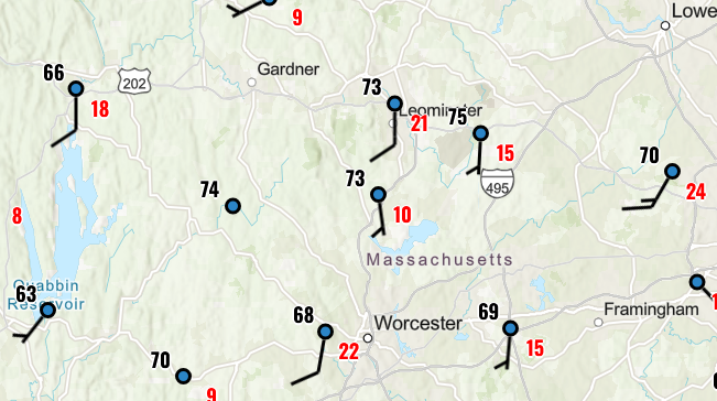
2 meter T/NAM graphics were just a non product it was so bad. Not sure what the MET had ... I seem to recall 67 at BDL ( I routinely check there, KFIT and KASH because that arc includes me), and 63 at KASH but don't quote me. I only glanced and tossed 'em. 77 was the high in town here and 76 at the Oxbow ob 2 mi as the crow flies/NWS site. bad. They may actually do better tomorrow in the d-slope.
-
yeah...this has been my experience with them over the years. They tend to not be significantly better than a coin flip beyond 14 days. Maaaybe some residue of usefulness very early in week 3 then seeya
-
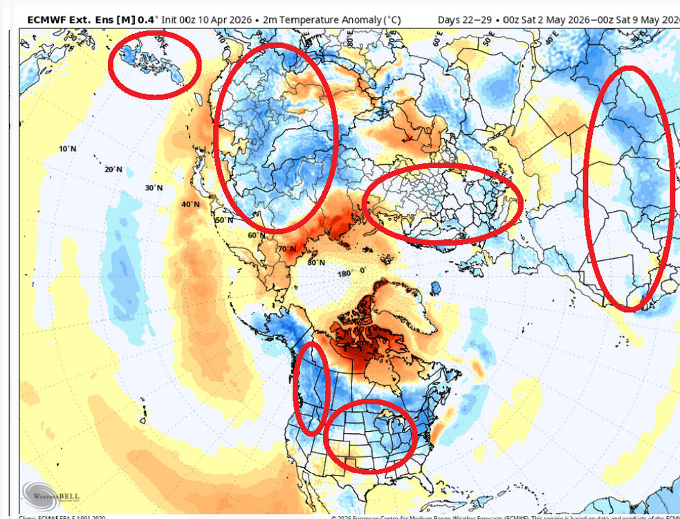
So does anyone know how these multi week products are derived? You should know if you use them... heh. Kinda like oh, I dunno, AI GFS. I'm just wondering in pure speculation if these may get increasingly more climate weighted out in time.
-
mmm those products are suss. Not just because they are way the hell and gone out in time, either. I noticed looking at the Euro Weeklies and the Can Extended, they are showing cool anomalies precisely everywhere the climate models, and verification over the last 10 years, have been actually going the other way from late Aprils thru May. That's a bit of a creepy coincidence where these runs are targeting all the hot problem regions like that ...cooking cutting the known hot zones for cooler anomalies -
-
-
Ha...wow, add the Canadian Extended to the list... NO summer for you, ONE YEAR!
-
Some of the American long lead products are doing the same thing, though. heh...I've never been fan of the weeklies. Not gonna start being a fan of the CFS2v tickled shits whatever it is, either. I've found that beyond 10 days, they are not significantly more dependable than just running the regular ensembles members out to kingdom come. Until a D19 long lead is shockingly on point, I'l defer to those for entertainment
-
I'm actually surprised there's that much water in the air this early in the year. huh
-
Yeah... it really just looks like those long lead products are assuming the winter pattern never stops. I'm not necessarily offended by persistence - it is what it is. The onus is on Earth to change it. LOL Fwiw ... not that our druthers have any say in matter, but having neggie anoms in the 3rd and 4th week getting toward the arrival of he solar max isn't a terrible reality, necessarily, either.
-
-
75 ...73 at KFIT about a 7 to 10F MET bust. Brian can you confirm that?
-
67 70 next door at KFIT with rounding
-
Heh... we can't look at it this way. We can't categorize and package these up as go or no, based on seasons. If there is blocking in the right place, it will be cold in July. Nothing more or less. People have ( likely ) made conjecture like this in the past, but honestly ...we have to take it case by case. There may be more blocking in winter then summer. Okay, but if the blocking is over eastern Canada... not sure summer protects us from cooler anomalies.
-
I haven't seen an actual spring cut off like we used to do in the mid 2000s probably since then. The last time was a cut-off on 'roids: May 2005. It wasn't "a" cut-off. It was an initial variant, that kept getting a new N stream parcel loading into the backside. The first in the series weakened and acted like it was going to beta-drift away, but then the reload grabbed it and it retrograded. This recurred a couple more times. So it was kind of like 4 consecutive ones with lull pauses between them. Staying cold. No sun. Each one was more loaded with "o'reah" than Montezuma's Revenge. Actually ... from a purely Meteorological dorkatudal-doo it was a pretty spectacular. There was IP and mangled aggregates mixed at times up in the Worcester Hills. There were three or four different accelerations of the NEesterly wind field during each re-invigoration of the coastal storm that would rotate back when said parcels reloaded. Winds gusted 45 mph. Sheets of 38 to 44F rain... The whole thing took like 2.5 to 3 weeks to finally kick out. Lesser, singular events with a cut-off in April were more common in the 1980s and '90s. Seems we've had a dearth of those in last decade?

