fountainguy97
-
Posts
1,112 -
Joined
-
Last visited
Content Type
Profiles
Blogs
Forums
American Weather
Media Demo
Store
Gallery
Everything posted by fountainguy97
-
I'm not sure how much room this really has to move north. Our NW trend is typically possible because of a lack of an arctic push. This one will turn our backyards into Canada for a few days. IMO the NW trend may not be as pronounced this time. I think ETN has a shot. But even here I think there is a good chance this one slides to our south. real talk, my friends back in NC are in desperate need of a big snowstorm. I'm rooting for them 100%!!
-
Sneaky system this weekend could be a surprise. Threat for next week looks icy for someone that's for sure. I think the ice threat is very very high with this setup with such a strong CAD push. The GEFS has a lot of really flat NW precip shields. Thin snow streak at the extreme northern edge but a huge ice shield.

-
 Seems like high-res more or less nailed the downsloping for me. I'm maybe at an inch. 32 on the button. I am patiently waiting for my NW snow to pad the stats good lesson from this one. Here is the HRRR initialization for 7pm. That downslope 850mb is ripping overheard. It will slowly come around and end up enhancing our side later tonight.
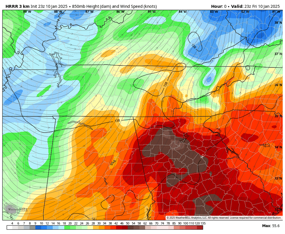
-
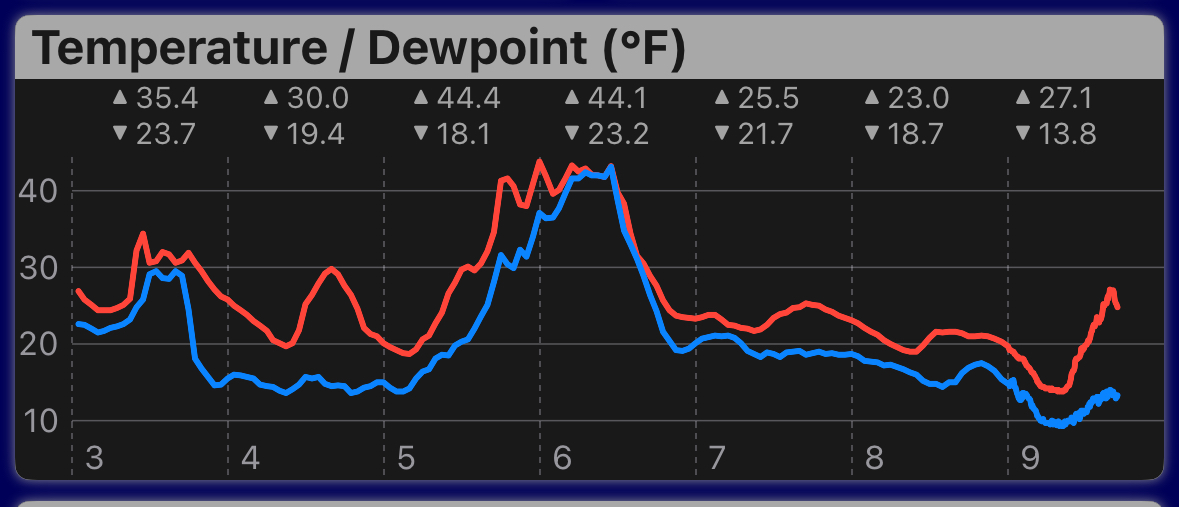
Moderate snow now. Roads whitening fast! 29.3.
-
Temp still climbing in the downslope zone. 29. Tiny tiny flakes falling now
-
Up to 28 here. But the sky is getting really soft. Snow not far from the surface but nothing yet.
-
26/18 here. Sky has that early virga look to it. temp rising steadily. How high do we go? And how much precip can actually overcome this downslope?
-
Said the same thing last t year haha
-
I mean this is just silly at this point.

-
Phew that is one ugly run for East TN
-
This is a week of my station data. An airmass like this before a snow/ ice event is such a luxury. Now just need the storm to cooperate lol.

-
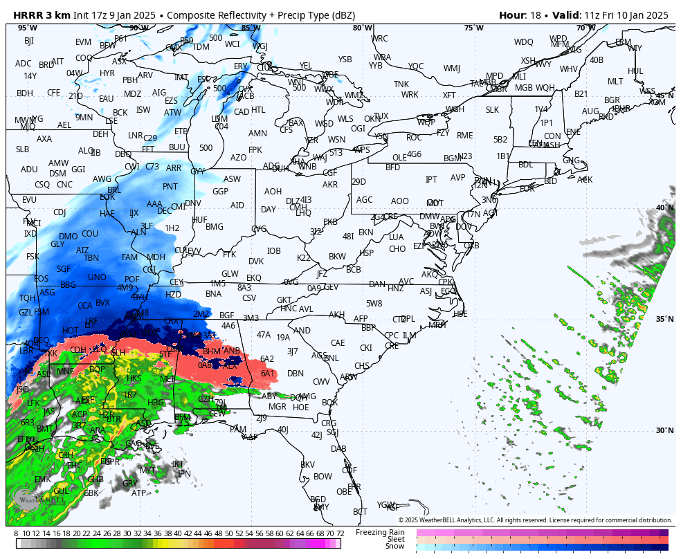
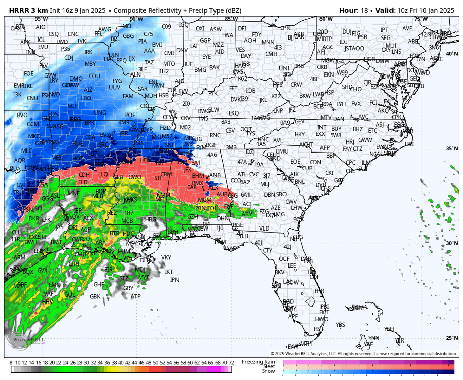
This looks incredibly south for frozen precip on 17z hrrr

-
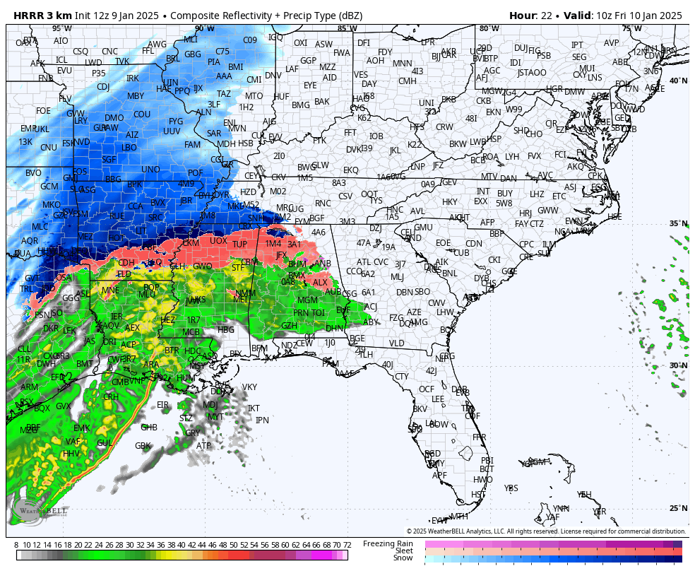
Hrrr ticking colder each run 16z 12z

-
Hrrr trend for TX
-
Reports of Dallas, TX getting snow. Time to watch these cities on the edge of the cold and see how the high res verifies
-
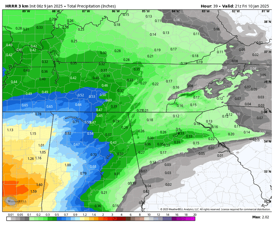
QPF trend is up. But we have one of the biggest gaps between the hrrr and nam I've seen in recent memory. The RGEM will be my tie breaker
-
Icing would be pretty devastating with ground temps like there are currently. ice would accumulate even at air temp of 33-34 because the ground is mid 20s
-
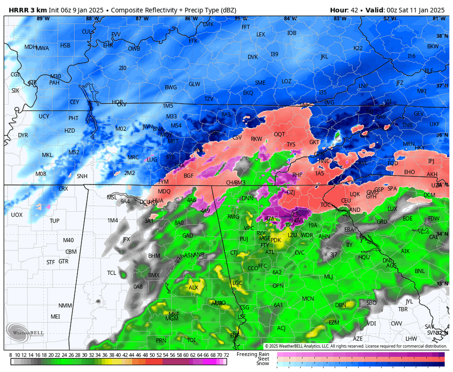
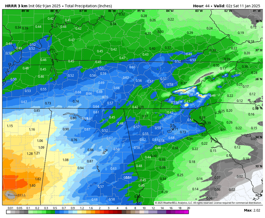
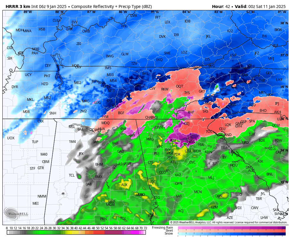
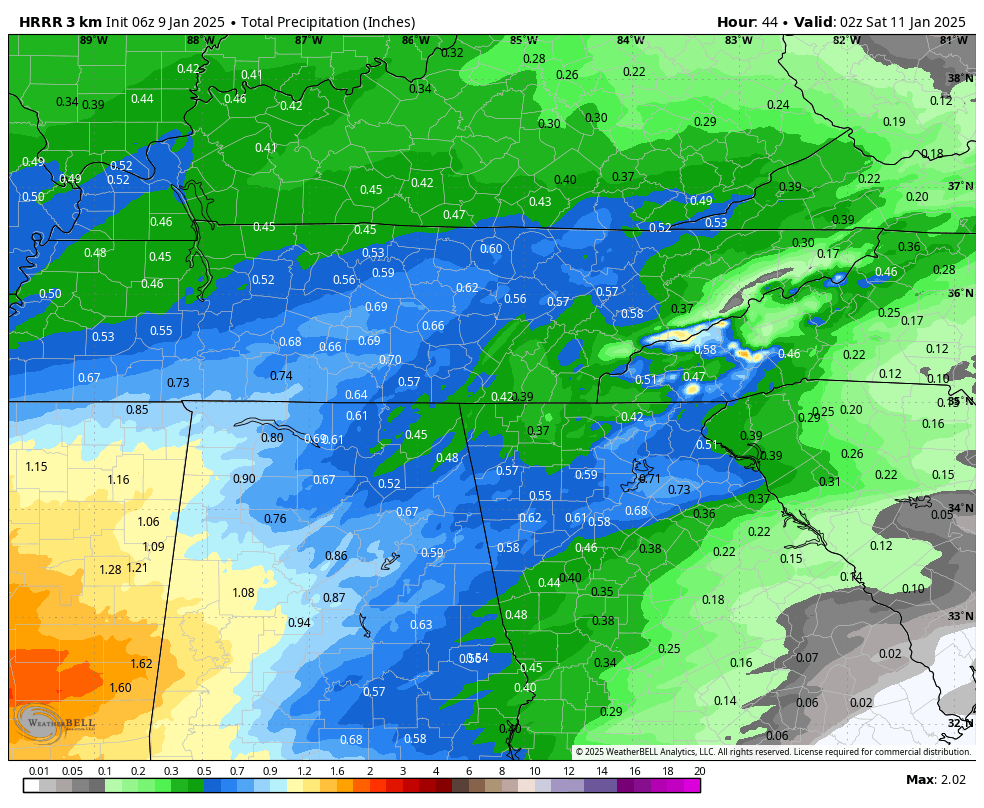
Hrrr has doubled precip for most of ETN. Looks like the 12km nam. seems like the shadow still exists but just way more QPF in general across the area.
-
12z hrrr rolling. Looking better for eastern areas regarding precip early on.
-
Yep. Good signs for downstream adjustments! Optimistic for a better 12z high res suite. one thing that is weird is how different the rgem is. I guess it's taking the euro approach with much less qpf.
-
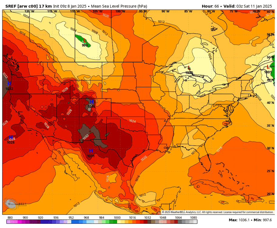
Here is a SREF control I assume for 09z. I was just watching them for hints of what the NAM may do. To me the trend is for a more consolidated southerly low. also seems to be more precip this run across NE areas
-
09z RAP jumping on the colder/wetter side is big. Everything has ticked better overnight for Estsern areas. Even NAM/HRRR. hopefully the RAP move is a sign and the NAM jumps again at 12z!
-
It is a tick better and ultimately didn't get worse. Consider that trend stopped. It would be so ironic that I've spent almost all week in the low 20s and the few hours of the week I need to be frozen I sit in the mid 30s haha
-
06z nam Hr 21 is slightly more positive tilt (better) looks like it's 18z run and not like the worse 00z. 12km nam still massive mixing issues. But it did tick better in the upper levels. Key is the trend stopped. Mountain shadow qpf issue is much better this time too.
-
I am randomly up at 06z time so I'll pull the night shift. 06z hrrr has importantly stopped the bleeding and even reversed. Eastern areas still having mountain shadow issues but it's much less noticeable this go around. Still going to cut the low into the apps though. You can clearly see better qpf across eastern regions. Warm nose is better too.