Buddy1987
-
Posts
4,178 -
Joined
-
Last visited
Content Type
Profiles
Blogs
Forums
American Weather
Media Demo
Store
Gallery
Everything posted by Buddy1987
-
Agreed. Track can’t get much better than that. This whole pattern is very volatile. Medium range is gonna get might busy me thinks.
-
Beat me to the punch. Icon trying to peeps closer to eastern apps.

-
I would never complain again if the CMC verified. Good lord what an absolute mammoth of a storm for the entire forum.
-
Didn’t suck down here for Monday’s system. Was Euro against the world and it came out victorious. Yes I pushed my chips all in. What else do I have to lose..
-
Boy that would be a kick right in the nuts if a track like that verified on the Icon and we get a cold a** rain at 38.
-
GOOD CHANCE OF 1ST LIGHT SNOW EVENT VA / nw NC/ MD DEL MONDAY DEC 7
Buddy1987 replied to DTWXRISK's topic in Mid Atlantic
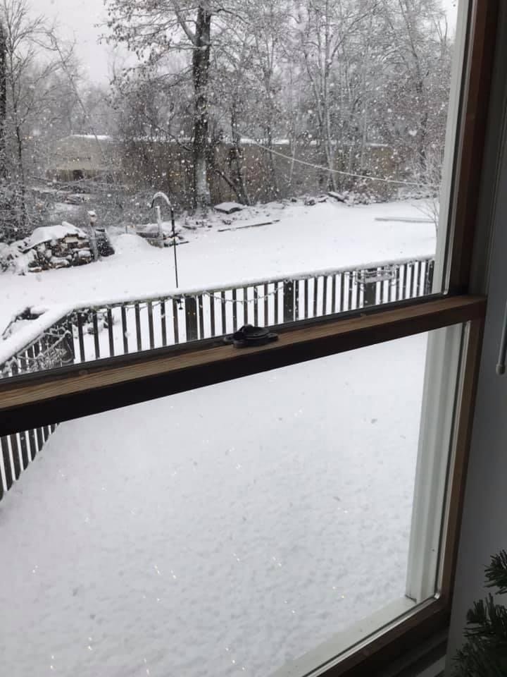
Nice little dusting here no complaints.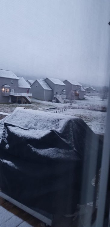
- 346 replies
-
- 18
-

-

-
GOOD CHANCE OF 1ST LIGHT SNOW EVENT VA / nw NC/ MD DEL MONDAY DEC 7
Buddy1987 replied to DTWXRISK's topic in Mid Atlantic
Love it!! Thanks a bunch brother. Just with any type of system these days down this part you don’t take for granted any opportunity with the hand Mother Nature has dealt last couple winters. -
GOOD CHANCE OF 1ST LIGHT SNOW EVENT VA / nw NC/ MD DEL MONDAY DEC 7
Buddy1987 replied to DTWXRISK's topic in Mid Atlantic
@Disc @wxdude64 here’s the area of precip I’m watching, as it has recently began to blossom. The NWS national radar has a pretty good loop to see where it has just recently taken off as well. I’m hoping the vort(s) end up giving us a nice little surprise wrt overachieving later on this evening. Disc is there any concern for downsloping or overall anything with the precip struggling once it encounters the apps that you see?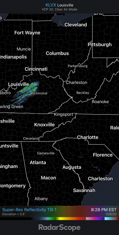
-
GOOD CHANCE OF 1ST LIGHT SNOW EVENT VA / nw NC/ MD DEL MONDAY DEC 7
Buddy1987 replied to DTWXRISK's topic in Mid Atlantic
Awesome. You got a little elevation on me up that way. 35.2 27.4 dew would equate to right at 32 for evaporational cooling purposes if we can’t drop much more. -
GOOD CHANCE OF 1ST LIGHT SNOW EVENT VA / nw NC/ MD DEL MONDAY DEC 7
Buddy1987 replied to DTWXRISK's topic in Mid Atlantic
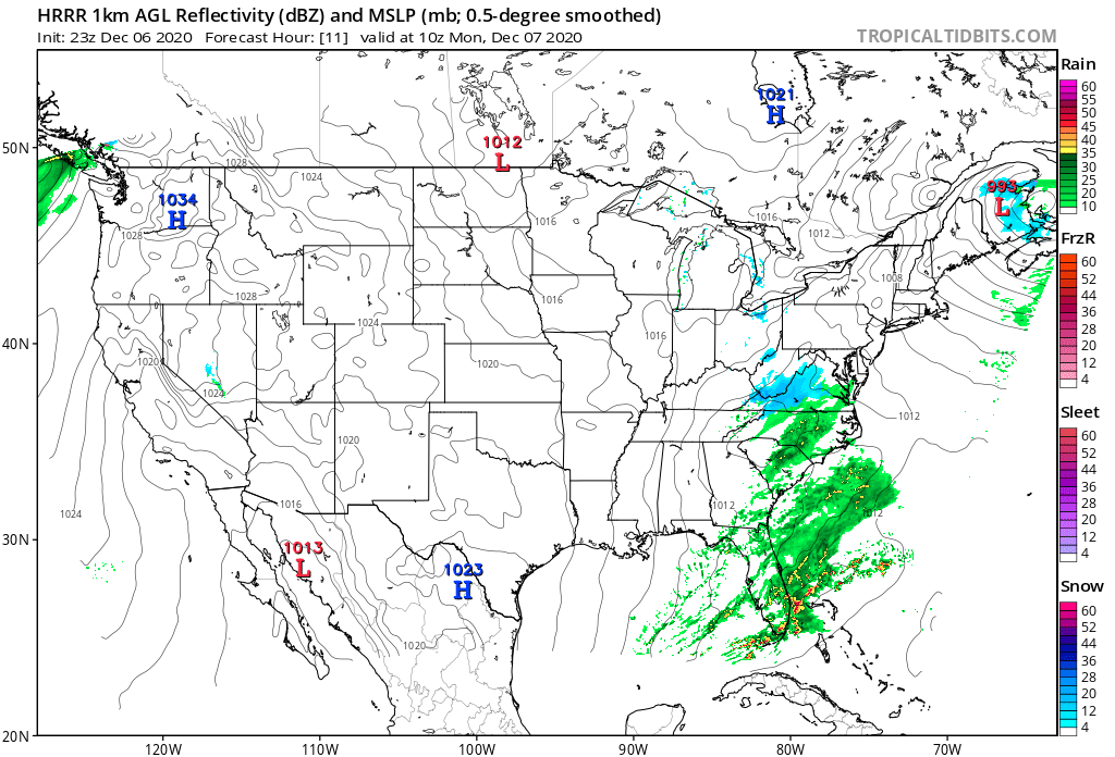
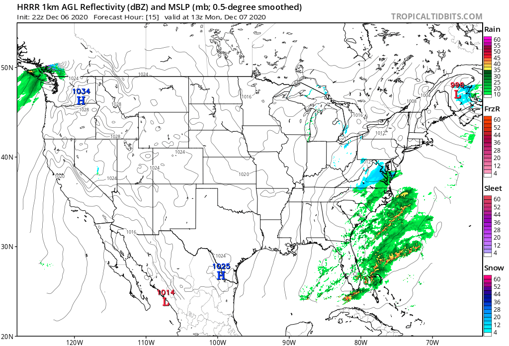
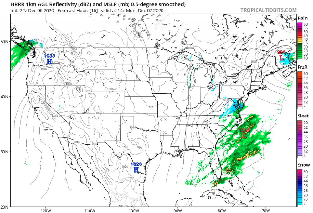
We need the northern most area of precip to continue to develop over northwestern most Alabama and into extreme southern TN. That will be what to watch tonight for those tracking. Also the disturbance rippling through to enhance anything that develops and crosses the mountains. Latest HRRR beefs up precip with 23z as well.

-
GOOD CHANCE OF 1ST LIGHT SNOW EVENT VA / nw NC/ MD DEL MONDAY DEC 7
Buddy1987 replied to DTWXRISK's topic in Mid Atlantic
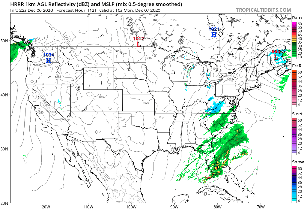
Looks like the latest HRRR gets some very light echoes into the DC area but it’s more or less kind of grasping at straws. Hey anything is better than nothing.
-
I thought and I could be wrong the HRRR is more widely used now over the RAP. At any rate I think marginal temps for you down your way may prove problematic. The more radiation this evening the better all of us may fare. Right now there’s zero clouds up here and the temp has corresponded by dropping 5 degrees.
-
Wholeheartedly agree. Pretty much every model today has flipped toward the juicier side of things. Will love to see the radar a little later on here.
-
GOOD CHANCE OF 1ST LIGHT SNOW EVENT VA / nw NC/ MD DEL MONDAY DEC 7
Buddy1987 replied to DTWXRISK's topic in Mid Atlantic
I really enjoy your in depth synopsis of things. Can you give me a brief write up as to what you expect for us in the southern MA from this and what some of the things to watch for other than radar and wrt the disturbance rippling along as well as to the NS energy diving down etc.. -
GOOD CHANCE OF 1ST LIGHT SNOW EVENT VA / nw NC/ MD DEL MONDAY DEC 7
Buddy1987 replied to DTWXRISK's topic in Mid Atlantic
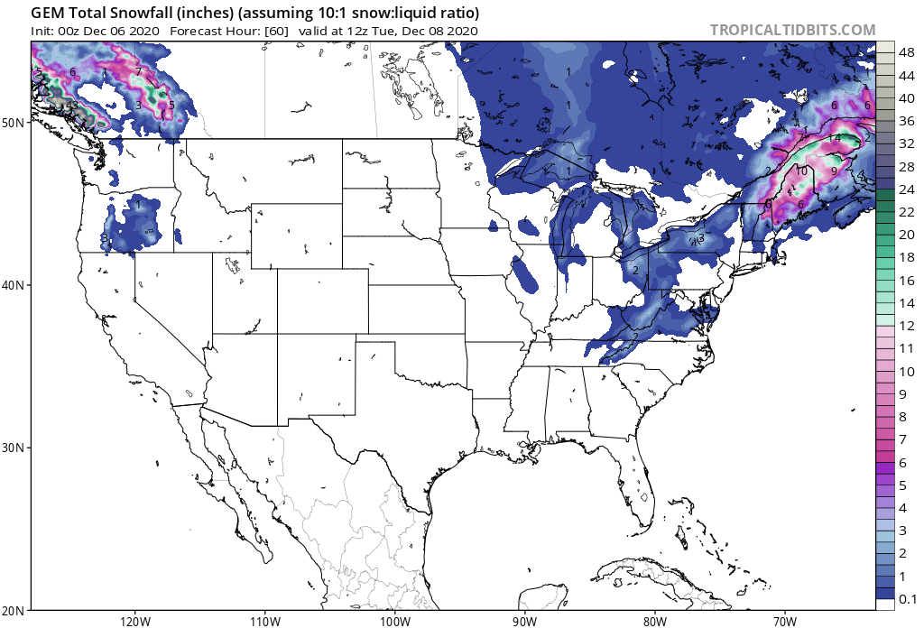
More uniform totals or swath across VA
-
GOOD CHANCE OF 1ST LIGHT SNOW EVENT VA / nw NC/ MD DEL MONDAY DEC 7
Buddy1987 replied to DTWXRISK's topic in Mid Atlantic
0z vs 12z Canadian more juicy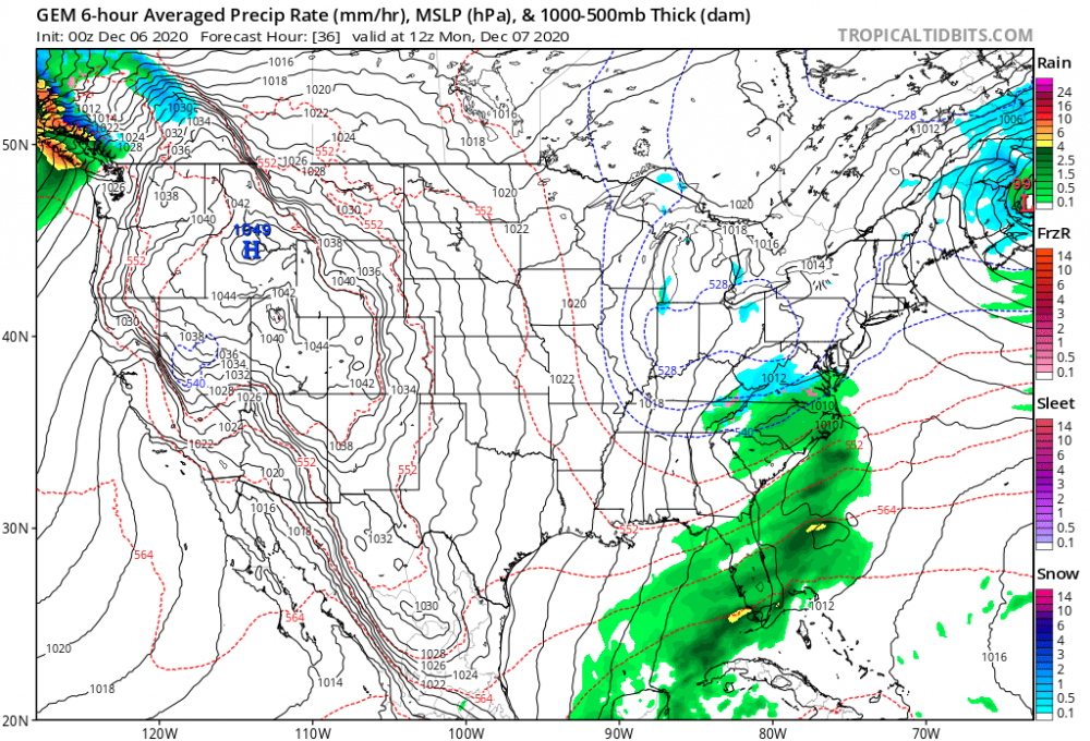

-
GOOD CHANCE OF 1ST LIGHT SNOW EVENT VA / nw NC/ MD DEL MONDAY DEC 7
Buddy1987 replied to DTWXRISK's topic in Mid Atlantic
I agree I wrote it off mid evening yesterday and all of a sudden this morning everything began trending. I still think GFS is playing catch-up as well. I guess I’m confused though. What or more or less is enhancing things. Is it the NS energy being progged stronger or is it more interaction between the two streams or is the SLP off the Carolinas tucked in further? -
GOOD CHANCE OF 1ST LIGHT SNOW EVENT VA / nw NC/ MD DEL MONDAY DEC 7
Buddy1987 replied to DTWXRISK's topic in Mid Atlantic
Agreed lol. Need that maritimes low to scoot just a little further north and east to allow the LP to not be pinched and forced to the east. Minimum I feel good about mood flakes for you all. -
GOOD CHANCE OF 1ST LIGHT SNOW EVENT VA / nw NC/ MD DEL MONDAY DEC 7
Buddy1987 replied to DTWXRISK's topic in Mid Atlantic
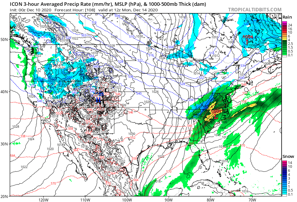
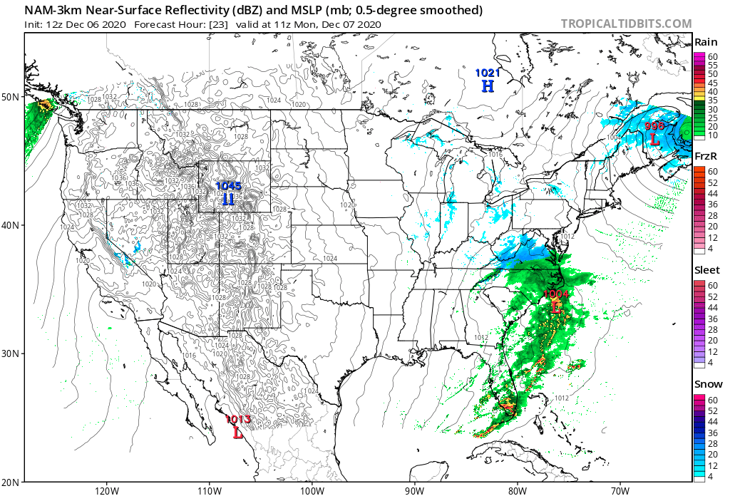
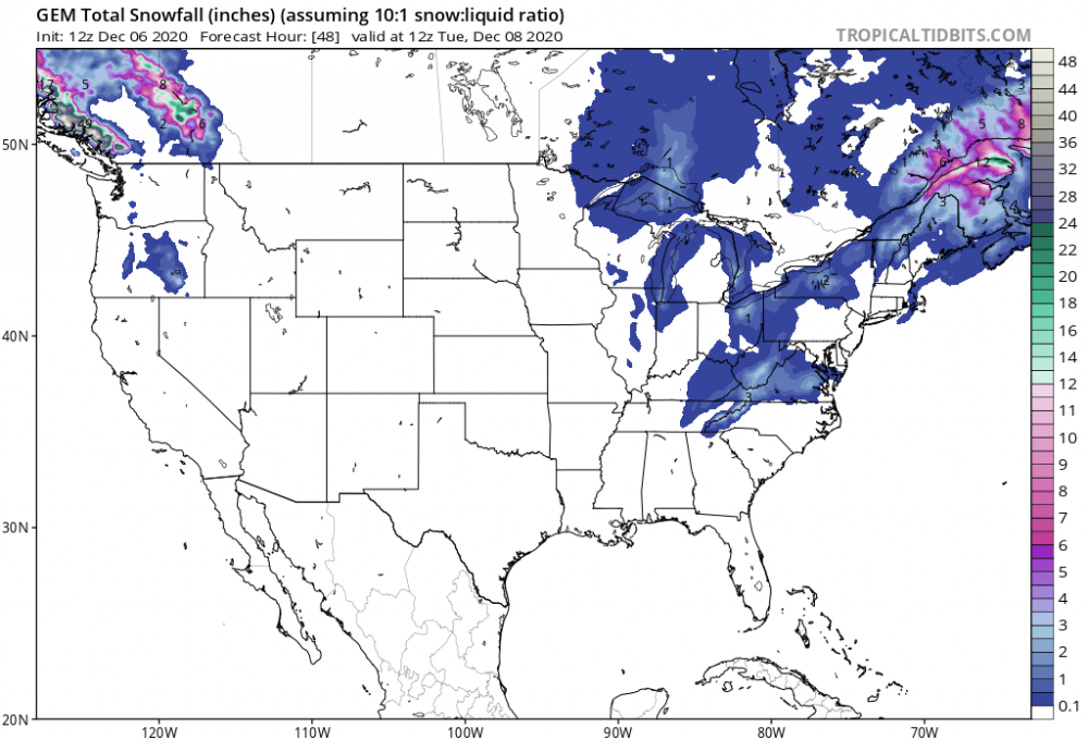
12z 3k NAM captures precip field a little better than previous image captured. We will see if gfs shows something similar to what NAM and Euro are now starting to key in on. @Disc starting to look a little closer to more of a “benchmark” track for southern portions of the forum? Low east of ILM south of Hatteras.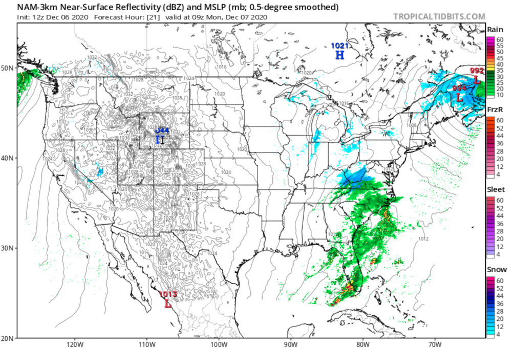

-
GOOD CHANCE OF 1ST LIGHT SNOW EVENT VA / nw NC/ MD DEL MONDAY DEC 7
Buddy1987 replied to DTWXRISK's topic in Mid Atlantic
12z 12k NAM looking much more Euroish with precip field for southern viewing area.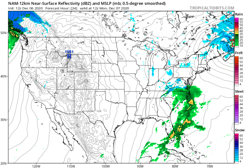
-
GOOD CHANCE OF 1ST LIGHT SNOW EVENT VA / nw NC/ MD DEL MONDAY DEC 7
Buddy1987 replied to DTWXRISK's topic in Mid Atlantic
Nice surprise to see both American models trend toward the European. Was honestly not expecting that. Can you tell me what the change was from 12/18z to 0z. More NS interaction or is the New England bomb hauling a little more than expected? -
Lol I literally just posted in the reaper forum about why all the hate suddenly for SW VA peeps? I enjoy reporting inbound meatballs to the Mid Atlantic crew from their southwest when we all have that awesome overrunning wall to wall shield of snow. Soon enough!
-
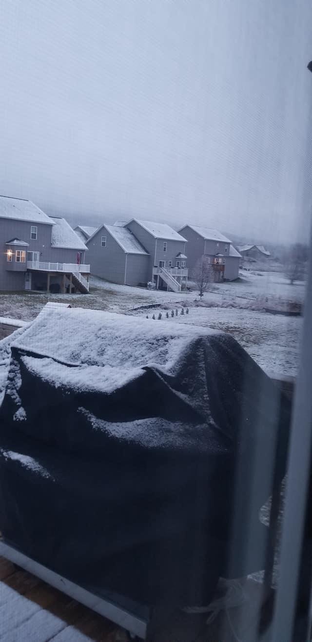
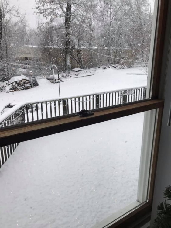
Everyone wanting snow just figured I’d post a pic from my aunt who lives in NW CT about 40-45 min from Mass border. Big time snows for Worcester and points north and east today. Only reason I miss living up there.
-
GOOD CHANCE OF 1ST LIGHT SNOW EVENT VA / nw NC/ MD DEL MONDAY DEC 7
Buddy1987 replied to DTWXRISK's topic in Mid Atlantic
Idk what if any updates have been done to the NAM but for me in years past if it wasn’t super over amped then that would normally spell trouble. 6z doesn’t even have a flake for anyone. Looks like the consensus minus the Euro have zilch for this. Is it just more or less the Euro is keying in on the NS vort differently? -
GOOD CHANCE OF 1ST LIGHT SNOW EVENT VA / nw NC/ MD DEL MONDAY DEC 7
Buddy1987 replied to DTWXRISK's topic in Mid Atlantic
Even down this way?