Buddy1987
-
Posts
4,178 -
Joined
-
Last visited
Content Type
Profiles
Blogs
Forums
American Weather
Media Demo
Store
Gallery
Everything posted by Buddy1987
-
Good shift in confluence and pushed to the south southwest at75.
-
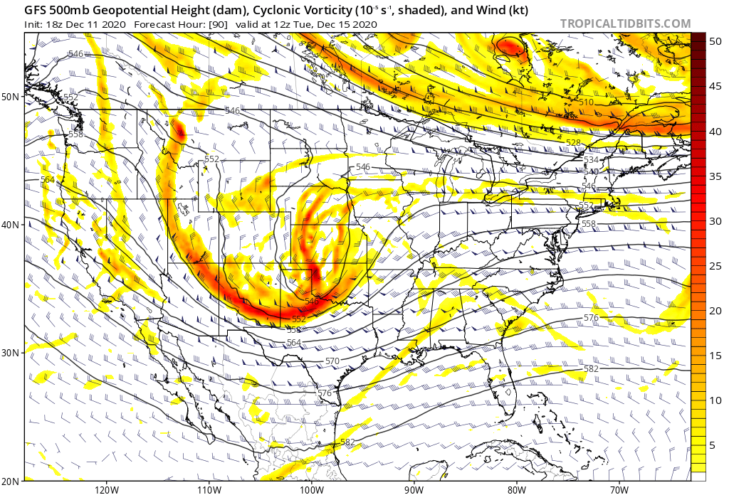
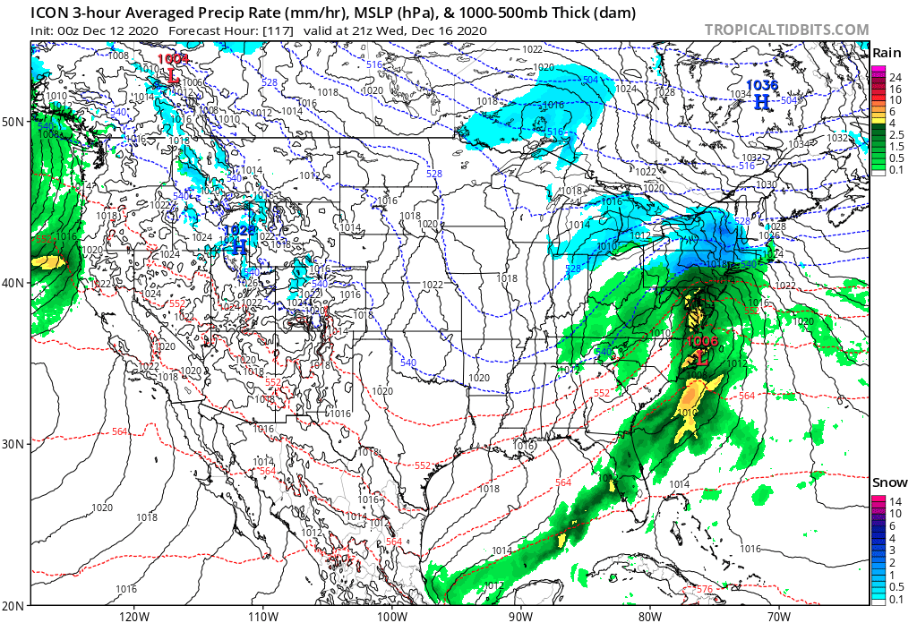
High 2mb deeper. That’s a plus. H5 looks ready to explode.
-
Agreed. It’s not a genuine one but it’s like a hybrid if there’s such thing. I don’t think the gfs is right in depicting the primary hanging on for that amount of time or driving that far into the high pressure. It used to fail before upgrade occurred. I alluded to this in mid Atlantic forum but don’t know if this has been corrected since upgrade.
-
Well... now that you say that in particular you bring up a good point because with the upgrade I’m not sure that it hasn’t corrected that bias or smoothed it over. One of the Mets or pros would have to chime in. I may stand corrected. I know for sure though there’s been many events to where they were trashing the model because of that tendency at least pre upgrade.
-
This is a known bias of the gfs to drive the primary too far and hold onto it longer. Seen it play out numerous times. I’m sure you have too you’ve been on the board for a long time.
-
Anyone have update on 6z euro?
-
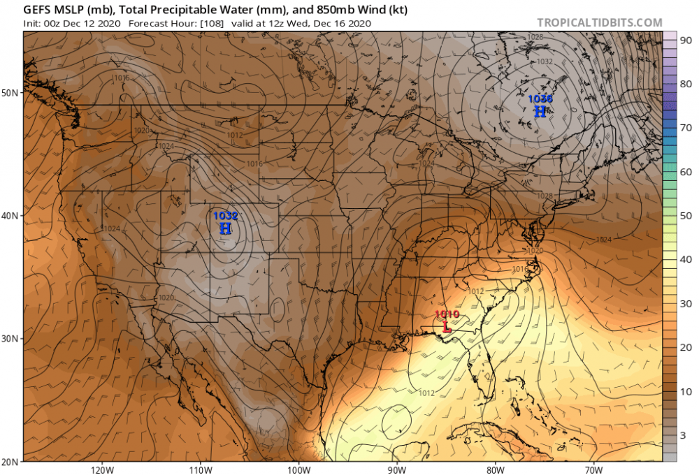
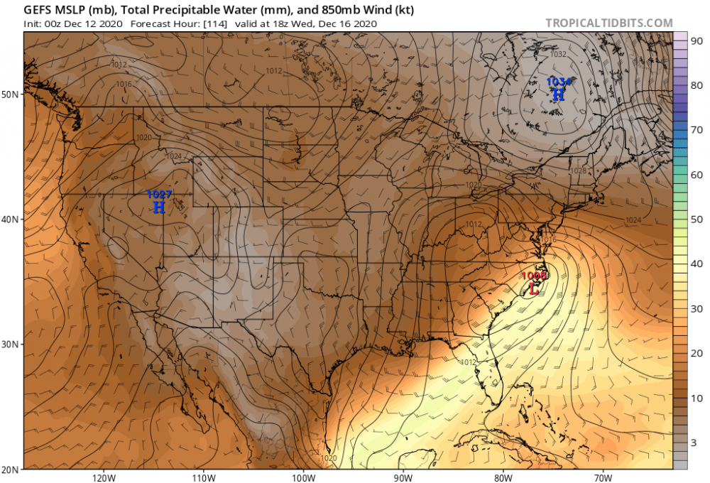
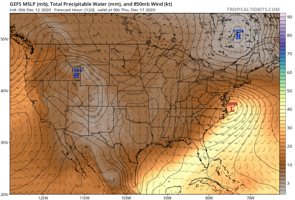
The takeaway that may make all the worlds difference to the south and west of me is the fact that GFS continues to scoot the HP off to the east as the storm begins its trek up the coast. Canadian kind of anchors it in place more so. That could have major implications for people on the cusp of a very cold rain or a prolonged icing event. Betting man I’d say Canadian wins out because it’s built more like nam to sniff out those instances.
-
Cape are you that guy that gets into the heated debates when it comes to the soil temp etc? I never understood why people get all wrapped up in that. If it’s gonna dump it will take care of the rest.
-
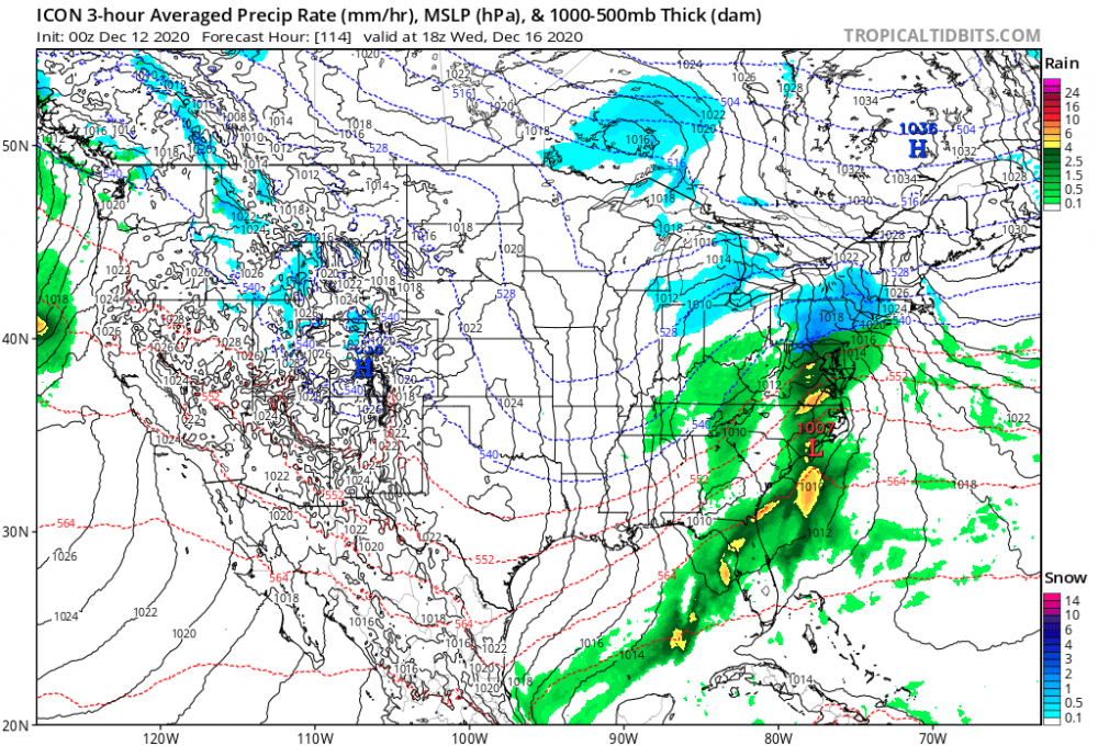
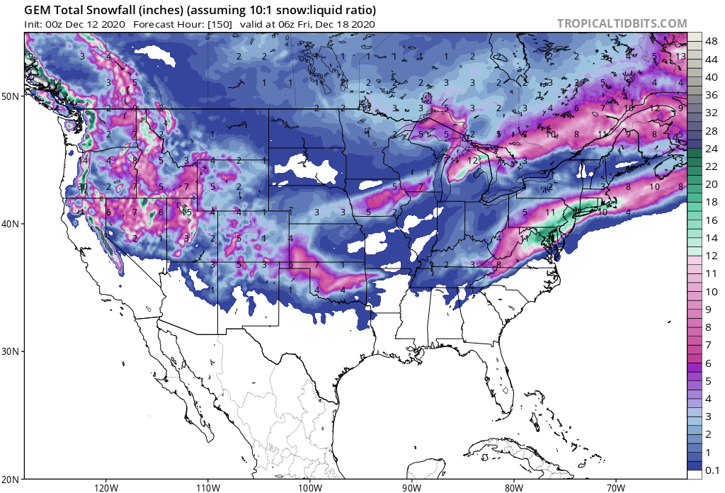
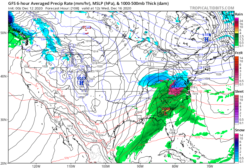
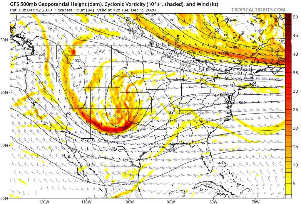
I went back here and compared the 6z gfs to the 0z Canadian and they are very similar with progression. Base of the trough looks to dig a little more on the Canadian right around 102-108 on 5h. By 114 however they are almost identical with the low placement right around Hatteras and the snow bomb is in full gear at that point. High pressure is slightly displaced to the east compared to the Canadian. All in all being picky but this is going to be one hell of a storm it looks like for majority of us. Monitoring for my aunt as well in CT and it’s crazy to see up there the whole state basically gets 3ft or just under.
-
Other concern for me would be from a resolution side of things specifically wrt to cold air superiority where nam at end of run is a good several mb weaker with high pressure. Has it at 1031 instead of 1035-1037. That def bears watching.
-
I thought 6z gfs looked a little more progressive with system although I couldn’t really sleep tonight just from being giddy with excitement so I may be wrong.
-
That for me is the caveat and the trend to watch. CMC further west GFS ICON a little further east.
-
LOLLLLL god the Nogaps was so bad it would have the storm near the Bahamas two days before and then would all of a sudden jump 800 miles nw and get a clue.
-
Ok where’s the JMA?
-
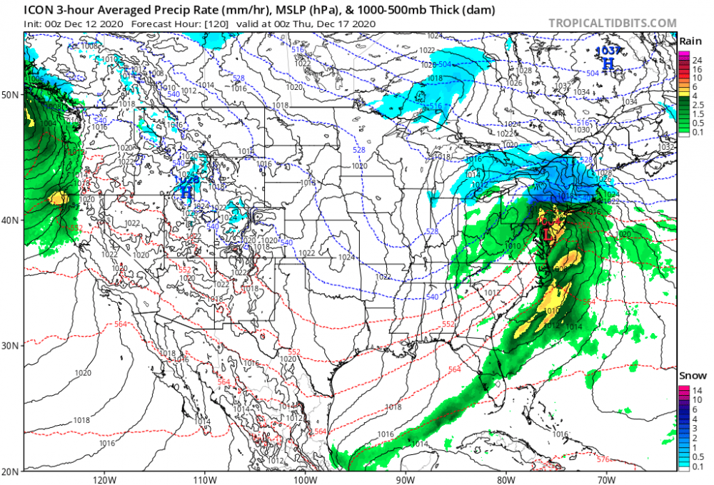
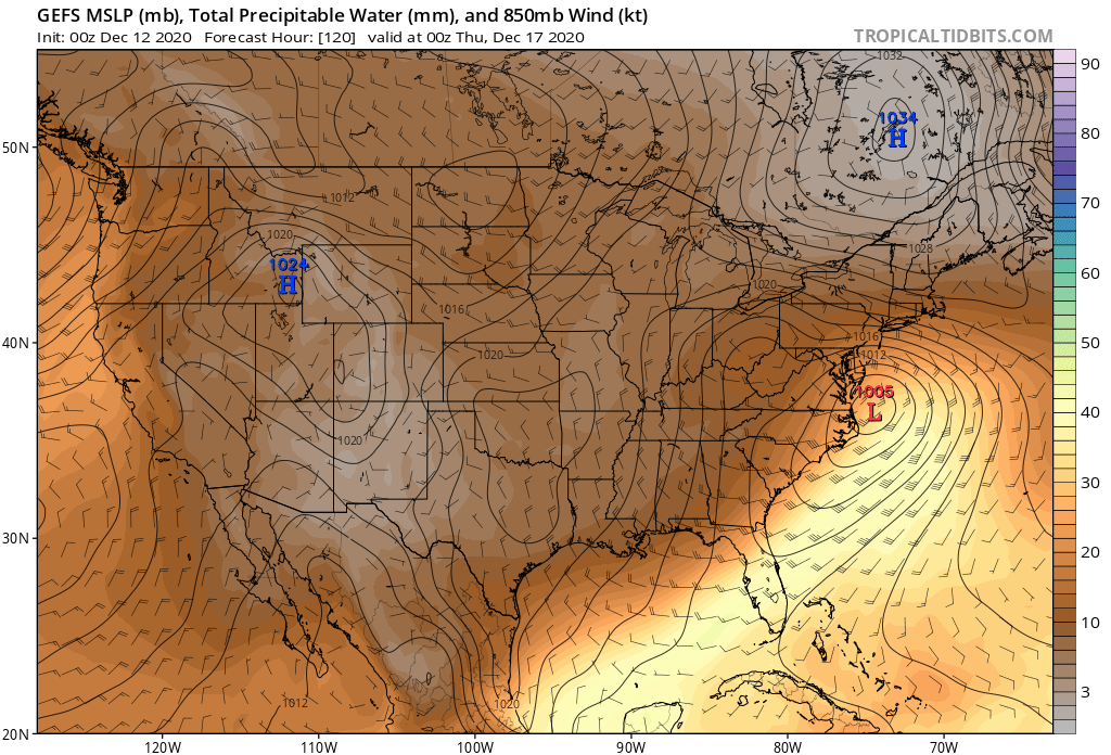
GEFS mean with textbook track and HP anchored in ideal location. 1036 at 0z vs 1034 at 18z. Good trends tonight. Nice to see GFS finally having a clue.
-
Yea you’re right on the cusp. I may sneak by with enough latitude up this way. We shall see.
-
Wow!

-
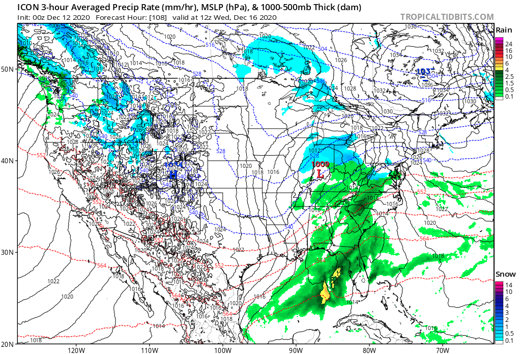
Canadian has the HP in prime position at 102, whereas so far the icon and gfs are more east comparing 0z frames. Edit: Also has HP about 2mb stronger tonight which is always a good sign when you see all models trending that way.
-
I honestly think this trends colder as game time is about to commence most instances it tends to. Not sure if you’re a big fan of ZR or PL for down your way but after two years of bs pretty much let’s go!!
-
Perfect track from Pensacola to Savannah to east of Hatteras. Anyone north of I40 in these setups usually end up pretty happy in normal winter circumstances.
-
Great CAD next frame after Yoda’s reference. Looking like 12z CMC
-
Beat me to it. Good 3mb deeper. I like it so far! HP in prime position. More of a Miller A no?
-


-
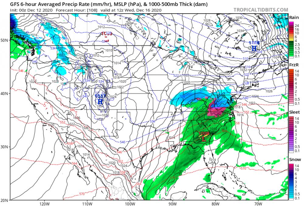
Confluence looks slightly better at 72 on gfs but I don’t have the knowledge to know if that will have a direct influence in the later frames.
-
@BristowWx