Buddy1987
-
Posts
4,178 -
Joined
-
Last visited
Content Type
Profiles
Blogs
Forums
American Weather
Media Demo
Store
Gallery
Everything posted by Buddy1987
-
Sad that model represents the United States of America lollll
-
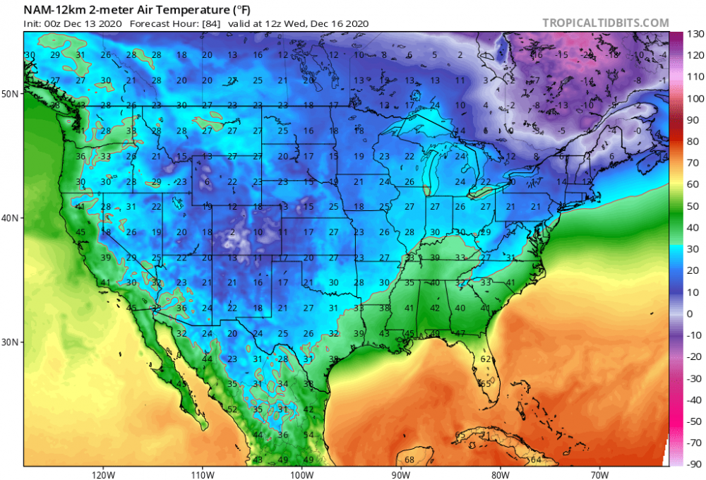
Most should know nam is normally over amped anyway so you take with grain of salt.
-
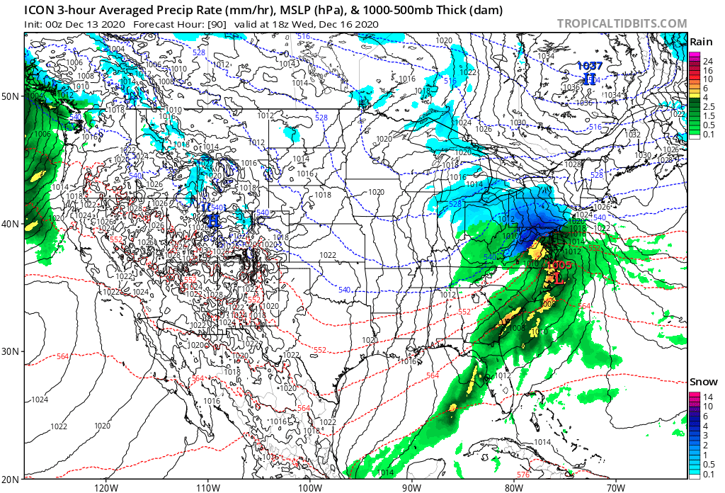
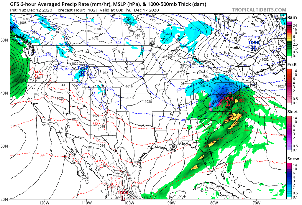
Most won’t like NAM’s evolution. Takes storm from Raleigh to just west of Richmond to a track about to traverse Delaware.
-
Cyclogenesis commences @63 s/se of CHS
-
Same trend looks to continue at 51 with a little better confluence
-
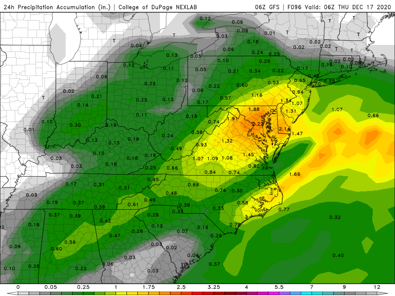
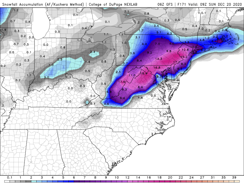
Awesome site thank you for that! So in this scenario I would be pleased. 1” of liquid and about 9.4” of snow if taken verbatim.
-
@WxUSAF @yoda @MN Transplant can you guys tell me what I’m missing down this way and why it’s not as aggressive? Do we get into a good deform band or does it never really materialize until you get north and east of here? I’m not meaning for imby question but I just want to understand the Synoptics a little bit better. I guess I’m just trying to figure out where the disconnect lies out my way and south of Staunton let’s say. Everything I’ve seen the 850’s never get above 0 and look to be -1/-2 all the way down the 81 corridor but the Euro and GFS aren’t as gung ho. I’m assuming we may miss the developing CCB but I also think the leaf on the nw side of things may end up looking better as simulated radars get in closer range. Does anyone have a concern of a dry slot since the decaying primary will be trying to push in toward us or will that be more of a concern for I77/west?
-
Or @MN Transplant for the win! Always bring good juju anyway. LETS GOOO!!!
-
I vote Yoda. Couple days back he really kicked off a nice run of model suites that set the stage.
-
Anyone willing to answer. Does a stronger low mean more flooding of the mid levels with warmer air above the surface or will this storm just be strictly dependent on the placement of the low and its eventual track?
-
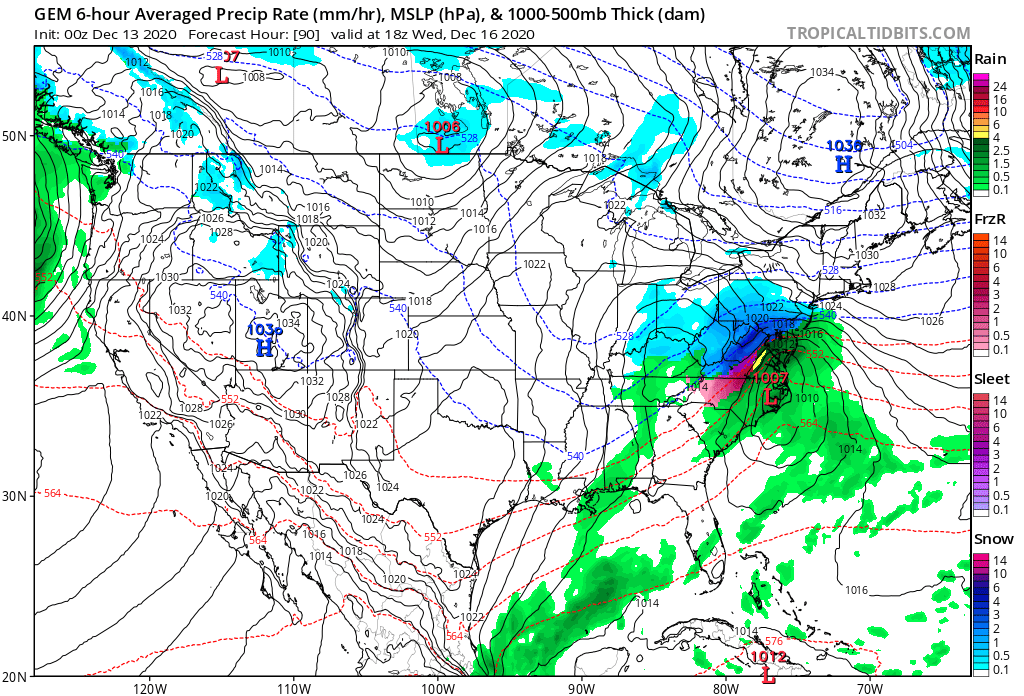
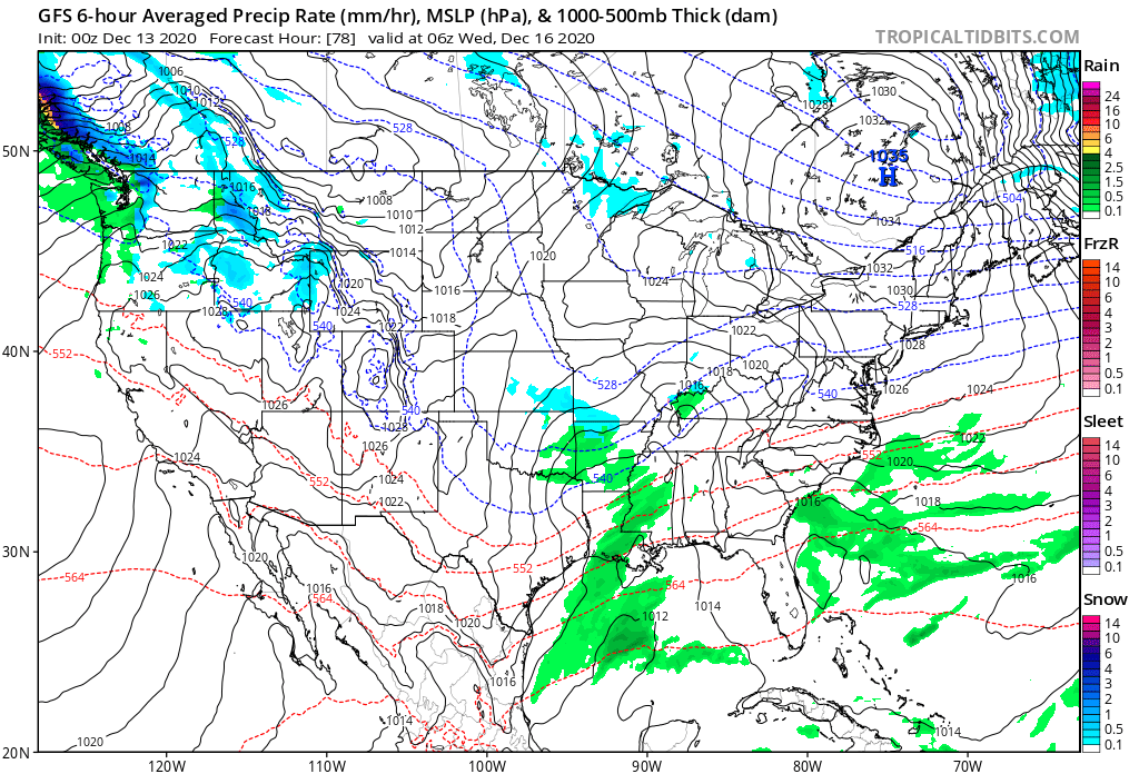
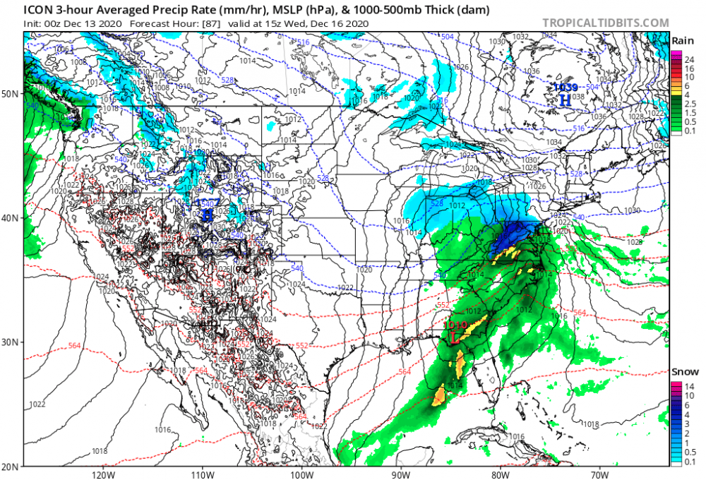
Icon finally updated and it too is a mauling considering its warm tendencies. Also has a 1039 high parked up top. Strongest I’ve seen yet.

-
Must’ve packed it in like the Icon tonight. Went out to 48 and called it a day.
-
Boy I hope not. I want everyone to cash in here. We could all use it.
-
Lol p27 would pretty much make the entire board happy here.
-
I mean for me confluence continues to be progged a little stronger as we get closer to game time. I may end up being wrong but for me that will more or less force the low to feel it’s effects and go more south than north.
-
Does Canadian look like it may have that tucked in look like 18z gfs did? That high pressure is an ideal spot.
-

-
I swear Harrisburg and SE PA is the weather capital. Supercell and tornadic thunderstorms in the summer year in and year out and then potent winter storms with maximum potential more often that not.
-
That’s what I was referencing was the placement and not overall strength.
-
Jesus worlds difference. Really puts in perspective how amped 18z was

-
Agreed with all sentiments shared. Definitely a colder run even down this way. Incoming meatballs! That high is primo.
-
@Yeoman there’s your primary in northern TN @78

-
Anyone is welcome to correct me but anything that would be cosmetic differences thus far. 1st wave maybe a tad more flat vs 18z and then at 60 high pressure appears to be potentially positioning itself just a little bit better wrt location.
-
I was literally just getting ready to post myself LOL! It got cold feet and flaked out
-
Def wouldn’t take much but I think even where it is at now we can still bank on all frozen for cad areas because that high is in a really good spot. Just depends what type of frozen is your cup of tea. I really want snow but after last year I will take anything I can get at least for myself.