wx2fish
-
Posts
2,487 -
Joined
-
Last visited
Content Type
Profiles
Blogs
Forums
American Weather
Media Demo
Store
Gallery
Everything posted by wx2fish
-
Decent burst now with a coating. 31
-
A few weenie oe flakes. 32.2
-
Hell of thump on the nam
-
Alot of high res really pegging the CF enhancement from kittery back into Rockingham. May happen
-
Next weekend could easily go back to ugly, but despite the gfs op the gefs looked a little flatter. Probably some more favorable members, esp up there.
-
Looked close to the cape. Smokes snh
-
19F and pelting here when the CF moves through. Man I'd lose it
-
Nice hit next weekend for CNE and NNE on the euro. That's a cold airmass across NNE on that run.
-
I had like 25" settled at the end of that. Fluffiest deep pack I've seen around here. 31" was reasonable measuring every 6hr.
-
Cant complain about that run in SNH. Still in a heck of a band at 84hr.
-
This has been one miserable stretch. Pavement hasn't dried off in days.
-
Through yesterday MHTs avg Dec temp was 39.1F. Nov was 39.2F. Seasons in seasons
-
The East and especially NE has furnaced over the past several years relative to the Plains/West in DJF. My guess is there is a regression to the background warming trend at some point.
-
Sunday, December 17 - Monday, December 18, 2023 Storm
wx2fish replied to weatherwiz's topic in New England
Looks like it just sustained it again on the last 5 min ob. Might be able to pop another big gust -
Sunday, December 17 - Monday, December 18, 2023 Storm
wx2fish replied to weatherwiz's topic in New England
G50kt TAN -
Yeah I can't tell on my cams at home alot of the time. Seems like some frozen mixed in there, but hard to tell for sure. 35-36 and slowly dropping on the meso stations nearby
-
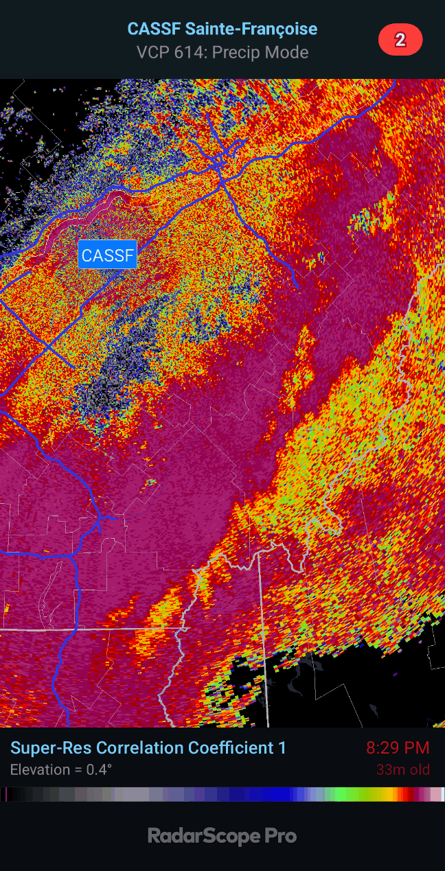
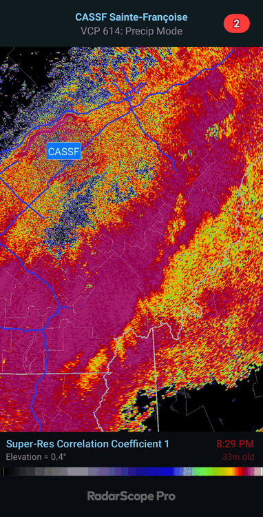
Looks like the mid level freezing line is getting close on CASSF
-
Could be quite the gradient across NW ME. Trends this morning give Coos Co a little more wiggle room and start to get more of NW Maine in the game
-
That LLJ is nuts. Some low topped convection ripping through around 15z, probably would help mix it down in spots
-
That is some wild qpf on the 0z nam and hrrr
-
I'd take that LLJ on the backside. Best shot at wind inland.
-
Brutal wedge Sat north of the pike that run. Wouldn't surprise me if you Dendy don't mix out until fropa.
-
18z op went wild with the NAO in weenie range. Probably wrong, but it would be one way to keep things a little more interesting.
-
Same here, sleet and catpaws. Temp steadily dropping. May have a brief window to flip over the next hour or 2.
-
@NHDrySlot Flipped to sloppy Snow in Bedford. So, the snow line isn't too far N&W of MHT