metagraphica
-
Posts
1,667 -
Joined
-
Last visited
Content Type
Profiles
Blogs
Forums
American Weather
Media Demo
Store
Gallery
Everything posted by metagraphica
-
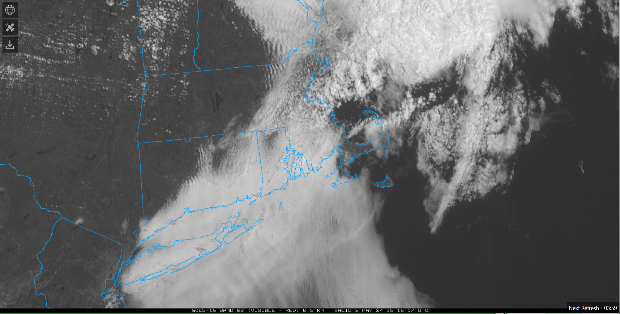
Currently dark and dank under a very low layer of clouds (not quite ground fog) with satellite showing mid-level clouds from the SW converging with mid-level clouds from the NE overhead. 65/60. Not gonna warm up much until this mank goes away.
-
Backdoor blocked by CoC, leading to sweaty dews. Always love the summah discussion on here.
-

May 2024 Discussion - Welcome to Severe Season!!!!
metagraphica replied to weatherwiz's topic in New England
Up to 62 already after bottoming out at 45. CoC as far as the eye can see. -
May 2024 Discussion - Welcome to Severe Season!!!!
metagraphica replied to weatherwiz's topic in New England
Same here. -
May 2024 Discussion - Welcome to Severe Season!!!!
metagraphica replied to weatherwiz's topic in New England
FYP. -
May 2024 Discussion - Welcome to Severe Season!!!!
metagraphica replied to weatherwiz's topic in New England
Looking good for SE CT folks.
-
May 2024 Discussion - Welcome to Severe Season!!!!
metagraphica replied to weatherwiz's topic in New England
68/65. Moist with occasional showers. -
May 2024 Discussion - Welcome to Severe Season!!!!
metagraphica replied to weatherwiz's topic in New England
80/64 Nice!!!! -
May 2024 Discussion - Welcome to Severe Season!!!!
metagraphica replied to weatherwiz's topic in New England
79/55. This is some nice CoC. -
May 2024 Discussion - Welcome to Severe Season!!!!
metagraphica replied to weatherwiz's topic in New England
67/65 @ 8:45pm. Installed!! Otherwise it would have been extra sticky night. -
May 2024 Discussion - Welcome to Severe Season!!!!
metagraphica replied to weatherwiz's topic in New England
Interesting roller coaster for temps today. Started at a low of 59. Made it up to 72 before the t-storms. Down to 64 during the rain and now back up to 77. Sticky with a 68 dewpoint. -
May 2024 Discussion - Welcome to Severe Season!!!!
metagraphica replied to weatherwiz's topic in New England
Looks like somewhere around the Ekonk Grange got slammed. Hail and maybe some wind. -
May 2024 Discussion - Welcome to Severe Season!!!!
metagraphica replied to weatherwiz's topic in New England
Just heavy rain and a couple rumbles. No wind at all. Made it up to 72, but now down to 68 with the rain. -
May 2024 Discussion - Welcome to Severe Season!!!!
metagraphica replied to weatherwiz's topic in New England
I'm sure SW CT will get the goods as usual. By the time it gets to New London county it will probably be weakening due to ocean taint....but we'll see. The current radar shows some good cells over and moving off the eastern end of Long Island. -
May 2024 Discussion - Welcome to Severe Season!!!!
metagraphica replied to weatherwiz's topic in New England
82 for the high. 78/62 now. AC still not installed. -
May 2024 Discussion - Welcome to Severe Season!!!!
metagraphica replied to weatherwiz's topic in New England
We can hope. I have a feeling this is summer is going to be warm and dewy. -
May 2024 Discussion - Welcome to Severe Season!!!!
metagraphica replied to weatherwiz's topic in New England
Hit 74 earlier. Back down to 68 already. Dew point is in the upper 50's though, so we got that going for us. -
May 2024 Discussion - Welcome to Severe Season!!!!
metagraphica replied to weatherwiz's topic in New England
bleh.....56 and rain. Not a great way to run a Saturday in the middle of May, but not unprecedented either. -
Was a small slot of clearing over my house in Salem in the past 10 minutes or so. Could see stars but no aurora.
-
May 2024 Discussion - Welcome to Severe Season!!!!
metagraphica replied to weatherwiz's topic in New England
Wiz, maybe you'll get to see something like this: -
May 2024 Discussion - Welcome to Severe Season!!!!
metagraphica replied to weatherwiz's topic in New England
Can't wait for these clouds to burn off. Still 52 under this mank as of 11:22.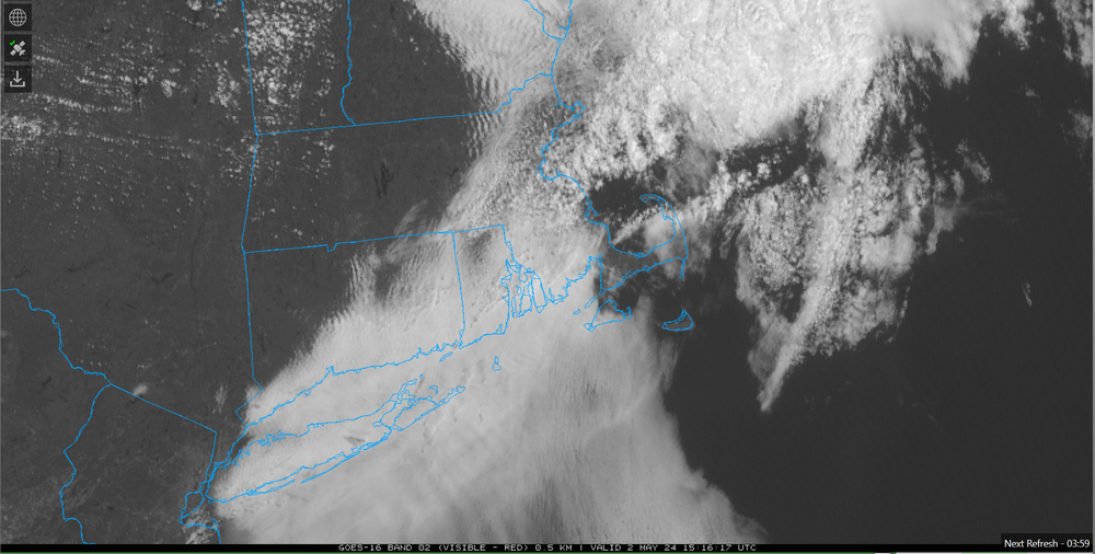
-
56/45 currently. Sun trying to break through. If it does we'll warm to the mid sixties pretty quick I'd reckon.
-
Now this is REAL fake cold. 36 @ HFD, 34 @ IJD, 37 @ SNC. What happened to the frost and freeze? It was much colder just a few days ago. Was hoping to get a real good freeze to kill the damn black flies.
-
GWDLT. Although it was holding steady at 49ish most of the morning until the clouds finally cleared...then popped to 60 right quick.
-
Warm to hot with average precip would be great IMBY.