metagraphica
-
Posts
2,214 -
Joined
-
Last visited
Content Type
Profiles
Blogs
Forums
American Weather
Media Demo
Store
Gallery
Everything posted by metagraphica
-
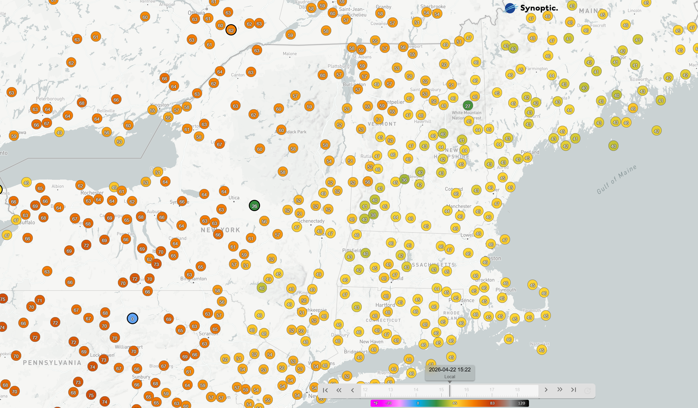
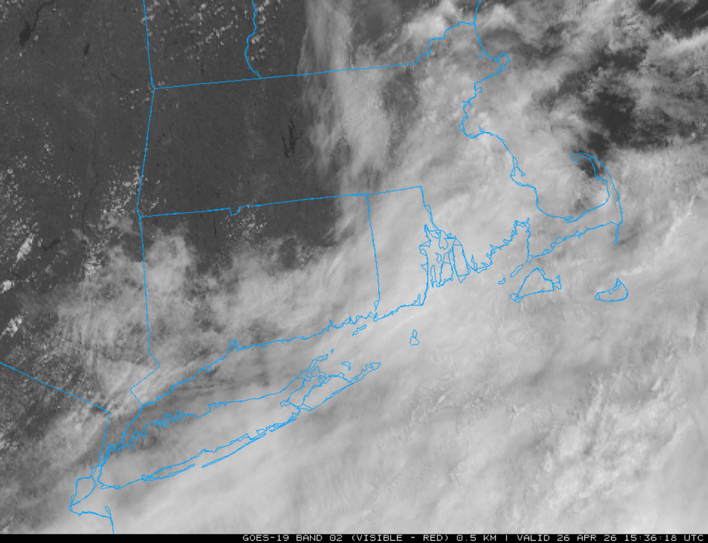
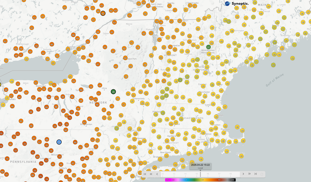
66 down to 59 with the onset of the rain. Wet.
-
Hit 72 off a low of 42. Now back down to 69 as the on-shore breeze made it this far inland. Fantastic day for getting literal shit done…
-
32.45 for the low. Hopefully that was the last one. Summah coming in a week or so.
-
Was gonna go out and do more yard work today. Too cold and biting with the wind, so I guess it's painting inside instead.
-
We had a lot of excellent days.
-
Meh...fitting end to "Napril". Onward and upward to warmer May weather.
-
I won't trigger your OCD with a picture of my "lawn". It is, unfortunately, mostly weeds.
-
Yep, finished mowing around 2:30. The weeds look better now.
-
As someone who understands the science - John, slow down, take a breath and write more concisely. You might find a wider audience. Either that or stop hitting the bong so early in the morning.
-
70 for most. Easy.
-
Love it when the temp is still climbing past 5pm. Up to 61 now. Great afternoon.
-
Stuck at 47. Can't wait for these clouds to burn off/move out. Hopefully by 2pm we'll be off to the races. Will be on vacation all week so great that Monday and Tuesday are going to perfect weather.
-
Nice April showers this evening. Looking forward to the eventual warm up in May.
-
Correct, haven't turned on my TV in at least 2 years. Watch most things on my computer monitor, or just listen to music via YouTube playlists while working. I read all of my news since there are zero sources of video news that are delivered in a non-breathless hype manner.
-
60 and sunny. Another beaut of a spring day.
-
Possibly just dry air for you. I expect we'll get at least little bit of precip down here. Good for the weeds.
-
I know this wasn't directed at me, but, yes. Haven't had cable or any subscription TV service for over a decade. Don't listen to any radio stations either. Ad-free YouTube music, physical dvds/blu-rays for movies/shows. Cancelled amazon prime because they started showing ads. Fuck all that noise.
-
63 and bluebird sky. Beautiful day!
-
At least those mid-60's are coming for us tomorrow, but yeah, today is in the shitter.
-
Nice couple of hours of rain down here. Still a bit of drizzle. Grass/weeds are happy.
-
Morch and the torch definitely sped things up this year.
-
Some of my Sugar Maples are lagging (still just flowers), but yes, surprised that the Oaks already have tiny leaves.
-
LOL. Ticks will survive the coming nuclear/AI holocaust. Mosquitos fortunately haven't hatched yet, but the black flies are definitely out already. I always notice if we have a mid-April freeze down here that the black fly population is significantly less the rest of the year.
-
Perfect for killing the black flies: Freeze Warning URGENT - WEATHER MESSAGE National Weather Service New York NY 218 PM EDT Sun Apr 19 2026 CTZ005>008-NJZ105>108-NYZ067-068-200230- /O.UPG.KOKX.FZ.A.0002.260421T0400Z-260421T1300Z/ /O.NEW.KOKX.FZ.W.0002.260421T0400Z-260421T1300Z/ Northern Fairfield-Northern New Haven-Northern Middlesex-Northern New London-Western Essex-Eastern Essex-Western Union-Eastern Union-Orange-Putnam- 218 PM EDT Sun Apr 19 2026 ...FREEZE WARNING IN EFFECT FROM MIDNIGHT MONDAY NIGHT TO 9 AM EDT TUESDAY... * WHAT...Sub-freezing temperatures from the mid 20s to lower 30s expected. * WHERE...In Connecticut, Northern Fairfield, Northern Middlesex, Northern New Haven, and Northern New London Counties. In New Jersey, Essex, and Union Counties. In New York, Orange and Putnam Counties. * WHEN...From midnight Monday Night to 9 AM EDT Tuesday. * IMPACTS...Frost and freeze conditions could kill crops and other sensitive vegetation. PRECAUTIONARY/PREPAREDNESS ACTIONS... Take steps now to protect tender plants from the cold.
-
Fast movers. First line that moved up just missed me to the east. Some pretty strong gusts in the past 20 minutes. Roaring in the treetops.