J.Spin
-
Posts
6,440 -
Joined
-
Last visited
Content Type
Profiles
Blogs
Forums
American Weather
Media Demo
Store
Gallery
Everything posted by J.Spin
-
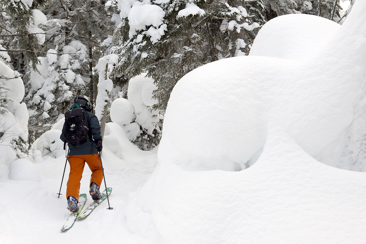
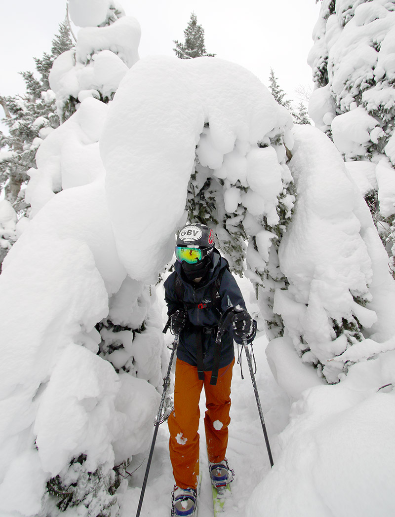
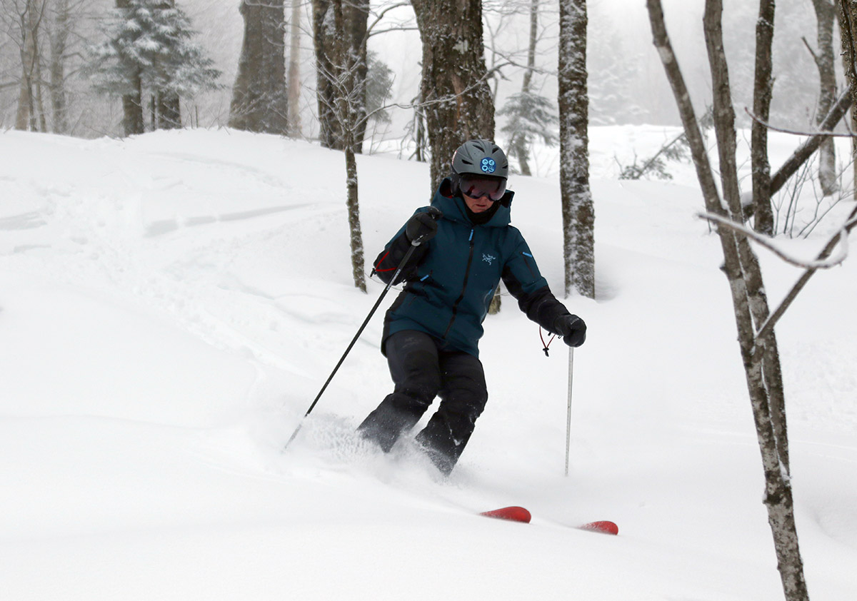
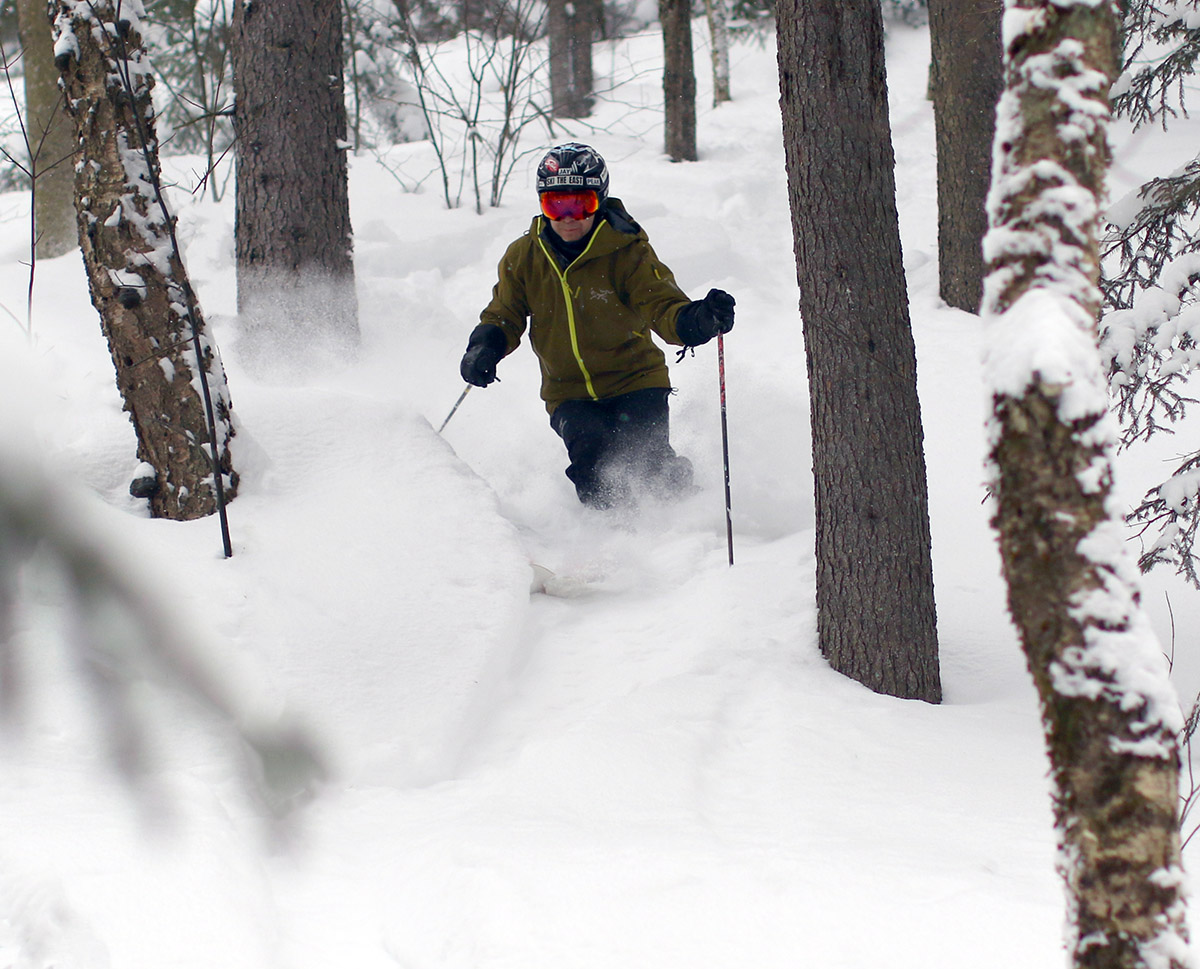
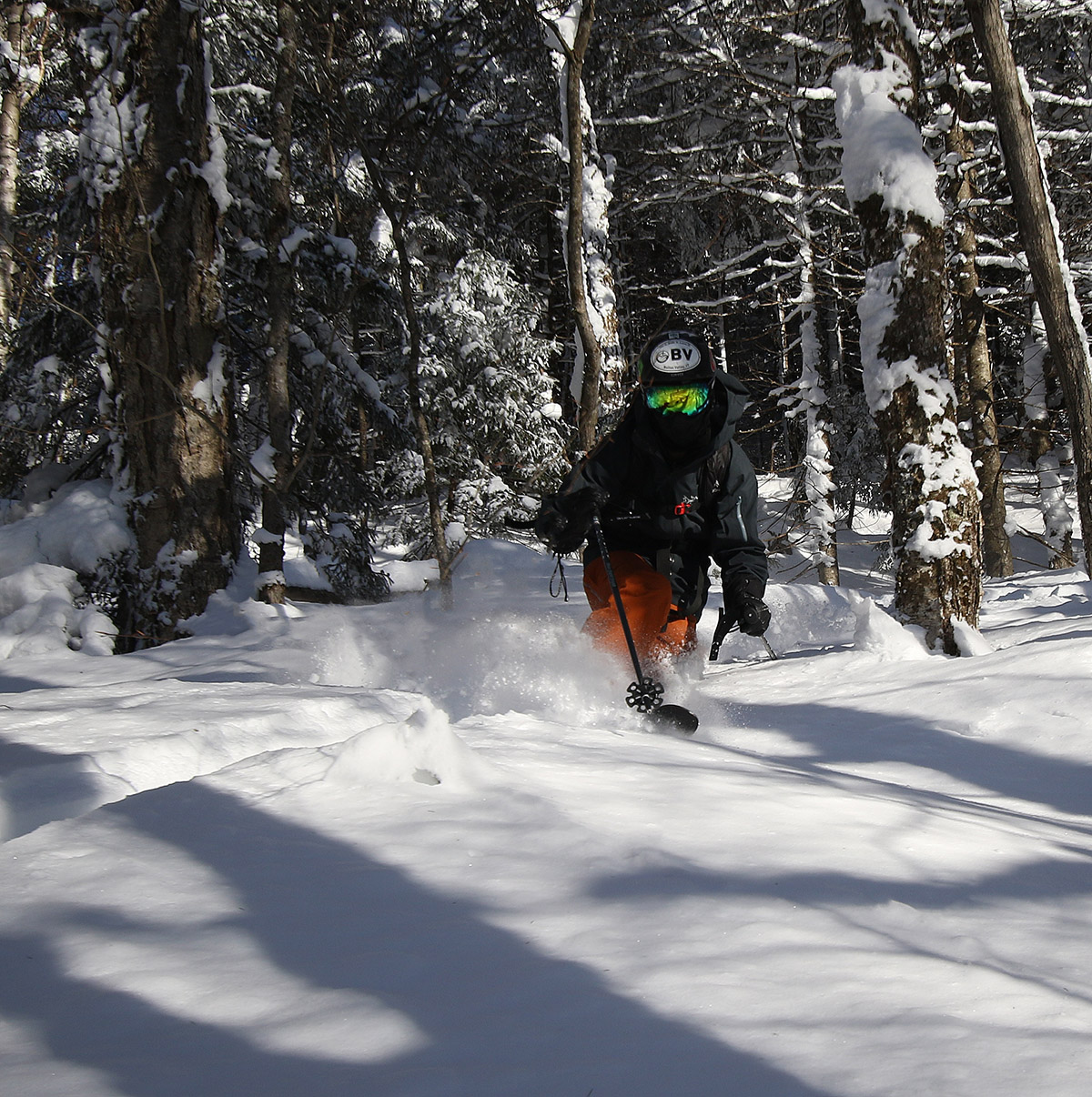
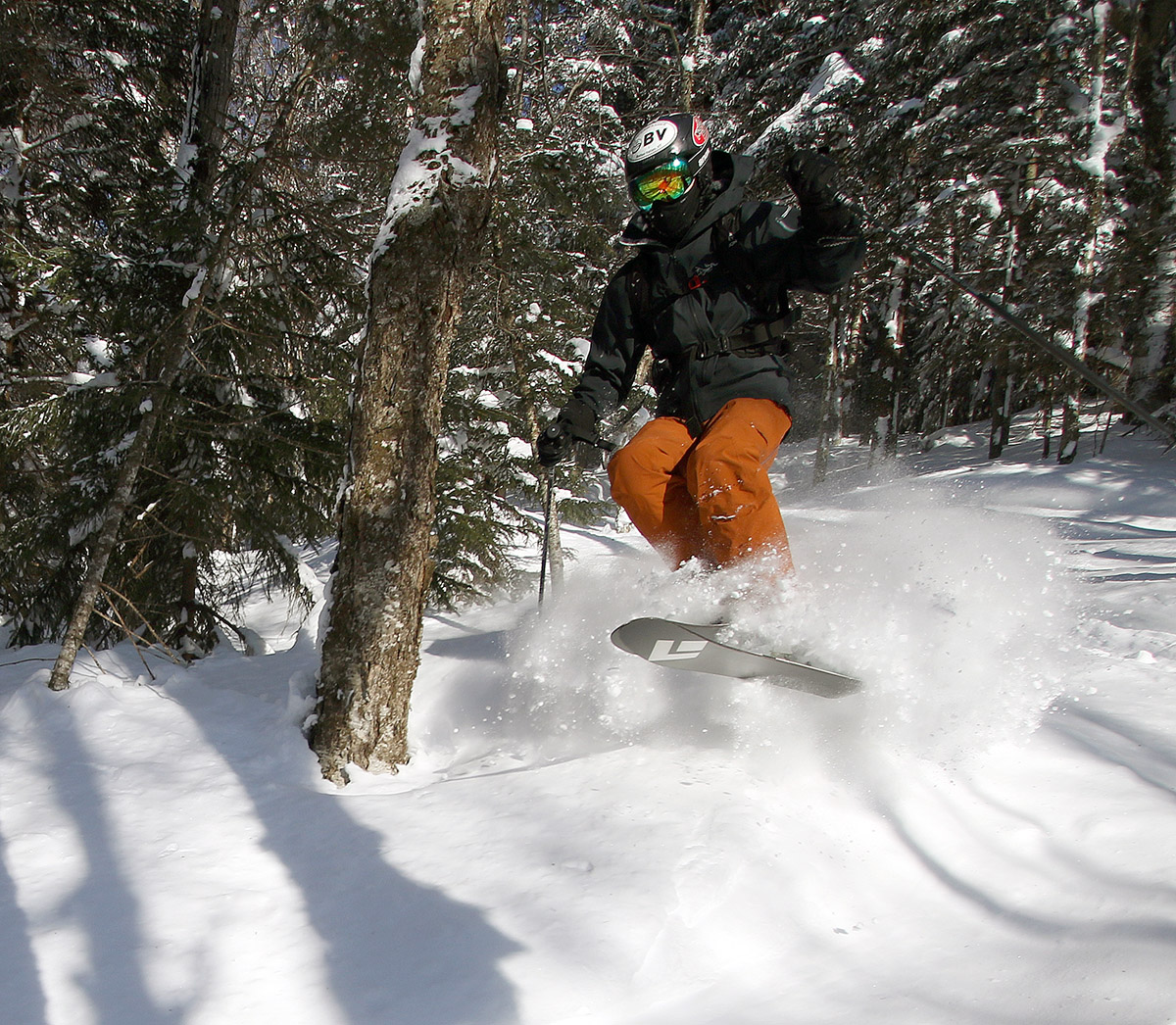
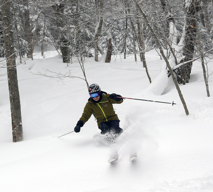
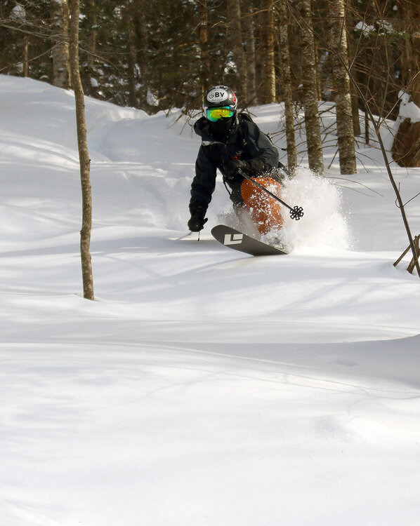
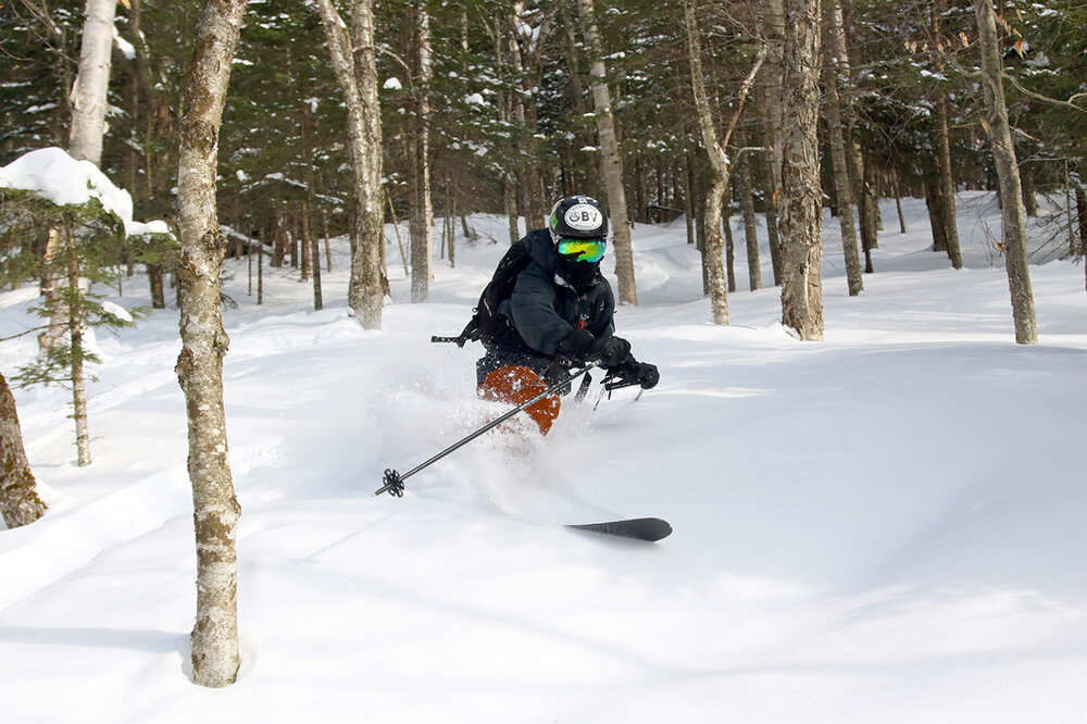
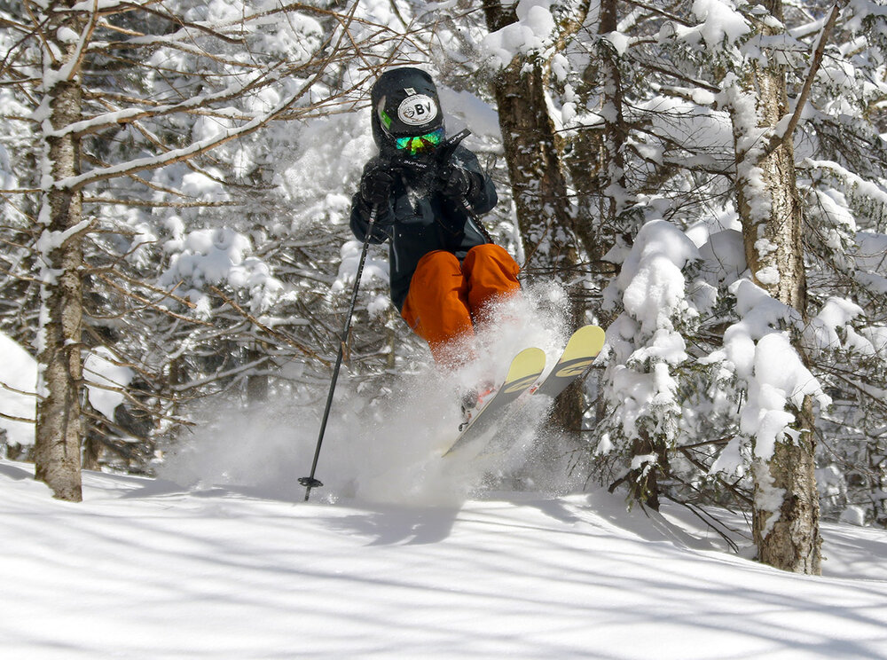
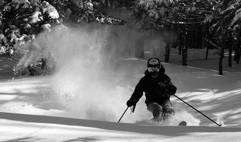
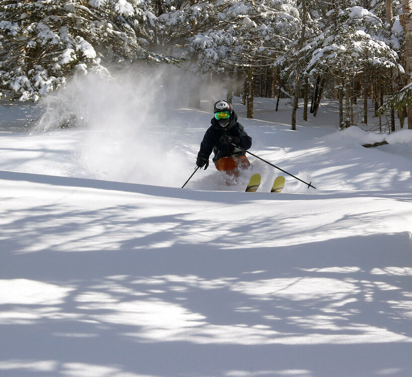
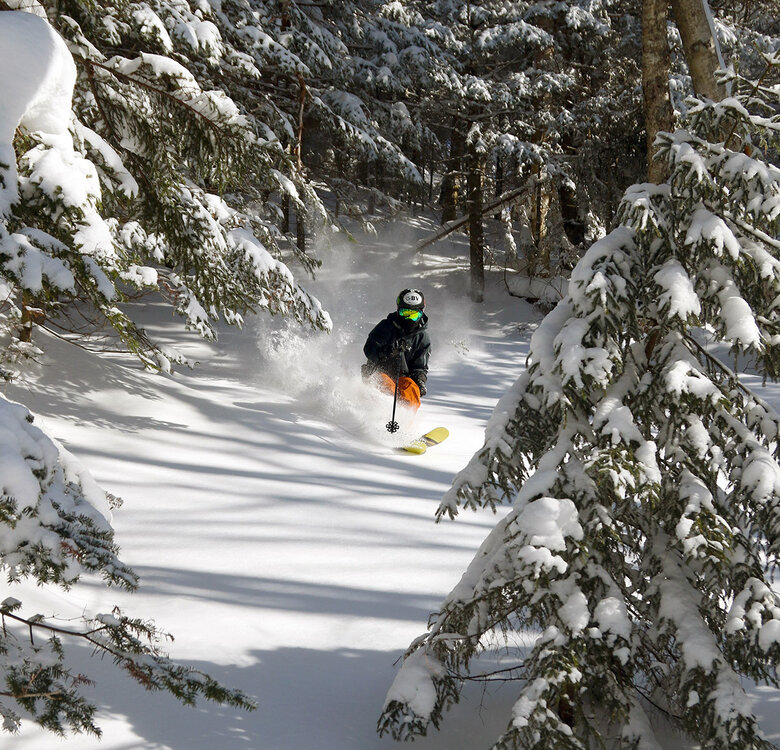
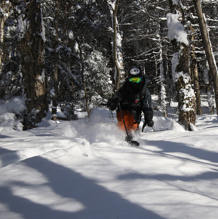
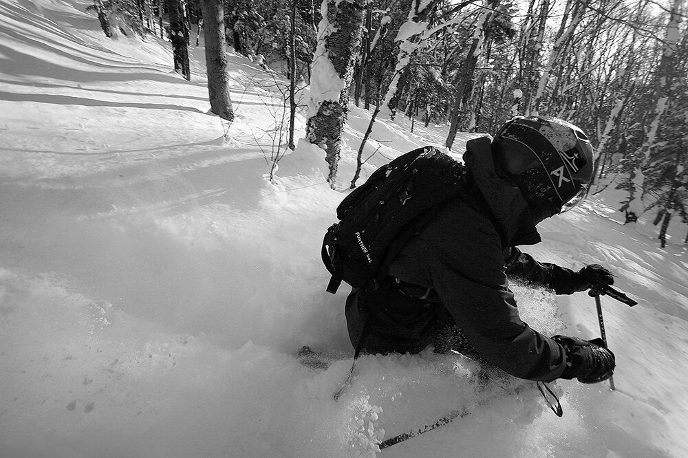
Friday’s storm provided a healthy shot of snow and liquid equivalent to the snowpack, but Saturday was fairly busy at Bolton Valley and by the end of the day a lot of terrain was tracked and packed. That got me thinking about another sidecountry day, so yesterday my older son and I headed up to the resort with that in mind. Last Sunday we spent much of our time in the sidecountry terrain on the north side of the resort, so yesterday I decided to introduce my son to some of the sidecountry terrain on the south side of the resort. One way to access the drainage to the south of Timberline below Goose Pond is to park at the Timberline Base, ride the lifts to the top of Vista Peak, and then traverse out on the Woodward Mountain Trail and drop in. We brought skins and backcountry gear to give us the freedom to do some extra exploring out toward Woodward Mountain, but if you know the terrain and are conservative with your traversing, you can also treat it as standard sidecountry on your downhill gear. The quality of the powder was very similar to what we experienced on Saturday – a lot of the recent storm had snow that fell in the 6 to 7% H2O range, but there were a few inches in the 10-11% H2O range at the end that gave it some medium density. Overall, the powder was surfy and dry, and deep – it’s very bottomless out there in the backcountry, and fat skis and powder baskets are a huge help getting around, whether you’re skiing or simply traversing. With the high elevation snowpack depth at around 7 feet in the Northern Greens, if your ski pole doesn’t gain any purchase and punches through some of the thicker layers in the pack, it will simply disappear into the void until your arm stops it. Another sign of the deep snowpack at the tall, multi-foot snow pillows that surround you in areas protected from the wind; they really give you a sense for how much the snowpack has been building over the past few weeks. The only knock I can make against the quality of the powder right now is in areas below roughly 2,000’ on southerly aspects. There’s been enough warming there to add a melt crust to the surface and degrade the powder. That’s the downside of skiing on the north side of that Goose Pond drainage as one gets farther into the spring. One way to avoid that is to ski on the other side of the drainage below Bone Mountain, but access and return to the resort from that side of the valley is much less convenient and requires more of a backcountry commitment. Thankfully all the powder at the head of the valley where there are a lot of great ski lines is in excellent shape Although the south side of the resort certainly doesn’t have the level of backcountry skier traffic that the north side does, we did encounter some backcountry activity out there. On our return traverse using one of the VAST trails, we came upon a group of combined snowmobiles and snow bikes cruising along in the deep snow, and they looked like they were having a blast. The 4x4 Center Driving School at the Timberline Base isn’t in operation this winter, so Bolton Valley is using their upper lot for additional parking, and that makes and excellent spot for returning from the VAST trails and back to the resort.


-
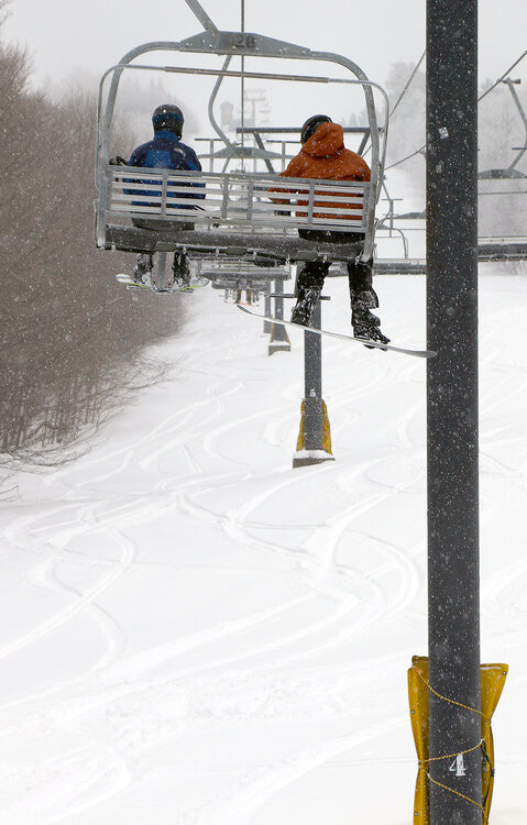
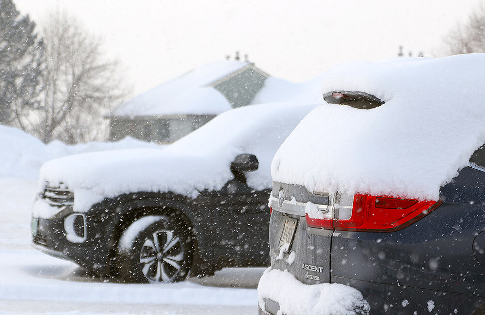
My wife and I headed up to Bolton Valley yesterday morning to check out the new snow from the storm that hit the area on Friday. The storm put down a decent amount of liquid, with close to ¾” of liquid down at our place in the valley. The first 8 to 9 inches of snow came in with a reasonably light density in the 6 to 7% H2O range as the snow was falling in the 1-1.5 inch/hr. range with large flakes on Friday evening, but the last few inches did have some snow up in the 10-11% H2O range as the snowfall slowed down and the flakes got smaller. The snow skied on the denser side thanks to those final inches, but it was still quite dry and that density in the snow certainly helped with the resurfacing. At ¾” of liquid or so, it wasn’t a full blown resurfacing of all pitches, but moderate-angle terrain offered up bottomless turns in snow that was untracked, and high-angle terrain was still quite good. Temperatures started off well into the 20s F when we began our morning at Timberline, but they were colder up high, and they continued dropping at all elevations throughout the morning.
-
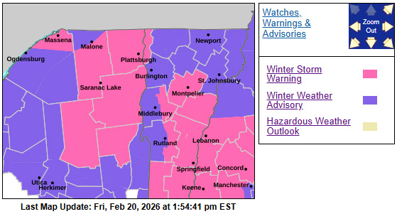
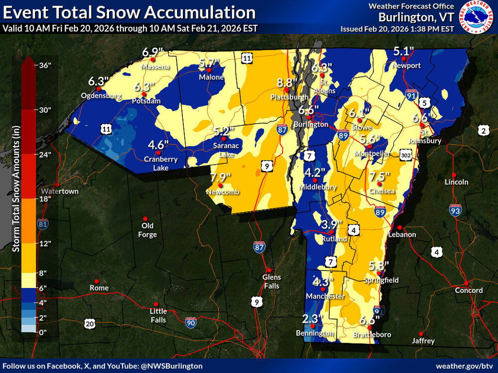
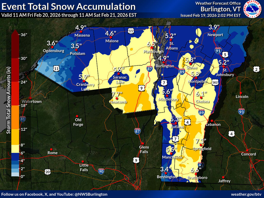
It looks like we’ve got a final update before this storm gets going around here – as noted in the BTV NWS forecast discussion, Winter Storm Warnings were expanded in the area to some additional counties. The latest Event Total Snow Accumulation map also has a more extensive area of 8-12” shading, and it looks like the point forecasts have taken a corresponding bump. I’m seeing some point forecasts in the Central Greens in the 9-18” range through Saturday, and there are a few hints of that 12-18” shading in the accumulations map.
-
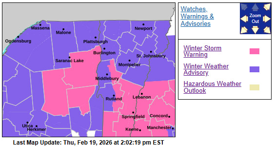
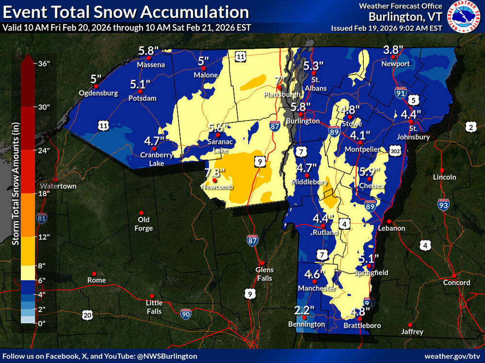
I was surprised to see that updates are already out for the BTV NWS maps associated with the next winter storm. Winter Storm Watches have been converted to Winter Weather Advisories and Winter Storm Warnings with more expansive 8-12” accumulations shading along the Green Mountains. I’m seeing snow forecasts of 5-10” in the valleys for our area with 8-12”+ for some of the higher elevations of the Greens, which seems in line with the accumulations map.
-
I see that Winter Storm Watches are starting to appear in the area ahead of the next anticipated winter storm. It sounds like one of the concerns is potential inch-per-hour snowfall rates during tomorrow’s evening commute. It looks like projected accumulations for us in the valley are in the 5-7” range at this point, with 6-8” shading here along the spine and a bit of 8-12” shading appearing in the Central Greens. We’ll see how things go when the BTV NWS puts out their next updates later today.
-
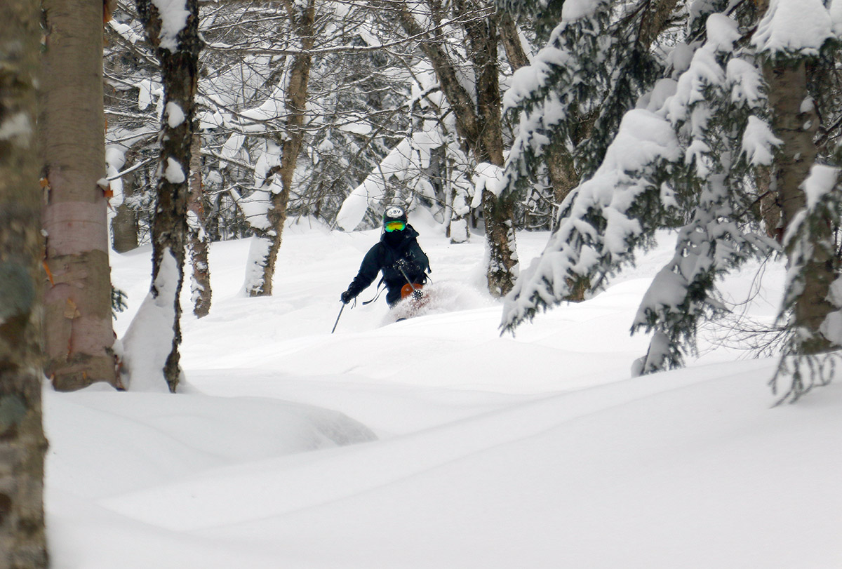
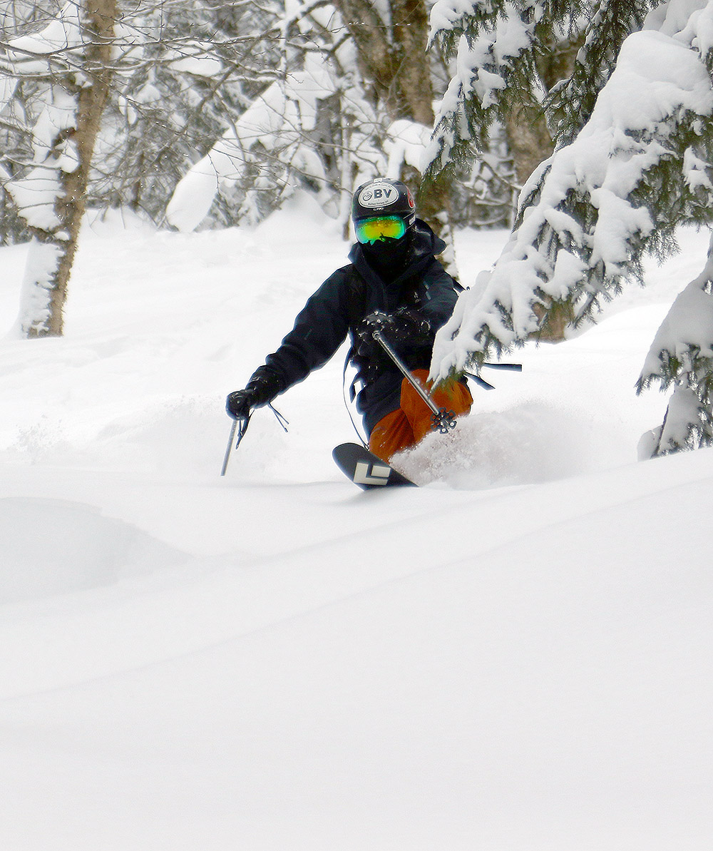
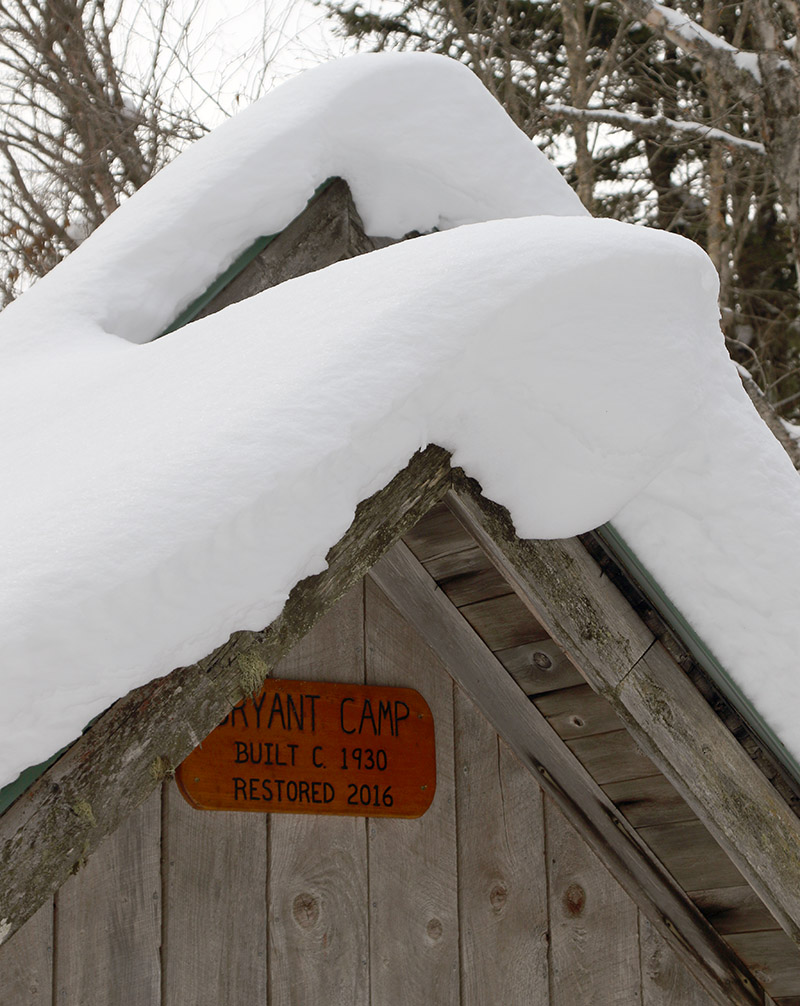
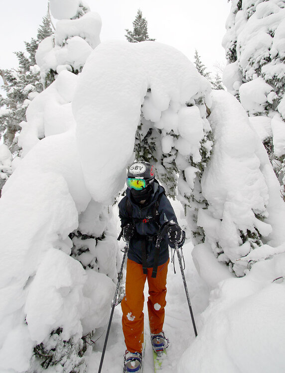
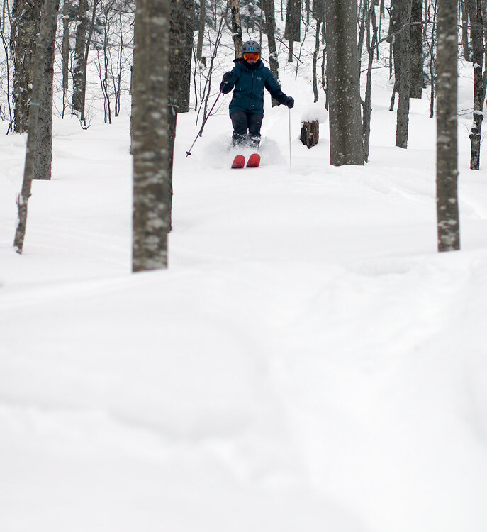
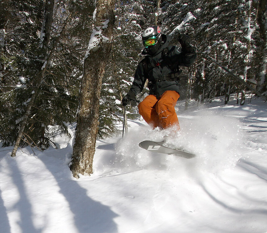
Yesterday my older son and I headed back up to Bolton Valley for another ski session. The powder is still staying in excellent condition, but with another day of holiday weekend skier traffic at the resort, we switched it up from our sidecountry excursions on Sunday to get further into the backcountry on the Bolton Valley Nordic & Backcountry Network. Temperatures were pleasantly seasonable again, but it was cloudy when we arrived in the mid- to late-morning period, and the number of visitors to the resort was much less than what we’d encountered on Sunday. We planned a relatively short tour up the Bryant Trail and then around the Bryant Cabin, but we ended up extending it a bit with a traverse up into the terrain between Heavenly Highway and North Slope. We descended through some fun new terrain down to North Slope, then followed some of the usual glades like Gun Sight through Gotham City and eventually down into some of the lower glades like Cup Runneth Over. We made a brief second lap to hit another glade off World Cup that we’d seen, and that trip helped clarify our understanding of some of those numerous Bryant Trail/World Cup intersections. By the time we were heading out in the mid-afternoon period, the sun was breaking through the clouds and temperatures were creeping up close to the freezing mark in the Village. We didn’t detect any issues with temperatures affecting the quality of the powder at that point, but I wouldn’t be surprised if south-facing lower-elevation areas ultimately saw a bit of thickening in the snow consistency.

-
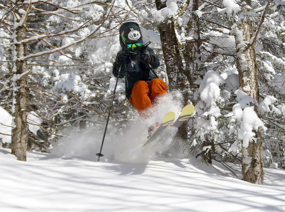
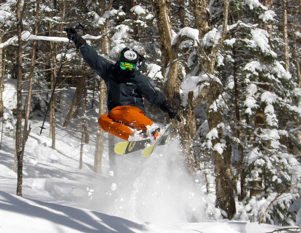
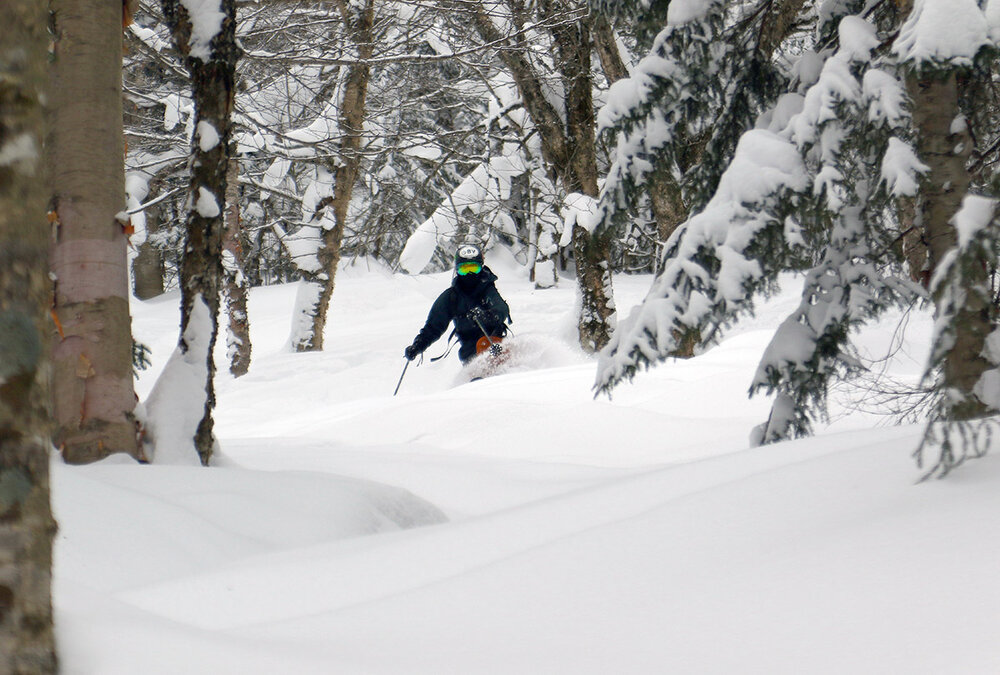
Our most recent storm brought some snow on Saturday into Sunday, with a couple more inches to top off the midwinter snowpack. It was nice to refresh the surfaces a little, but it certainly wasn’t enough to reset the powder brought by our previous system, which has been getting skied pretty thoroughly after several days and some holiday weekend skier traffic. Our midwinter temperatures have been preserving the snow quite well however, so my older son and I headed up yesterday for a lift-served session at Bolton Valley. We spent most of the outing working the sidecountry to get to fresh snow and did a lot of what my son likes to call “high octane” skiing. It’s not that it’s especially aggressive skiing, but it’s the term he uses for when he ventures into tightly forested spots that most people don’t visit, areas that can be a little more challenging to get through initially. They can still offer great skiing though if the powder is deep and allows your turns to fit the pacing of the tree spacing. And these less frequently visited areas with tighter trees often quickly drop you into areas of open forest that nobody has skied. And that’s how yesterday’s session evolved; we spent most of the first half of our time in the sidecountry on the north side of the resort and used the Wilderness Lift for access. Then we finished off by hitting some of the sidecountry on the south side of the resort that is serviced by the Timberline Quad. The snow has been staying light, dry and bottomless, so as long as you can get to untracked areas, you’re going to be rewarded with fantastic powder turns. On piste, the packed conditions are also quite good, but the snow is well packed at this point with holiday levels of skier traffic. Sunday seemed much busier than Saturday, and I bet that’s because it was a beautiful sunny day for most of it, and people really love to get out when you have seasonable temperatures and sun. Clouds did build in later in the afternoon ahead of the small system that is in the area today.

-
My wife and I headed up to Bolton Valley for a lift-served session this morning, so I can pass along the conditions updates. We planned to spend our time on Timberline and arrived there right around the opening of the Timberline Quad. Being a holiday weekend, we were a bit worried about how busy the resort was going to get, but the Timberline Quad remained at pretty much walk-on levels of traffic right up through noontime when we were done. So, skier traffic was relatively light, but the snowfall from the larger storm earlier in the week was really spread out over the course of multiple days (Tuesday through Thursday). So, with respect to lift-served terrain, that storm’s powder has certainly been skied. Therefore, on piste areas and easily accessed off piste areas are mostly packed at this point, and we had to travel a bit farther afield to get into untracked lines. We did pick up another inch or two of snow today down at our place in the valley, and it snowed lightly all morning on the mountain to add similar amounts, so that added another layer of freshened up snow. In general, the powder was in excellent shape, albeit with a bit more settling that what I encountered on my ski tour yesterday. We actually encountered a bit of sun/melt crust on some southerly aspects down around 1,500’, so be aware of that possibility if you’re planning to hit a any low elevation terrain with substantial southerly exposure. On piste conditions were excellent packed powder aside from the usual areas that have a manmade base, so it looks like the holiday weekend will continue to roll on with great midwinter conditions in the Northern Greens.

-
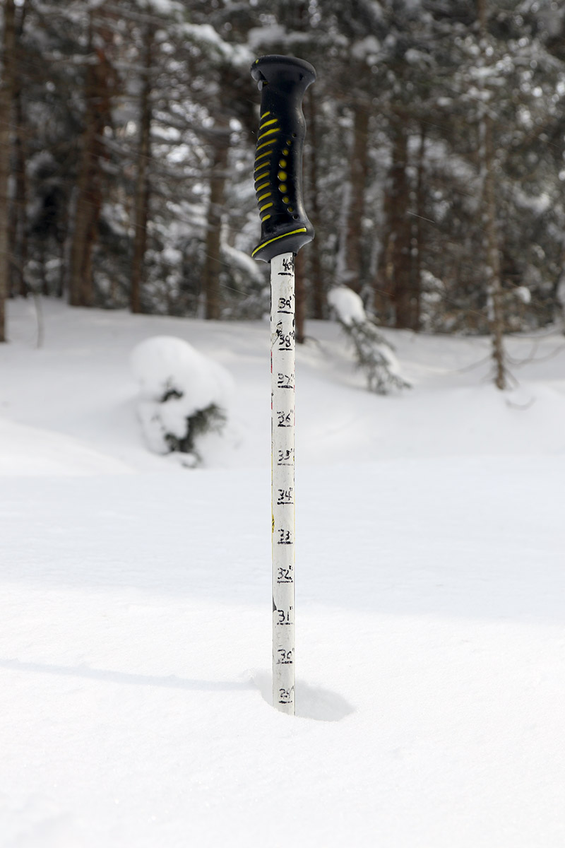
Our most recent system was one of those classic setups when an Alberta Clipper interacts with the Northern Greens and turns into a 12”+ event. I didn’t have time to get out for turns yesterday, so I headed up to the mountain this morning for a ski session. The Wilderness Lift has been closed for the past couple of days per its usual weekly schedule, so I toured via the Wilderness Uphill Route this morning ahead of its Friday opening. As I mentioned in my Wednesday report, the first half foot of snow from this system came in fairly dense, with snow in the 9-10% H2O range, but the next half foot or so was in the 4-6% H2O range, and then then the final rounds of snow that came through yesterday finished off in the 2-3% H2O range. So all told, the storm cycle played out beautifully by delivering an excellent gradient of right-side-up powder. And indeed the powder skiing today was as one might expect with those numbers – fantastic and bottomless unless you were on terrain that had been groomed during the storm. And even then, you were touching a subsurface that is of very high quality due to the rounds and rounds of snow we’ve received in the past few weeks. I last did powder depth checks during my Saturday outing on the Bolton Valley Nordic & Backcountry Network and was typically finding powder in the 20 to 30-inch range above the subsurface. We’re getting to the point now that it’s getting hard to put numbers to it – the overall powder stack is getting deep enough that it’s crushing and settling the lower levels of powder into denser snow beneath it, and it’s getting hard to assess where the actual subsurface sits. Oh well, that’s a great place to be in midwinter, so let’s just say that the powder out there in off piste areas that haven’t been touched is 20-30”+, and it’s got a beautiful density gradient in it that has set up naturally over time. On a related note, I see that the snowpack depth has now jumped back up above 80” according to the Mansfield Stake. So right now in the Northern Greens, the powder is deep, the overall snowpack is deep, the forecast calls for seasonable temperatures, and the modeling has 2 to 3 smaller systems with snow over the next few days. My recommendation is to get out there and enjoy it.


-
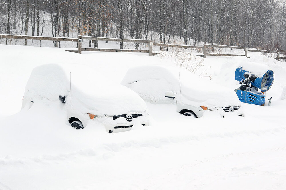
The Alberta Clipper currently affecting the area had already dropped a half foot of snow at the house as of early this morning, so it was certainly a day to hit the hill. This morning’s snow had some heft – there was over a half inch of liquid in it, and that’s much denser than the snow we’ve typically been seeing over the past few weeks. We’ve had a pleasant return to more seasonable temperatures in the 20s F, which meant it was a good day to get back to some lift-served turns. Up at Bolton Valley, the Timberline Quad was running for the first time this week, so I started my session there and got a nice sampling of the snow. Accumulations were similar to what we’d seen down in the valley, but with a half inch or more of liquid in the snow, it was a decent resurfacing. There was even a little mixed precipitation that snuck its way into the snowpack, but thankfully it was minimal enough that it was inconsequential to the skiing. The main tenor of the conditions was set up by that relatively dense powder – it was surfy, and it felt like it would have been a great day to get out the snowboard. Off piste in unracked areas the snow is quite deep, and you need decent pitch to make the best of it with the additional of this new shot of liquid. The untouched powder is a bit upside down with this new denser snow on top, so that’s a great situation to pull out your fat skis or snowboards. It was snowing steadily the entire time I was on the mountain, and it continued to snow throughout the area for the rest of the day and now into the overnight, so the snow consistency will be changing. Now that the backside upslope portion of the system is coming through, we’re getting much bigger flakes and drier snow, so that should reset the powder gradient for tomorrow.
-
I was surprised this afternoon when I saw a Winter Weather Advisory appear in the alerts on my laptop, but the BTV NWS has them up for parts of the forecast area, including the western slopes of the Northern/Central Greens. On the Event Total Snow Accumulation map I see there’s some yellow 6-8” shading in the Northern Greens around here in the Bolton-Mansfield stretch, and that seems to align reasonably well with the mountain forecasts. Here at our site the numbers come in around 4-8” through Wednesday night, which is a little more aggressive than the general 4-6” shading along the spine, but we’ll have to see how long the snowfall persists – some models keep the upslope snow showers going through Thursday. The modeling also has another system coming through the area on Saturday, and with temperatures finally getting back to more normal values, we could be in line for some excellent days to hit the slopes.
-
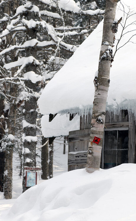
We’ve got yet another weekend on our hands with well below average temperatures, and when you’re talking this time of year in the mountains of Northern Vermont… that’s cold. Seeing the forecast, my plan for the weekend had always been to get out Saturday morning to hopefully get in a tour before the frigid air became fully entrenched. The cold came in quickly though, and there really wasn’t much hope in outpacing it today – by the time I arrived up in the Bolton Valley Village, it was already -3 F, and there were brisk winds throwing the wind chill well down into the double digits below zero. Despite the temperatures, the parking lots indicated that there were a good number of visitors, but I was still able to get a trailside spot in the second backcountry lot that let me gear up out of the wind. As of their early morning report, Bolton Valley was reporting just a couple inches of snow from our current system, but once I was out on the trail, I knew that report would be increasing – I was consistently finding a half foot of new snow in previously packed areas that had not yet seen any skier traffic. With just a couple of inches of new snow reported, I was initially debating between going with mid-fat or full-fat skis, but the decision to take out the fat skis was easy when I knew there was still going to be plenty of terrain out there that hadn’t seen a skier in a couple of weeks. Indeed, fat skis were the way to go today; between another half foot of fresh snow on top of the depth of powder that was already out there, it was clearly the call. With no big snowpack consolidation events in recent weeks, the depths of the surface powder just continue to grow. I toured in the 2,000’ to 2,800’ range today, and powder depths in untouched areas were consistently 20 to 30 inches. I toured up past Bryant Cabin onto Birch Loop and Heavenly Highway, and my initial plans to hit some lower-angle slopes on my descent quickly went out the window. With the snow a bit slow due to subzero temperatures, and 20 to 30 inches of powder to slow you down, low-angle slopes were generally off the menu. I stuck to roughly the same tour I had planned down through the Not a Trail area, Gardiner’s Lane, North Slope, Gotham City, and Alchemist, but with the available powder conditions I could dive into the steepest lines I wanted, and those delivered the best turns. So, if you head out into the backcountry around here in the Northern Greens, shoot for steep to accommodate the deep.

-
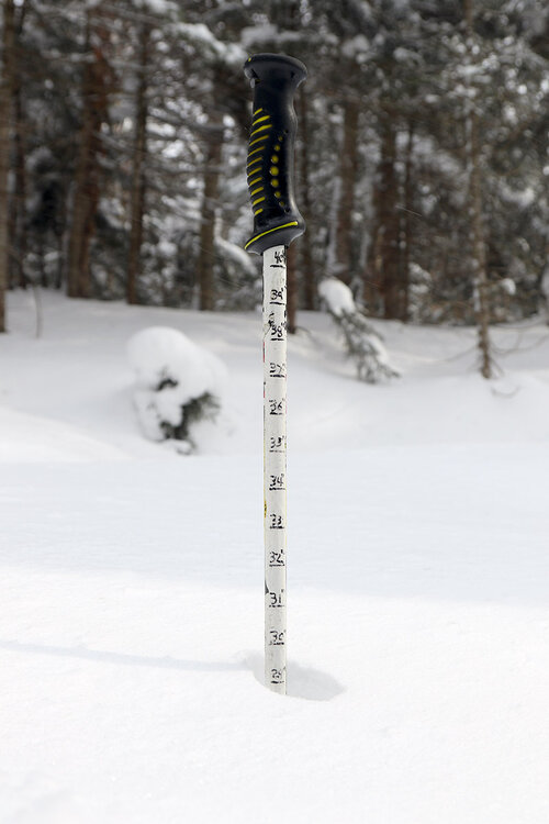
Yesterday was the first day that we hadn’t reported new snow at our site in over a week, and only the third day without snowfall since back before Christmas. So indeed, it’s been quite a snowy stretch around here over the past several weeks. In typical Northern Greens style, the period without new snow abruptly ended at just one day because this morning I awoke to moderately heavy snowfall made up of large flakes in the 5-20 mm range. We picked up 2 to 3 inches of champagne snow at the house by the time it was starting to taper down, and along with much more seasonable temperatures, it got me thinking about a morning ski tour to check out the new powder. Today being a Wednesday, the Timberline Quad was running instead of the Wilderness Lift, so touring via the Wilderness Uphill Route was an obvious play. It was still snowing moderately when I arrived up in the Bolton Valley Village, and I could immediately tell that the mountain had picked up substantially more snow than we had at our house – accumulations in the Village were about double the amount we’d received in the valley. I toured in the 2,000’ to 2,700’ elevation range, and new accumulations I found as of late morning were as follows: 2,000’: 4-6” 2,500’: 6-7” 2,700’: 6-7” The only way to assess the depth of the snow from this event was to check on groomed terrain, because off piste, the unconsolidated snow is very deep and it’s a long way to the subsurface. I didn’t get up above 3,000’ today, but it didn’t look like there was much of an increase in depths above the 2,500’ level. The new powder was very dry – right around 2% H2O based on my analyses from this morning and this evening. So it skied really well, but I certainly wasn’t setting up bottomless turns or providing a resurfacing on groomed terrain – there just wasn’t enough liquid equivalent in there. Thankfully, there isn’t a huge need for a resurfacing at the moment - the quality of the subsurface out there right now is excellent because of all the snow and cold temperatures we’ve had over the past few weeks.
-
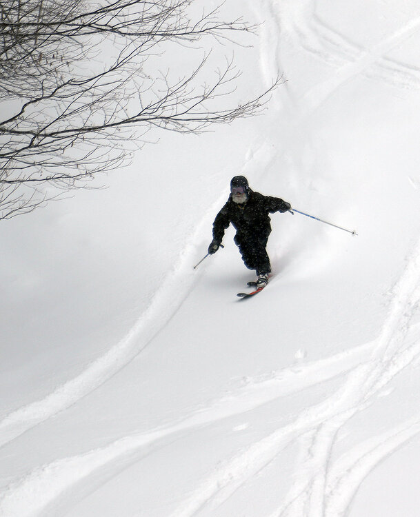
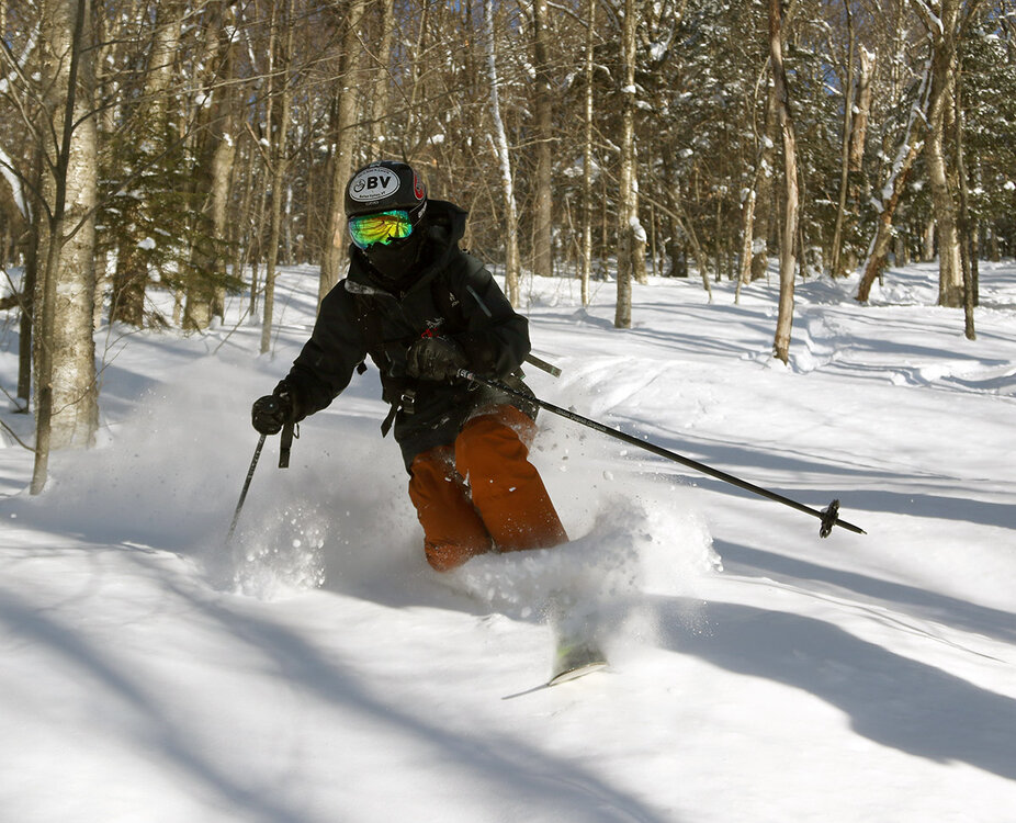
Yesterday’s ski tour up at Bolton Valley yielded some great powder skiing, so with today being sunnier and warmer, my older son and I headed up for another tour on the Bolton Valley Nordic & Backcountry Network. I’d gotten a good bead on the conditions in the Bryant Cabin area during yesterday’s tour, so I took my son on the same general route today in the 2,000’ to 2,800’ range, and we just varied it up a bit as we sought out untracked areas. The resort reported a couple of inches of new snow overnight, so between new accumulations and settling, powder depths were similar to yesterday, with 14-15” on the low end, and 21-25” on the high end. It turns out that the wind slab and more condensed areas of powder I’d encountered yesterday were strictly in the higher elevations above 2,600’ or so, but it wasn’t really until I’d been through areas again today that I was able to confirm that. Similar to yesterday, we were skiing generally western aspects today, so leeward aspects may be unaffected with the wind slab. In any case, once you got below that threshold elevation where the wind had its effects, the quality of the powder took a noticeable bump up, and that was the case for every line we skied today.
-
January has just finished up and we’re at the approximate midpoint of the snowfall season around here, so I have the plot with the latest seasonal snowfall progression from our site. The current season is the red trace in the plot, and since that flurry of activity leading up to Christmas, snowfall strolled along at a roughly average pace until about the second week of January. The slope of the average snowfall trace can be used for comparison, but at that point the pace of snowfall actually fell off to a bit below average. This season definitely started to fall behind the snowfall pace of those comparator seasons I have in the plot, and that’s how it was going until that big snowfall spike near the end of January representing Winter Storm Fern. That storm and the couple of additional events we’ve had this week have brough this season right back up into the mix among those other seasons. Starting with the numbers in hand at this point of the season, the stats can be used to get some odds of where the overall seasonal snowfall may end up: Chance of reaching average season snowfall of ~160”: 96.0% Chance of reaching season snowfall of 200”: 38.0% Chance of matching the 1st ½ season snowfall to reach 240”: 1.4% Clearly it would be quite unlikely for this season to continue with the snowfall pace we’ve seen so far for this first half. We’ve never had a season reach 240” of snowfall during my period of record here – none of those other strong seasons in the plot reached that total. I also have the storm list for the first half of the season below. I haven’t assembled stats on the pacing for the number of storm we get during the season, but we’re probably ahead of average there. If storm frequency were to continue at this pace, we’d have over 80 storms on the season, which is way above average – the greatest number of storms we’ve seen in a single season thus far at this site has been 64. If I were to run the numbers, I bet we’d find that there are fewer storms in the second half of the season relative to the first half. As we head father into the winter season, the tenor/typical weather pattern feels different than the November and December regime that has relatively warm Great Lakes and often provides lots of smaller systems/lake-effect events with frequent snowfall. But, every season is different, and we’ll see what Mother Nature decides to do this time around.
-
We had another cold January Saturday on our hands today, but temperatures were certainly up a notch from what we encountered last weekend. Instead of valley temperatures hovering around 0 F for highs, they were up around 10 F today, so I headed up to the mountain for a ski tour. The temperature was still only around 0 F when I arrived in the Bolton Valley Village around midday, and it was busy, but not “holiday weekend” type of busy, and I was able to get a parking spot right in the backcountry access lot. Thanks to Winter Storm Fern and the subsequent systems that have come through the area, we’ve had over two feet of new snow in the valley over the past week, and the Bolton Valley snow report was indicating 30 inches of snow at the resort in the past 7 days. The powder is still deep and plentiful, but the powder quality certainly isn’t up where it was right after Winter Storm Fern. That storm cycle concluded with a period of incredibly dry 1-3% H2O powder; that champagne was so incredibly light and dry that it skied like a dream on any sort of pitch. Powder of that airy nature would naturally settle rapidly on its own, and it’s easily been crushed by the snows of these more recent storms. The powder from this week’s smaller systems certainly wasn’t too dense, with snow densities in the 2-7% H2O range, but the tail end of our most recent one did finish off with some fine-grained flakes that came around 10% H2O. In combination with the powder settling on its own and under the new snow, I even encountered some areas of wind slab out there on my tour. All told, the combination of depth and density in the powder out there today couldn’t support good turns on low-angle terrain, so you had to hit mid-angle terrain or steeper. I toured up and around the Bryant Cabin today at elevations in the 2,000’ to 2,800’ range and settled powder depths were typically 14-15” on the low end, and 21-25” on the high end. So, I may be dissecting the finer points of the snow density, but there’s absolutely some fantastic powder out there. I initially descended through Gotham City and did a bit of exploring on new terrain, then I did another quick ascent to get a descent through Gotham in the Gun Sight area, which yielded some of the best turns of the day. There really hasn’t been a ton of traffic in many areas of the Nordic and Backcountry Network yet, so as long as you find those areas with appropriate pitches for the deep powder, you can get in some really nice turns. The resort looked like it was actually getting a little busier when I was leaving in the early to mid-afternoon period – the sun was coming out and the temperatures were climbing a bit, so that was the little extra nudge that people might have needed to get out for a few runs.
-
Since we’re right around the midpoint of the snowfall season around here, I did a quick check on where the Vermont ski areas stand for season snowfall thus far, and the north to south listing of totals is below. The four resorts along the spine of the Northern Greens are all reporting 200-300”+ for the season so far. It would naturally be difficult to keep up that same snowfall pace for the entire second half of the season, but that would certainly result in some solid overall snow numbers. As is typical, the numbers drop off a bit to <200” for the ski areas in the Central Greens, and some areas are even <100” in the Southern Greens. These numbers are all subsequent to the strong boost from Winter Storm Fern last weekend, so some of those snowfall numbers in the south must have been quite low prior to that. A quick look at the season snowfall totals thus far for the Vermont CoCoRaHS sites shows that several of them have seen more snow than any of the resorts in the Southern Greens - and CoCoRaHS sites are generally going to be valley/non-mountain locations. That disparity may be a function of the season thus far being characterized by more progressive/northern jet stream patterns vs. coastal or southern jet stream events. Jay Peak: 309” Burke: 118” Smuggler’s Notch: 218” Stowe: 218” Bolton Valley: 222” Mad River Glen: 138” Sugarbush: 154” Saskadena Six: 50” Pico: 140” Killington: 140” Okemo: 84” Bromley: 117” Magic Mountain: 73” Stratton: 106” Mount Snow: 88”
-
As of yesterday morning, the mountains had picked up another few inches of snow from the disturbance coming through the area on Tuesday, so I headed up to Bolton Valley for a tour. The Timberline Quad was set to start running at 9:30 AM for the first time this week, so getting in ahead of that opening was the best bet for untouched snow ahead of the lift-served traffic. Temperatures have remained much better than the cold we saw over the weekend – with temps running around 10 F and minimal wind present, the skiing is a lot more comfortable, especially while touring. With the additional snow from the end of Winter Storm Fern and this more recent system, powder depths were a bit deeper yesterday than what I’d found on Monday. Depth measurements were more in the 15-20” range vs. the 12-18” range that was out there before. The powder didn’t come across quite as dry as what was out there on Monday, since the snow from this disturbance has been coming in with snow densities in the 3-6% range vs. those 1-3% readings from the end of Winter Storm Fern, but it was still fantastic midwinter champagne powder - you’d be hard pressed to tell the difference unless you were out there both days and paying close attention.
-
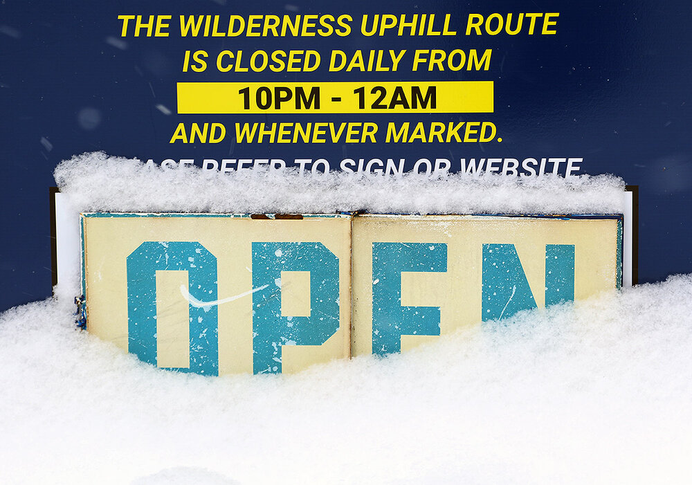
I’d initially thought of heading out for a lift-served alpine skiing session today to check out the snow from Winter Storm Fern, but while temperatures have been warming somewhat since the cold spell over the weekend, morning temperatures were still going to start out in the rather unappealing single-digit F range. Once the snow reports started coming in though, it was clear that there wasn’t much elevation dependence with the storm, and that made the idea of touring at Bolton’s Timberline area where the uphill route has just officially opened for the season, a bit more appealing. And with the Timberline Quad not running on Mondays and Tuesdays, the area was only going to see ski touring levels of traffic. It was clearly a god day for a Timberline tour, and a number of people had similar thoughts - there were more than a dozen cars in the Timberline parking lot when I arrived in the mid to late-morning timeframe. Temperatures had risen into the double digits F, and backside snows were continuing to add to the accumulations. By the midday timeframe I was finding a general 12-18” of powder depending on exposure. Areas with 12” weren’t quite enough to deliver bottomless turns on the steepest pitches, but 18” was enough to do it. The quality of the powder was simply fantastic, with a right-side-up gradient that started off around 11% H2O and tapered down to the 1-3% H2O range. It was so super dry champagne that it skied well on any pitch – you could crash the steep pitches, and the snow was so light and dry that it simply let you float your way down through even lower-angle terrain.
-
Well, you were absolutely right to be gun shy with respect to that type of forecast – how often do we actually get upslope-style snowfall ratios with surface temperatures around 0 F? I will say that thankfully, temperatures did come up quite a bit today – we got up to 15 F in the valley, which felt really nice. While that may not seem all that warm, without any wind it’s dramatically different from temperatures below zero F with brisk winds. Anyway, we certainly doubted whether or not Mother Nature could pull off those higher snow totals in the forecast at those temperatures, but she did. We just hit 20” on the storm as tonight’s snow is rolling through, and low and behold, we are just about to hit 0.75” of total liquid equivalent. So, it was just like the upper end our ~10”-20” point forecast range here suggested, and the overall snow to liquid ratio is around 27:1 for the storm. Kudos to the BTV NWS for their forecasting as usual. And for folks that got our for powder turns today, if you were wondering why the quality of the powder seemed like it was off the charts good… well, you weren’t crazy. The quality of the powder was off the charts. OK, well maybe it wasn’t quite off the charts, since I can, actually, chart out just why the powder skiing was of such incredible quality around here. As noted earlier in the discussion, the storm started off Sunday afternoon with a couple inches of 11.1% H2O/ 9:1 snow, then during Sunday evening, the snow to liquid ratio more than doubled, for another 7 to 8 inches of 4.2% H2O/24:1 snow. Then overnight, the ratio nearly doubled again, leaving about a half foot of 2.4% H2O/42:1 snow. Then through the day today there was another half foot of snow that fell in the 1-3% H2O range. Even for around here, that’s some impressively dry powder, and with the way that right-side-up density gradient came together, it skied really well. This certainly wasn’t an especially large storm by Northern Greens standards, but the very high quality of the powder that fell was definitely noticeable.
-
Well, the modeling certainly knew what it was talking about with the snow growth potential. At least when snowfall rates were on the higher side, I was seeing flakes up to 20-30 mm in diameter, but midnight observations here still had flakes up to 20 mm. I wasn’t sure if that 6 PM to 7 PM snow ratio would be maintained for the whole 6 PM to 12 AM block, but LOL, no worries there. This most recent block’s snow density just came in at 4.2% H2O for a 24:1 ratio – that impressive for an entire snow collection period, and indeed it’s right up there with the quality of upslope snow. This has certainly been some of the loftiest snow I’ve seen with temperatures hovering around the 0 F mark, so some unique conditions have come together with this system. At 24:1, even 0.75” of liquid produces 18” of snowfall, so the forecast numbers certainly aren’t crazy for areas that are in the banding.
-
The tenor of the snowfall had changed so much that I decided to run a quick liquid analysis on the new snow at 7 PM – it came in at 5.5% H2O for an 18.3:1 ratio, so indeed the snow to liquid ratio had essentially doubled from what it was earlier.
-
The snow thus far in the storm has seemed fairly dense, and indeed the 6 PM liquid analysis came in at 11.1% H2O for a 9:1 ratio. Flakes were generally in the 1-3 mm range this afternoon, but with that said, flake size has been increasing over the past hour or two. With that band that’s moved into the area, the snowfall rate has jumped up to the 1-2”/hr. range and I’m seeing flakes up to 10 mm in diameter. That’s more in line with the type of snowfall that would be needed to hit those higher end totals, and if I were to run another liquid analysis right now it would be much higher ratio snow. I’m not convinced that these snowfall rates and ratios would continue to be the norm overnight, but it’s nice to hear that some of the modeling is suggesting the potential is there.
-
Well, it’s wall-to-wall Winter Storm Warnings on the BTV NWS alerts map now that those cold weather alerts are gone, and that’s typically a good sign for a storm. I see that the latest Event Total Snow Accumulation map update has some areas of that 18-24” shading up here along the spine, and there’s a bit of that 24-30” shading down in the Southern Greens. The forecast here at our site does come in around that 10-20” range through tomorrow night, and the mountains are a bit more than that. Those numbers generally match up with the accumulations shading, but it’s a little tough to envision the high end of those numbers with the liquid equivalent that I’m generally seeing in the models (which seems to top out in the 0.75”-1.00” brackets). Accumulations could get there with some high snow to liquid ratios, but I’m not used to getting great snow ratios when the air is this cold – we often get that relatively dense arctic sand. The ratios are being mentioned a lot, so the dendritic growth zone setup must be there, and I guess we’ll see if this event is different and gives some lake-effect/upslope style snow ratios. What’s in the forecast is certainly a moderate resurfacing event, but it’s not even as large as Winter Storm Ezra from a few weeks back, which brought 1.24” of liquid here in the valley and even more to the mountains. This should be a nice addition of liquid equivalent to the snowpack in any case – I’m not sure if we’ve had a storm in the 1.0” liquid equivalent range since Ezra? And it’s always great to add to the snowpack when it’s already in really good shape and the surface conditions are relatively good as well – the ski conditions should only get better. This system (Winter Storm Fern) is rightfully getting a good amount of attention though because it’s affecting a relatively large amount of the country and some big population centers.
-
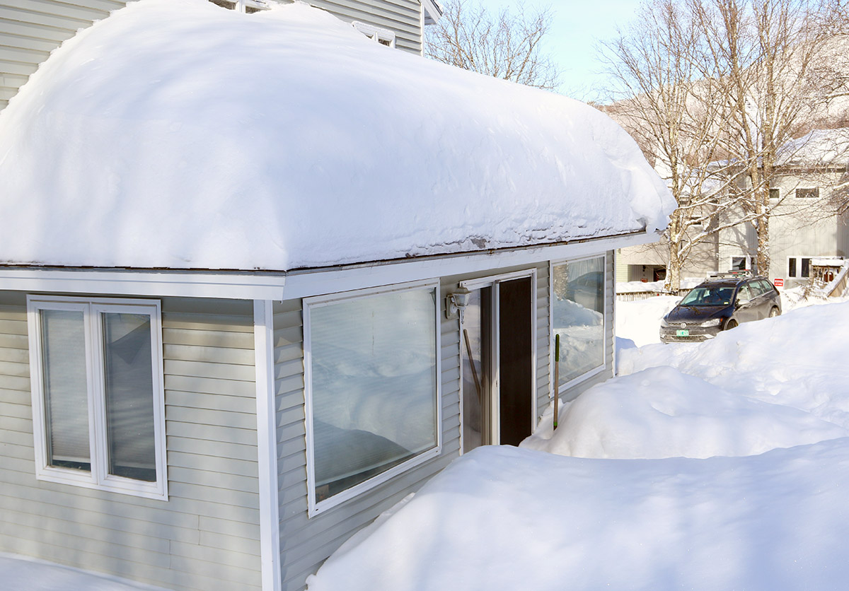
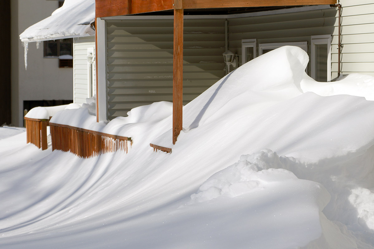
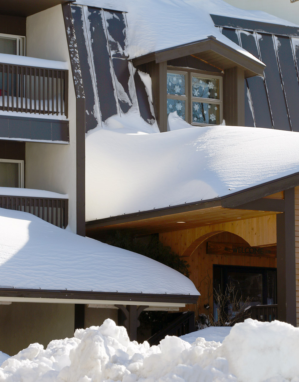
Hitting 70-80” snowpack depths is pretty typical for Mt. Mansfield and similar elevations in the Northern Greens in most seasons as the Mt. Mansfield Stake data suggest, with 80-100” depths a bit less common. Strong seasons will hit 100”+ snowpack depth with either the right combination of liquid equivalent and/or lack of large storm cycles with substantial warmth – I think last season was just above the 100” snowpack mark at its peak. With everything so evenly covered and buried, it can be difficult to get a sense for the depth unless you are in areas that have sharp wells to the ground as PF discussed or dig a pit like backedge showed. One approach that has always helped set up the perspective for me is warm season hiking above Stowe’s Cliff House, not too far from the area that PF describes in his post. When you hike up there in the summer among the car, truck, or even house-sized boulders and realize that many of those areas are actually smoothed over into snowfields that you’re skiing in the winter, it sort of hits home. Once you get up in that 100”+ range of depth, you’re at that height of a one-story building, so it’s not hard to see how all those huge obstacles can get covered. The image below shows summertime shots of some of the types of terrain features there that are covered, and then the bottom right of the collage is a shot of what it looks like in the winter when we were out with some of the kinds in our school’s ski program guiding them in the alpine. The next image is a great representation of how smoothed out it gets, and there are more winter shots of the area in my web page archives.