Go Kart Mozart
-
Posts
3,128 -
Joined
-
Last visited
Content Type
Profiles
Blogs
Forums
American Weather
Media Demo
Store
Gallery
Everything posted by Go Kart Mozart
-
Seems reasonable https://www.scribd.com/document/531730561/2021-22-Winter-Outlook
-
And of course, the control knob for our winter weather:
-
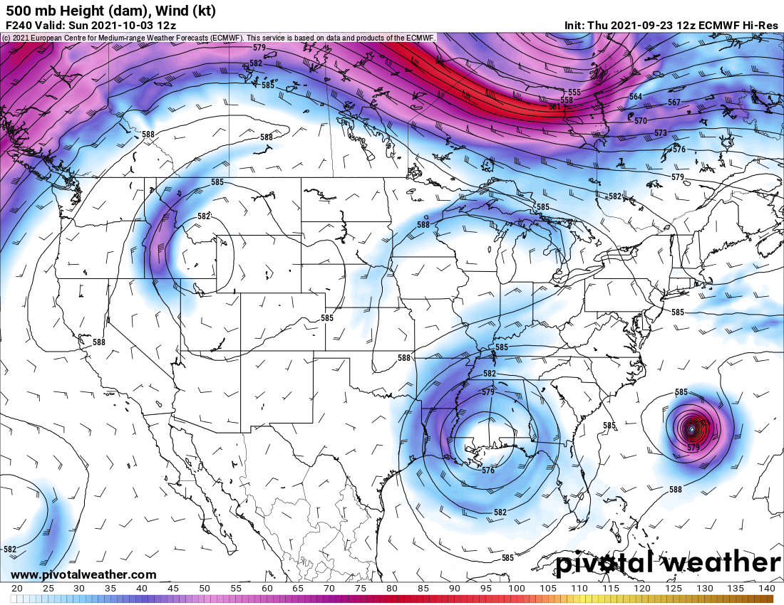
Taking day 10 Euro literally...does it make a hard right at Chincoteague?
-
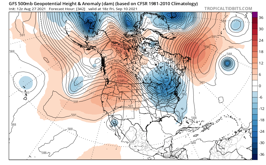
As someone who owns an insurance agency and hates landfalling hurricanes...this could be a nerve wracking 10 days
-
September Discussion Thread: Bring the frost; kill the bugs.
Go Kart Mozart replied to moneypitmike's topic in New England
Is Cape Race going to get boat-raced by Larry? -
We are in the same boat. Like the Boothbay area...but not much more snow there than here!
-
Any way we can tap into the vaccine microchip that has been implanted?
-
Central PA seems to be drying quickly now. A few good bands sweep through later,maybe some ponding on the poor drainage roadways.
-
Steinage so far within 15 miles of the coast. I'm going for less than 3" at BDR.
-
I dunno. This has not been a rainy summer here....even though it has been all around us. Steinage seems possible with the best forcing in central and northern CT.
-
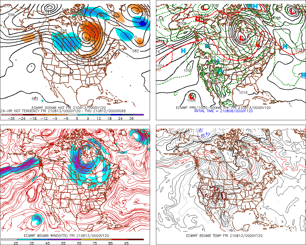
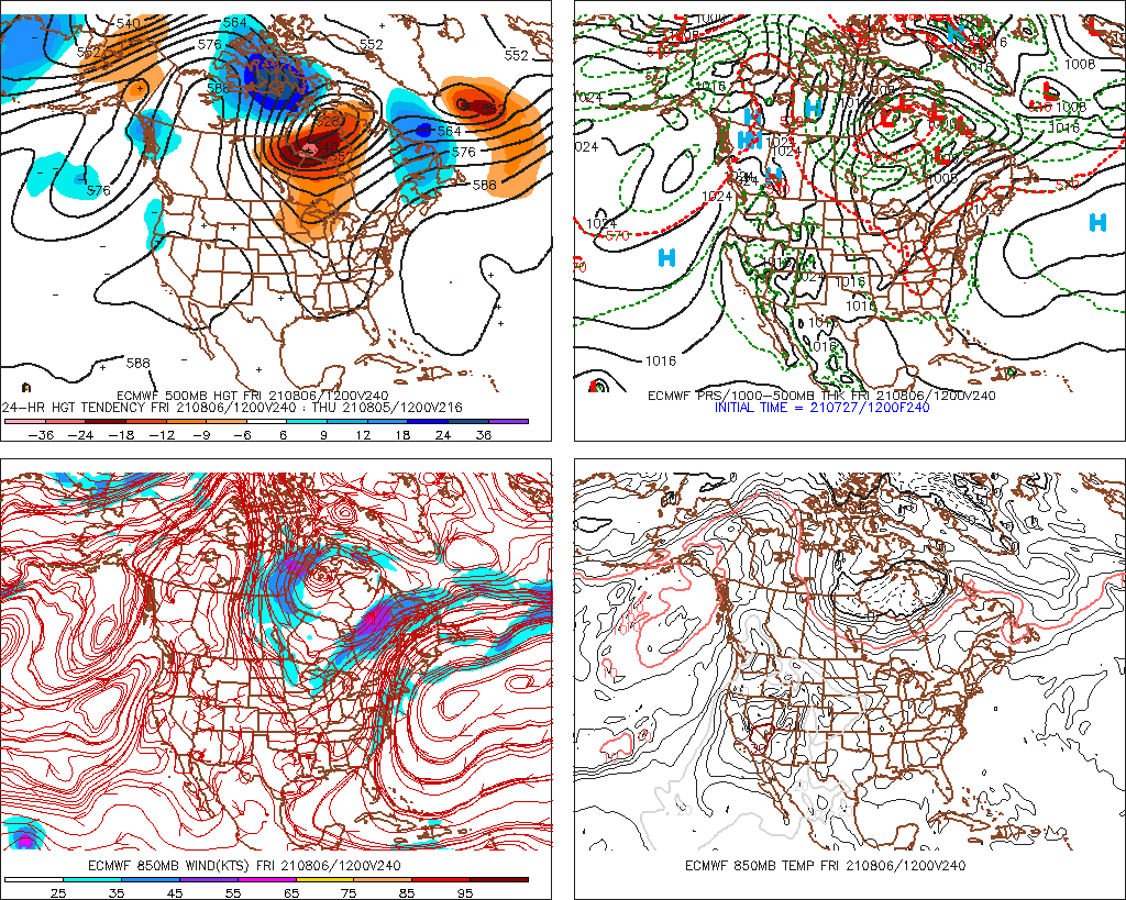
This could well match Henri for devastation.
-
August Disco 2021. Do record dews continue?
Go Kart Mozart replied to Damage In Tolland's topic in New England
Anyone here had FROPA yet? Please check the sky for a blue line with penant-like spikes facing to the south. -
August Disco 2021. Do record dews continue?
Go Kart Mozart replied to Damage In Tolland's topic in New England
This goes well into September, but yes please, and can we have this for a large portion of the winter?
-
It may not rain again here for the duration of this event.
-
Miraculously dry summer in Trumbull. Virtually every Tstorm complex has missed us, and now this. The mighty Pequonnock is running low!
-
May you enter the eye, big moose from Moosup (trivia test, anyone know who that was)?
-
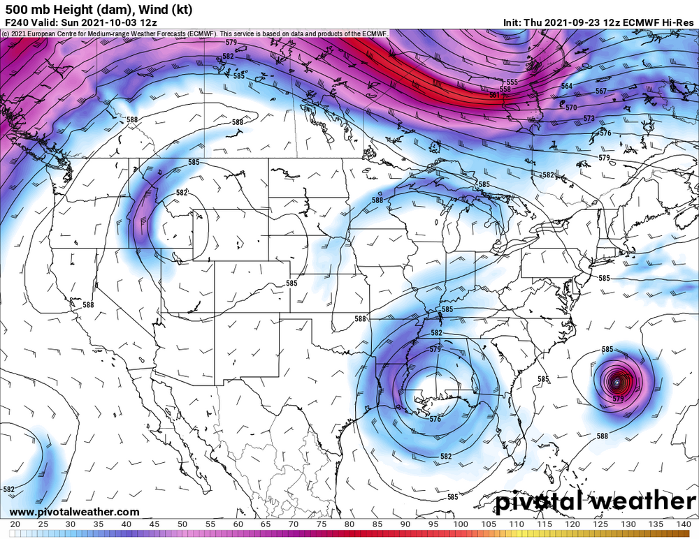
I'll take the NAM track for the blizzard of 22...how about Super Bowl Sunday?
-
If this thing injests enough air from the SE United States.....could it become a full-blown COVIDcane?
-
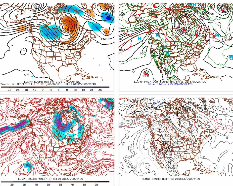
Nice to see some blue 850s show up on the last few euro runs. It's coming!
-
Is that a warm front visible on radar, running from about Utica to New Haven?
-
Better CAPE on the Cape?
-
August Disco 2021. Do record dews continue?
Go Kart Mozart replied to Damage In Tolland's topic in New England
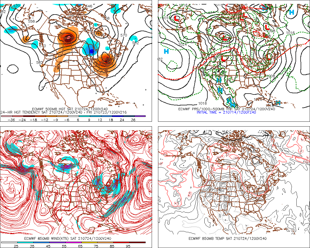
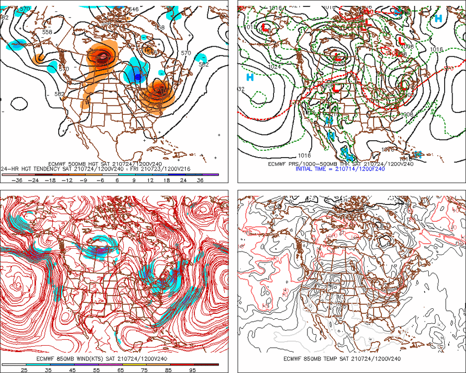
I gotta say these euro 10 day maps have been insanity for mid-summer. What's this...a three-stream phaser? Can we have this in winter, please?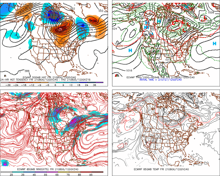
-
Not far from snow in the mountains...
-
It is a tired temp.
-
SWCT may suck for snow and T-storms. But we are underrated for fog!