Go Kart Mozart
-
Posts
2,643 -
Joined
-
Last visited
Content Type
Profiles
Blogs
Forums
American Weather
Media Demo
Store
Gallery
Everything posted by Go Kart Mozart
-
OK, I am back to seeing the "western guy", at least on my work computer. That was weird. It looked like a pic of the judge from the old TV show Night Court. I will have to check my laptop when I get home.
-
That's weird. On my screen I am seeing a pic of a 40ish year old man with glasses, no more western-guy.
-
Avatar change?
-
Weren't 93-94, and 95-96, considered to be "Pinatubo winters"?
-
Great squall just came through here. Who knows, best event of 20-21 for SWCT?
-
How much does one of those snow guns cost?
-
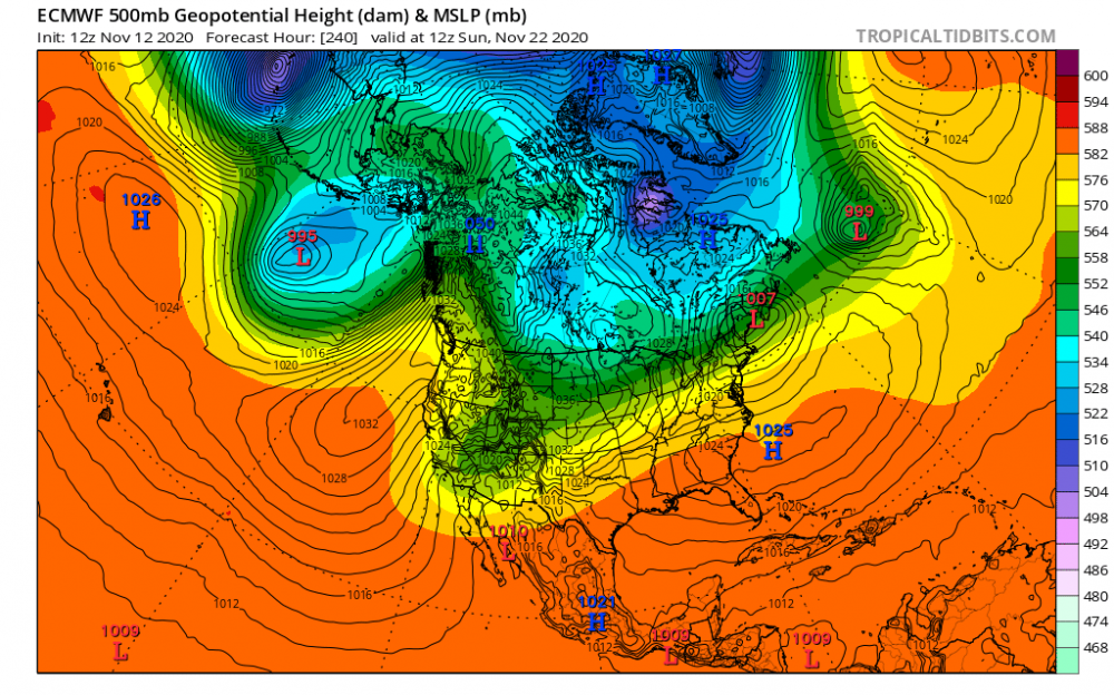
How 'bout this blocking on the day 13 GFS operational!

-
I always though an SWFE was a relativley weaker wave moving along a sharp thermal gradient. Wouldn't this be more of a robust Miller B? (Of course, academic exercise only, it is a 10 day op map!):
-
The models have been hinting at -nao for a while now, but the signal looks a little bit more pronounced in the most recent runs.
-
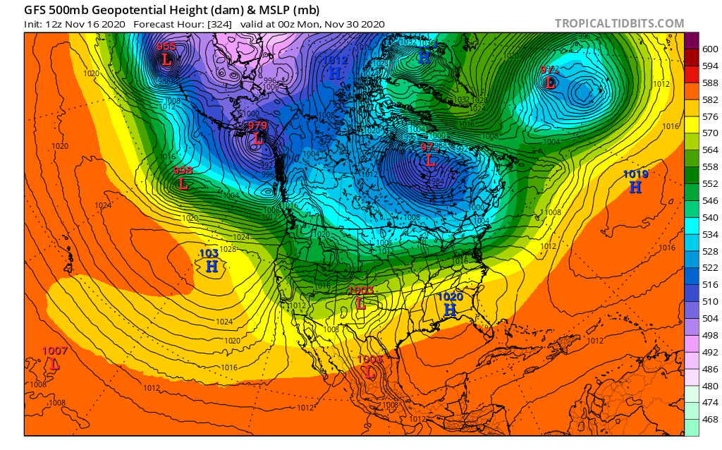
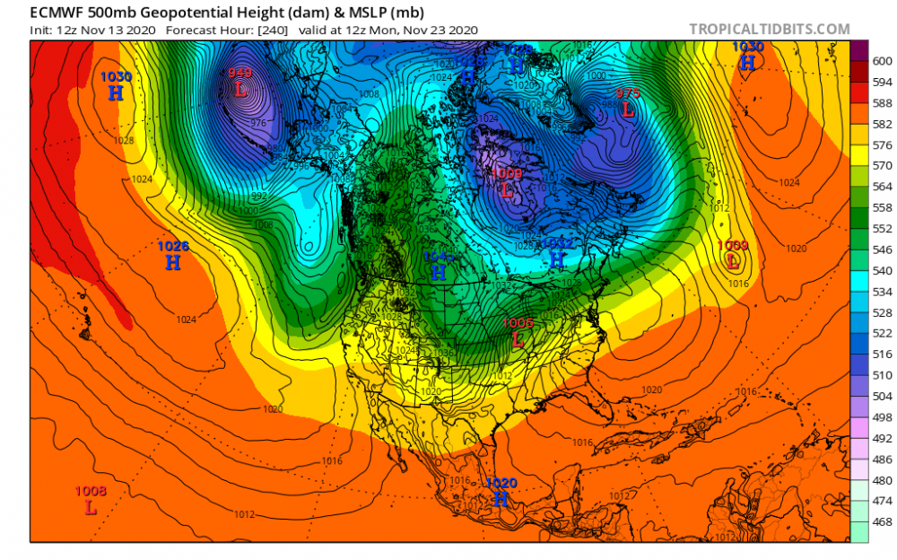
Speaking of lack of cold up north, I think this map is interesting. Some fairly well placed features...but deep cold almost nowhere to be found:
-
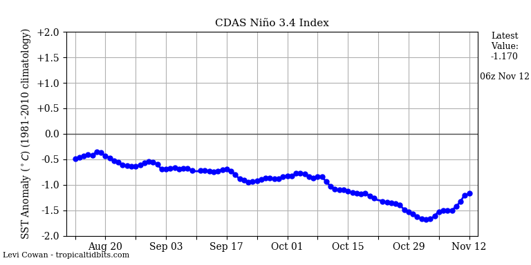
3.4 and 4 rallying?
-
Yes, you are.
-
What do you expect with the Hadley Cell expanding!
-
Is that East Booth Bay in the first pic?
-
Euro op and ensembles looking better towards day 10.
-
Interesting stuff Sebastian....drop by here anytime!
-
Yes, I've notice the "fold over -epo"...or whatever you called it....on the last few GFS runs.
-
In any case, the bright red over and to the northeast of Newfy beats the crap out of having the bright red over South Carolina!
-
That map indicates some in January too, though not as clear-cut as December.
-
Uh oh, let's hope it's wrapped up before spring.
-
I've seen research showing that it's the two years just after the nadir that give us our best blocking chances. My hunch is that the Pacific is rarely good this winter, but we will have periods where Atlantic blocking does the trick....saving us from a total ratter.
-
Were any of the cases at a solar cycle nadir?
-
16-17 we had 48" down here, including two double-digit storms. The February event where it went from 63f on the 8th, to a wind driven Tsnow event on the 9th, was tremendous. 12"-18" statewide in CT. So yes, we could do a lot worse than that!
-
Hazey, if this ridiculousness verified, can you imagine the La Suete?
-
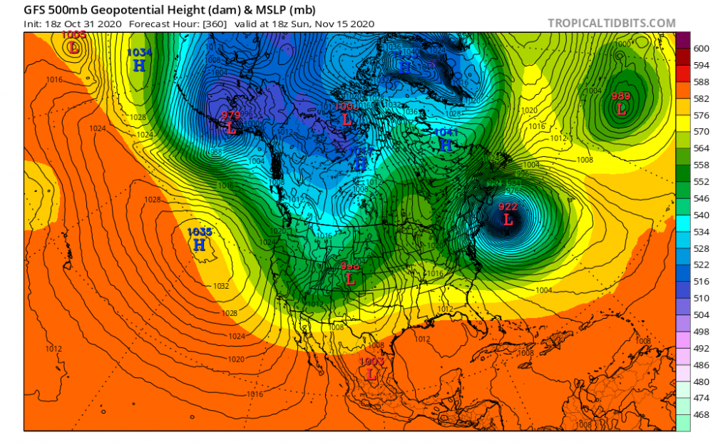
1041 high, and a 922 low. Is that what you weather folks call a gradient?