Go Kart Mozart
-
Posts
2,643 -
Joined
-
Last visited
Content Type
Profiles
Blogs
Forums
American Weather
Media Demo
Store
Gallery
Everything posted by Go Kart Mozart
-
Regrets for someone in about 20 mins
-
Canadian OD'd on Viagra?
-
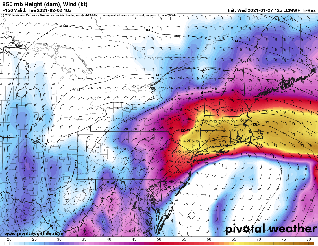
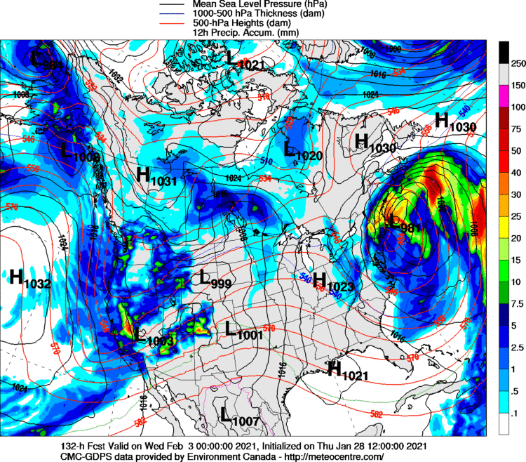
While the Canadian puts a 980 low over Nantucket at 132hrs....but I fear the ukie, euro often follows suit.
-
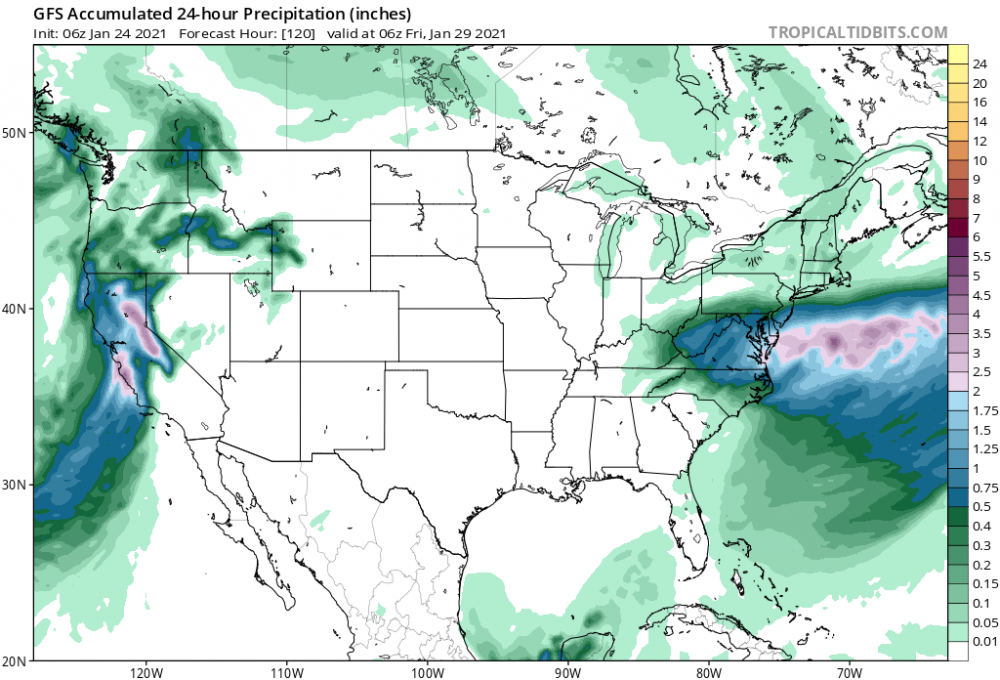
CMC bringing it to SWCT tonight.
-
Still good for SWCT.
-
Fetch me

-
Western ridge much higher at 126hrs on GFS
-
For those of you interested in discussing weather forecasting rather than how to measure your weenie, Tip has started a thread for this storm.
-
Euro precip field looks a lot like March 1958, in the KU book. That one had huge snows in NEMD and SEPA, moderate in NYC and CT, big agin into EMass.
-
So Scooter can also be called, "Son of Norlun"?
-
If you get a north wind with the 510dm lobe overhead, you can do quite well. No low level inversion layer.
-
James, the one thing I will say is that the Cape looks good for OES on Thursday and Friday. That lobe coming over your head is at 510dm, with a good northerly fetch, -20 at h850. Please give us the full analysis.
-
Then
-
Is that from last night?
-
Geez, I was thumbing through KU Volume I today....and that's a spitting image of March 1958. At the surface, that one was a primary over OH, redeveloping near Norfolk. The end result was not pretty for most of NE. 30"+ over SEPA and NEMD. Good hit in Poconos, with another max near Fitchburg. Also, I saw where K&U like the NAO block on the eastern shore of Greenland, not the Davis straight area.
-
0z NAM. lol at the Mid-Atlantic
-
After looking at the 12z GFS...it's on to February. Edit, it's on to Tuesday, lol.
-
As a blockbuster, sure. But we can move the blues 75 miles in four days and get the season's second best event for the south coast.
-
I am not giving up until 12z Monday. The 6z gfs has the Tuesday POS some 8-12mb weaker as it approaches the Azores than what was shown at 0z. Unfortunately upstream took a small step in the wrong direction. The vertical stacking my be too much to overcome in any case...but we've seen late moves to the north before.
-
The other problem is that the storm stacks vertically early and big. It would need to come very close to hit SNE...maybe north of Cape May.
-
18mb drop from 108hr to 114
-
Yup. Better upstream, worse downstream. I am afraid Tuesday's POS isn't helping matters.
-
GFS better through 90hrs. Sharper trof going neggy faster.
-
Any news from the 18z Euro?
-
For Thursday, we want the Rockies ridge to be taller, which needs a deeper trough west of California, which is influenced by the annoying meso-low near Kodiak Island, which is affected by the low coming off of Siberia...it's an endless chain! If we can finesse just one variable in the equation...anyway, it's a real long shot, I will toss in the towel if 0z Monday doesn't show big improvements.