TWCCraig
-
Posts
2,500 -
Joined
-
Last visited
Content Type
Profiles
Blogs
Forums
American Weather
Media Demo
Store
Gallery
Everything posted by TWCCraig
-
Quick little shower, the heaviest was to our north again but I'll take it. Just need the sun to come back out and we'll be in business again
-
Looks like a cell just popped up to our SW, already getting dark. Raining here now.
-
I've been trying to be more optimistic. Just glad that we will see some rain today! The fact that this is our first bona fide cold front is a plus. The sun has been peaking out so far, which could help destabilize more. Up to 77 here, 55 at Monticello. Don't think we see an inch today, more like 0.3"-0.7"
-
Front will sweep through around noon, last several hours. I think we will the see the most significant rain in several months compared to the very little amounts we've gotten. Anymore than 0.35" and it will be the best event since June. What an insanely dry period we're in here. Never seen so many trees wilting, and or dead. ISP has received way more rain than my location, so it's the second driest July 1-September 21 period on record there behind 2005. Would assume it's probably the driest on record for my location if we had long term data here
-
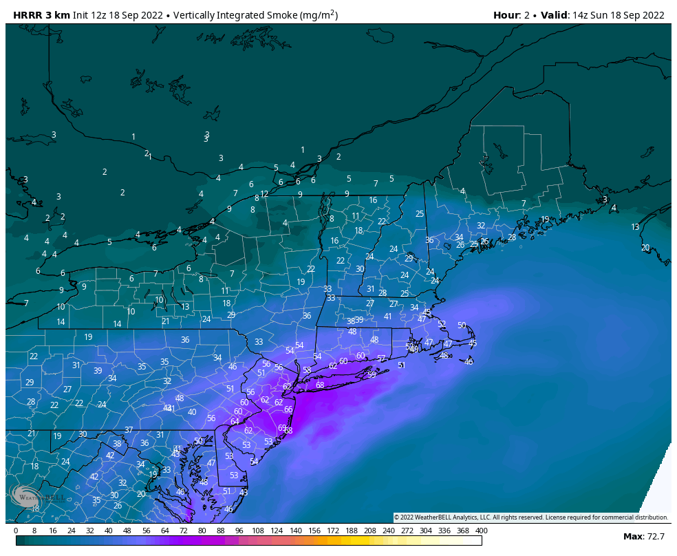
Off to a smoky start

-
Looking back at the radar, looks like I split the hairs here between two cells, probabaly only picked up around a quarter inch or less. It's something
- 1,529 replies
-
- 1
-

-
- hurricane
- tropical storm
- (and 1 more)
-

-
It wasn't enough for most vegetation around here. Honestly looks like October out there with all the stressed trees. Bad foliage season coming up like we had in 2020 when the salt spray from Isaias destroyed the trees around here
-
LA will get more rain in one day than we did all summer
-
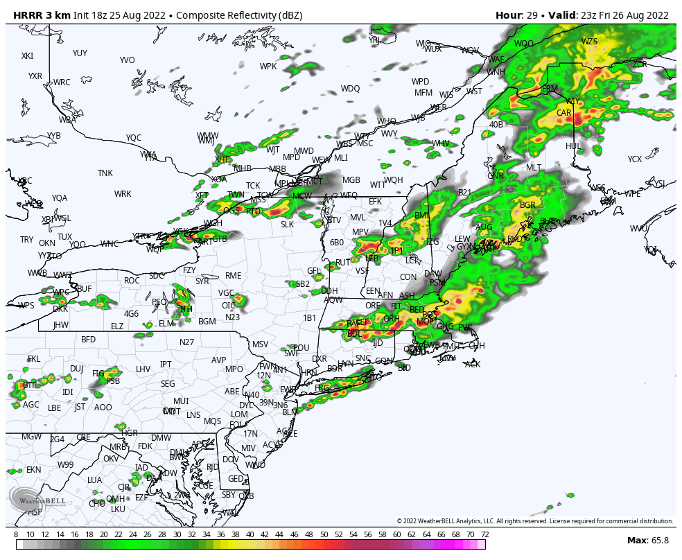
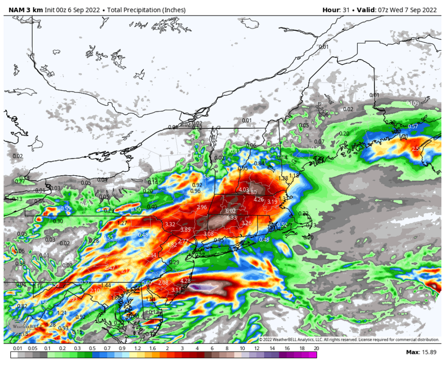
HRRR and NAM have some rain into the evening hours and tonight so hopefully we can add to the totals. It's almost no surprise that we have been getting the lower amount in all the events. You have to expect it at this point. I was never buying the bullish models for today. The potential for a dry slot was there
-
Seriously, after being skunked all summer, I'm way more excited for this than I should be. So glad it's raining
-
Yikes
- 1,529 replies
-
- 5
-
-

-

-
- hurricane
- tropical storm
- (and 1 more)
-
Just north of you, can verify we've had almost next to nothing in terms of rain this entire summer. We are in the driest spot on LI. Turned out to be a nice day. Lots of high clouds but enough sun for it to be a nice day though it was never forecasted to be completely overcast. 84 and humid
-
If it wasn't for the 1st of August being below 80 degrees, ISP would currently have it's longest run of consecutive 80+ degree days at 63 days. August 2022 was the warmest August on record at ISP as well. Number of Consecutive Days Max Temperature >= 80 for Islip Area, NY (ThreadEx) Click column heading to sort ascending, click again to sort descending. Rank Run Length Ending Date Period of record: 1963-09-05 to 2022-08-31 1 41 2010-08-11 2 33 2022-07-31 - 33 1966-07-29 4 30 2022-08-31 5 27 2019-07-22 6 25 1988-08-18 7 24 1995-08-05 8 22 2015-08-09 - 22 2012-07-18 - 22 1998-07-30
-
0.0" again 0.30" for August 0.78" since July 1st
-
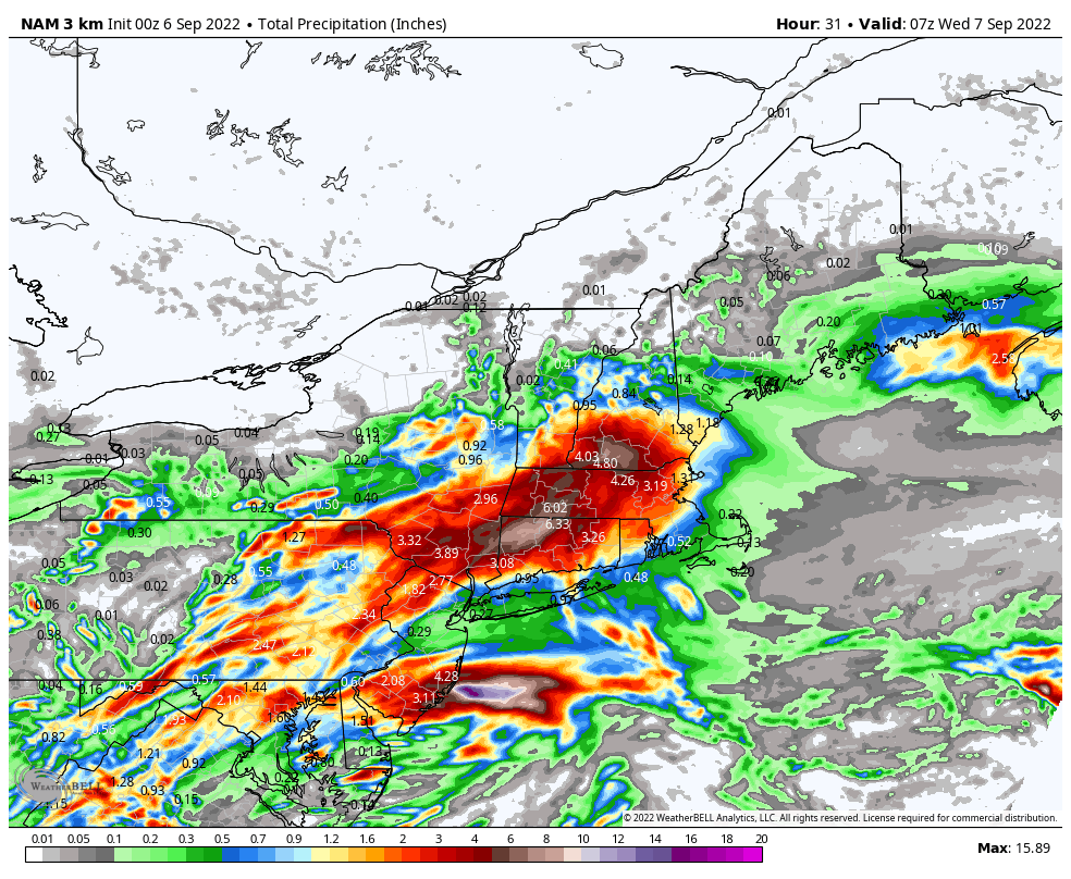
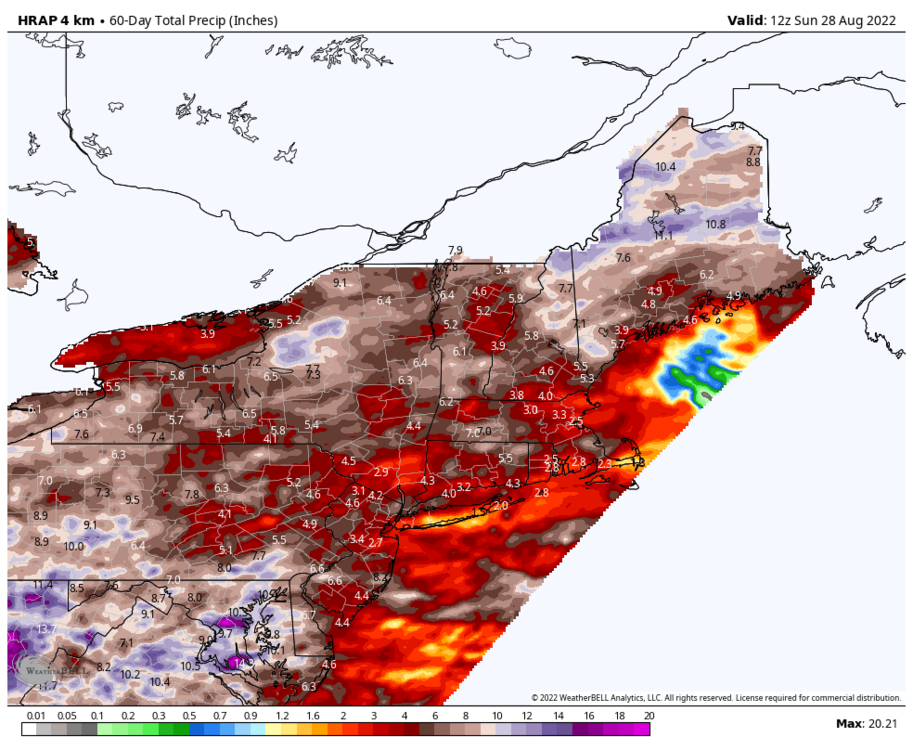
It's a bit high here too since FRG has only had 1.00" since July 1st. It'll blend the precip totals over a space since it doesn't have the resolution to pinpoint exactly where it has and hasn't rained. Though it is good to show where some areas have done better, and worse.
-
Rough estimate of precipitation totals over the past 60 days. Shows the south shore of Long Island being the driest in the entire region, on par with a portion of the Cape.
-
What site is that with the time-series summaries? The one @bluewave posts. I would love to find out the driest 60-day/90-day period for each of climate sites around here.
-
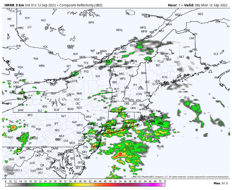
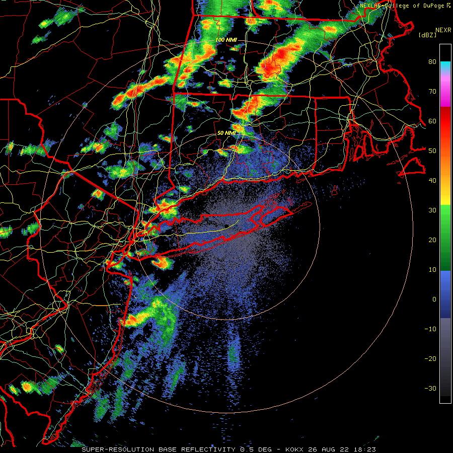
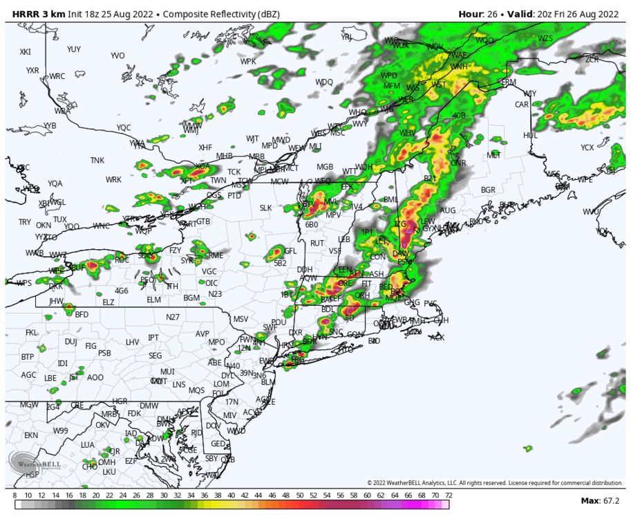
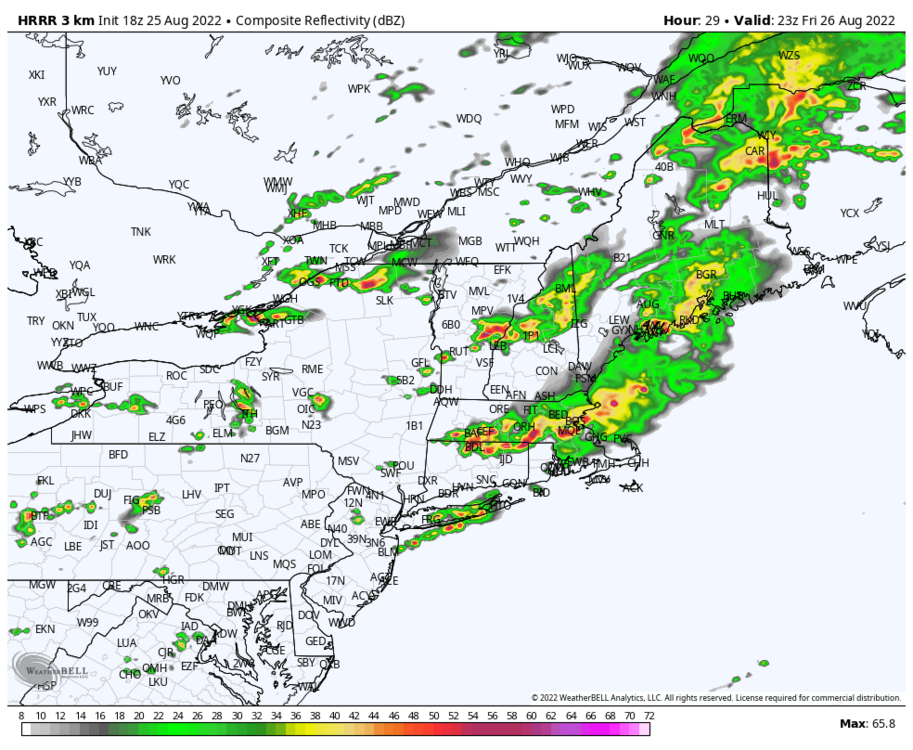
Looks like ISP will get hit with a storm, bringing their monthly total up. Storm just missed to my north. Bone dry here
-
That cell weakened a lot by the time it got here. Just a sprinkle here with the sun trying to come out already. It just doesn't want to rain
-
That cell over Long Beach looks decent. If only it would just hold together by the time it gets here.
-

-
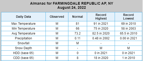
This is the driest July 1st - August 25th period on record at ISP. 1966 had 2.91" by this day. FRG has only had 1.00" since July 1st.
-
Can only hope the HRRR is on to something for tomorrow. Would certainly help bring some temporary relief
-
Oh ok, they must have not updated that site because it hit 91 on this day last year at FRG. But then again, FRG's period of record only starts in 1999