TWCCraig
-
Posts
2,500 -
Joined
-
Last visited
Content Type
Profiles
Blogs
Forums
American Weather
Media Demo
Store
Gallery
Everything posted by TWCCraig
-
That was a truly historic day. A foot of snow is nice, but a foot of rain is another beast. ISP holds the state record for the most amount of rain in such a short amount of time. It really was one of the most significant rainfall/flooding events ever in our area given the time frame and considering it wasn't from a tropical system.
-
Nothing but a few drops here, but the HRRR still pops a few cells later so it's not all said and done. The south shore of Suffolk County remains bone dry.
-
Jinxed it. Worst of it will be to my south on the beaches. Going to get some light rain
-
South shore might actually get some rain out of that cell
-
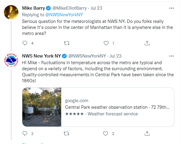
The difference is most notable in the daytime in the summer months, nighttime temperatures are more consistent with surrounding observations in the city. In the middle of winter, temperatures at the park are pretty consistent with surrounding areas within the city. In the late spring when trees leaf out, the difference becomes more noticeable. The argument is that the growth over the past couple of decades have made this difference more noticeable. I'm not here to debate whether this is the way it should be or not, but the environment around the park is not the same as it was 30 years ago, let alone 100 years ago.
-
In regards to the Central Park issue, this was OKX's response when someone asked about it. Wow
-
It does look too high of a number to be true and it's most likely wrong. I'll be honest, I don't particularly recall the water being that warm either, highest being about 81°. 84° would not be an accurate measurement of the average temperature in the top 5ft of the water column. Checking the data, the air temperature was cooler than the water on that day.
-
Depends on the summer but average water temperatures usually peak in August, sometimes earlier, sometimes later. It mostly depends on the weather though. Water temperatures are usually at their highest at the end of heat waves.
-
Just combed through the data. 44025 reached a brief high of 29.1 degrees celsius or 84.4°F in 2016. 44025 never had water temps above 27°C (80.6°F) until 2016, it also happened in 2020 as well. This heat wave will bring them very close, top 3 for sure. https://www.ndbc.noaa.gov/histsearch.php?station=44025&year=2016&f1=wtmp&t1a=ge&v1a=27&t1b=&v1b=&c1=&f2=&t2a=&v2a=&t2b=&v2b=&c2=&f3=&t3a=&v3a=&t3b=&v3b=&mode=sum https://www.ndbc.noaa.gov/histsearch.php?station=44025&year=2020&f1=wtmp&t1a=ge&v1a=27&t1b=&v1b=&c1=&f2=&t2a=&v2a=&t2b=&v2b=&c2=&f3=&t3a=&v3a=&t3b=&v3b=&mode=sum
-
At least the city (Central Park) is down to 93 lol
-
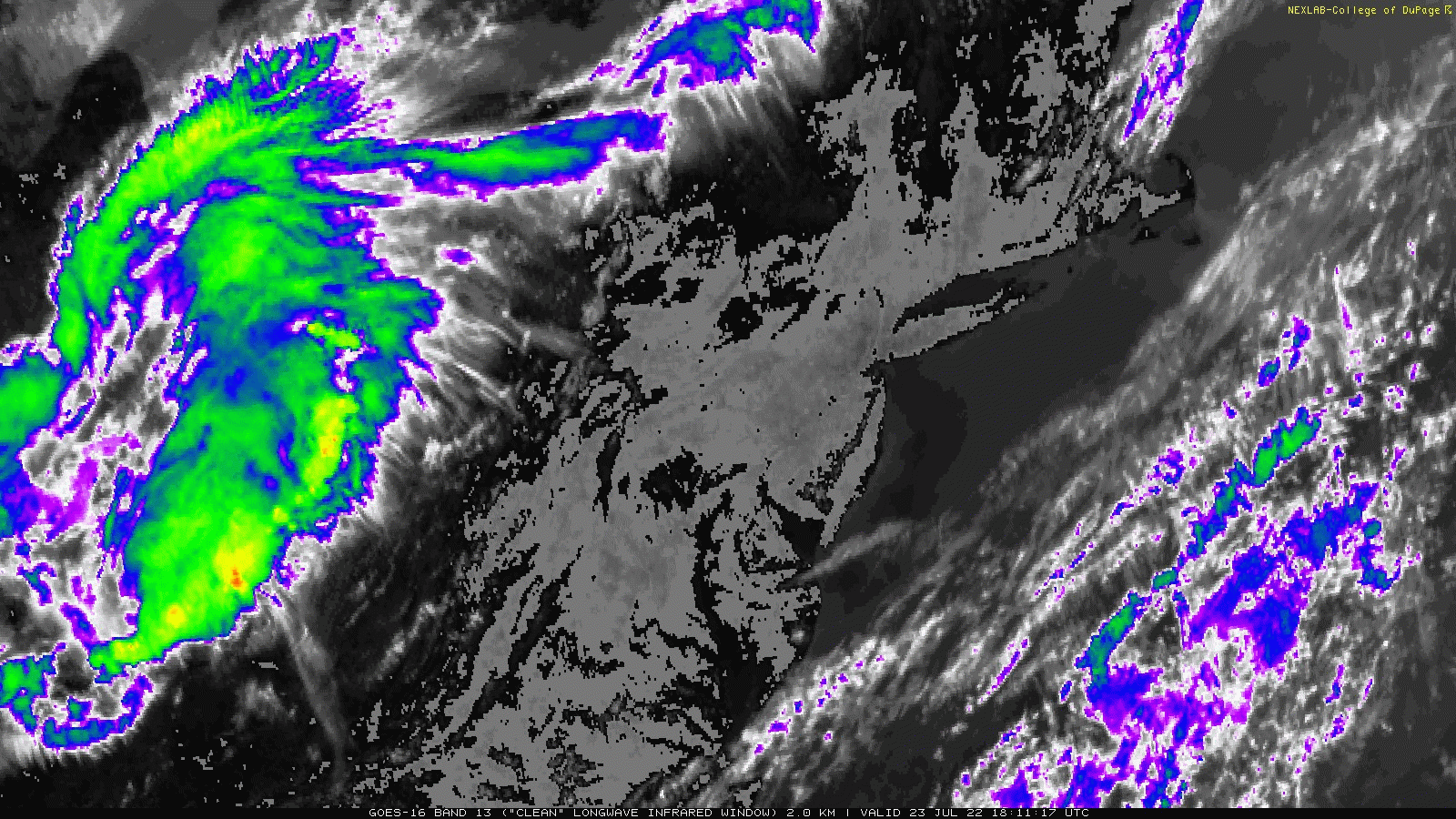
On a mostly clear, hot, and relatively dry day with minimal haze, the satellite picks up well on the heat at the surface. Surface temperatures are averaging over 110°F in some spots. 91 here on the south shore with a sea breeze.

-
Insane for LGA to reach a high temperature of 97 after 7PM
-
The fact that live TV stations like CBS and Lonnie Quinn still use Central Park as the go-to temperature observation for the city is pathetic to say the least. Everyone knows it's too cool and not representative of the city. It misleads some people to think it's cooler than it is, thus taking less precaution to the heat. They really had people thinking it's only 87 in the city when every site around it is in the 90's except JFK. They'd be better off showing the temperatures across the area from each station
-
48mph gust at ISP FRG also gusted to 48mph
-
Torrential rain, winds gusting 35mph or so. Thankfully not worse
-
Getting rain now, some wind as well
-
This looks like it's trying to push SE, might get clipped if it holds together. Outflow boundary is pushing south & east
-
North shore gets slammed again. Wish those storms came SE more, hearing constant thunder
-
ISP holding between 93 and 95 with a sea breeze, probably around 94 due to rounding in celsius between 35 and 34 celcius. Keep this in mind when reading in between the hour observations through Mesowest. Temps should decline now. LGA is at 95 as well JFK still at 93 FOK at 91, been holding since the sea breeze came through
-
Sea breeze has yet to drop temps significantly, just holding steady in the low 90s, slightly above or less depending on proximity to water. By 2pm they should begin to fall
-
Temperatures don't fall that much if the sea breeze front comes in before solar noon. JFK and Shirley both at 93 with SW winds. FOK capped at 91 with SW wind.
-
Yep, the sea breeze front already moved through here, easily picked up on the radar. 92 here. Cumulus forming along the sea breeze front as well.
-
0.03" yesterday. Not counting yesterday, it only rained once here in the past 3 weeks which was on the 14th. I think we'll go another week without any rain here.
-
I'm sure the average precipitation on the north shore in July is way more than the average on the south shore, though that's just a guess based off years of watching the weather. Marine stabilization and sea breeze boundaries always keep the action to the north of us this time of year.
-
It's all north of the LIE. South shore been dry as a bone. The north shore always gets rocked. It rained very lightly here 3 times, added up to pretty much nothing.