

cstrunk
-
Posts
589 -
Joined
-
Last visited
About cstrunk

Recent Profile Visitors
3,172 profile views


-
Pretty strong wind with very heavy rain with the line that moved through Longview this morning. My boss's shed landed in my backyard. Fences are fine so it went airborne.
-
That Day 1 upgrade for tornado probabilities is concerning for NTX and S/C OK since it will be a late night/early morning threat. Hopefully storm mode stays messy and it doesn't get out of hand.
-
Tuesday is definitely on my radar for threat to my local (ETX) area, but the highest threat seems to be into AR and LA at this time. BTW - The dates should be 3/4 and 3/5.
-
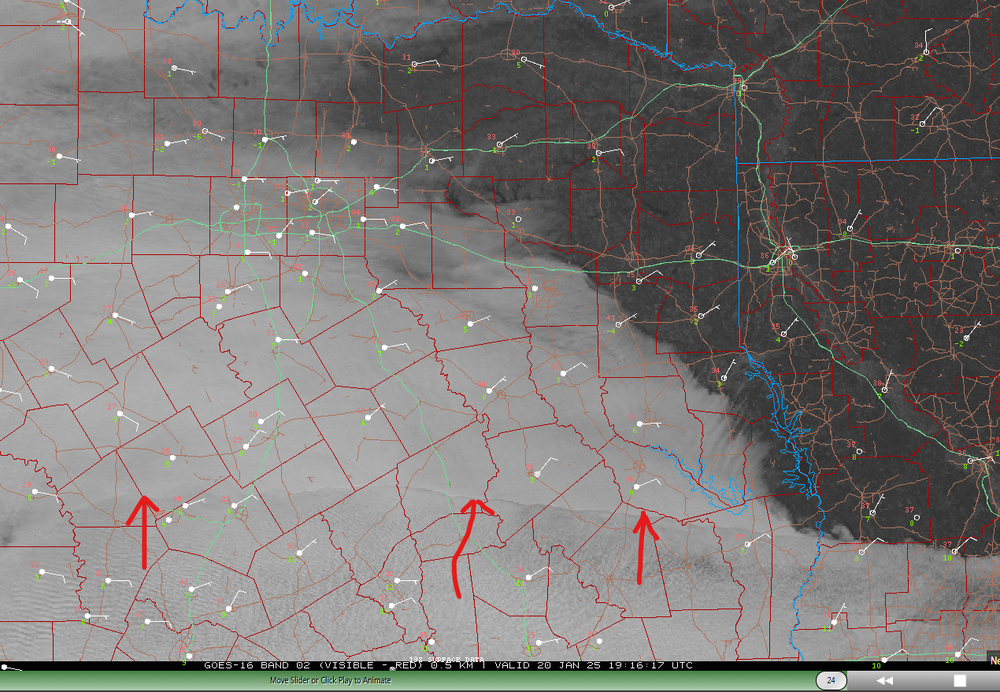
Interesting satellite imagery... can someone explain what this feature is that is rapidly expanding north? Seems like some kind of mid-layer moisture (causing clouds) advecting northward?
-
06z GFS has the storm on Tuesday the 21st now. 18" of snow in deep ETX.
-
Around 5:30 pm we dropped to 31.8F and stayed there until a little while ago, rose to 32.2F. About the worst possible winter weather situation.
-
Agree. WAA/warm nose wins.
-
Might be something around/after New Year's Day... according to GFS.
-
Changes coming later next week, it seems. Just in time for my wedding weekend.
-
Pretty common in Longview. Too many trees next to above ground electric lines.
-
 Luckily, none for me!
 -
I ended up with 1" on Sunday and 5.25" yesterday on the north side of Longview. The tornado warnings yesterday were something else.
-
At my house, I got 1.00" of rain on Sunday, and 5.25" yesterday from Beryl. Yesterday was pretty wild with all of the tornado warnings in E TX and NW LA. Winds were a little gusty at times yesterday afternoon, but thankfully we only lost power once for about 20 seconds and that was all.
-
Keeping an eye on Beryl...
-
I'm on day 8 in a row with measurable rainfall, with several multi-inch events within this span. Tomorrow morning will likely be day 9.


