bkviking
-
Posts
743 -
Joined
-
Last visited
Content Type
Profiles
Blogs
Forums
American Weather
Media Demo
Store
Gallery
Everything posted by bkviking
-
DCA: -1.6 NYC: -1.5 BOS: -1.3 ORD: -1.3 ATL: +0.8 IAH: +0.8 DEN: -0.8 PHX: +1.0 SEA: -0.3 DCA _ NYC _ BOS ___ ORD _ DTW _ BUF ___ DEN _ SEA _ BTV 25”—52”—60”—38”—50”—90”—60”—18”—90”
-
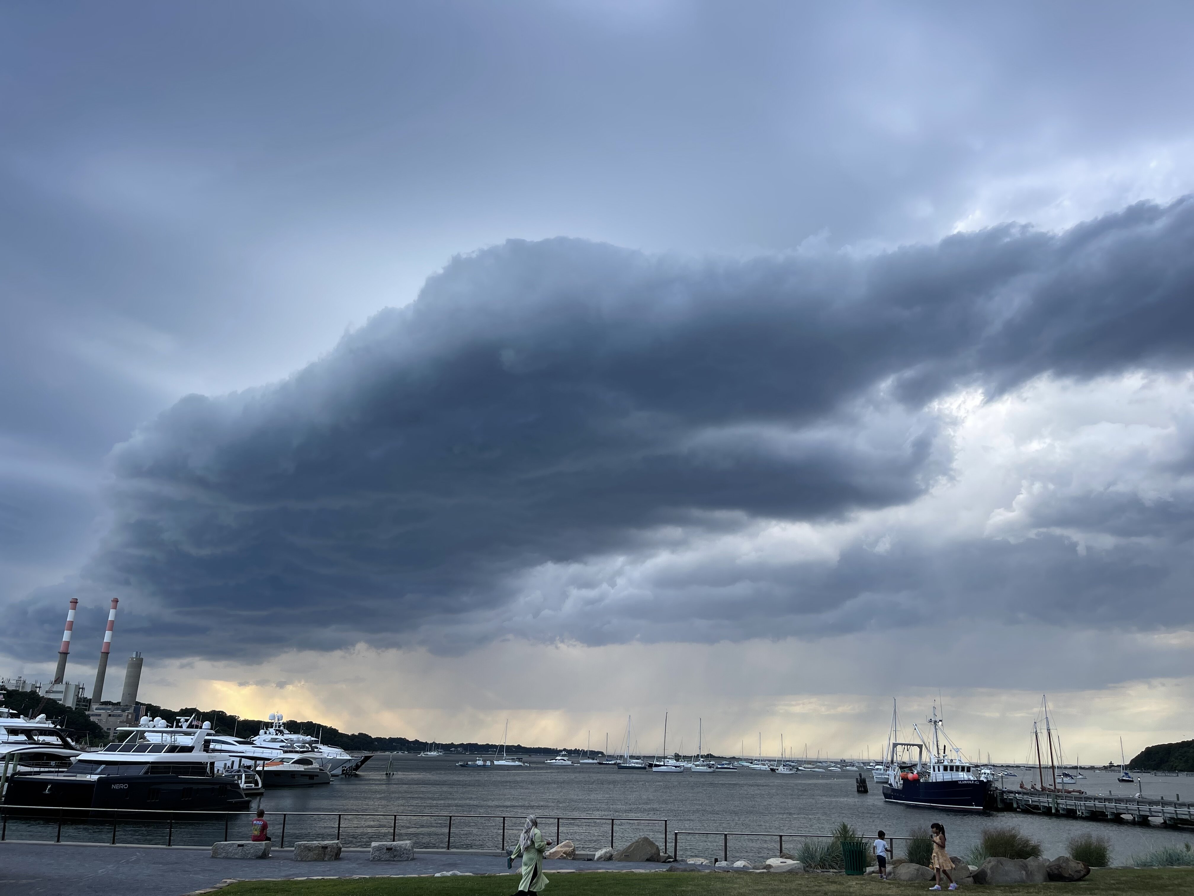
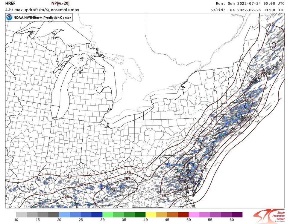
Radar quite solid now with large mass of convective type storminess heading northeast towards NYC/LI. Rains today have been that distinct tropical type rains - small little droplets
-
November 2022 temperature forecast contest
bkviking replied to Roger Smith's topic in Weather Forecasting and Discussion
DCA: +2.3 NYC: +2.4 BOS: +2.4 ORD: +1.4 ATL: +2.0 IAH: +1..5 DEN: +1.2 PHX: +1.0 SEA: -1.0 -
Sudden crash of thunder followed by lightning here in Smithtown. Wasn’t paying attention to radar past hours or so but it held together quite nicely …
-
Thunderstorms now moving in to eastern Long Island from the east.
-
October 2022 temperature forecast contest
bkviking replied to Roger Smith's topic in Weather Forecasting and Discussion
DCA: +1.0 NYC: +0.8 BOS: +0.2 ORD: +1.0 ATL: +0.6 IAH: +1.4 DEN: +2.5 PHX: +2.3 SEA: +1.9 -
Warnings here in Smithtown- I can see a swivel with the storm coming through. Looks nasty
-
Why is he being weenied? It’s truth
- 1,529 replies
-
- 2
-

-

-
- hurricane
- tropical storm
- (and 1 more)
-
Nudged up to .61” now on the Tempest. you always had best records of LI snow allocation— and I lived in heart of it in Miller Place for years attesting to your records . But now on Stengel so yes nice short walk to Sweetbriar.
- 1,529 replies
-
- 1
-
-
- hurricane
- tropical storm
- (and 1 more)
-
.55” from this stationary storm by me in Smithtown (by Sweetbriar). Glad I didn’t water the veggies.
- 1,529 replies
-
- 2
-
-
- hurricane
- tropical storm
- (and 1 more)
-
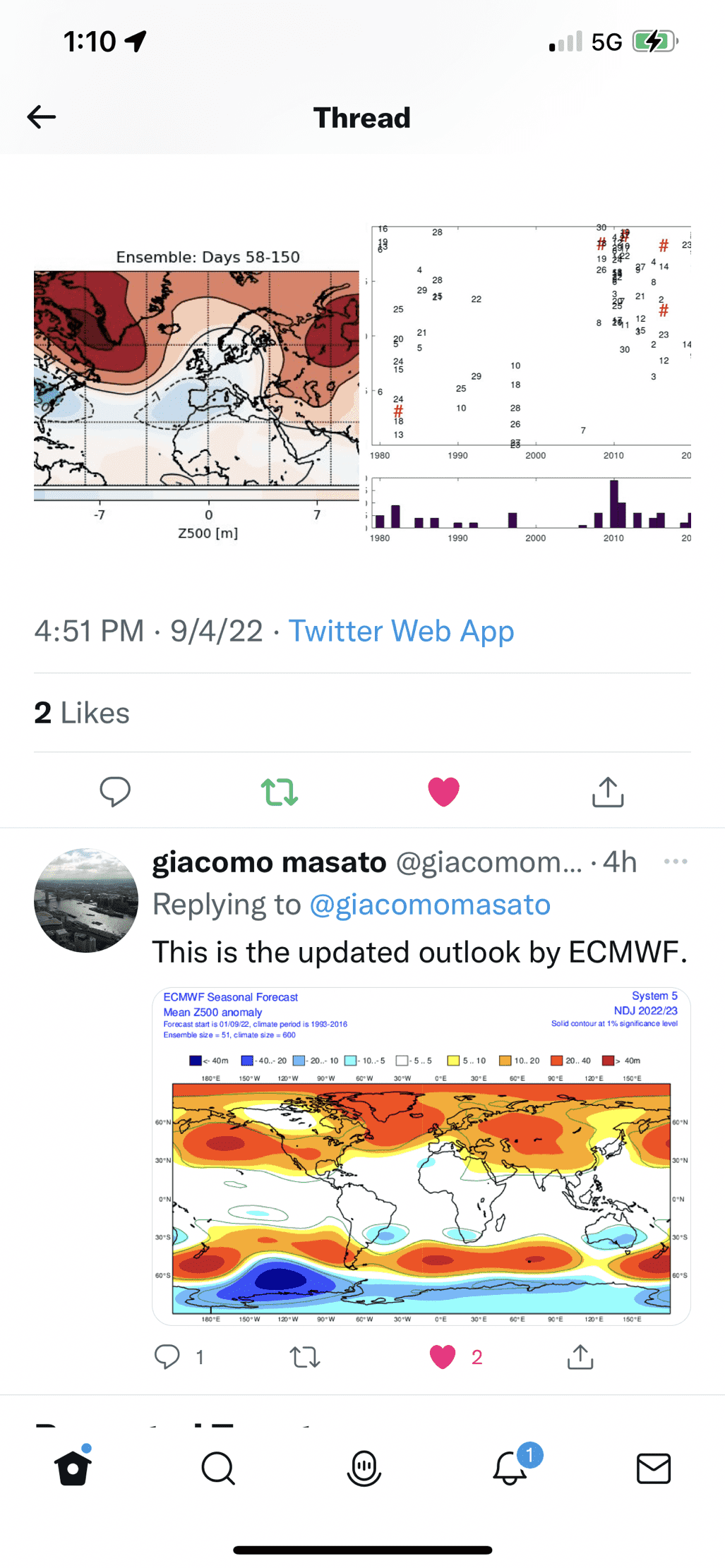
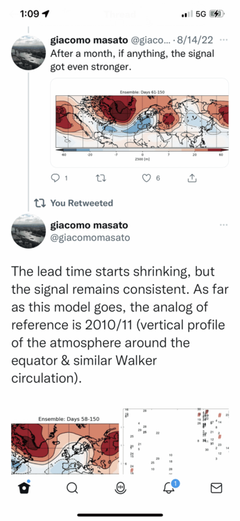
From Giacomo:
-
DCA: +2.0 NYC: +2.2 BOS: +2.2 ORD: +1.2 ATL: -0.7 IAH: -0.9 DEN: +1.9 PHX: +0.7 SEA: +3.0
-
Looks like it’s about to pull two straight rain outs in Port Jefferson - tonight I did not expect at all ! Advancing showers heading to Port Jeff Village

-
Heavy rain here in Smithtown. Although I haven’t lacked for rain all summer , hooray for this one!!!!
-
My station in Smithtown 94F/78DP
-
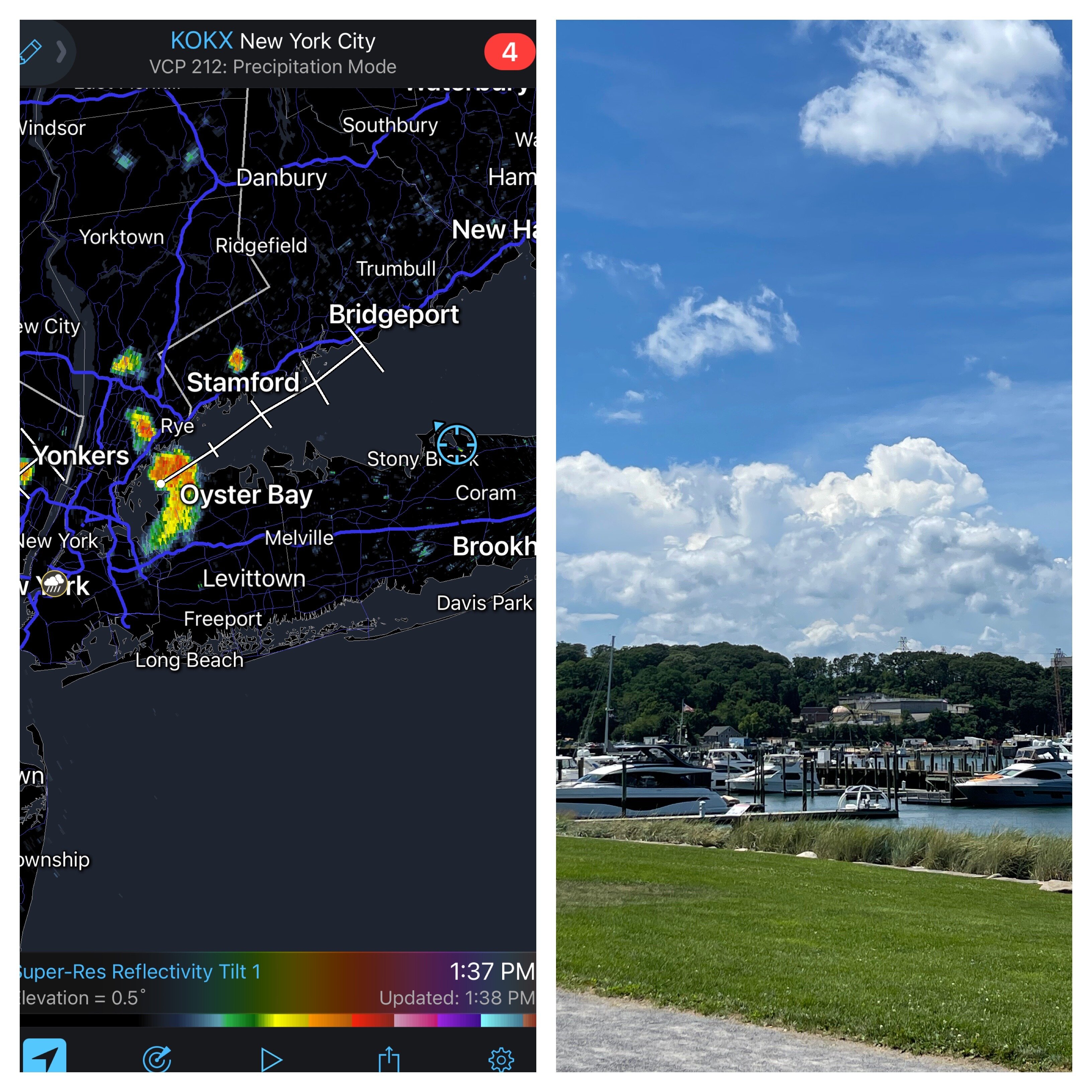
87F/76DP at home in Smithtown see bubbling cumulus west of me in PJ Harbor - and matched radar .
-
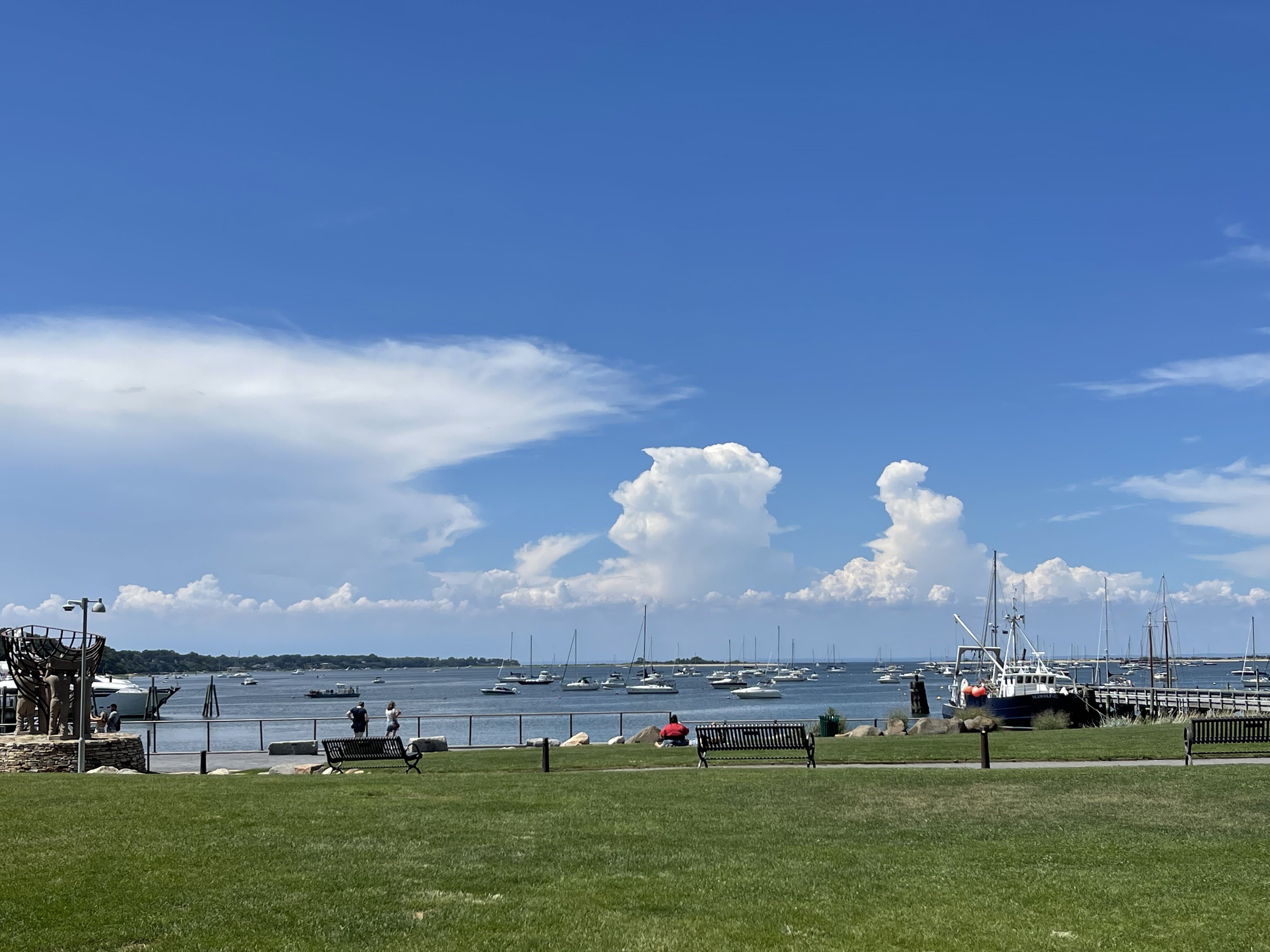
That’s odd - I took video clip of that yesterday - it was a little further south than one above… IMG_2131.MOV
-
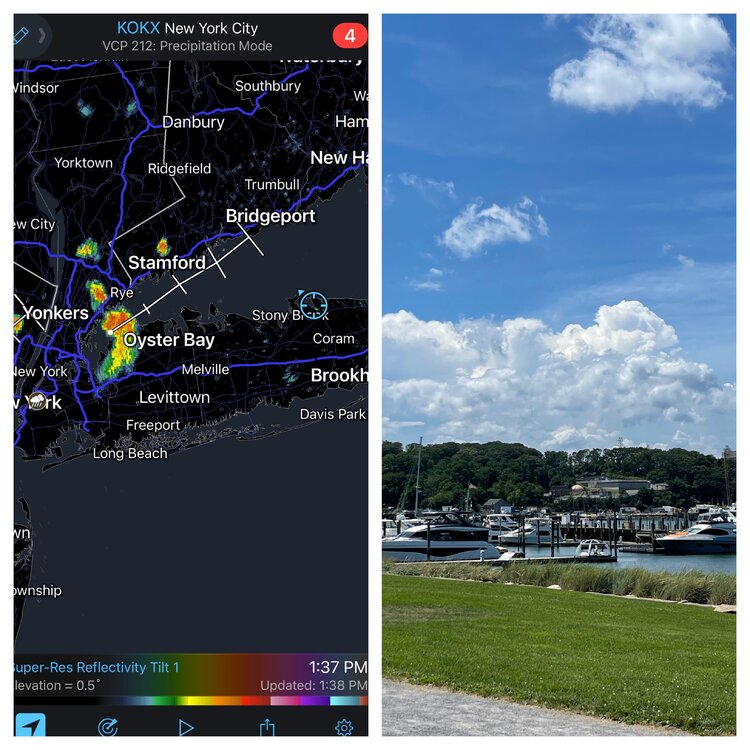
Actually pretty nice out in Port Jefferson like PSV said - pretty nice breeze - tropical but nice in shade especially . Btw, photo below from Port Jeff harbor attest to the tropical Feel - looks more like Florida or islands :

-
My part of Smithtown 12:25pm 88°F /72°DP/95°HI
-
August 2022 temperature forecast contest
bkviking replied to Roger Smith's topic in Weather Forecasting and Discussion
DCA: +2.2 NYC: +2.2 BOS: +2.5 ORD: +2.7 ATL: +2.6 IAH: +2.4 DEN: +2.0 PHX: +2.0 SEA: +1.3 -
Smithtown 93°/74°. Pretty brutal . Worse than yesterday. Didn’t expect this.
-
Smithtown : 92°/69°
-
From Ginx in NE Forum:
-
I’m on north shore of Long Island. I’ll wager above 1” based on how things are working this summer.
-
Since Heatwave began my spot In Smithtown 7/23: 97 7/22: 94 7/21: 89 (Severe storm) 7/20: 97 7/19: 93