Heisy
-
Posts
9,030 -
Joined
-
Last visited
Content Type
Profiles
Blogs
Forums
American Weather
Media Demo
Store
Gallery
Everything posted by Heisy
-
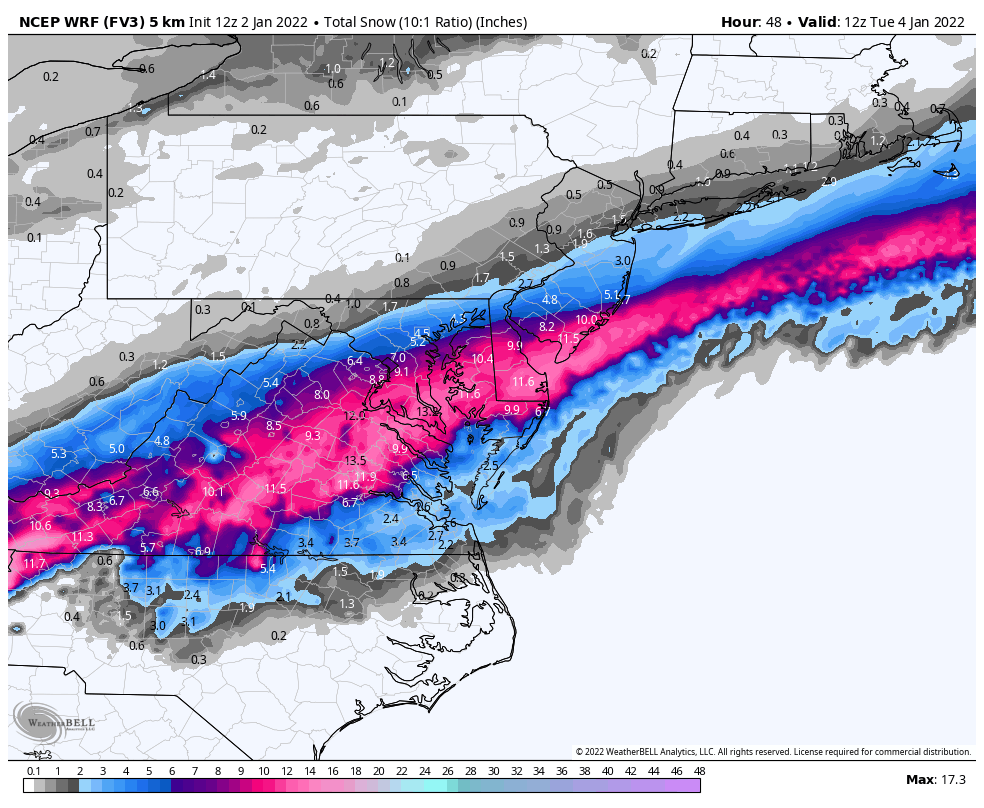
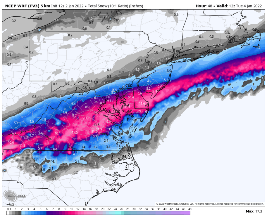
Mother of God.jpg
-
From my understanding a night or two from the event the Mrf was pretty far south with precip just skirting the city
-
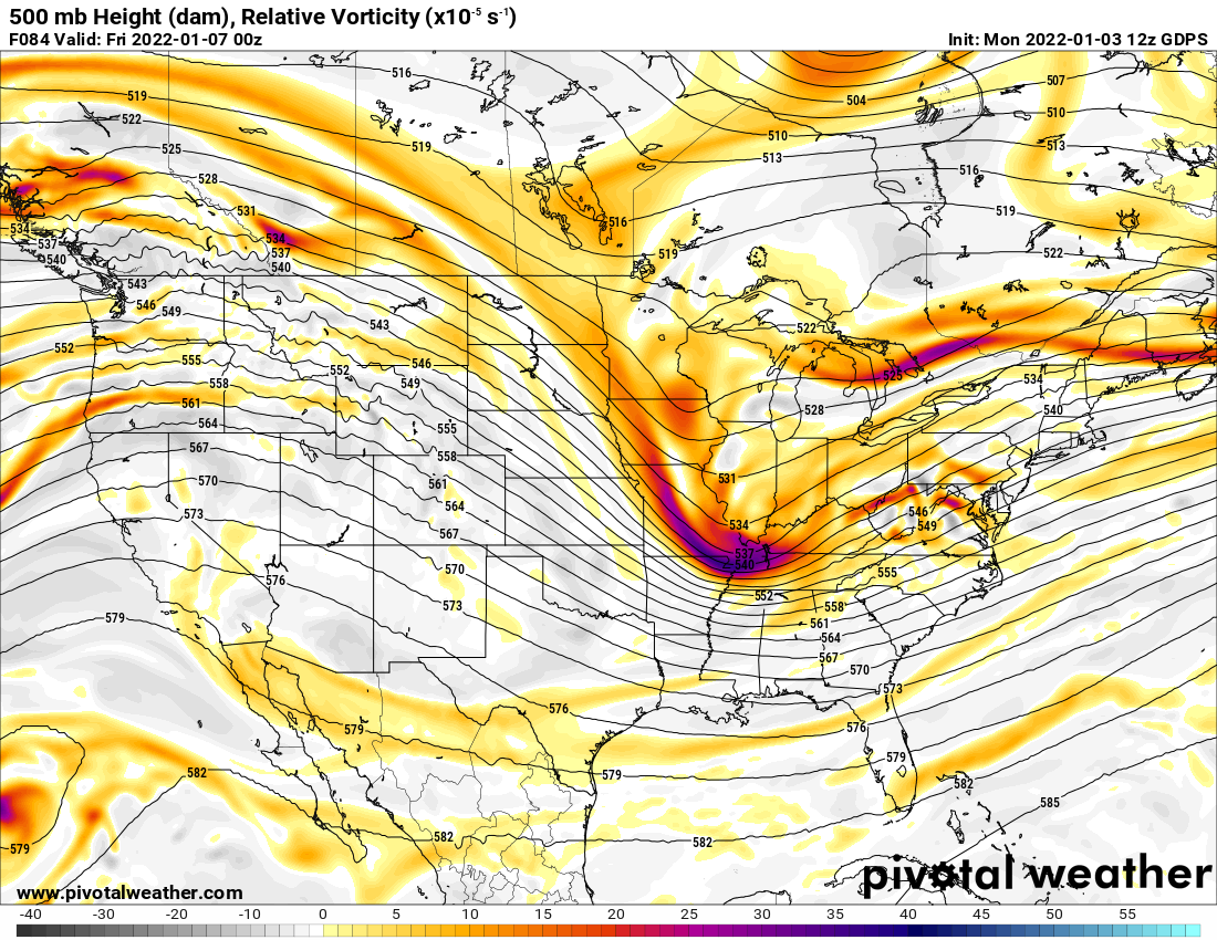
12z cmc was actually setting something up as well for the same period the gfs has this monstrosity. Just fun and games for now
-
My first year on the forums (Wright-Weather) was winter of 2000-01, what a crazy winter to get the hobby started. I was 14 at the time, I remember watching a segment on the 6PM news from Hurricane Schwartz down here in Philly. It was early to mid December at the time. He was talking about an upcoming pattern change and something called a NAO. I did a google, uh, maybe askjeeves search and the test was history... That winter started off with a major cold front in mid to late December which lead to the block forming in the Atlantic. This eventually lead to the dec 30 2000 event. A week or so before that event the models were showing a HECS Miller A. It eventually turned into a purely Miller B ULL. @Jiprobably doesnt remember this, but I was up all night watching the radar during that dec 30 event. We spoke on AIM and he told me how he could see still see the stars outside which was a terrible sign. DC was supposed to get like 6-10" and instead got partly sunny. That season also had the infamous March 2001 bust. All in all it was actually a decent winter in philly. I understand @Bob Chill not getting invested on LR op runs. Personally, I still cant help it. During Nov-April I check each model run during the day. I will stay up late for euro during if theres a big one approaching. I can't help it. The lows way out weigh the highs, but that's the beauty if this hobby. The big ones are rare, but when they happen theres no better feeling as a snow enthusiast.
-
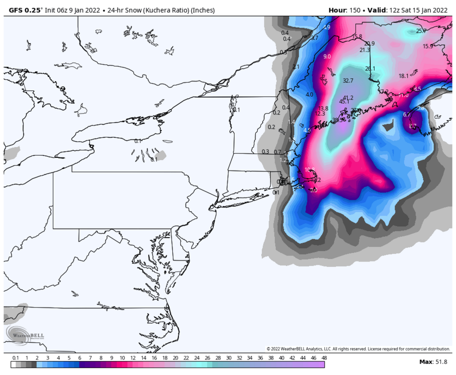
The band up there reminds of last years Feb event down here in philly. Radar signature almost identical.
-
Pretty good classic redeveloper look there especially with the confluence and HP setup. Fun times ahead hopefully
-

January 7th First Snow for some N&W folks Discussion
Heisy replied to ChescoWx's topic in Philadelphia Region
There going to be an annoying snow hole somewhere in E PA from the coastal taking over. -
Considering the sref mean 24 hours out for mondays event here in philly was 11 inches I agree haha
-
Hey @psuhoffman

-
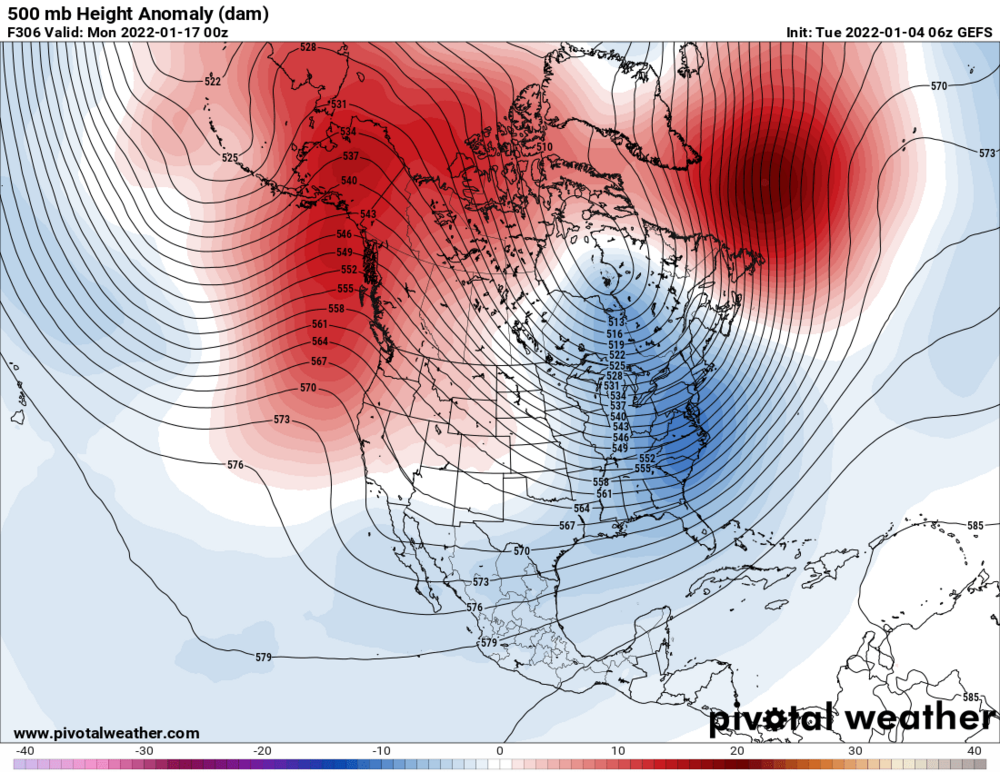
GEFS pretty sick in the LR
-
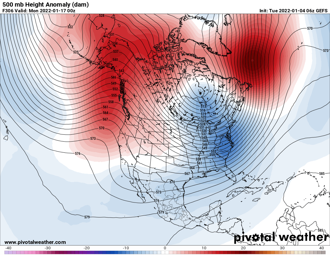
Completely fine with where the euro is at this point. Tends to do this a lot at this range. Wont take much for a slightly sharper trough. Also, check out the GEFS for mid to mid/late month, could be a pattern we havent had in a while, pure arctic.
-
Yep, want to be SE if city for this one IMO. Hoping for a solid 4-7" winter storm warning Thursday though.
-
Looks like it was a nice hit in SNE

-
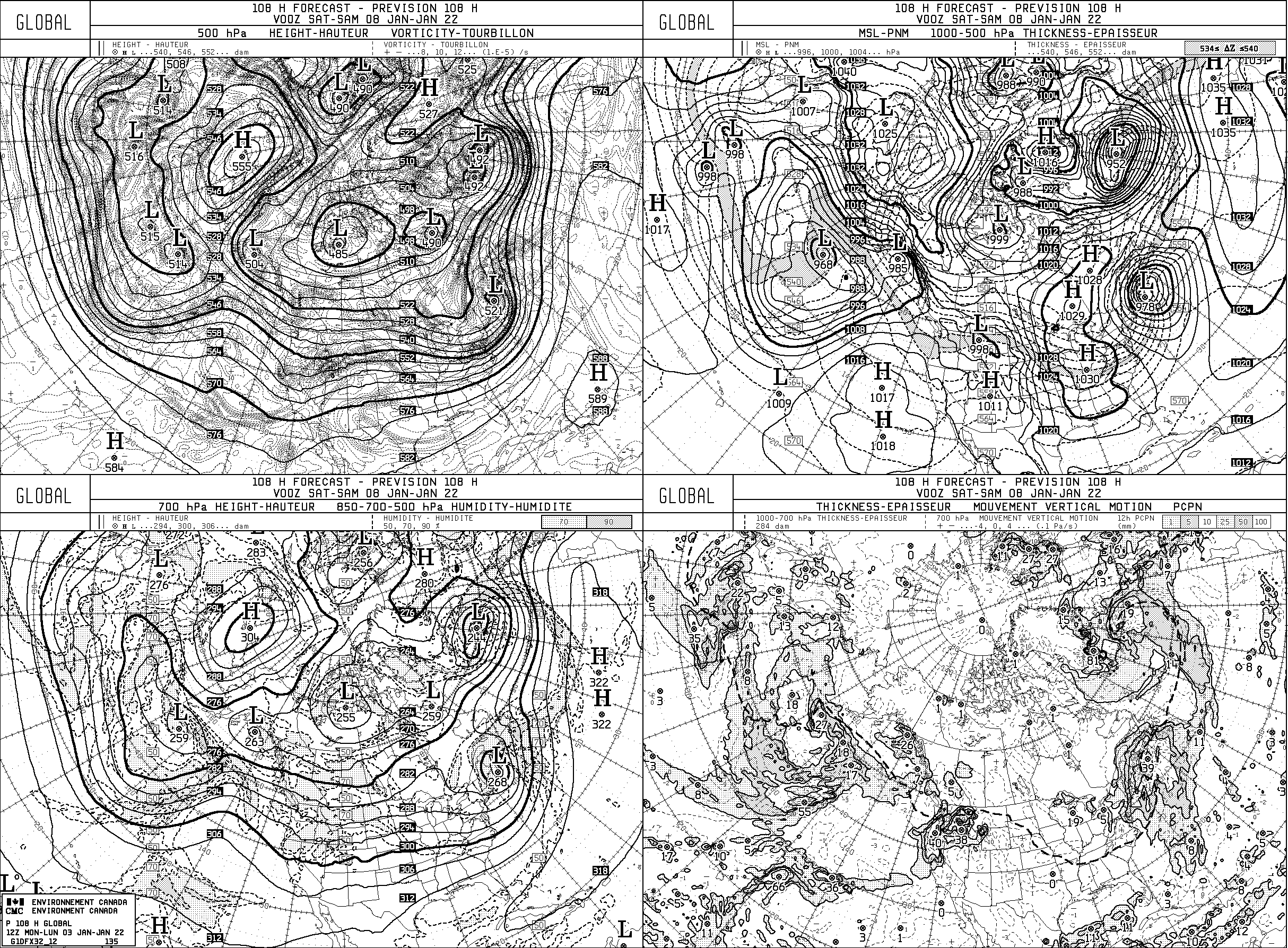
Cmc bit more progressive vs 00z. Sorry for the old school graphics

-
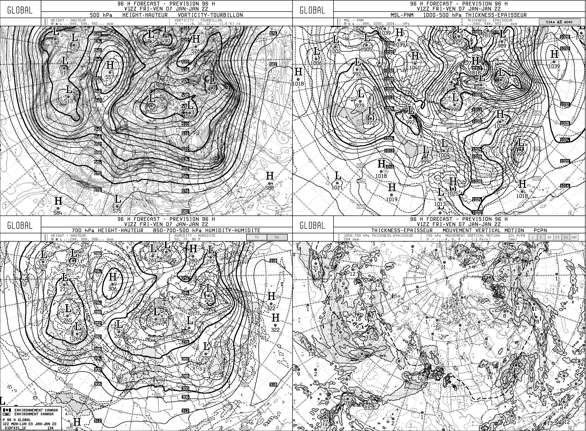
12z cmc more progressive

-
Radar just blew up over VA, S NJ and S DE gonna get crushed
-
Cmc looks like a bomb on the black and white maps
-
So do you go with a forecast of cloudy skies and lean NAM or 4-8" with euro, haha this hobby never easy
-
Might do a mini chase tomorrow well see. Rates somewhere in DE and S NJ should be pretty good for a few hours
-
Stealing this from my region, thanks Tony, but this is the model that will be replacing the NAM soon. Let's see how it does...
-
The Ukie is out?
-
Ukie on board too pretty much, would really like the euro to join the party for once under 5 days, well see...
-
This wave has been on the models for two plus days now. It will be there at 12z, though that doesn't mean it will show snow. Easy to be negative right now, I dont blame you, but this is probably the best threat if the year so far imo
-
Nam is really interesting at end of run. It nailed some events last year at its end range