-
Posts
9,030 -
Joined
-
Last visited
Content Type
Profiles
Blogs
Forums
American Weather
Media Demo
Store
Gallery
Everything posted by Heisy
-
Probably way overdone on the Nam obviously, but you never know, it nailed 2016 when every other model was farther E
-
I remember chasing to C MA for the 2013 event. Great event but S of me crushed. Then 2015 I head to RI and the goods go back to C MA Each storm I chased I went to where the model consensus was for the best totals. You just never know. Last December I chased to Lewishburg PA and models kept bumping N. I'm headed up there tomorrow with the girl. Can't wait! Haven't decided on a destination yet but it will likely be somewhere in SE MA. I honestly think that I may have seen more snow fall at my location, wherever that is, then any person in the country. Guinness WW are you listening?
-
Pretty painful that just the small change of having the wave eject faster would have locked up this storm as a HECS. As is there is still potential for a large event. I plan to chase as long as we don't see any more substantial shifts and the euro holds. SE LI could could a destination for me
-
Top 3 worst winter of my life. I can deal with no snow, but to get constantly teased by the euro is an absolute nightmare
-
Been a long time since we got NAMED
-
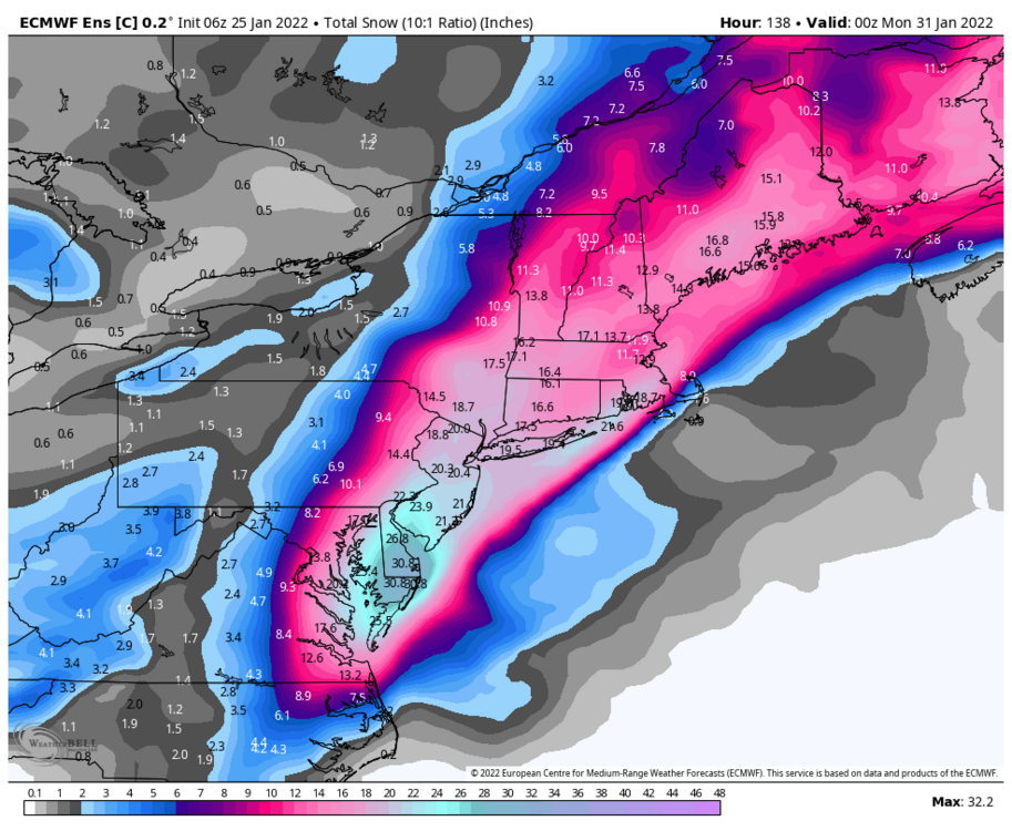
While you guys up in SNE can cash in regardless of early track the euro is really the only model showing this type of snow down here in Philly. I would urge caution right now with it. Early on in the run it looked like it was going to actually tick east. It held back more energy. It has caved towards other modeling many times this year, and for some reason during its off runs it seems to double down before doing so. You guys should do damn good regardless though. Even eastern adjustment SNE would crush it still
-
-
6z euro looked better at the end of the run, but it did tick towards leaving more energy behind. It's just impossible to trust this model right now unless we see some support from other guidance. I think the wave will be on shore by 18z today. Might help guidance sampling
-
The 12z control did what I was hoping the OP was going to do. If only a little more energy headed east from main shortwave it would had
-
This wave has huge importance to this storm (don't hate my photo editing skills). The 6z eps/euro/control actually pushed the main wave farther west towards four corners, but this second shortwave drops down and helps ignite everything. The control is an example of what could go wrong with a late phase. It still is a decent run verbatim.
-

Late January and February Medium/Long Range Discussion
Heisy replied to WinterWxLuvr's topic in Mid Atlantic
Wow good find, h5 looks very similar.- 4,130 replies
-
- prime climo
- cold canada
-
(and 1 more)
Tagged with:


