

marsman
-
Posts
459 -
Joined
-
Last visited
Content Type
Profiles
Blogs
Forums
American Weather
Media Demo
Store
Gallery
Everything posted by marsman
-
I'm traveling for work and will be out of town on Feb 3rd. Locked in.
-
-
Still coming down and blowing in eastern Carteret and OBX. On the security camera it looks like a 1' snow drift on my north-facing back porch there.
-
FYI NWS Morehead City radar:
-
Wake Co. schools that were in today are getting out an hour early.... which is if not now, very soon. Very short day too - they had a two-hour delayed start. I'm betting they're closed tomorrow and at least another 2 hour delay on Thursday.
-
Low of 17.2 at 4:30am, High of 52 at 3:30pm.
-
Possibly trees falling over from the snow/ice, especially where the ground was cut/eroded from Helene. Mountain terrain and mixed precip can make sound do interesting things.
-
1/10-11 super awesome winter SE OBS thread
marsman replied to strongwxnc's topic in Southeastern States
Cloud line goes all the way to the Pacific: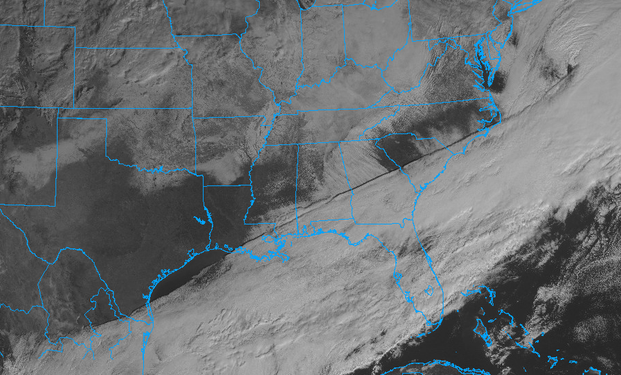
-
1/10-11 super awesome winter SE OBS thread
marsman replied to strongwxnc's topic in Southeastern States
.5" snow/sleet before the freezing rain pushed it down. Clouds clearing, temp at 31.2 and climbing. -
1/10-11 super awesome winter SE OBS thread
marsman replied to strongwxnc's topic in Southeastern States
Light freezing drizzle here. Icicles showing up. Smaller shrubs/bushes bowing down. -
1/10-11 super awesome winter SE OBS thread
marsman replied to strongwxnc's topic in Southeastern States
Down to 31.8 / dew at 23. Dusting of snow/sleet mix. -
1/10-11 super awesome winter SE OBS thread
marsman replied to strongwxnc's topic in Southeastern States
Wow: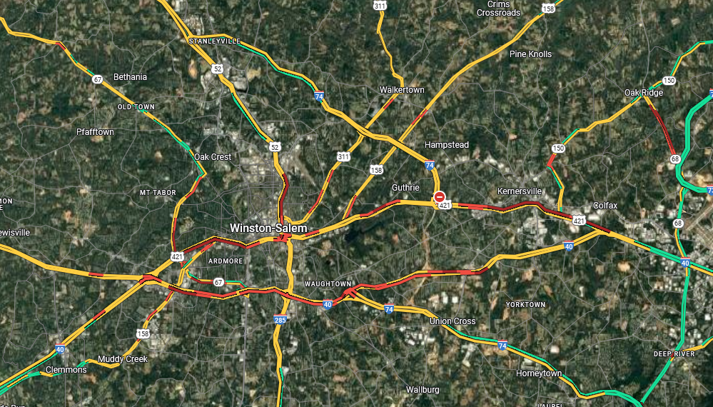
-
1/10-11 super awesome winter SE OBS thread
marsman replied to strongwxnc's topic in Southeastern States
36.1 air temp - ground temps anywhere from 31 (north shaded areas with small ice/frost heaves) to 37 (south facing). Dew at 17. edit: sun is poking through! -
1/10-11 super awesome winter SE OBS thread
marsman replied to strongwxnc's topic in Southeastern States
I know the Harris power plant often gives off a radar signature but radar shows there might be some lake effect snow coming off Lake Jordan. -
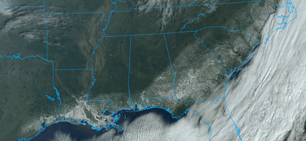
There's some in the Obs thread:
-
RELEASE THE BALOONS
-
Cold ground for sure - air temps here in Cary right now are at 38-39 - ice is still on the roads and ground in the shaded areas and not melting (maybe sublimating though).
-
.62" from this event.
-
Moderate sleet now. Deck is icy/slippery, temp down to 39 from 46 at 1pm.
-
Sleet SW Cary!
-
NWS now saying chance of rain/snow mix tonight in the triangle. Dewpoint at 12. Gonna be tough to see some flakes, but fingers crossed. Special Weather Statement National Weather Service Raleigh NC 159 PM EST Sun Jan 5 2025 NCZ007>011-021>027-038>041-073>076-052100- Person-Granville-Vance-Warren-Halifax-Forsyth-Guilford-Alamance- Orange-Durham-Franklin-Nash-Davidson-Randolph-Chatham-Wake-Stanly- Montgomery-Moore-Lee- Including the cities of Roxboro, Oxford, Creedmoor, Henderson, Kittrell, Warrenton, Norlina, Roanoke Rapids, Enfield, Scotland Neck, Winston-Salem, Greensboro, High Point, Burlington, Graham, Mebane, Hillsborough, Chapel Hill, Carrboro, Durham, Rougemont, Louisburg, Franklinton, Nashville, Spring Hope, Rocky Mount, Lexington, Thomasville, Asheboro, Archdale, Siler City, Pittsboro, Raleigh, Cary, Apex, Wake Forest, Knightdale, Albemarle, Troy, Southern Pines, Pinehurst, Aberdeen, Carthage, and Sanford 159 PM EST Sun Jan 5 2025 ...A Brief Period of Snow/Sleet across NC Piedmont and Northern Coastal Plain... A brief period of light snow or a snow-sleet mix will spread across the the NC Piedmont and Northern Coastal Plain Sections through 4 pm. Accumulations will be light, mainly on elevated and grassy surfaces.
-
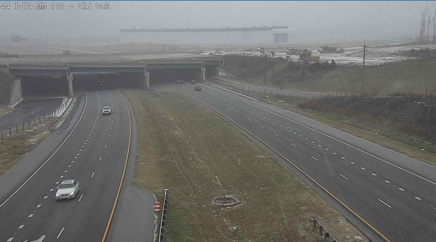
Snow very visible on cameras around GSO:
-
This cold air and wind gives OBX a chance for some sound effect flurries. Better chance for that than anything at RDU.
-
Didn't hit the teens as was forecast. 20.9 at 7:20am.
-
Low of 22.9 at 7:50am Edit: High of 39.3 at 3pm.


