marsman
-
Posts
459 -
Joined
-
Last visited
Content Type
Profiles
Blogs
Forums
American Weather
Media Demo
Store
Gallery
Everything posted by marsman
-
Winter Storm Izzy Obs Thread
marsman replied to Prismshine Productions's topic in Southeastern States
Still all sleet at 27F in east Cary. -
Winter Storm Izzy Obs Thread
marsman replied to Prismshine Productions's topic in Southeastern States
Duke energy outages in NC/SC so far: https://outagemaps.duke-energy.com/#/current-outages/ncsc
-
Winter Storm Izzy Obs Thread
marsman replied to Prismshine Productions's topic in Southeastern States
Light to moderate sleet in Cary, 26F. Friends are reporting freezing rain in Jacksonville, NC. -
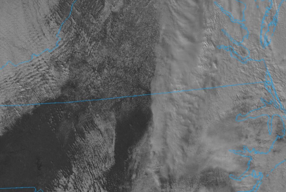
As the storm clears, snow on the ground visible from sat:
-
They're not coming up for me between Burlington and Greensboro.
-
Temp is 41.5 and falling with 2.21" in the bucket in Cary. Several branches down in the neighborhood, leftover leaf piles have clogged some drains, leaving standing water on some roads.
-
Anyone post this yet? Visible ground scar on a satellite image from Dec 13th. Madisonville, KY is in the center of the map, the Cumberland River is at the bottom left.
-
This dry weather and the piles of leaves along the street are making me a bit uncomfortable...especially when people park their cars on the leaf piles.
-
1.69" from yesterday. 9.18" for the month, 6.5" of that is from 10/9.
-
47F this morning and loving it. Great yardwork day before some football this afternoon. Still need some cleaning up from the 10/9 storm.
-
As of 8am this morning 5.74" in the bucket since midnight. Most of that was between 3:30am and 6:30am. Worst downpour I've seen in a long time.
-
Been keeping an eye out for some purple and pink in the NWS map for the lower 48. WWA for the Yosemite, CA area: Snippets from the Reno AFD:
-
Forecast looks good for upper 50's in the RDU area tomorrow and Friday night. Gonna have the windows open if that holds true!
-
Looks lower here too. Constant beating likely shifted interior or exterior mounts.
-
I was watching the HTV stream at https://www.htv10.tv/livestream. They might have gone down about 5 minutes ago... been replaying commercials since then.
-
Anyone else just lose John Humphress' stream? https://www.severestudios.com/storm-chasers/john.humphress2.html edit: nevermind, back up
-
Headed to the coast for Labor Day weekend... this might make it windy.
-
Cary rain/snow hole at 100%, no precip IMBY. Outflow has cooled things off nicely though.
-
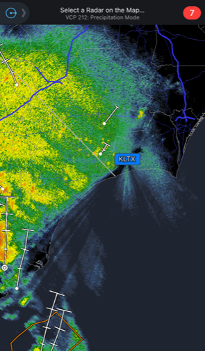
Mentioned in this thread, I think the issue with the KLTX radar and trees was very noticeable early this morning
- 28 replies
-
- 1
-

-
- elsa
- tropical storm
- (and 3 more)
-
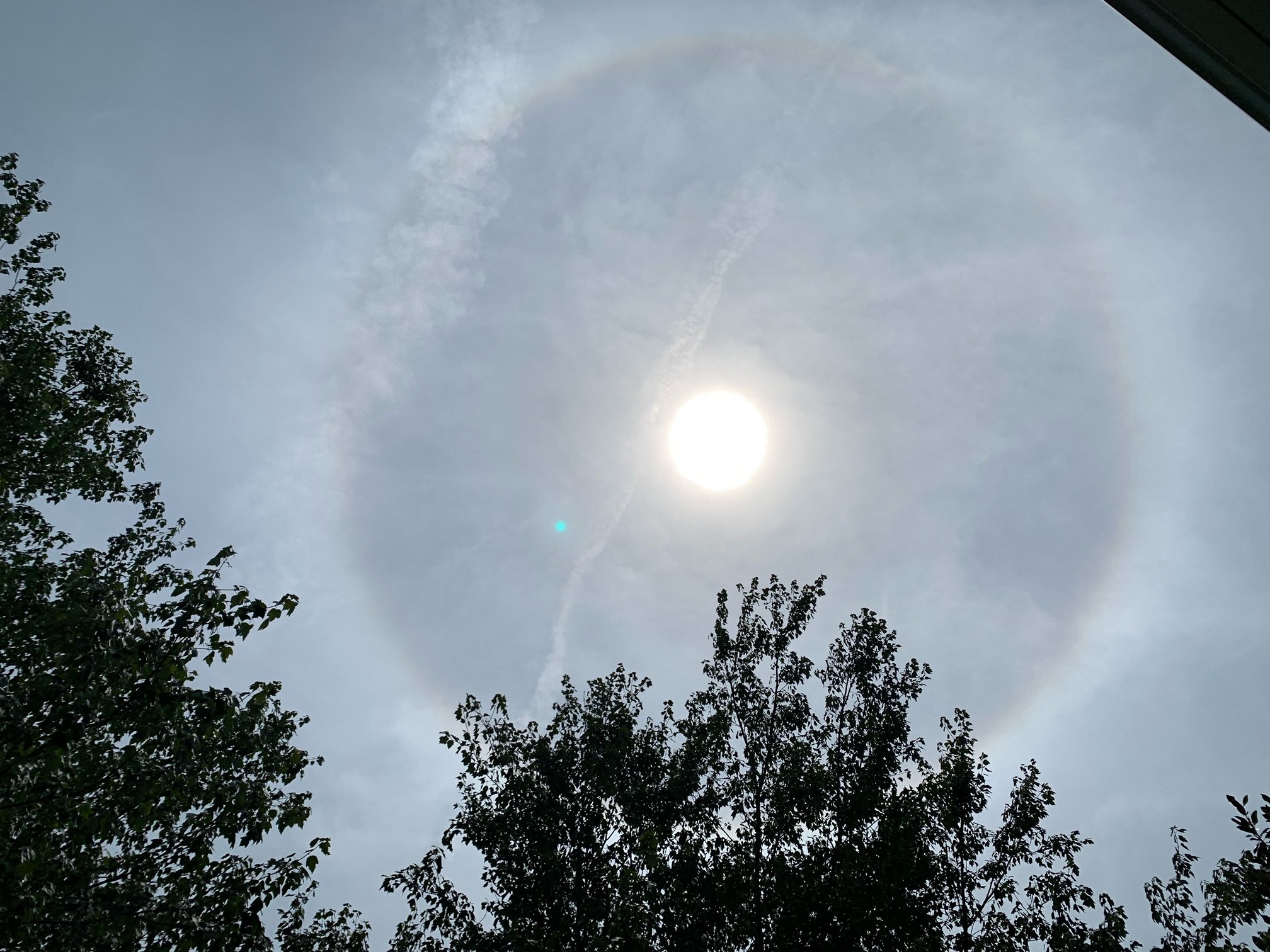
93.9F in Cary. High clouds bringing a sun halo.

-
Harkers Island reporting 5.4" since midnight and counting.
-
Ongoing NWS Radar Coverage Issues in Brunswick County, NC
marsman replied to magpiemaniac's topic in Southeastern States
Pines do grow tall, that's nothing new. Looking on street view the radar looks low for the area: https://www.google.com/maps/@33.9879645,-78.4298804,3a,75y,350.61h,85.15t/data=!3m6!1e1!3m4!1sT_-p6gHiuaeuVcfisTzczg!2e0!7i13312!8i6656 I'm not an expert on lumber, but I understand the prices are very high right now, maybe even for pine. That might be an incentive for the landowner to cut the trees. -
.11" in the bucket. 95.8 for a high early a little after 1pm.
-
2021 Atlantic Hurricane season
marsman replied to StormchaserChuck!'s topic in Tropical Headquarters
-
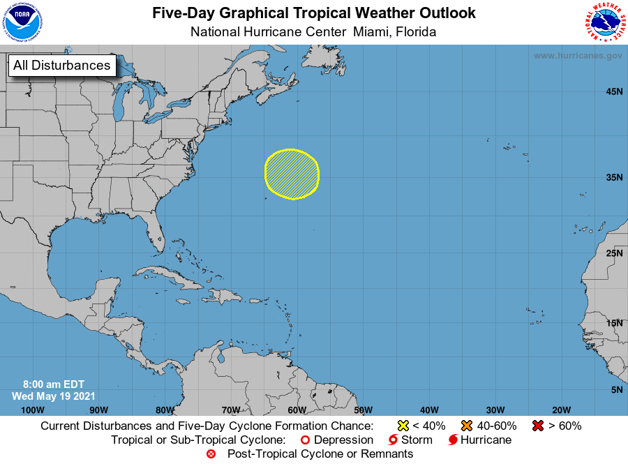
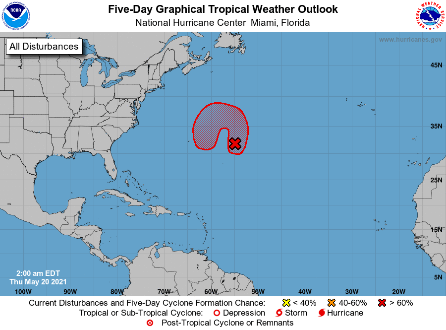
2021 Atlantic Hurricane season
marsman replied to StormchaserChuck!'s topic in Tropical Headquarters
30% on the 5-day: 1. A non-tropical low pressure system is forecast to develop a few hundred miles northeast of Bermuda by late Thursday and produce gale-force winds. The low could then move southwestward over warmer waters on Friday and acquire some subtropical characteristics before the system moves toward the north and northeast into a more hostile environment by Sunday. * Formation chance through 48 hours...low...near 0 percent. * Formation chance through 5 days...low...30 percent.