AmericanWxFreak
-
Posts
1,624 -
Joined
-
Last visited
Content Type
Profiles
Blogs
Forums
American Weather
Media Demo
Store
Gallery
Everything posted by AmericanWxFreak
-
I got excited when I saw your post, checked radar just now and was like “well that’s lame, let me go peep the forum” and find this lol
-

2022 Mid-Atlantic Severe Wx Thread (General Discussion Etc)
AmericanWxFreak replied to Kmlwx's topic in Mid Atlantic
Doesn’t look promising. Been a hard month for us Columbian storm lovers. -
2022 Mid-Atlantic Severe Wx Thread (General Discussion Etc)
AmericanWxFreak replied to Kmlwx's topic in Mid Atlantic
Ugh seems like Columbia is gonna get scraped again. Been a month of good storms going north and south. -
2022 Mid-Atlantic Severe Wx Thread (General Discussion Etc)
AmericanWxFreak replied to Kmlwx's topic in Mid Atlantic
Monday? -
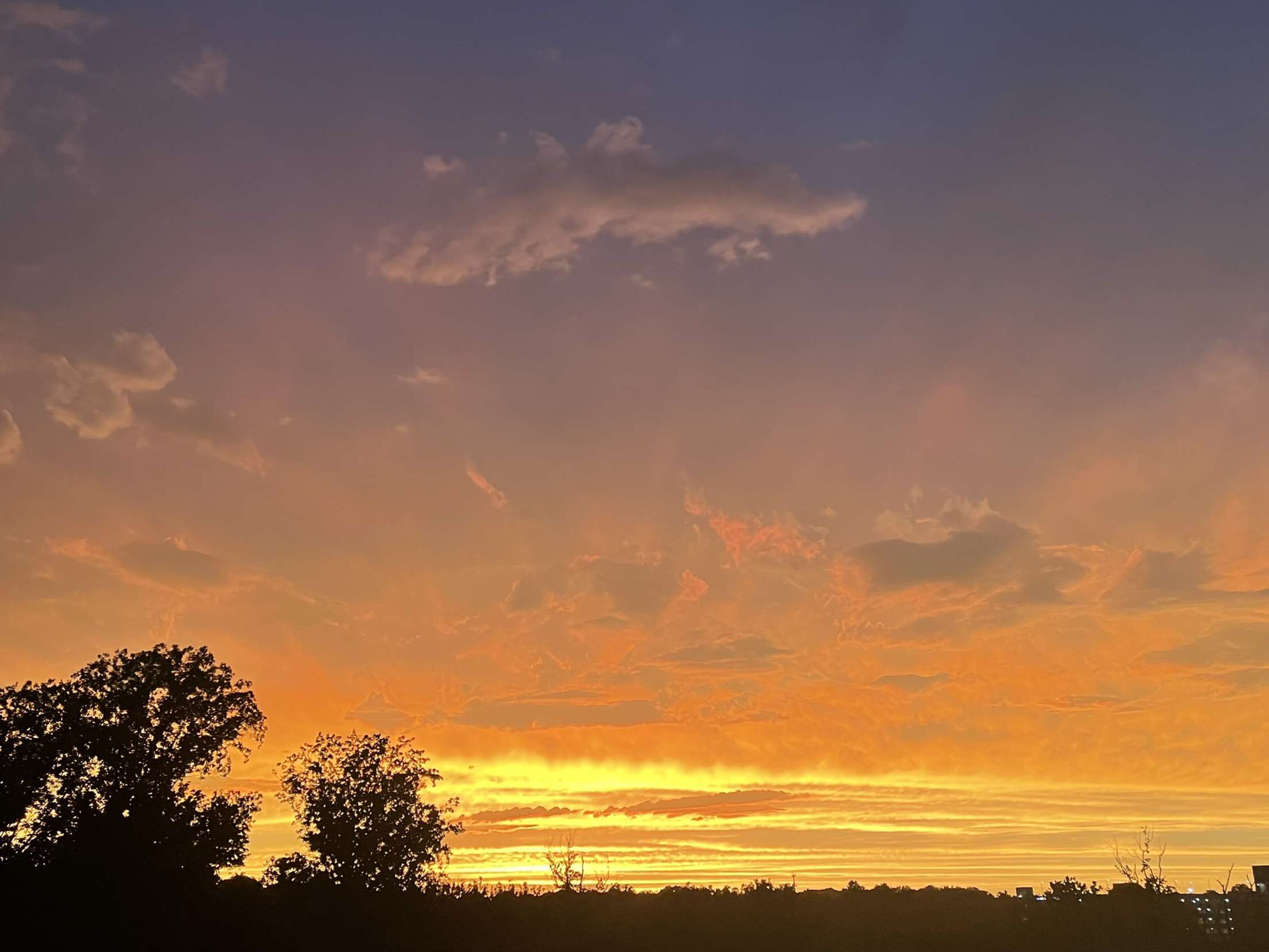
Last week of sunsets have been prime
-
Local cells popping in the Laurel and Olney area w rumbles of thunder being heard in Columbia.
-
2022 Mid-Atlantic Severe Wx Thread (General Discussion Etc)
AmericanWxFreak replied to Kmlwx's topic in Mid Atlantic
Yeah that was something else. It was quite sudden too, the entire sky just exploded with orange/yellow. -
Insane sunset with some crazy CTC lightning spidering into the sunset often. What a night.

-
That was a pretty cool sunset. As the sun got to the horizon, it just illuminated the entire sky so brightly yellow. So cool.
-
2022 Mid-Atlantic Severe Wx Thread (General Discussion Etc)
AmericanWxFreak replied to Kmlwx's topic in Mid Atlantic
Microburst College Park? -
2022 Mid-Atlantic Severe Wx Thread (General Discussion Etc)
AmericanWxFreak replied to Kmlwx's topic in Mid Atlantic
Noticeably cooler once that passed through. -
2022 Mid-Atlantic Severe Wx Thread (General Discussion Etc)
AmericanWxFreak replied to Kmlwx's topic in Mid Atlantic
While all eyes are in VA - quite the hail sig near taneytown -
2022 Mid-Atlantic Severe Wx Thread (General Discussion Etc)
AmericanWxFreak replied to Kmlwx's topic in Mid Atlantic
This is one for the books. Wow. -
2022 Mid-Atlantic Severe Wx Thread (General Discussion Etc)
AmericanWxFreak replied to Kmlwx's topic in Mid Atlantic
Quite the hail signature forming on that storm too. -
2022 Mid-Atlantic Severe Wx Thread (General Discussion Etc)
AmericanWxFreak replied to Kmlwx's topic in Mid Atlantic
Some really impressive velocities headed into HGR. -
2022 Mid-Atlantic Severe Wx Thread (General Discussion Etc)
AmericanWxFreak replied to Kmlwx's topic in Mid Atlantic
some spin happening in that WV cluster -
2022 Mid-Atlantic Severe Wx Thread (General Discussion Etc)
AmericanWxFreak replied to Kmlwx's topic in Mid Atlantic
Yeah that does seem a fairly bold take - I know the timing isn’t perfect as you mentioned earlier, but hmmmmm -
2022 Mid-Atlantic Severe Wx Thread (General Discussion Etc)
AmericanWxFreak replied to Kmlwx's topic in Mid Atlantic
Honestly contains more pitty then I expected given the ENH -
2022 Mid-Atlantic Severe Wx Thread (General Discussion Etc)
AmericanWxFreak replied to Kmlwx's topic in Mid Atlantic
Looks like 23z-1z time frame is most likely. -
2022 Mid-Atlantic Severe Wx Thread (General Discussion Etc)
AmericanWxFreak replied to Kmlwx's topic in Mid Atlantic
ooooo I enjoy intense lines .NEAR TERM /THROUGH TONIGHT/... A lot of sunshine as of 1030am from just west of I-81 and east to the Chesapeake Bay. This will obviously ramp up our temperatures quickly into the lower 90s and our dewpoint temperatures to near 70s by the middle part of this afternoon. A low pressure trough is in place parallel to I-81 with a surface cold front sagging across eastern Ohio and western Pennsylvania. The combination of these two features, along with a mid-level trough and a right entrance jet max sagging into the CWA will allow for numerous thunderstorms, some severe, to develop and possibly forming an intense line around mid-afternoon into this evening. Both MLCAPE and MUCAPE is expected to approach 2000 to 2500 J/kg. 0-3km wind shear will be 15 to 20 knots easily in most places. The main threats will be damaging winds and isolated tornadoes. Large hail and flooding rainfall is also a distinct possibility. SPC has Northeast MD and northeastern VA in an Enhanced Risk for severe thunderstorms. WPC has the heart of our CWA in a Marginal Risk for Excessive Rainfall that could lead to Flash Flooding. Timing on supercells or a line of intense thunderstorms reaching the metro areas would be 4pm to 8pm. Much of this activity will reach southern Maryland closer to 8pm to 10pm. Nonetheless, it looks like a busy and stormy day. -
2022 Mid-Atlantic Severe Wx Thread (General Discussion Etc)
AmericanWxFreak replied to Kmlwx's topic in Mid Atlantic
I knew that. Doh. Seems to be pretty good agreement on 00z arrival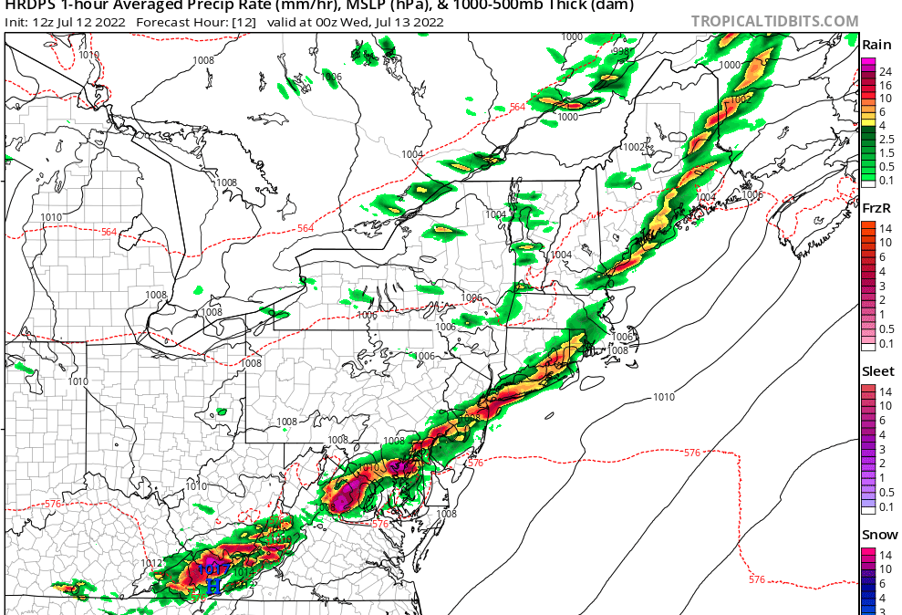
-
2022 Mid-Atlantic Severe Wx Thread (General Discussion Etc)
AmericanWxFreak replied to Kmlwx's topic in Mid Atlantic
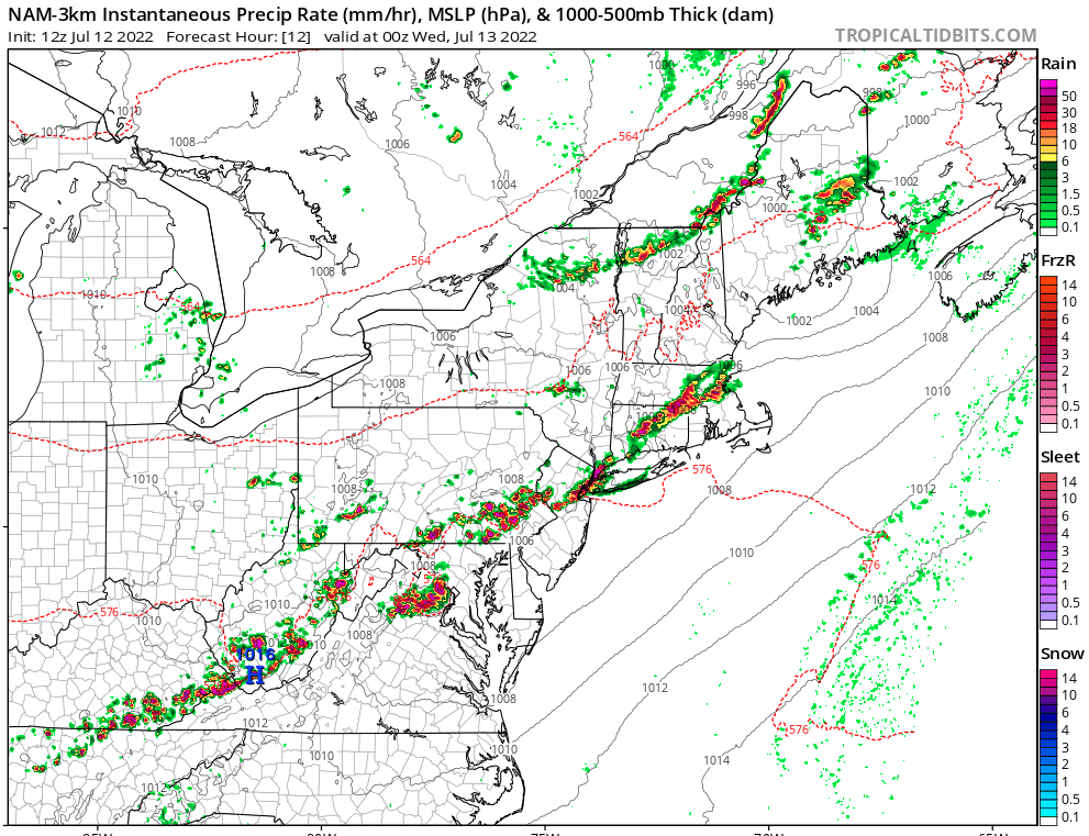
I don't think I have ever seen you guys use this for severe, but it looks like a good time later so I like it and am expecting it to be right - RGEM lol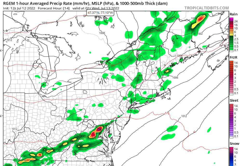
-
2022 Mid-Atlantic Severe Wx Thread (General Discussion Etc)
AmericanWxFreak replied to Kmlwx's topic in Mid Atlantic
Ends up splitting Central MD but sends quite the bow thru NOVA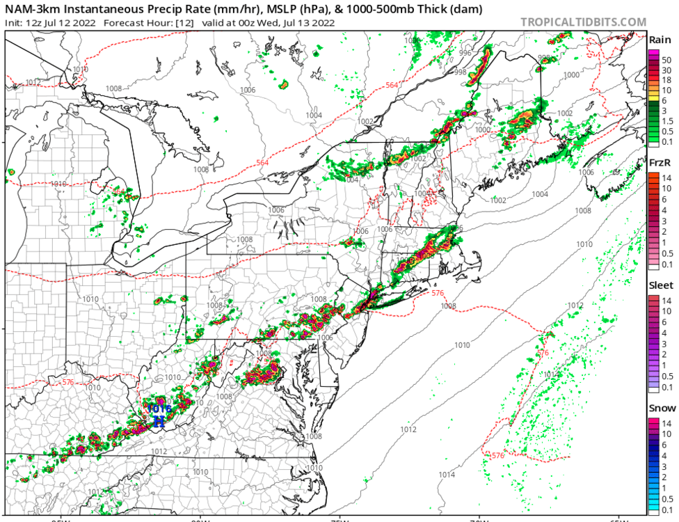
-
Trouble brewing in that area from Sterling to Potomac.
-
2022 Mid-Atlantic Severe Wx Thread (General Discussion Etc)
AmericanWxFreak replied to Kmlwx's topic in Mid Atlantic
Seems like we’re just seeing this precip max just waffle around. Someone’s going to get some trouble tonight it’s just a matter of where.