

AmericanWxFreak
-
Posts
1,624 -
Joined
-
Last visited
Content Type
Profiles
Blogs
Forums
American Weather
Media Demo
Store
Gallery
Everything posted by AmericanWxFreak
-

2023 Mid-Atlantic Severe Wx Thread (General Discussion)
AmericanWxFreak replied to Kmlwx's topic in Mid Atlantic
A whole bunch of nothing on the mesos for today's SLGT risk.... -
2023 Mid-Atlantic Severe Wx Thread (General Discussion)
AmericanWxFreak replied to Kmlwx's topic in Mid Atlantic
HRRR has barely had anything except a couple cells scraping through the northern tier for several runs in a row now. The 3k NAM continues to be much more bullish for most of the area.- 2,785 replies
-
- 1
-

-
- severe
- thunderstorms
- (and 3 more)
-
2023 Mid-Atlantic Severe Wx Thread (General Discussion)
AmericanWxFreak replied to Kmlwx's topic in Mid Atlantic
Well that was pretty underwhelming lol -
2023 Mid-Atlantic Severe Wx Thread (General Discussion)
AmericanWxFreak replied to Kmlwx's topic in Mid Atlantic
It’s posted a page back. -
2023 Mid-Atlantic Severe Wx Thread (General Discussion)
AmericanWxFreak replied to Kmlwx's topic in Mid Atlantic
-
2023 Mid-Atlantic Severe Wx Thread (General Discussion)
AmericanWxFreak replied to Kmlwx's topic in Mid Atlantic
First box over NC/VA posted - ours should be coming shortly- 2,785 replies
-
- 1
-
-
- severe
- thunderstorms
- (and 3 more)
-
2023 Mid-Atlantic Severe Wx Thread (General Discussion)
AmericanWxFreak replied to Kmlwx's topic in Mid Atlantic
https://www.spc.noaa.gov/products/md/md1999.html Watch Likely DISCUSSION...An upper trough/low centered over the Great Lakes/OH Valley will continue moving slowly eastward this afternoon. Modest ascent preceding this feature and low-level convergence along a surface cold front will likely foster robust convective initiation within the next 1-2 hours (by around 3 PM EDT) across parts of western/central NC into the coastal Mid-Atlantic. Strong daytime heating has already warmed surface temperatures into the upper 80s and 90s across this region. A rather moist airmass, with precipitable water values of 1.5 to 2+ inches and surface dewpoints generally in the 70s, should help offset poor mid-level lapse rates to some extent. Around 1500-3000+ J/kg of MLCAPE has already developed given the ample diurnal heating that has occurred. While weak west-southwesterly low-level winds exist, they do strengthen with height to around 45-60 kt through mid levels. Related 35-50 kt of deep-layer shear will act to organize updrafts, with a mix of bowing clusters and supercells possible. Isolated severe hail may occur with the more discrete convection that initially develops. A tendency for upscale growth into multiple clusters appears likely given the linear forcing of the front and mainly boundary-parallel flow aloft. Scattered damaging/severe wind gusts should be the main threat as this convection spreads eastward through the rest of the afternoon and evening. One or more Severe Thunderstorm Watches will likely be needed as robust convection develops over the next couple of hours. -
2023 Mid-Atlantic Severe Wx Thread (General Discussion)
AmericanWxFreak replied to Kmlwx's topic in Mid Atlantic
Wow. Quite a storm thru HoCo and AAco on the 16z HtripleR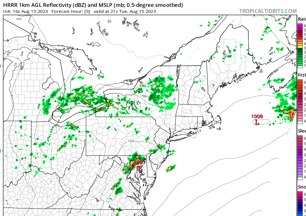
-
2023 Mid-Atlantic Severe Wx Thread (General Discussion)
AmericanWxFreak replied to Kmlwx's topic in Mid Atlantic
That was crazy. Was down to practically 0 vis here w strong gusts too -
2023 Mid-Atlantic Severe Wx Thread (General Discussion)
AmericanWxFreak replied to Kmlwx's topic in Mid Atlantic
Where in DTC ya at? -
2023 Mid-Atlantic Severe Wx Thread (General Discussion)
AmericanWxFreak replied to Kmlwx's topic in Mid Atlantic
Some impressive dry gusts in downtown Columbia from the bow to the north passing. Wonder if we’ll get this southern bow. Temp has dropped massively here already tho. -
2023 Mid-Atlantic Severe Wx Thread (General Discussion)
AmericanWxFreak replied to Kmlwx's topic in Mid Atlantic
Run of the mill warning. Meh. -
2023 Mid-Atlantic Severe Wx Thread (General Discussion)
AmericanWxFreak replied to Kmlwx's topic in Mid Atlantic
Where’s the next box? -
2023 Mid-Atlantic Severe Wx Thread (General Discussion)
AmericanWxFreak replied to Kmlwx's topic in Mid Atlantic
Still very broad on the velocities. I’d be surprised to hear of anything otg- 2,785 replies
-
- 1
-
-
- severe
- thunderstorms
- (and 3 more)
-
2023 Mid-Atlantic Severe Wx Thread (General Discussion)
AmericanWxFreak replied to Kmlwx's topic in Mid Atlantic
Feels like an interesting spot to be here in Columbia. Not sure which bow to be watching for us lol -
2023 Mid-Atlantic Severe Wx Thread (General Discussion)
AmericanWxFreak replied to Kmlwx's topic in Mid Atlantic
You can really see the curvature of the bow forming now- 2,785 replies
-
- 1
-
-
- severe
- thunderstorms
- (and 3 more)
-
2023 Mid-Atlantic Severe Wx Thread (General Discussion)
AmericanWxFreak replied to Kmlwx's topic in Mid Atlantic
Yeah that run had a weird evolution of things -
2023 Mid-Atlantic Severe Wx Thread (General Discussion)
AmericanWxFreak replied to Kmlwx's topic in Mid Atlantic
Def still develops that nasty bow from the frame before this to the end of this frame and punches through the area. -
2023 Mid-Atlantic Severe Wx Thread (General Discussion)
AmericanWxFreak replied to Kmlwx's topic in Mid Atlantic
Baltimore County SMOKED- 2,785 replies
-
- 1
-
-
- severe
- thunderstorms
- (and 3 more)
-
2023 Mid-Atlantic Severe Wx Thread (General Discussion)
AmericanWxFreak replied to Kmlwx's topic in Mid Atlantic
- 2,785 replies
-
- 2
-
-
- severe
- thunderstorms
- (and 3 more)
-
2023 Mid-Atlantic Severe Wx Thread (General Discussion)
AmericanWxFreak replied to Kmlwx's topic in Mid Atlantic
- 2,785 replies
-
- 1
-

-
- severe
- thunderstorms
- (and 3 more)
-
2023 Mid-Atlantic Severe Wx Thread (General Discussion)
AmericanWxFreak replied to Kmlwx's topic in Mid Atlantic
Ill share the 3k image once its loads. -
2023 Mid-Atlantic Severe Wx Thread (General Discussion)
AmericanWxFreak replied to Kmlwx's topic in Mid Atlantic
Also trying to set myself up for a 3:30 work departure personally - also hoping its not too late. -
2023 Mid-Atlantic Severe Wx Thread (General Discussion)
AmericanWxFreak replied to Kmlwx's topic in Mid Atlantic
Pretty wild look from the 11z HRRR -
2023 Mid-Atlantic Severe Wx Thread (General Discussion)
AmericanWxFreak replied to Kmlwx's topic in Mid Atlantic
10z HRRR has some discretes move across Fred and Carroll Counties before this beast trudges through