madwx
-
Posts
2,260 -
Joined
-
Last visited
Content Type
Profiles
Blogs
Forums
American Weather
Media Demo
Store
Gallery
Everything posted by madwx
-

January 22nd-25th Winter Storm Potential
madwx replied to Thundersnow12's topic in Lakes/Ohio Valley
Snow depth this morning was 5". Will be interesting to see how much it will actually change over the next few days -
January 22nd-25th Winter Storm Potential
madwx replied to Thundersnow12's topic in Lakes/Ohio Valley
record setting amounts of drizzle -
January 22nd-25th Winter Storm Potential
madwx replied to Thundersnow12's topic in Lakes/Ohio Valley
QPF numbers have been trending downward on the GFS with this system. Will be interesting to note this trend throughout the next couple days -
Got down to 0 last night. A couple chances at subzero lows the next two nights but this stretch is looking milder than it did a few days ago
-
5.2” here in MSN with a light glaze on top
-
Rates are still good here and it’s nice and gusty out but some dry patches in the radar are showing up to the west. Hope the snow doesn’t shut off too soon
-
Snow started 15 mins ago and it’s already moderate snow and accumulating nicely. Visibility is definitely below a mile
-
Got down to 1 here this morning. Tying our lowest temp of the winter. Looks like a good chance to go below 0 Sunday thru Tuesday
-
January 10th-12th Winter Storm Potential
madwx replied to Thundersnow12's topic in Lakes/Ohio Valley
was spot on with my wave 1 call of 3.3" but I'm going to bust hard with wave 2. Looking more like an inch, maybe 2 -
January 10th-12th Winter Storm Potential
madwx replied to Thundersnow12's topic in Lakes/Ohio Valley
About 2” on the ground now. Back to sleet in Madison. Feeling good about my wave 1 call but not very good about tomorrow’s snow -
January 10th-12th Winter Storm Potential
madwx replied to Thundersnow12's topic in Lakes/Ohio Valley
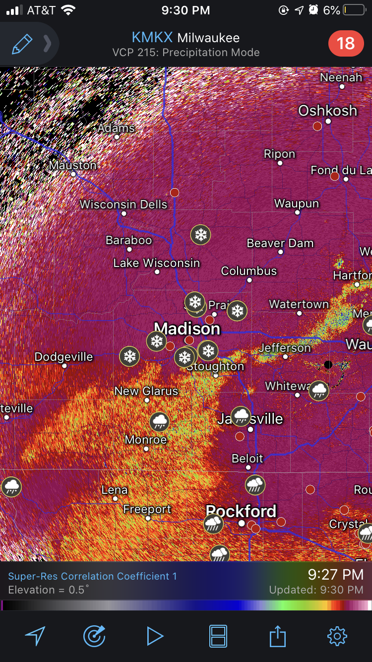
Snow/sleet/rain transition showing up nicely on radar
-
January 10th-12th Winter Storm Potential
madwx replied to Thundersnow12's topic in Lakes/Ohio Valley
Been snowing in Madison for about an hour now. Coming down at a very nice clip and snow accumulating nicely on top of the sleet layer -
January 10th-12th Winter Storm Potential
madwx replied to Thundersnow12's topic in Lakes/Ohio Valley
Starting off as sleet here with a couple snowflakes mixed in. -
January 10th-12th Winter Storm Potential
madwx replied to Thundersnow12's topic in Lakes/Ohio Valley
Precip about to start here. Final call of 3.3” with the first wave and 4.0” with the second wave -
January 10th-12th Winter Storm Potential
madwx replied to Thundersnow12's topic in Lakes/Ohio Valley
it still gives over 6" in S Wi. Not giving up hope on this yet -
January 10th-12th Winter Storm Potential
madwx replied to Thundersnow12's topic in Lakes/Ohio Valley
HRRR remains consistent bringing the heavy snow band through Iowa City to Madison tonight. -
January 10th-12th Winter Storm Potential
madwx replied to Thundersnow12's topic in Lakes/Ohio Valley
Yeah not sure what to think of it. May be leaning more toward the CAMs because they can resolve all the convection occurring to the south but there is still more uncertainty at this point than I'd like. -
January 10th-12th Winter Storm Potential
madwx replied to Thundersnow12's topic in Lakes/Ohio Valley
12z NAM pushes freezing rain all the way up to MSN, no snow with the first band but still 6"-9" with the second wave -
January 10th-12th Winter Storm Potential
madwx replied to Thundersnow12's topic in Lakes/Ohio Valley
3km NAM has about a foot total here between the two waves. less sleet mixing in as well. -
January 10th-12th Winter Storm Potential
madwx replied to Thundersnow12's topic in Lakes/Ohio Valley
SN/IP line comes right up to MSN between noon and 6pm Saturday cutting down on totals here. The back end of the storm moves out quicker as well, snow is done by midnight. -
January 10th-12th Winter Storm Potential
madwx replied to Thundersnow12's topic in Lakes/Ohio Valley
NAM going big league in IA/S WI with the first wave, 4-5" + -
Lots of icing occurring with the freezing rain in central Wisconsin right now. Numerous reports of slideoffs and accidents on almost all major roads.
-
January 10th-12th Winter Storm Potential
madwx replied to Thundersnow12's topic in Lakes/Ohio Valley
All the models are now showing heavy snow in S WI saturday evening. Could definitely see some 1"+ rates for a period between 6pm and midnight. -
January 10th-12th Winter Storm Potential
madwx replied to Thundersnow12's topic in Lakes/Ohio Valley
Verbatim it's a 6 hour period of sleet here . still accumulates almost a foot of snow though. -
January 10th-12th Winter Storm Potential
madwx replied to Thundersnow12's topic in Lakes/Ohio Valley
Big time snowstorm in Oklahoma this run