
mjwise
-
Posts
455 -
Joined
-
Last visited
Content Type
Profiles
Blogs
Forums
American Weather
Media Demo
Store
Gallery
Everything posted by mjwise
-
Dekalb ASOS just clocked an 83 dew at 7:35pm. I went out for a casual walk and arrived home soaked (and not from rain!).
-
A gross 87/80/102 at the airport here. I think this is the first 80 degree dewpoint for DeKalb this year.
-
Looking hazy and intermittently smoky on the surface on the smoke HRRR for Northern Ill starting Sat morning all the way through Sun.
-
2023 Short/Medium Range Severe Weather Discussion
mjwise replied to Chicago Storm's topic in Lakes/Ohio Valley
The SPC is a believer at least... https://www.spc.noaa.gov/products/md/md1506.html Mesoscale Discussion 1506 NWS Storm Prediction Center Norman OK 0305 PM CDT Wed Jul 12 2023 Areas affected...Northern Illinois and far southern Wisconsin Concerning...Severe potential...Tornado Watch likely Valid 122005Z - 122130Z Probability of Watch Issuance...95 percent SUMMARY...A tornado watch is likely across northern Illinois and possibly southern Wisconsin by 21Z. DISCUSSION...The air mass is recovering rapidly across northern Illinois in the wake of the morning MCS. An EML, advecting eastward amid 40-50 knots of mid-level flow has cleared out cloud cover and allowed for surface heating across eastern Iowa and northwest Illinois. Temperatures in this area have warmed into the low 80s with dewpoints remaining steady, or even climbing slightly, into the low 70s. Temperatures remain in the 60s across northern Illinois, but expect this warm front to lift quickly northeast through the evening as a result of surface heating north of this front and strengthening low-level flow in response to the deepening surface cyclone across eastern Iowa. Additional heating, combined with cooling temperatures aloft ahead of the approaching shortwave trough should result in 1500 to 2000 J/kg MLCAPE by this evening across northern and northeast Illinois. This instability will be co-located with a strong, veering wind profile (sampled by the 20Z LOT VWP). Expect a similar wind profile (featuring 200+ m2/s2 0-500m SRH) to remain along the outflow boundary/composite front through the evening. Supercells are expected to form along this boundary as ascent increases ahead of a digging mid-level shortwave trough and within the left-exit region of the upper-level jet. Southerly winds ahead of the surface low will provide sufficient low-level streamwise vorticity for a tornado threat. However, any storms which remain along or slightly north/east of the boundary, where more backed surface winds will be present, should ingest much higher SRH and will pose a greater tornado threat and even the potential for a strong tornado. In addition, large hail and damaging wind gusts will be possible. A tornado watch is likely by 4pm to cover this threat. ..Bentley.. 07/12/2023 -
That's a crazy stat to me. We have had 1 90 so far this summer, a 90 on 6/25. Granted, we have gotten 89'ed 5 (!) times, but still, even despite being ~300 feet higher, less urbanized and at a slightly higher latitude, I wouldn't expect that contrast between two sites separated by a <2 hour drive.
-
The GFS is also mixing to about 650-700mb to get that absurd surface output. It advertised that last year too, at time frames a lot sooner than 300hrs+, and it didn't remotely pan out then either. Whenever GFS 2m temps are spitting out 110+ in the midwest or GL, it's because it's got some broken mixing scheme going on.
-
DeKalb actually ended the month below normal per NOWData - at -0.2, month high was 90 on 6/25. We got 89'ed a hilarious 5 times, including four days in a row (6/1-6/4). Precip was 50% of normal.
-
Reminiscent of the August 11, 2014 Detroit flood event. Near tropical airmass + mild/moderate baroclinicity results in weak, diffuse, ambling surface low that can produce impressive rainfall. They tend to be poorly modeled. The ECMWF saw it for the most part but the GFS and NAM were clueless. 1.25" in Dekalb today. Most rainfall in a day in the last 3 months.
-
I spent the middle of July 1995 at a summer camp in an unair-conditioned dorm in southwest Ohio. It was a miserable week. We would take cold showers (well, as cold as they could get, which wasn't very) every night to get any kind of relief.
-
We will see if today's high risk areas merge (or should have been merged in retrospect). If the separate high risk areas stay separate for the duration, that will be a first at least (I think?).
-
I think this might be the first day one high risk day with two non-contiguous high risk areas. At least I can't find any others.
-
From a review of IEM VTEC, KLOX hasn't previously issued a Blizzard Warning since 1986 at least, when the IEM VTEC database starts (and is populated by KLOX warnings starting in that year). Winter storm warnings for the LA-area mountains typically occur once or twice a year or so, but not blizzard warnings. I'm also not sure when "Blizzard Warnings" started as a standardized product. ETA: This article claims a blizzard warning was issued in 1989, but it doesn't appear in IEM VTEC. ETA2: This tweet shows the 1989 blizzard warning, which was embedded into a weather summary. That's probably why it doesn't appear in IEM VTEC.
-
Given the zone forecast yesterday called for 0.25" of ice, I'm a little mystified as to the lack of an ice storm warning then.
-
One report of 0.6" in Lenawee County is the highest I've seen, but IWX hasn't posted reports yet. Around 0.5" in the I-94 corridor.
-
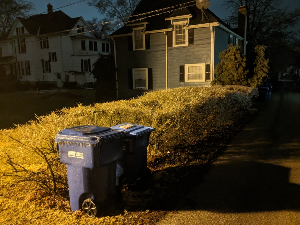
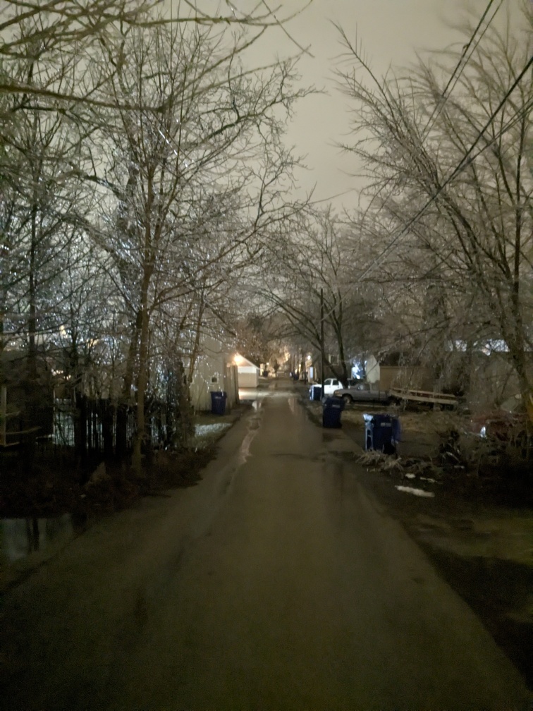
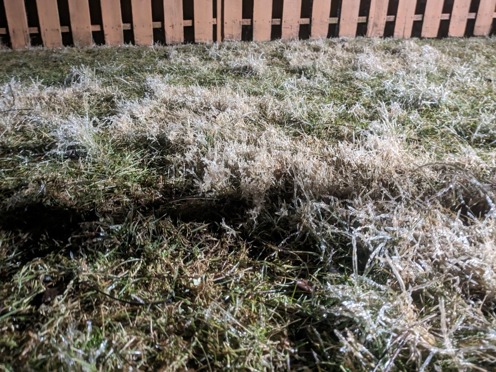
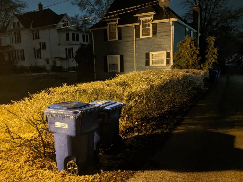
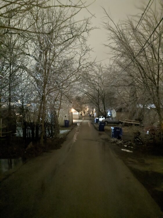
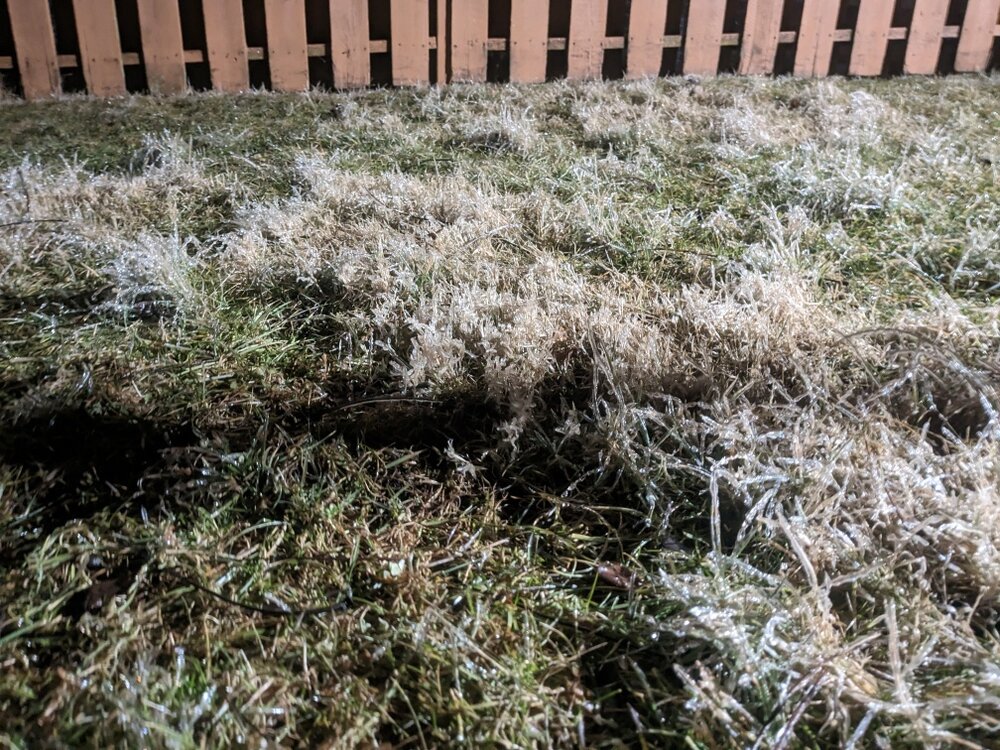
The view from DeKalb. Even the grass crusted up nicely. A few isolated slick spots on roads - but they are generally fine at least in town. Still 32 out - GFS seems to have gotten this one right (never really had us warming up during precip the way the NAM, Euro, and other hires models showed). My point and click was predicting a trace, this is in the realm of 0.1"-0.15". Oops.
-
Hm, I'd like to see that reflected on a sounding. Freezing-melting-freezing-melting.
-
Power flickered and heard something blow up in the distance in Dekalb. I can see where this is going. We need 32.5 degrees.
-
19Z HRRR has ticked cooler. ZR in Ann Arbor from now until 11PM ET.
-
Same here. Rain is coming down moderately here. Ground is too warm for any ice but elevated surfaces and wires are a definite problem. HRRR says we should bump above freezing soon but seeing more persistent ZR in other short term models. HRRR for SE MI is just ugly - Hilldale, Jackson, Washtenaw counties looking at 8+ more hours of moderate to heavy ZR.
-
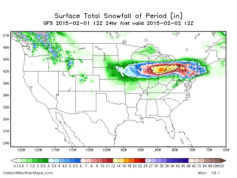
The SREF plumes are fun across MN. Marshall area in western MN seems to be the max. The 9Z mean is 26.8", with a range of 17.5" to 36.8".
-
Somehow it got down to 1 degree in DeKalb last night. I swear the point and click low was a solid 10 degrees (or more) above that. ETA: Yep, per the Zone forecast: De Kalb- Including the cities of DeKalb and Sycamore 814 PM CST Thu Jan 26 2023 .REST OF TONIGHT...Partly cloudy. Lows around 11. Southwest winds 10 to 15 mph.
-
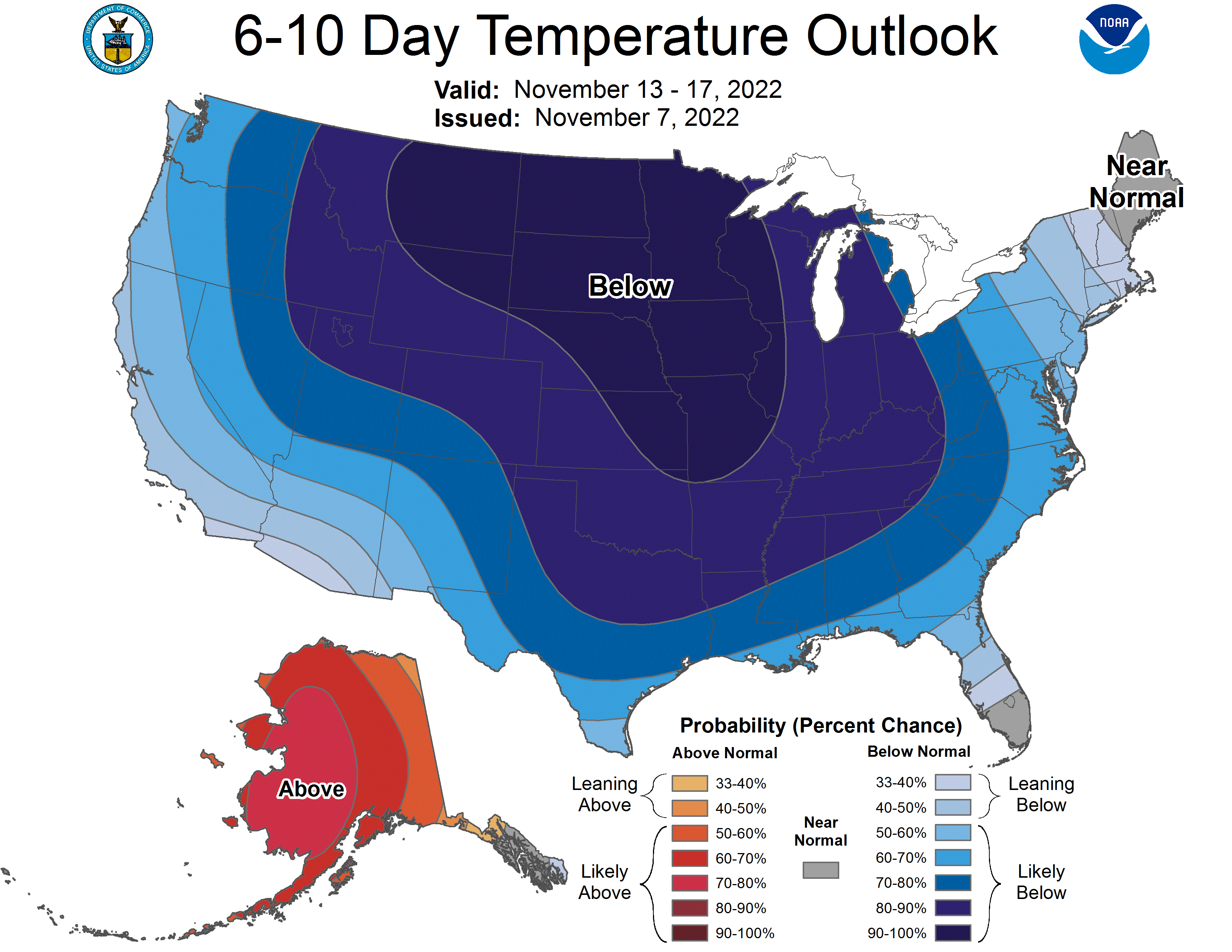
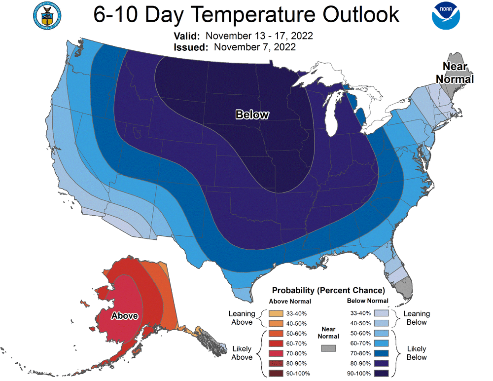
Yes. Seems like there hasn't been a full latitude CONUS trough predicted for some time, complete with the hardly ever seen 90% Below contour. Point and click high for Sat and Sun is 33 here.
-
ECMWF and GFS are both advertising a pretty potent temp drop plowing through eastern Nebraska and western Iowa Thursday evening - mid 60's to mid 20's in about 6 hours.
-
2022 Short/Medium Range Severe Weather Discussion
mjwise replied to Chicago Storm's topic in Lakes/Ohio Valley
Not severe here, but that was a howling wind and cloud of leaf debris that just swept over us. -
Just a quick storm last night, but Dekalb has had 1'+ of rain since August 1. What a run after a dry aug/sep the last two years.