

frostfern
-
Posts
1,983 -
Joined
-
Last visited
Content Type
Profiles
Blogs
Forums
American Weather
Media Demo
Store
Gallery
Everything posted by frostfern
-
Western Michigan is being lake shadowed to hell though. I can see it getting extremely dry if we don't get a single damn thunderstorm. These constant weak synoptic conditions with light west wind don't give any rain on this side of the lake.
-
The lake breeze clears out dust and pollen but increases invisible ozone. If you're sensitive to ozone the lake makes it worse. It tends to have less pollen and dust though if that's what bothers you. It's kind of a choose your poison thing. It's not as clean as an ocean sea-breeze because the smaller volume of the inversion-trapped marine air can collect more and more pollution over time. Stagnant high pressure is causing high ozone levels near the lakes. There's some trapped fireworks smoke around as well.
-
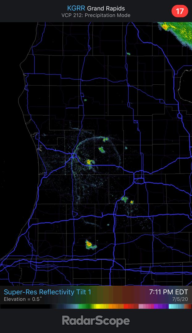
Little circular outflow boundary still exists even though the convection is pretty much dead now.
-
There was also a tiny cell over the GRR airport this afternoon. Black cloud base drifted right overhead, but the rain shaft only appeared once it moved off to the SE of me. I heard about two claps of thunder as it slowly moved away, but not even a single drop of rain fell IMBY.
-
Same happened at GRR. Little backdoor cooling off Lake Huron and a thin cirrus canopy around mid-day wasn't enough. Lower dews allowed it rebound late in the afternoon once full sunshine returned. It briefly hit 90 between 5pm and 6pm. From here on out the only event that could possibly thwart a long streak of 90s will be random thunderstorms. I don't think the coverage will be widespread enough tomorrow, and wednesday through friday look so hot that it may hit 90 early, so even an afternoon storm/outflow probably won't get in the way.
-
I don't think it's going to get to 90 here today either. There's definitely some kind of very weak back-door cold front here that the models didn't emphasize enough. The easterlies brought in an airmass that's a few degrees cooler and also a few degrees dryer (dewpoints dropping down into the lower 60s). There's even some pop-up storms in the far SW corner where this little weak backdoor front is converging with the lake breeze.
-
Well, a lot of places will need a good rain, especially the southeastern part of the state. 2012 was very very dry into August. There was a derecho around the 4th, but it missed most places to the south. There was spotty severe weather (some large hail), but significant rainfall was scattered at best.
-
The problem with only looking at deaths to estimate the true infection rate is it ignores changes in behavior. In general older people are being more cautious. It's mainly 20 and 30 somethings going to bars and parties. These are the main super-spreading type events. In Lansing close to 100 cases were linked to a single freaking bar!!! While the initial infected are mostly mild cases involving young people, when the amount of community spread reaches a certain threshold, older people will be involved again and death rates will climb again. Many vulnerable people still have to work and shop and they will come in contact with careless spreaders. Also not that not all non-deadly cases are "mild". Even people in their 20s who never required hospitalization say it was the worst illness in their life and nobody even knows how long certain problems last. Many people still have symptoms after 2 months!!! Even people who were never hospitalized!!! Many people never know they had it, but others become ill for a protracted period of time. It isn't a brief illness like the flu.
-
Hope models are wrong. There is an annoying tendency for the ring of fire to skip Michigan completely. No guarantee it will even rain here significantly any time in the next week. Nothing sucks more than a dry cold front after a scorching heat wave.
-
It seems Lake Michigan has already warmed to the point where it's adding humidity to the air. The wind switch from easterly to northwesterly added a decided amount of humidity without knocking the temperature down much at all.
-
It seems a little dryer here today compared to yesterday with a better east wind again. Don't know if there was a little bit of a backdoor coldfront push as it's actually little cooler as well. It's only 86 whereas yesterday it was already 90 at this time. Maybe it's also the band of high clouds overhead right now throwing the forecast off, but I don't think it will reach low 90s today, even with lower dewpoints. It was annoying how the very weak lake breeze just seemed to add humidity without really cooling it off at all the past couple days. Dewpoint somehow managed to creep up to 70 in the narrow little lake breeze convergence zone, along with low 90s temps. Heat index was definitely worse than forecast due to lake breeze.
-
Illinois has always had more general summer convective rainfall than Michigan and it's a sharp gradient right near southern Lake Michigan. I think maybe the gradient has shifted a little from being more NW-SE oriented to NNW-SSE oriented. For instance, northern Wisconsin may be getting more thunderstorm days while NE Ohio / SE Michigan / SE Ontario are getting less. I wish I could look at the data to confirm this though. It just the mid-summer pattern though. Increased stratiform precip in every other seasons has caused a general increase in precipitation overall. Also, infrequent but very heavy rain events associated with tropical moisture may be becoming more common and this can easily cancel any drying trend due to decrease in continental ridge-rider type MCS activity.
-
Lake Michigan is a major barrier in these weak-flow patterns. Chicago is a wet summer microclimate with ample lake-breeze convergence whenever there is SW flow. SE flow that is moist enough to actually trigger thunder with lake convergence is more rare. SW flow is always the most moist.
-
The arctic was cooler back then. Climate change is reducing the baroclinicity. These amplified wavy jets, east coast cutoffs, etc.. are garbage for t-storms in lake shadow areas.
-
Highly amplified patterns seem to be becoming more common. It's either a massive ridge in the center of the CONUS with NW flow, or digging east coast cutoff low. Both scenarios are mostly dry east of Lake Michigan, because the low-level jet is confined either the Upper Mississippi Valley (former case) or High Plains (later case). More zonal patterns that bring interesting weather to the Great Lakes by pulling the low-level jet east are so transient lately.
-
Don't know if lake breeze cumulus are going to do anything today. Even if storms do fire they'll probably just sit in place instead of moving east and giving inland areas needed rain. Could really use a little more rain here before the death ridge takes total control. Next cold front doesn't come until the 8th or 9th according to the ECMWF.
-
Storm at South Haven...
-
Typical. Looks like 2018 repeat.
-
Editing my footage now. Laptop is kinda old so it's taking a long time to make. I'm guessing winds were in the 55 mph range... so just barely sub-severe. 70 mph gusts were a little south of me.
-
I drove all the to South Haven waterfront to capture some footage. Glad I went. It was awesome. Marine-layer shelf was so low it was almost touching the water. Nice lightning bolts too. The portion that hit was near the kink in the line with the stronger bowing segment / rear-inflow-jet slamming the shore just a few miles south. Winds were still impressive, though not quite as severe as down towards Benton Harbor. The worst wind seemed to hit directly between Benton Harbor and South Haven, but it would have been hard to find a public location to park the car with a beach view.
-
MUCAPE is rising into the 2000s even with clouds though. There's a good moisture tongue coming in from Iowa.

-
The sad thing is some places in the world have managed to keep numbers low without hanging a threat of destitution on millions. The barrier to management in the US is ideological.
-
Destabilization will have to be entirely by advection.
-
You better believe lots of people will place blame and not have a lot of sympathy for the selfish.
-
Could also load up on Lysol. Take a long ass needle and inject it into the lungs as a preventive measure.


