frostfern
-
Posts
2,267 -
Joined
-
Last visited
Content Type
Profiles
Blogs
Forums
American Weather
Media Demo
Store
Gallery
Everything posted by frostfern
-
I heard that type of thunder while chasing a hailer in Allegan County, MI on April 7, 2020. It was after dark and there were almost no breaks in the lighting. It was a constant strobe. That was after dark though. It would be amazing to see video of that Chi metro cell from the air. If any planes were coming into O'Hare they would be circling waiting for it to move. Sometimes you see more lighting from a distance, or even from the air, as a thick low updraft base tends to obscure a lot of the intracloud lighting. It's always really hard to see the full structure of a beast HP cell with a super low base just because it's so big and low to the ground.
-
The picture is just a thumbnail. Click here to see the timelapse.
-
Its frustrating how the most significant severe events near me have targeted unchaseable zones and populated areas. First Gaylord Michigan, then metro Chicago.
-
Maybe the thing that saved us from a sig-tor event was less impressive wind at the anvil level compared to the mid level. With such high dewpoints you get a lot of precip loading to overcome. With such high echo tops a stronger wind at 8-12 km would push more precip out ahead of the meso. 70-80 rfd downdrafts indicate the meso is chocked with a lot of precipitation.
-
Is that a CB anvil or a volcanic eruption column! The symmetry is so odd for a severe weather environment with high shear. Absolute beast.
-
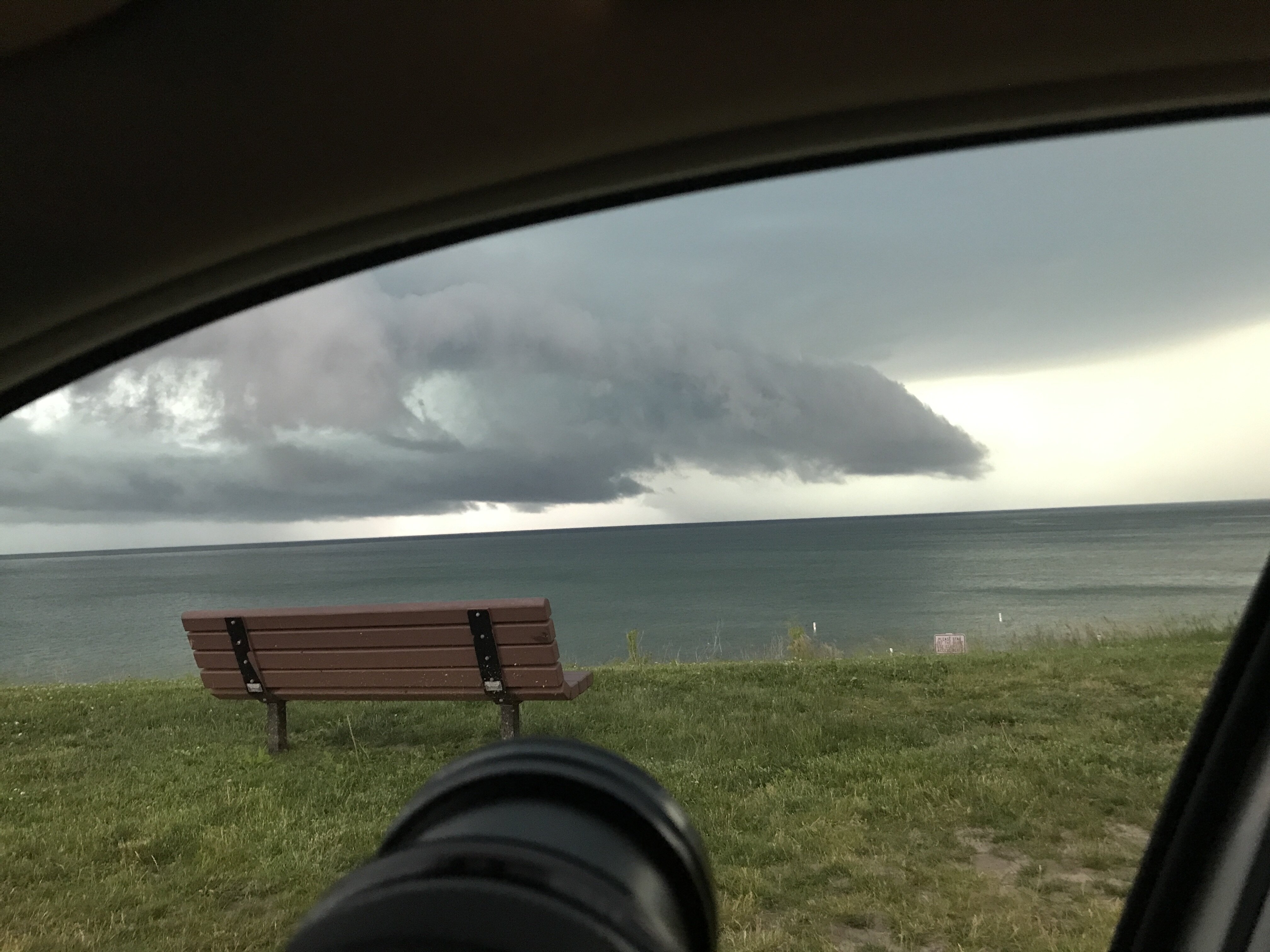
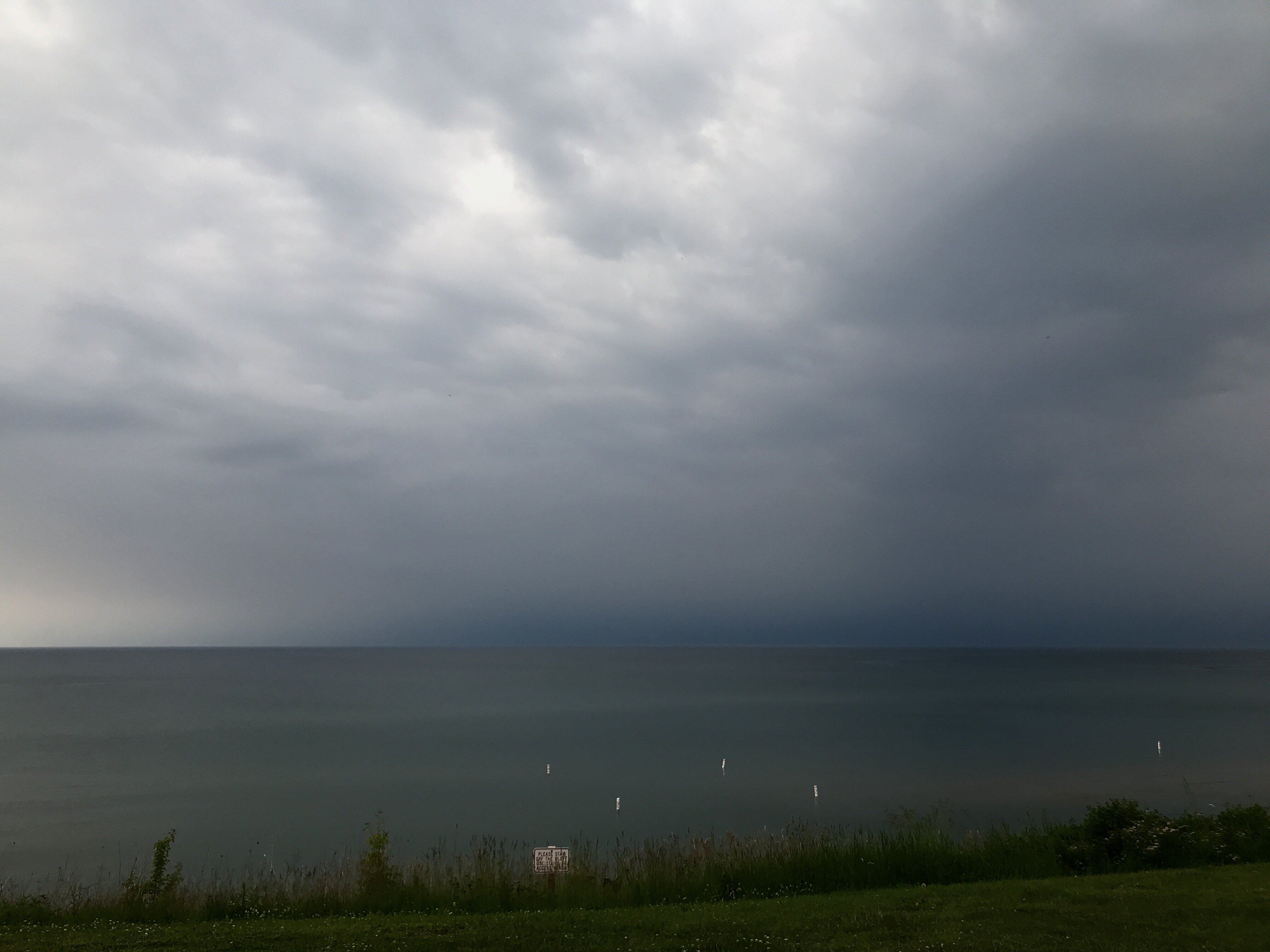
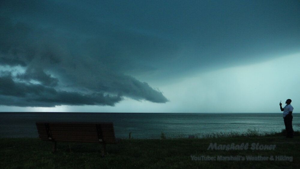
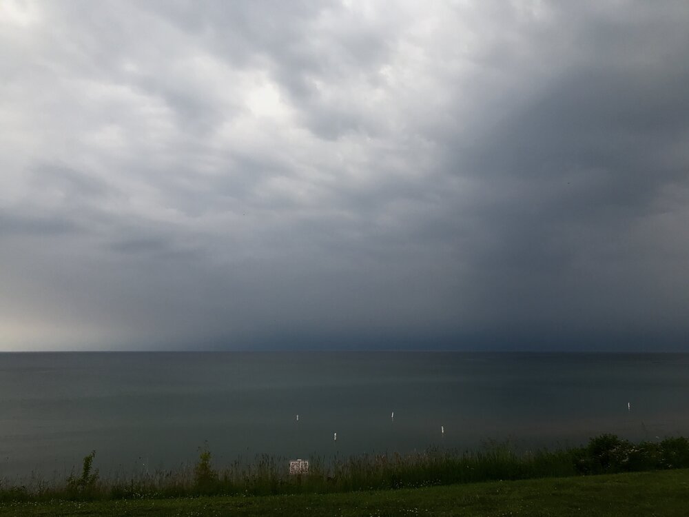
Hazy but menacing. Hear soft rumbles. Have to plan an escape if it looks like hail. Got to hurry.
-
Watching cell roll in off the lake at south haven. Will have to dart for the nearest gas station canopy if its a hailer.
-
Wondering if that cell will eventually become the northern bookend of a bow. Or if it will remain discrete for a while. CAMS say the upscale growth will probably happen over Lake Michigan. I think the line will start to build build south into the extreme instability over northern Indiana.
-
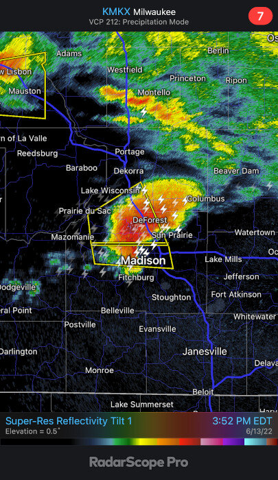
Upward suction from mesocyclone can overcome quite a bit of surface CIN. The surface instability is/was pretty meager right there in Madison, but the big gradient is close enough if it turns a little to the right. I don't think the analysis captures a sharp gradient well. It smooths it. The lake-modified vs not lake modified boundary can be pretty sharp. There are breaks in the clouds and low 80s plus low 70s dews near the Illinois border.
-
This cell is getting organized and tapping some surface instability.
-
I'm just debating if I should immediately drive down to the southern lake shore to watch when I get off work. Maybe Benton Harbor area. Still uncertainty though.
-
The 12C isotherm at 700 mb seems like the boundary for where convection is overcoming the cap. If the cell near Madison is indicative of where an MCS could form, it might backbuild south into the more extreme instability over northern Indiana once it passes southern lake Michigan. Better shear is coming in from the west with time as well.
-
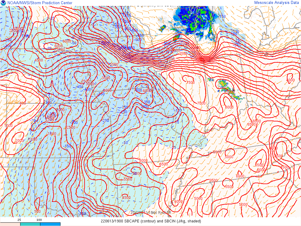
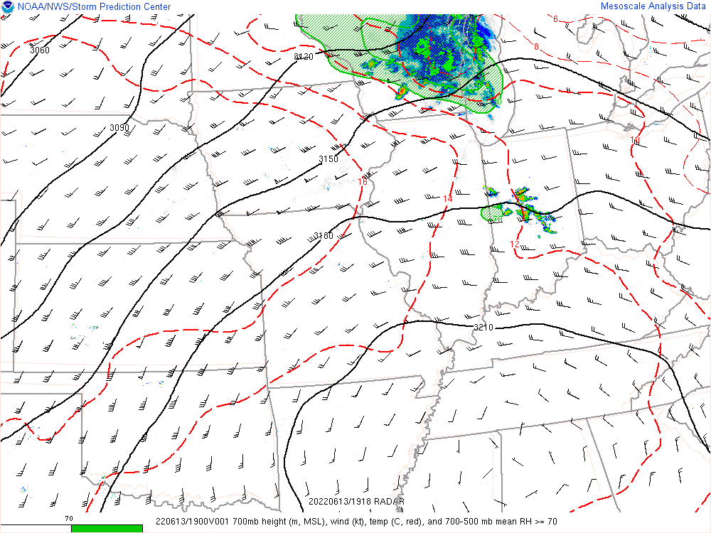
Yea, the 925 mb inflow is west of that cluster. It would have to back-build across Illinois to really get in the way. Seems unlikely with a strong cap over Illinois. I think its way more likely it will just dive SE into Kentucky.
-
That MCV is pretty weak at this point. It's got some clouds and light precip with it, but it's also pulling the front north a little. The surface cool layer in Wisconsin is partly due to wind off Lake Michigan. Maybe something will pop up in the SW corner of MI because of the lake breeze. CAPE is becoming more surface based there finally.
-

2022 Short/Medium Range Severe Weather Discussion
frostfern replied to Chicago Storm's topic in Lakes/Ohio Valley
That little 60 kt 500mb jet will be the thing to watch I think. Maybe some supercells around if the cap breaks just a little southwest of the current elevated activity.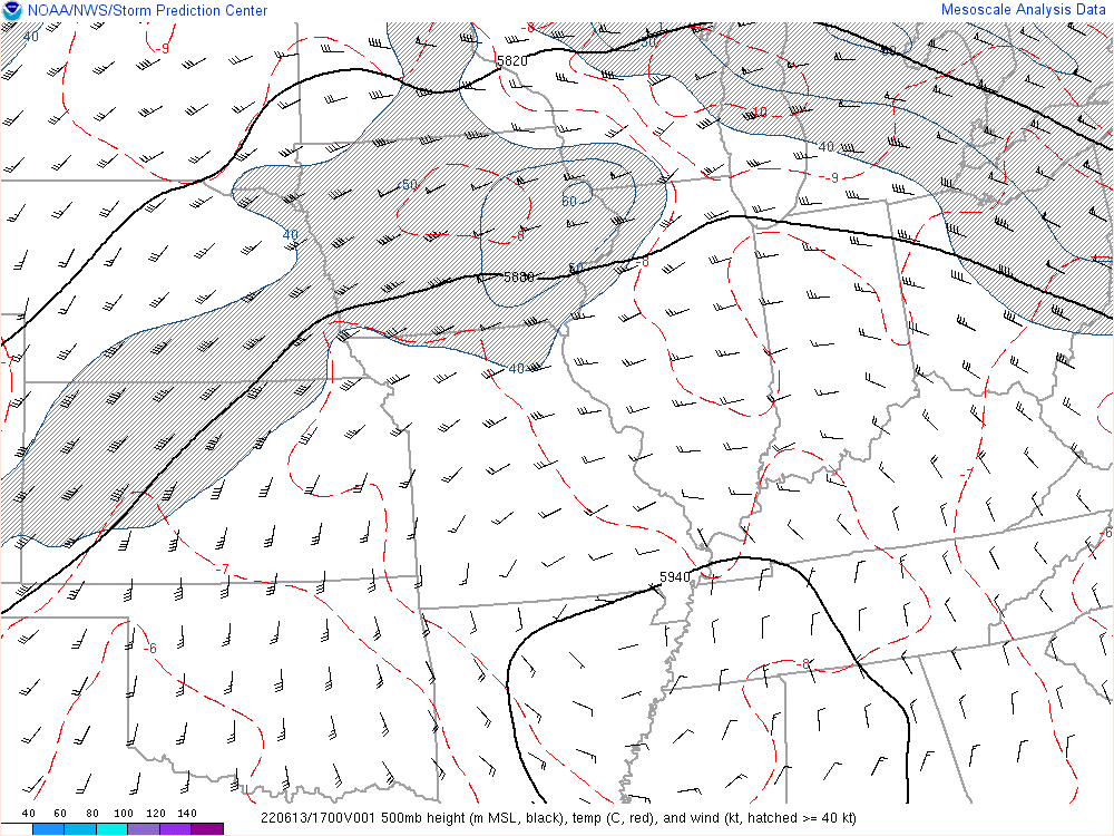
-
2022 Short/Medium Range Severe Weather Discussion
frostfern replied to Chicago Storm's topic in Lakes/Ohio Valley
Not an easy day for them. Too quick to latch on to the squall line CAM solutions earlier today. -
2022 Short/Medium Range Severe Weather Discussion
frostfern replied to Chicago Storm's topic in Lakes/Ohio Valley
Just watching SW lower. With no squall line and not a lot of outflow from the elevated activity over WI, the chance for an isolated tornado near the lake breeze seems higher to me. SE winds plus lake breeze plus 50 kts of 0-6 shear would be scary if there is enough surface based instability. That's pretty limited right now, but maybe a tongue of 1000-2000 SBCAPE will come north into the SW corner eventually. The front seems kind of hung up at the moment. -
2022 Short/Medium Range Severe Weather Discussion
frostfern replied to Chicago Storm's topic in Lakes/Ohio Valley
Summer 2012 was extremely warm, but it was a dry heat most of the time. Rain was very hit and miss with all the post-torch cold fronts because dewpoints were mixing down into the upper 50s a lot in the afternoon and the lake shadow effect was strong. When gulf moisture did occasionally make it north of the OV, the MCS track was mostly south of Michigan. -
2022 Short/Medium Range Severe Weather Discussion
frostfern replied to Chicago Storm's topic in Lakes/Ohio Valley
I have never seen a 30 C at 850 mb over a low spot like KC before.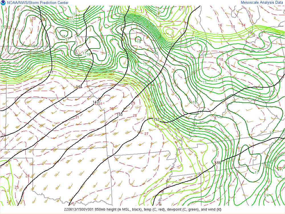
-
2022 Short/Medium Range Severe Weather Discussion
frostfern replied to Chicago Storm's topic in Lakes/Ohio Valley
The Morch, April, May had some amazing lightning shows and of course the surprise tornado. After that it was just off-and-on heat, underperforming dewpoints, and weak dry cold fronts. Spring was interesting, summer was boring. Lately it has been the opposite. Most severe opportunities are mid-June or later... more like typical climatology. -
2022 Short/Medium Range Severe Weather Discussion
frostfern replied to Chicago Storm's topic in Lakes/Ohio Valley
It's really up in the air at this point. If the elevated stuff currently over southern Minnesota reaches my side of the lake this afternoon there could be a supercell or two that becomes surface based. The surface wind will certainly be backed along the warm front, pooling some higher dewpoints up against the lake meso-high. Even without discrete cells, a lake-breeze / warm-front combo can produce QLCS tornadoes and/or mesocyclone wind damage. That has happened more than once here, even later at night. -
2022 Short/Medium Range Severe Weather Discussion
frostfern replied to Chicago Storm's topic in Lakes/Ohio Valley
I don’t know how to feel about a derecho followed by 100+ heat indeces IMBY. My folks are in the process of moving and having power out into Tuesday will be a nightmare. Hope it misses south honestly. -
2022 Short/Medium Range Severe Weather Discussion
frostfern replied to Chicago Storm's topic in Lakes/Ohio Valley
Yea. If I were them I'd adjust the orientation. It will probably be more NW-SE. Northern Indiana will get hit. Northern Illinois, not so likely. -
2022 Short/Medium Range Severe Weather Discussion
frostfern replied to Chicago Storm's topic in Lakes/Ohio Valley
Maybe their thinking is the farther north solutions have less wind threat due to the best instability being slightly elevated in those cases. The warm front is moving north and will have some clouds associated with it. In any case, I think 80 degree dewpoints will eventually overcome any cap once a strong cold pool is established. Even if Illinois is missed, it could still do the hard right turn moving into Michigan then back build across Indiana.