blizzardof96
-
Posts
1,565 -
Joined
-
Last visited
Content Type
Profiles
Blogs
Forums
American Weather
Media Demo
Store
Gallery
Everything posted by blizzardof96
-
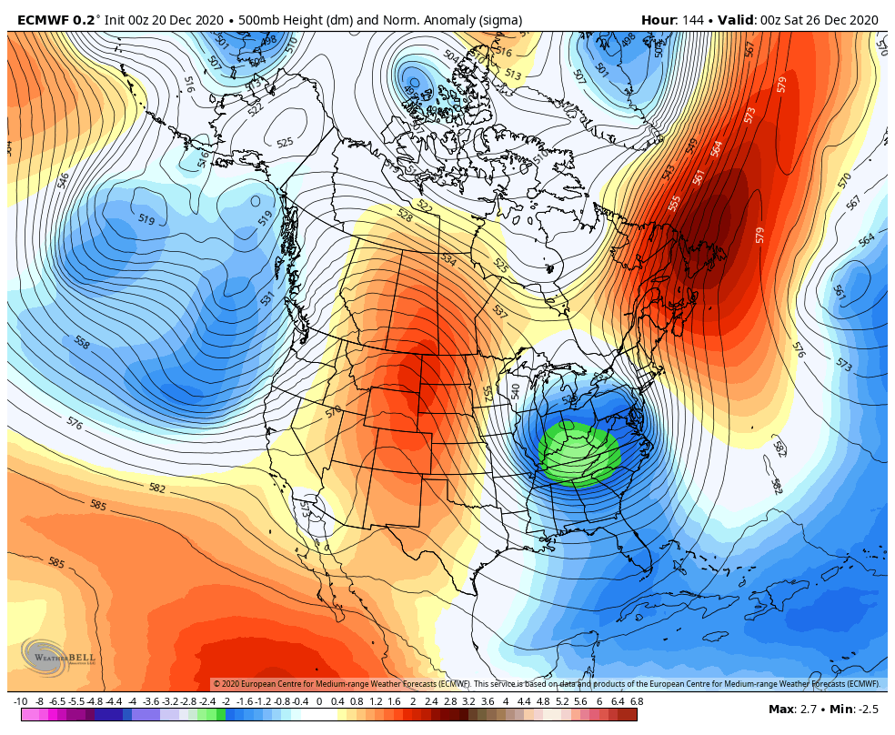
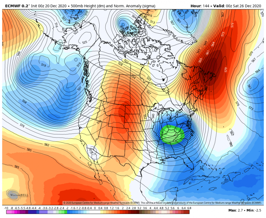
I think we're gonna see accumulating snow from this...possibly significant if things can align correctly. This upper level pattern is generally favourable for our area, especially with the ridge bridge to the north of the upper low. Would like to see more consistency on guidance. A wave is expected to develop as a secondary low along the front, so models will probably struggle with the sfc low track. If track is up the spine of the apps it becomes slightly more challenging as well.
-
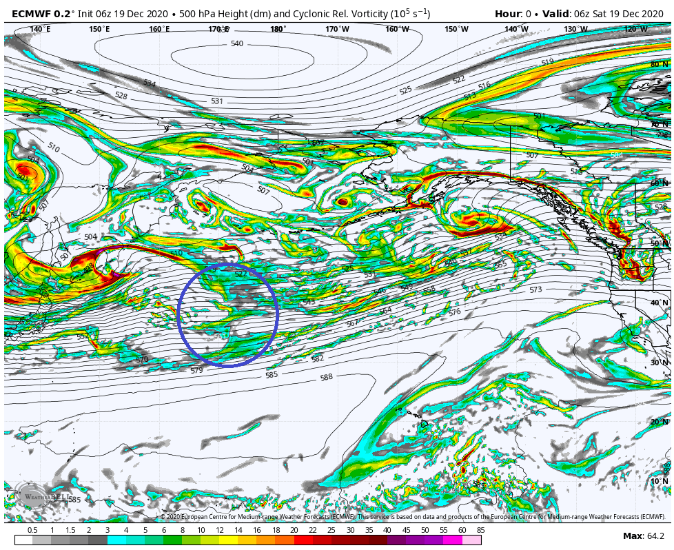
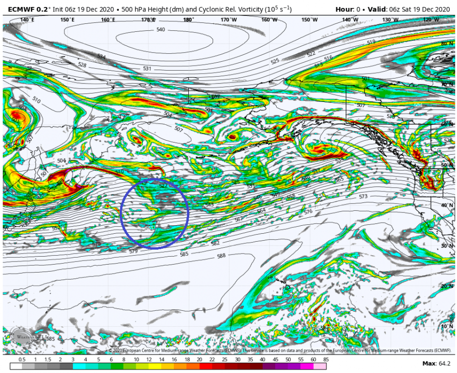
Here's a look at the location of the energy from the time of 6z ECMWF initialization. I suspect model guidance will continue to struggle as the energy is embedded within a broad/complex jet streak out over the North Pacific. The energy is incident on the west coast by ~0z Tuesday.
-
November 30-December 2 *Potential* Winter Storm
blizzardof96 replied to Hoosier's topic in Lakes/Ohio Valley
Interesting to note that the GFS OP is within the Northwest quadrant of the ensemble envelope -
November 30-December 2 *Potential* Winter Storm
blizzardof96 replied to Hoosier's topic in Lakes/Ohio Valley
Thank you. Nice to be back... hope to chime in from time to time this winter. -
November 30-December 2 *Potential* Winter Storm
blizzardof96 replied to Hoosier's topic in Lakes/Ohio Valley
For those curious, these are the >3” probs from the other two ensemble suites. 12z GEFS 12z GEPS -
November 30-December 2 *Potential* Winter Storm
blizzardof96 replied to Hoosier's topic in Lakes/Ohio Valley
-
November 30-December 2 *Potential* Winter Storm
blizzardof96 replied to Hoosier's topic in Lakes/Ohio Valley
12z CMC Ensemble -
January 22nd-25th Winter Storm Potential
blizzardof96 replied to Thundersnow12's topic in Lakes/Ohio Valley
NAM has the 12" line sneak through east end of the city (Toronto). I'll eat crow if this verifies. -
January 22nd-25th Winter Storm Potential
blizzardof96 replied to Thundersnow12's topic in Lakes/Ohio Valley
The weekend system is confusing for a few reasons: 1) Very slow movement of the upper low 2) Highly variable precipitation rates + banding 3) Marginal thermals, causing snowfall accumulations to be dependant on precip rates. Areas with stronger upward motion may win out. -
January 22nd-25th Winter Storm Potential
blizzardof96 replied to Thundersnow12's topic in Lakes/Ohio Valley
6z EPS looks pretty favourable for Toronto. It has 60-70% probability of >3". -
12z GEFS mean 700mb RH looks pretty decent from DTX--->YYZ
-
A little pre-season thread: Can Nov. 8 pull off an early win?
blizzardof96 replied to moneypitmike's topic in New England
Video I created which discusses the differences between the CMC and GFS: