luckyweather
-
Posts
595 -
Joined
-
Last visited
Content Type
Profiles
Blogs
Forums
American Weather
Media Demo
Store
Gallery
Everything posted by luckyweather
-

Summer 2023 Medium/Long Range Discussion
luckyweather replied to Chicago Storm's topic in Lakes/Ohio Valley
LOT: Confidence continues to rise in a much-needed pattern change Sunday onward as zonal to northwesterly flow becomes established aloft and opens the door for numerous upper-level shortwaves to propagate into the Great Lakes. The net result will be a return of regular chances for showers and thunderstorms (e.g. every few days), rising humidity levels, and moderating temperatures. It`s still a hair too early to talk specifics about timing, intensity, and coverage of showers and storms next week, though at least parts of the area appear in line to receive much needed rainfall from Sunday onward. -
Spring 2023 Medium/Long Range Discussion
luckyweather replied to Chicago Storm's topic in Lakes/Ohio Valley
I have a feeling we'll have to pay in arrears for this. 105 degree days in October on tap. -
Northern IL crop situation about to transition from annoying but periodic drought to a more severe, generational type situation if we don’t get rain in the next 10-14 days or so.
-
I joined the board because of the OG Morch. You were a prolific poster back then under another name. I thought you were a trip but not in a bad way. As a cold lover you get on my nerves when you start jonesing for spring but seeing this I get it man. Never change.
-
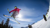
gonna head up to Madison to Tyrol’s June Jam tomorrow. Pic from last year, they said they have significantly more snow this year. At least an acre of coverage. I’m not sure how they keep it at Tyrol but usually hay and/or sawdust will do the trick. A-Basin in Colorado closing this weekend, but it was snowing there today. Still got about 11 minutes of day length to pick up, but it’s almost over. Less than 19 days til they start getting shorter.
-
“Not to hijack your thread” Proceeds to make 5 successive replies on Toledo’s average mean temp in a historical drought thread. [emoji848][emoji848][emoji848] I remember as a kid in the 80s seeing several segments on the local St Louis area news about various shipwrecks being exposed as the Mississippi and Missouri rivers all but dried up.
-
Showing 7/10” imby, my netatmo rain gauge usually runs a little lower than reality so probably closer to an inch here as well in far northeastern Winnebago county IL.
-
Oak is my favorite. Always do a summer weekend in the city in late summer when the water temps are just right and spend a chunk of a day on Oak st beach. Small, crowds aren’t too bad, and not as chaotic as North Ave beach (although North Ave can be a good time depending on the crowd). Miami like vibe with the city behind you and water in front of you.
-
Flash drought mentioned in LOT AFD this morning. That’s a new one for me.
-
Prairie fires were more common in the fall pre-settlement but certainly happened in the spring if there hadn’t been one the prior fall. Pre settlement large expanses of the plains and Canadian prairies could burn pretty much in one big go. Fires of a scale simply unimaginable and unprecedented in modern times. So while post settlement wildfires are certainly bad for life and property, they aren’t a new phenomenon and actually much smaller scale than they were before man’s impact on the land.
-
~50 days until days start getting shorter
-
Spring 2023 Medium/Long Range Discussion
luckyweather replied to Chicago Storm's topic in Lakes/Ohio Valley
Very true. Part of the give and the take at this latitude. -
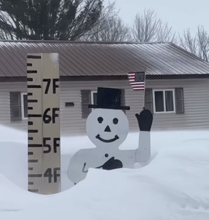
Pic from Krupps in Twin Lakes this morning.
-
752 ACUS11 KWNS 041954 SWOMCD SPC MCD 041954 WIZ000-ILZ000-IAZ000-MNZ000-042230- Mesoscale Discussion 0457 NWS Storm Prediction Center Norman OK 0254 PM CDT Tue Apr 04 2023 Areas affected...northeast Iowa...far southeast Minnesota...and southwest/central Wisconsin Concerning...Severe potential...Watch likely Valid 041954Z - 042230Z Probability of Watch Issuance...80 percent SUMMARY...Thunderstorms are expected to develop in the 22-00z/5pm-7pm CDT time frame. Large hail, damaging gusts and a couple tornadoes appear likely through this evening. A watch will likely be needed in the next couple of hours. DISCUSSION...Some uncertainty remains regarding how far north the surface warm front will advance across the region through this evening. Most guidance suggest the boundary will lift into far southern WI by this evening. Thunderstorms are expected to develop in the vicinity of the surface low across western/central IA in the next couple hours. Storms will track northeast near, or to the cool side, of the northward-advancing warm front. This will likely result in most convection remaining elevated, though a couple of storms could become rooted in the frontal zone across northeast IA or far southwest WI. The storms that can ingest better quality low-level moisture and vorticity along the boundary will have a better opportunity to produce a tornado. However, current thinking is that convection will largely remain elevated. Nevertheless, strong vertical shear will support supercells. Very steep midlevel lapse rates will support MUCAPE around 500-1500 J/kg and large hail will be possible. Fast moving storms, coupled with strong deep-layer flow also will support some damaging wind potential. A relative max in severe potential will exist across southern portions of the MCD where at least some chance of near surface-based convection will exist within the warm frontal zone. With northward extent, overall potential will gradually lessen. A watch will likely be needed in the next couple of hours. ..Leitman/Hart.. 04/04/2023 ...Please see www.spc.noaa.gov for graphic product... ATTN...WFO...GRB...LOT...MKX...DVN...ARX...MPX...DMX... LAT...LON 42419421 42639424 42909410 43609329 44059229 44159170 44359055 44278942 44168904 43898880 43638873 43048877 42538916 42438961 42499184 42419421
-
Getting diverted to Omaha (was inbound to ORD), pilot was trying to fly north but said we were going to run out of fuel with the route ATC wanted us to take.
-
for sure. I would have called it if it were my job. that said it fell apart basically the next scan after the one I posted.
-
Storm motion is right through the middle of Peoria. @janetjanet998 aren’t you home based in Peoria?
-
LOT MESOSCALE DISCUSSION... Issued at 127 PM CDT Fri Mar 31 2023 Initial concerns continue to highlight the growing cluster of convection now crossing from northeast Missouri into west-central Illinois as of 1pm/18Z. The primary question is now focused on how far northeast surface-based convection can reach to and then extend into the forecast area. Latest CAM/WoFs guidance has been rather consistent with the longevity of more robust convection lasting through our area for areas south of a line from La Salle County through the southern Chicago metro. Rapid destabilization is ongoing through the warm sector given an unusual and unexpected amount of clearing across much of Illinois with this type of dynamic system (nearly 70F all the way into the Chicago metro). A subtle surface moisture discontinuity extending ESE from west central Illinois has become a bit diffuse early this afternoon, but is gradually lifting northeast and closing in on our far southwest CWA. Near term guidance supports a rapid erosion of MLCIN into the aforementioned area of our CWA concurrent with convection arriving from the southwest (~3-5pm). Therefore, the likelihood of true surface-based convection entering our CWA has increased early this afternoon. Severe weather parameters favor all severe hazards, including an inherent risk for strong tornadoes with any fully surface-based supercells. The greatest risk initially favors into the southwest CWA, but if the storms can keep pace with the northeast moisture transport, we need to keep a very close eye into east-central IL through the southern Chicago metro.
-
Was flying in to ORD for a 5pm arrival from Vail, UA/ATC now holding back our departure 3 hours. Not a clean flight path through or around. Bummer, was looking forward to getting some shots of some of these storms from above.
-
that’s such a crazy number. just checked and they are having a just average season. coincidentally I actually summited Mt. Baker last August. Pic from the Easton Glacier, my wife and kids ahead of me. 10/10 would recommend. was the warmup for Rainier tentatively in July. we had just navigated through some beastly crevasses, I’m the heaviest so I held up the flank to get us through them.
-
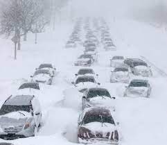
not in the sub but Alta in Utah just cracked 700” on the season and Mammoth (CA) is now over 800”. Absolutely incredible winter in the Wasatch and Sierras and it’s still got some wind left in it.
-
Just looked back, nice hit of nostalgia. Lot of old names I had forgot but remember well. Got to wonder what happened to so many of them. Weather interest was an unhealthy obsession for some, others lost interest, some banned (just noticed wisconsinwx got banned last September, wonder what that was about), and unfortunately some have passed away. But not weatherbo, will never forget the search party that was sent up for him.
-
In the spirit of board unity he’d be welcome to ride with me and michsnowfreak through the gradient. We’re all weather buddies at the end of the day.
-
that gradient, wild. if that verified i think I’d have a hard time not driving through it with the windows down just to experience it.
-
I was observing the same thing yesterday afternoon driving up for a few hours of skiing from the stateline to Tyrol Basin west of Madison. It wasn’t until just south of Madison the ground went from bare to snow covered. Madison did well though, roads were partially ice/snow covered out of town, and Tyrol has excellent coverage, including in the glades where they’re purely relying on natural snow. Not a great pic but illustrates the coverage under that lift line in the woods. On the other hand, Friday night, Alpine Valley and Wilmot had a parade of ambulances in and out. The rain they got and subsequent refreeze was taking people out every 5 minutes. I heard there were at least 5 ambulances in 3 hours at AV, Friday nights there ordinarily are pretty quiet.


